|
|
Mountain/Rock |
|---|---|
|
|
39.34318°N / 119.91622°W |
|
|
Washoe |
|
|
Hiking, Scrambling |
|
|
Spring, Summer, Fall, Winter |
|
|
10776 ft / 3285 m |
|
|
Overview
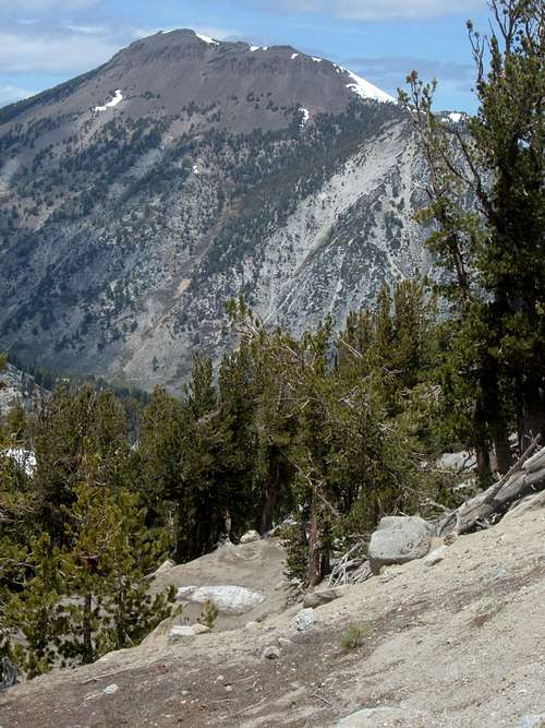
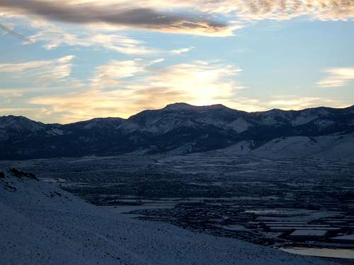
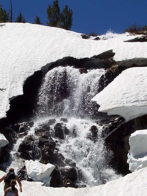
Mount Rose is a gem in the northern Sierra Nevada Range. It rises only a few miles northeast of Lake Tahoe. It is the 2nd highest mountain in the Lake Tahoe Basin and the highest Tahoe Basin peak in Nevada. Standing over 6,300 feet above downtown Reno, the mountain looks daunting, however well-maintained trails starting high up a mountain pass road, cut most of the difficulty for the armchair hiker. For this reason, if you hike the main trail, expect company, lots of company. Not everybody hikes to the top of the mountain. Many just go to the waterfall about 2 1/2 miles up the trail. However, all of the Mount Rose Trail gets crowds all over, every weekend. If you want the mountain to yourself, you are better off hiking during a weekday.
Because of its proximity to Carson City, Reno, and Lake Tahoe, the Mount Rose area offers many ski destinations. Mount Rose itself does not have a ski run, although skiers do occasionally ski from the actual summit. The Mount Rose-Ski Tahoe ski slopes are actually on nearby Slide Mountain.
Mount Rose is the result of volcanic activity that began 30 million years ago. It marks the transition zone between the Sierra Nevada and the Great Basin. In fact, recent hydrothermal activity in the area has been measured, and power is generated from underground geothermal reservoirs only 10 miles east of the mountain.
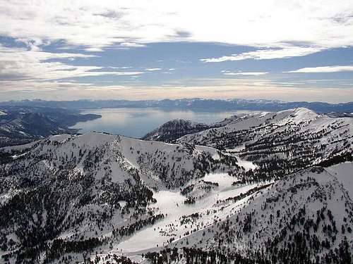
Although it resides just 20 miles from the mountains on the west side of Lake Tahoe, it receives about half the moisture. For this reason, the snowfall on Mount Rose is generally less than you’ll find in neighboring peaks to the West. The summit of Mount Rose is above tree line, but only by a couple hundred feet. Views from the summit are expansive. There are great views to the Sierras stretching as far as Northern Yosemite on a clear day. Views to the north include Lassen Peak on a clear day. Views into Nevada are also expansive. There are so many peaks in view on a clear day, it could make your brain explode if you try to figure all of them out!
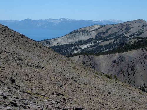
Of course, the most prized view from the summit is probably Lake Tahoe.
Getting There and Route Information
The main trailhead for Mount Rose is at the aptly named “Mount Rose Summit”. This is not the actual summit, but rather the top of a mountain pass along SR 431 which links Reno, Nevada with Lake Tahoe and is a non-highway pass route to California. From Reno take 395 to the Mount Rose Highway (431). Take 431 as it winds up the mountains. The Mount Rose Highway runs for about 20 miles between Reno and Incline Village, and the Mount Rose Summit is about 25 minutes up the road from 395. The Mount Rose Summit Parking Area rests at an elevation of 8,911'. The trailhead has space for nearly 50 cars. There are bathrooms, brochures, and trail maps.
From the Mount Rose Summit trailhead, there are two main approach routes, which follow the same trail for the last 2.3 miles. The last 2.3 miles is where the last 1700 feet of elevation is gained.
1) New Mount Rose Trail
One-way distance to summit: 5.2 miles
Elevation Gain: ~2000 feet
Difficulty: Walk up
From the parking lot, head behind the bathrooms to the start of the trail. Everything is well marked, and maps of the route are provided.
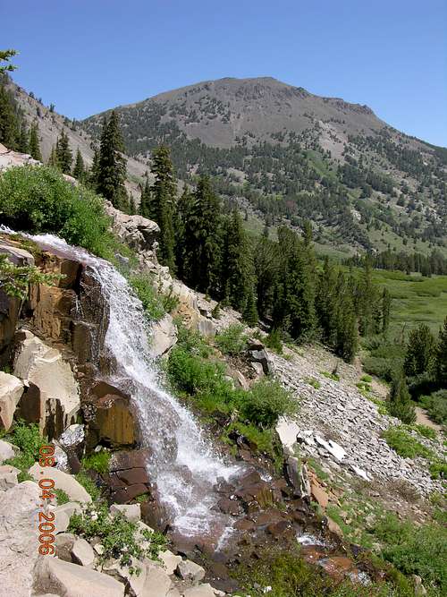
Once you head up the start of the trail, a sign points the way to the new Mount Rose Trail. You head up some stairs to the start of the trail. The first 2.5 miles are relatively level, with only minor ups and downs. The trail heads straight towards Mount Rose at the base below the north side of Tamarack Peak. After about 2 1/2 miles you pass an impressive waterfall. Within 10 minutes you reach the start of the steep hike up the mountain. You climb 700 feet in 1 1/4 or so miles along the west side of mountain until you reach a sign pointing to the final stretch to the saddle, which you reach in about a mile. Once at the saddle between Mount Rose and Church Peak, this is at about 4 3/4 miles. Then the trail takes you the remaining distance to the summit.
2) Old Mount Rose Trail
One-way distance to summit: 6 miles
Elevation Gain: ~2280 feet
Difficulty: Walk up
Instead of heading up the stairs to the new trail, the Old Mount Rose Trail heads directly west from the trailhead to the Relay Peak Service Road. The trail hits the road in half a mile. Follow the road for a little more than 2 miles to a sign for the Mount Rose trail. From here, a trail heads north away from the service road and descends about 300 feet as it makes its way towards Mount Rose. About ¾ miles from the road, the trail joins up with the New Mount Rose Trail.
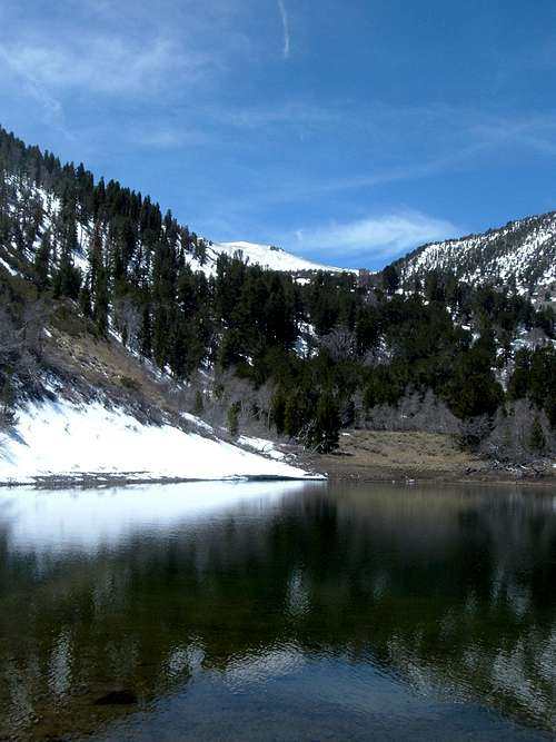
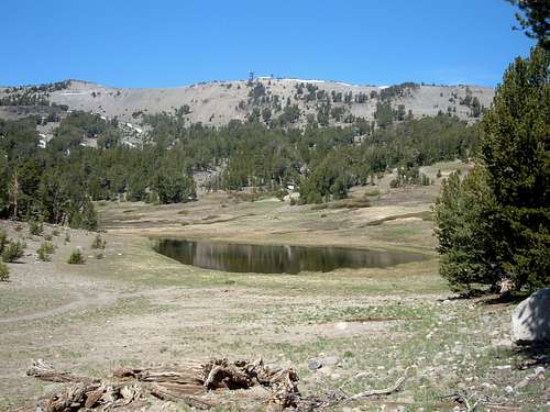 View of Frog Pond along the Relay Peak Service Road on the way to the Old Mount Rose Trail. Frog Pond is very close to the turn off. The electrical equipment is on Relay Ridge.
There are two other primary routes up the mountain located closer to Reno, on 431.
3) Southeast Ridge
One-way distance to summit: 2.7 miles
Elevation Gain: ~3350 feet
Difficulty: Walk up/scramble
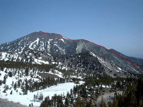
The Southeast Ridge route starts a few miles before the "Mount Rose Summit" parking area. It is far less known, and far less traveled, yet it is the shortest route the summit. To get to the trailhead from Reno, follow 431 up past the 7,000 foot marker. The road heads up a steep hill, passing a dirt road on the left before you hit a horseshoe shaped turn. It is just before this turn, on the right side of the road, where you'll find a small dirt parking area by the Galena Creek. There are no signs for this trailhead. However, there is a trick to finding it. Just past the horseshoe turn there is a silver shack on the left. If you see the silver shack, you need to turn around and head back to the horseshoe turn. It is easy to find in summer, but not in winter. If you aren't satisfied with these directions and want a more surefire landmark, well you are in luck. About 1/4 mile up the road from the horseshoe turn is the Sky Tavern Ski Area on your right. This is a good place to turn around if you've gone too far.
Now for the route itself. From the parking area head towards the mountain along the trail, and cross a bridge over the Galena Creek. Follow the trail as it steeply heads through a canyon. After about one mile you reach the base of Point 10,005, which is an East shoulder of Mount Rose. It is here that the trail basically ends. From here you wind up the ridge following whatever appears to be the most direct and least overgrown. Once at the top of Point 10,005, the final assualt to Mount Rose is self-explanatory. This route is short, but very steep, so be prepared for burning lungs and bring plenty of water. This route is better in springtime or fall. In summer it gets pretty hot and you'll run into more bugs. It is also possible to run into rattlesnakes.
4) Jones-Creek/Whites Creek Loop Trail to Church’s Pond
One-way distance to summit: ~5 miles
Elevation Gain: ~4700 feet
Difficulty: Walk up/scramble
This route is the steepest of the four listed on this page, but is the route closest to Reno. It is only about 15-20 minutes drive from downtown Reno. From Reno, take 395 South to the Mount Rose Highway (rt. 431). Once on 431, take it to the west for 6.3 miles to the north entrance of Galena Creek County Park. You can park here, and walk towards the woods where a wide trail takes you up to the Jones Creek/White Creek loop.
Take the main trail for about 5-10 minutes until you reach a fork. To the left if the Jones Creek Trail, and to the right is the White Creek trail. Head left up the Jones Creek Trail. The Jones Creek Trail heads up several switchbacks until it tops out after about 2.7 miles. Here you will see a sign for Church’s Pond. Follow the trail to Church’s Pond, which you will reach after another 0.3 miles. This is your starting point for Mount Rose. The elevation of the pond is 8,290’.
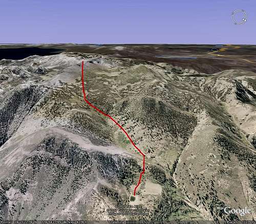
See the Google Earth™ image below. From Church’s Pond, head slightly to the right up and over the tree-covered hillside. From there, head straight up to Mount Rose. You’ll have to route-find through the lower sub-alpine forest, and then scramble up the boulder field to the top. The summit of Mount Rose is about 2 miles from Church’s Pond via the route seen below. The elevation gain from Church’s Pond is almost 2600 feet considering the need to go up and over the hill above Church’s Pond.
Red Tape
There are no pemits to climb Mount Rose. Just a overnight campfire permit is required. When the pass gets heavy snows, roads may be closed. Roads may also be closed during the summer due to fire danger. Parking at the trailheads is free.
When To Climb
You can climb Mount Rose all year around if roads are open. It is not a difficult winter hike, it just takes a lot more time. The amount of snow varies. In 2007, Mount Rose could be hiked without being impeded by snow from late May into early December. In 2006, there was still snow in July. In subsequent years, Mount Rose was best climbed typically late May-mid-November. For some of the drought years, Mount Rose was mostly free of snow as late as January, or as early as April.
Camping
The Mount Rose Campground is located across the Mount Rose Highway from the Mount Rose Summit parking area. The campground has restrooms and picnic tables and reservations can be made. Click here for information on the Mount Rose Campground.
For more information on camping, see here and here.
You can also camp at the top.
External Links
Lake Tahoe Basin Management Unit
Wilderness.net
Webcam


