
|
|
Mountain/Rock |
|---|---|
|
|
36.84290°N / 116.6745°W |
|
|
Nye |
|
|
Hiking |
|
|
Spring, Summer, Fall, Winter |
|
|
6317 ft / 1925 m |
|
|
Overview
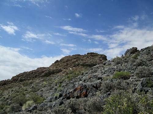
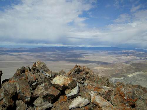
Approaching the summit
Bare Mountain, just south of Beatty Nevada and not all that far from Death Valley California truly fulfills the image most people might have of a desert mountain. Summers are blistering hot and best avoided unless an unusual cool day in the desert happens along.
The mountain is very barren and no trees or even big bushes can be found on the route up it that we took. With close to 2200' of prominence, this mountain comes in at #134 on the Nevada prominence list and thus attracts those who are interested in Nevada prominence peaks.
Courtney Purcell in his book "Rambles and Scrambles" (unfortunately now out of print) describes the Bare Mountain range as "a colorful range of dry rugged beauty" and provides information about how to climb most of the peaks in the range including the highpoint to which this Summitpost page is dedicated. He also mentions that the terrain is inhospitable and seldom visited and I would refer you to his book if you can find a copy to consult. The register we found on top was placed in 1978 and while it had quite a few entries in its pages, the number of visitors to this mountain averaged out to less than one a year which is truly an indicator of how rare a visit is to this summit. (Peakbagger.com shows but 17 visitors in 36 years as of 2014)
Bob Michael also provided some information on this one in his report posted HERE.
I provide this summitpost page for the few who might be interested in finding a good route to the summit and I sure would appreciate your feedback and some pictures when you go there so this page can be updated and improved.
Getting There
At one time most people accessed this one from the west side but an active mining operation has put the old access route onto private property. If you try to drive up Carrara canyon from the southwest, you are stopped by "No trespassing" signs as you enter the canyon. Eric Kassan used a western route from near the Gold Ace Mine and he has a GPS track showing his route here.Dennis Poulin found another way when he hit the stopper on Carrara Canyon and the key is driving to Beatty Nevada and then following his directions that he kindly shared on peakbagger.com
"From the cattle guard on US 95 at the south end of Beatty I went .6 miles south and turned left on a good gravel road. Zero your odometer and go 4.9 miles where I took a lesser road to the left. The right fork goes up to the micorwave towers on the hill. High clearance is good to have on this lesser road. At 5.0 miles from Hwy 95 go over secret pass, at 6.5 miles turn right on an unsigned road that goes up Tarantula Canyon. Follow this road for another 1.0 mile and park at a flat circular turn out." This is the trailhead and you will begin your hike from here.
Route
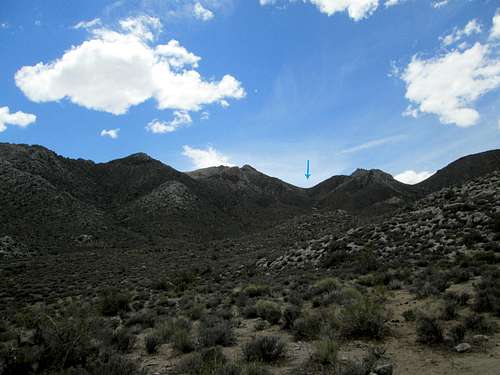
The route from the north as found by Dennis Poulin, is really an outstanding way to get to the summit of this one. It has less elevation gain and is a less technical route than the other west side routes. The key is having a sturdy vehicle that will allow you to drive to what we used as a trailhead.
From our "trailhead" in Tarantula canyon (we saw no tarantulas) we hiked south up the wash to a saddle that is somewhat northwest of the summit. Work your way up the wash avoiding the brushy areas and aim for the saddle mentioned, After gaining about 1,000 ft to the saddle, turn left and work your way up to the ridgeline and cross over to the left side and continue by traversing along the east slope as you head south toward the summit. Once you gain the north ridgeline of Bare Mountain, you will see where the summit is, continue to work your way toward the summit by staying on easy ground, nothing more serious than high class 2 on this route. Several rocky outcroppings can be bypassed by going left and traversing around them. Overall elevation gain around 1800 feet and about 3.8 miles roundtrip. To get to where we parked, I recommend high clearance and 4WD.
Dennis Poulin has posted a GPS track on peakbagger.com which might help clarify some of what I've tried to describe above.
Red Tape
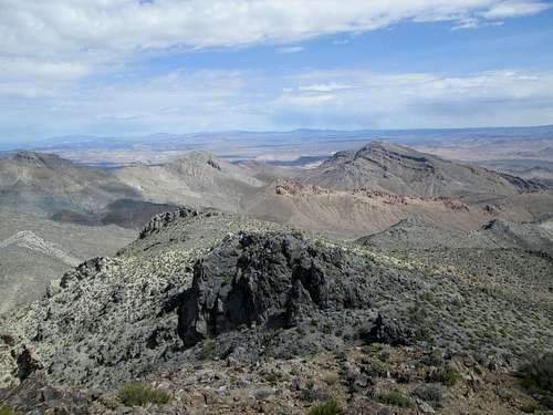
Area 51 in the distance
When to Climb
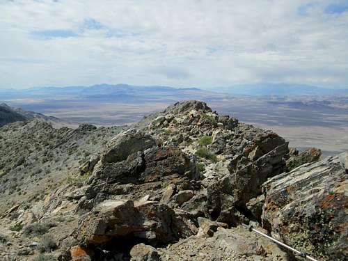
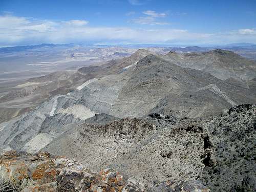
Southwest view from summit
Winter, late fall and early spring would be the best time to climb this mountain. I would avoid it when it gets hot because temps might easily reach the 90's or triple digits.
Camping
Northwest view from summit
Car camping is always possible on BLM land. Remember to clean up your area and leave no trash behind. Please practice the "leave no trace" ethics.
Motels are available in nearby Beatty.
Weather
North from summit
Beatty Nevada