
|
|
Mountain/Rock |
|---|---|
|
|
38.68297°N / 120.02248°W |
|
|
Alpine |
|
|
Hiking, Scrambling |
|
|
Spring, Summer, Fall, Winter |
|
|
9013 ft / 2747 m |
|
|
Overview
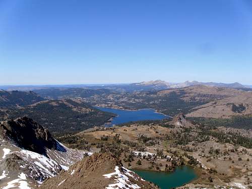
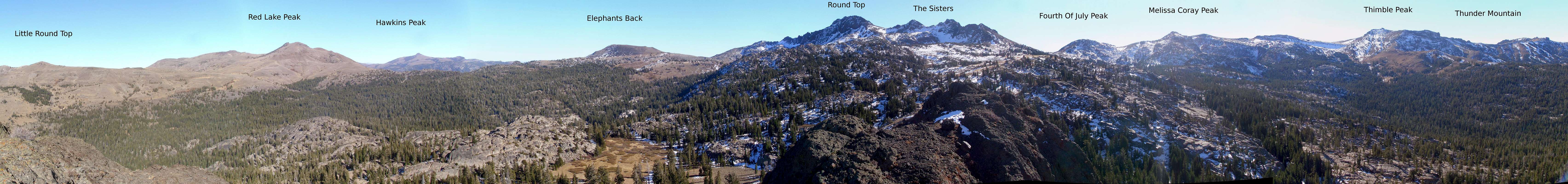
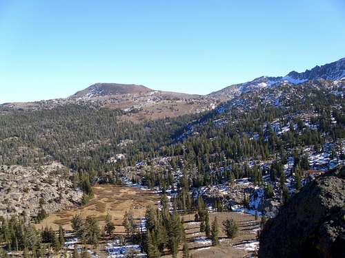
Black Butte is a striking rock pinnacle in the Mokelumne Wilderness in California’s northern Sierra Nevada. The peak is the highest of a serrated ridge of basalt pinnacles. The ridge runs north to south with a total of five pinnacles, the highest of which is second from north. The peak is prominently visible from Highway 88 on the drive to Carson Pass, appearing as a single rugged pinnacle nearly the height of Round Top.While the peak appears significant from the north and east, the peak sports little relief on its south slopes and it appears diminutive compared to the peaks on the Carson Spur. Despite this fact the views from the summit are quite impressive. The peak sports arguably the best views of the Carson Spur, with Round Top and The Sisters dead south, Melissa Corey Peak and Fourth of July Peak slightly west and Thimble Peak and Thunder Mountain to the southwest.
 Black Butte from The Sisters | 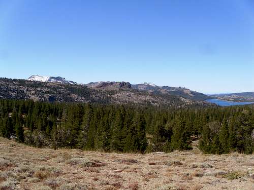 Black Butte from the trail to Round top |
The Mokelumne Wilderness is a rare tract of relatively pristine mountains in what is otherwise the Sierra Nevada’s least pristine region. Unlike other “wilderness” areas in the region, the Mokelumne actually retains some wild characteristics. The volcanic nature of the mountains in this area offers a very different scene than the classic glaciated granite the “Range of Llight” is known for. Unlike the nearby Desolation Wilderness, which is basically an overcrowded, overregulated, miniaturized tease of what the true High Sierra has to offer, the Mokelumne Wilderness is its own unique beast, and in my opinion, far more worthy of exploration.
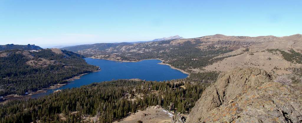
Caples Lake
The peak is very accessible, requiring only 3 miles of hiking round trip and 900 feet of elevation gain. The difficulty does not exceed class 3 scrambling. The ease of accessibility makes this peak a fine “drive by” scramble, or a fun peak to do in conjunction with other peaks in the region.
  Summit View |
Getting There
Woods Lake Trailhead:From South Lake Tahoe:
Head West to the Junction with Highway 89. Follow Highway 89 for 5 miles over Luther Pass to the Junction with Highway 88. Turn west on 88 over Carson Pass, look for a sign to the Woods Lake trailhead. Turn here and proceed about a mile up the access road to the trailhead. Park here and backtrack to the campground to begin the hike (one cannot park in the campground without paying for a site).
From Jackson:
Head east along Highway 88 for approximately 60 miles to the Woods Lake trailhead turnoff. Turn here and proceed about a mile up the access road to the trailhead. Park here and backtrack to the campground to begin the hike.
Route
The best approach for Black Butte begins on an old mining road that starts behind campsite 12 in the woods lake campground. Follow this road for a couple of switchbacks, eventually you’ll come to a signed junction with the Lost Cabin Mine Trail. Stay on the main road as it continues to switchback up the hill, you will pass some old mining gear. After a short distance longer you’ll crest a small rise and enter a pristine meadow below the rugged east face of Black Butte.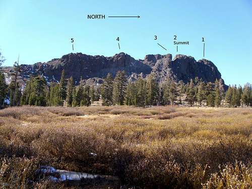
Annotated photo showing the 5 pinnacles of the Black Buttes
From this meadow all five pinnacles of the Black Butte ridgeline are visible, the true summit is the second form the north. To attain the summit cross the meadow and climb to the base of the pinnacles on class 2-3 slabs. Enter the notch between the second and third pinnacles by climbing a class 3 gully. Once the notch is reached the summit is a simple class 3 scramble to the north, stay on the east side of the notch to keep the difficulty to a minimum.
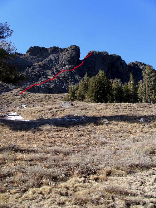 The route to The Summit | 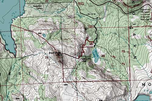 Route map for Black Butte |
Red Tape
Round Top and The Sisters
Black Butte is within the Mokelumne Wilderness in the Eldorado National Forest. Standard wilderness rules and ethics apply. The area around Carson Pass caries special restrictions on camping and parking, to park at any of the trailheads in the area requires a $5.00/day fee. More information on regulation for the Carson Pass Management Area can be found at the link below.
http://www.fs.usda.gov/detailfull/eldorado/specialplaces/?cid=fsbdev7_019058&width=full
During the winter months a California Sno-Park Permit is required to park along the parking lots on Highway 88.
When to Climb
Black Butte is most easily accessed when the road to woods lake is open, during the summer months. Black Butte would also make for a fine winter objective; the winter approach is less than 2 miles longer factoring in walking the road to Woods Lake and back. The scrambling sections would be more challenging when covered with snow.Camping
Elephants Back
Several campgrounds are present on the west side of Carson Pass, on the east side a few good campgrounds are present in Hope Valley. Dispersed camping should be allowed in most areas in non-wilderness national forest land unless otherwise posted. Camping in the Mokelumne Wilderness requires a free permit, for the wilderness outside of the Carson Pass Management Area there is no quota. The Carson Pass Management Area carries strict restrictions, see the link above for details
Contact Links
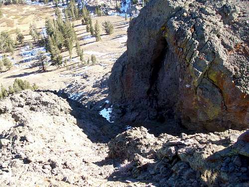
Looking down the gully
Eldorado National Forest Home Page
http://www.fs.usda.gov/main/eldorado/home
Amador Ranger District
26820 Silver Drive
Pioneer, CA 95666
209-295-4251
bobpickering - Oct 15, 2022 10:39 am - Hasn't voted
Private PropertyThe entire meadow that everyone seems to cross on the way to Black Butte from the east is on private property. On 10-14-22, I came upon a “Private Property” sign that prohibited crossing the meadow without permission. It isn’t too hard to continue further up the trail, and then approach Black Butte legally from the south. You can scramble up the ridge, staying reasonably close to the crest. Downclimb around the last pinnacle on the right/east, and then scramble up to the summit. There is no need to trespass.