-
 25629 Hits
-
 88.45% Score
-
 27 Votes
|
|
Area/Range |
|---|---|
|
|
43.20251°N / 5.49780°E |
|
|
Hiking, Trad Climbing, Sport Climbing |
|
|
Spring, Summer, Fall, Winter |
|
|
492 ft / 150 m |
|
|
Overview
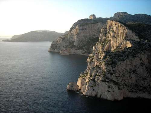
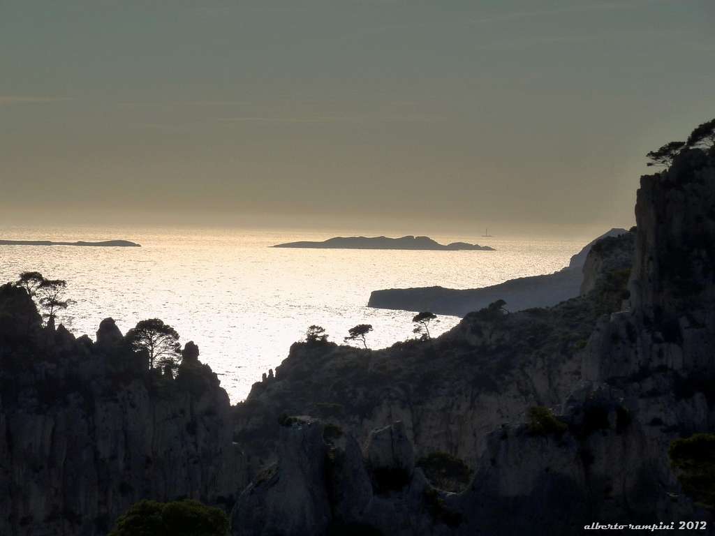
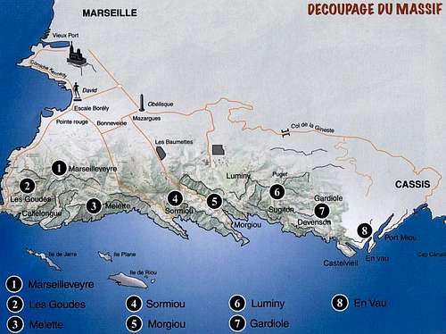
Between Marseille and Cassis the Mediterranean coast shows high cliffs of white rock interspersed with numerous narrow and long coves: the Calanques de Marseille. It's one of the finest limestone massif in the world, wild and well preserved, despite being very close to the civilization. All the Calanques are truly amazing, a unique environment, breathtaking and world famous! Untouched nature, transparent sea and beautiful backdrops, a spectacular area and a magical place to practise many outdoor activities, including hiking and above all climbing. The white limestone of the Calanques overlooks narrow coves and a blue and turquoise sea with unmatched aesthetics and offers unforgettable sensations. When people talk about "Les Calanques" it actually covers an area that is almost 20 kms long with several climbing sites:
CALANQUE D'EN-VAU
- La Guardiole
- Calanque de Sugiton / Luminy
- Calanque de Morgiou
- Calanque de Sormiou
- Calanque Les Goudes
- Melette
- Marseilleveyre
![Calanque d'En Vau [2 Apr 2002]](https://images-sp.summitpost.org/tr:e-sharpen,e-contrast-1,fit-max,q-60,h-800/46775.jpg)
Among the most spectacular sites there is the Calanque d'En-Vau with wonderful panoramic points! En-Vau climbing area is one of the highlight of Calanques de Marseille. Located at the Eastern end of the Calanques Massif, En Vau is a wonderful narrow bay borded on both sides by vertical limestone walls. It's one of the most famous rocky cirques of the Calanques. When looking at the sea from the beach, the Calanque d'En-Vau is dominated on the right (West) by the cliffs that descend from the Plateau de Castelvieil, including the Arch of Marseilles, Americans, La Supercalanques. On the left, facing them, other cliffs, including the Saphire, the Petite Aiguille, the Doigt de Dieux...
The great thing is that you can climb almost all year long, apart from summer where it can be hot and closed for fire risks.
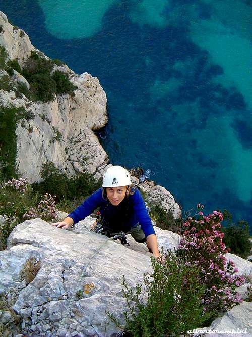
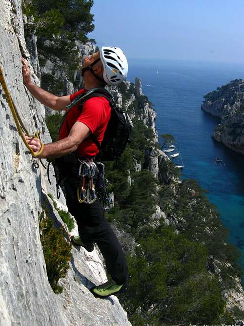
The landscape is stunning, as you climb right above the blue Mediterranean Sea!
The Calanques are also famous for two of its most passionated climbers :
Gaston Rebuffat and Georges Livanos (known as "Le Grec").
Getting There
- How to reach the Calanque d'En-Vau
Currently, after the closure of the "Gaston Rebuffat" route to the Col de la Guardiole, the shortest access to the Calanque d'En Vau is from the town of Cassis (located to the East of Marseille), via Port Miou and Port Pin.
Approach from Cassis - Road access
From Cassis Camp-site drive to the city centre following signposts "Les Calanques", going to the large parking lot of Presqu'île at the end of the Avenue Notre Dame on the peninsula of Cassis (road without end, pay parking). Possibility of parking in the surrounding streets. Sometimes places are scarce, in this case park directly on the parking Gorguettes (near the entrance to Cassis arriving from Marseille by the road departmental). Shuttles will allow you to reach the center (casino roundabout) or the peninsula.
Approach from Cassis - Walking access - Port Miou to Port Pin and En Vau path (Old GR98-51 - Finest path)
The hike from the cove of Port Miou (Cassis peninsula) allows the access to the creek of Port Pin and En Vau. The path follows the route of GR98-51, whose layout was modified a few years ago. There are two itineraries. Here it will be described the old path. From the parking lot join the cove of Port Miou by the "Green" dotted trail, then take the wide track that runs along the creek and the old quarries (Route GR98-51 marked Red and White ). At the end of approximately 800 m, after having passed a building on your left and before the track starts to climb, take to the left the old trail of Port Pin marked in "Black" dotted lines which goes along the sea. Attention to the slippery rocks. When overhanging Port Pin turn turn to right to reach the GR and descend to the cove. From the cove of Port Pin, take the GR98-51 trail marked out in Red and White that climbs into the valley on the West side of the beach. Follow the path to the junction at the exit of the valley. Take straight, the path becomes a little more steep with 100 m of difference in level to descend. Arrived at the bottom, take on the left the trail "Red" which goes down to the creek of En vau.
Approach from La Guardiole
Access via La Guardiole is always possible, but due to the closure of the "Gaston Rebuffat" road it is much longer (about 2 hours), in fact it is necessary to reach the old parking lot of the Guardiole on foot from the road D559.
- From Cassis, take the D559 towards Marseille. After a few kilometers (uphill then false flat), we arrive at the military camp of Carpiagne. At camp level, park.
- From Marseille, take the road D559 direction Cassis, climb the Gineste pass and continue for 3.5 km. At a barrier on the right, park.
Access to the previous car park of La Gardiole can be done either by following the old "Gaston Rebuffat" carriage or via a path (much shorter). From the Gineste barrier (opposite the military camp of Carpiagne), follow the paved road that goes down into the valley and then go up to the pass of the Gardiole. Take the marked path in Red. It takes a tarred portion and then turns into a wide track that bypasses the forest house Gardiole. After going around the forest house, the path goes to the right and a few minutes after the track goes into a valley. Continue on this path that remains at the bottom of the valley to the creek En Vau.
Site Description & Essential Gear
In Les Calanques, the entire rock is limestone.
It's not always perfect as there can be bushes and rotten rock, but usually the rock quality is very good.
Routes can be up to 150m high. A few are long horizontal traverse.
To descend, sometimes you have to abseil, sometimes you can walk down on the other side.
As there can several pitches the usual climbing gear is need :
2x 50m ropes
Quickdraws and sling
Abseiling equipment
Helmet (highly recommended !!)
Sun cream and lots of water in summer (undoubtedly)
Here is a description of the climbing areas in Calanque d'En-Vau :
| ____Climbing Area____ | ____Routes____ | ____Pitches____ | ____Level____ |
| Le Pouce | 6 | 1 to 4 | 3a to 6c |
| La Grande Aiguille | 5 | 1 to 3 | 3c to 5c |
| La Moitié Moitié | 5 | 1 to 4 | 2c to 6b |
| Sirène | 9 | 1 to 5 | 2b to 6a+ |
| La Petite Aiguille | 10 | 1 | 4c to 6a |
| Saphir | 3 | 1 to 4 | 2b to 5c+ |
| Dalle du Chat | 6 | 1 | 5c to 7a |
| Dalle de la Conversation | 7 | 1 to 3 | 4c to 7a |
| Doigt de Dieu | 6 | 1 to 5 | 3b to 7a+ |
| Arche des Marseillais | 4 | 1 to 5 | 4b to 6b / A3 |
| Secteur des Américains | 20 | 1 to 5 | 4b to 8a |
| Passerelle | 16 | 1 to 4 | 4c to 6c / A3 |
| Conan | 5 | 1 | 6b to 7b |
| Les Sans Souci | 4 | 1 to 6 | 2b to 6b |
| Calendal | 19 | 1 | 4c to 7b |
| Dalle de Port-Miou | 15 | 1 | 5b to 7a |
Red Tape
A very frail “milieu”
In the Calanques National Park the climate is arid and the winds may sometimes be violent; this factors, together with the closeness to the urban areas, make this environment particularly frail. Fires risk is very high; Sormiou, Morgioux and Callelongue routes are closed from 7h to 19h starting from June to the end of September. Fires, free camping and bivouac are absolutely forbidden. Check the park official website to know the prohibitions and permissions for the access during the summer months: Calanques National Park.

Climate and geology
The Mediterranean climate – sunny and very mild – is extremely dry in this area; the precipitations are very few and centred on rare rainy days, but sometimes becoming torrential. Eastern and North Western winds – the last one is the famous “mistral” - sometimes may be extremely violent. The Calanques are almost entirely molded by the urgonian limestone, a white sedimentary and hard rock having an excellent quality.
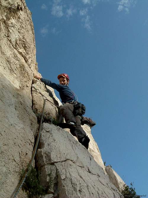
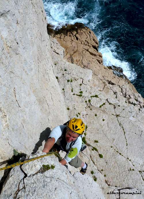
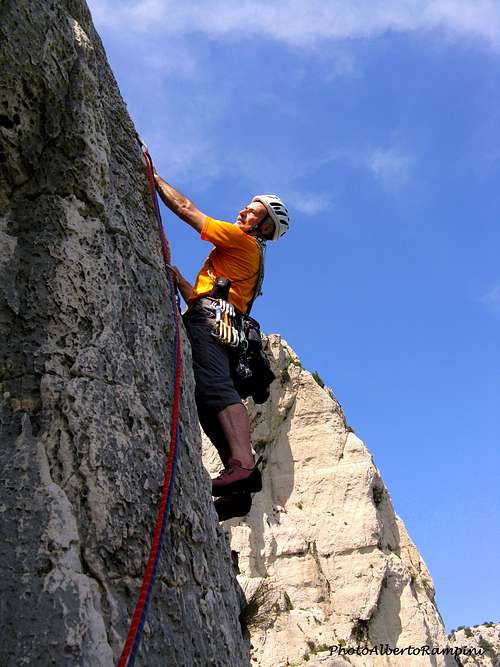
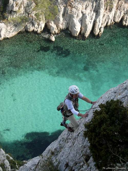
Climbing pictures
When to climb
All year round excluding the summer really too hot and with various access restrictions as said at the previous chapter. Local climbers adapt themselves to the climate, climbing all around the year and choosing the sunny sides in wintertime and North faces during the hot season. Anyhow this is an excellent advice for planning a climbing trip: the best season goes from October to May.
Where to stay
A great place to stay is the little town of Cassis (20 km East of Marseille) with wide possibility of accomodation, including a good campsite:
Camping Les Cigales
Avenue de la Marne
13260 CASSIS
Tel 04 42 01 07 34
In Cassis you can find shops and petrol easily. It would be a mistake to stay in Marseille as there can be traffic jams (second biggest city in France after Paris... 1 million people) and there is no camp site. However the good thing about is that it is only 3 hours away from Paris by train.
Meteo
Guidebooks and maps
 |
 |
 |
 |
 |
“Escalade Les Calanques” by Andrè Bernard - Gilles Bernard - Pierre Clarac – Hervè Guigliarelli – Bernard Privat Ed. Nota Bene
"Alpes du Sud - Provence" by Hervé Galley - Editions Olizane
“Calanques Escalade” by Jean Luois Fenouil and Cèdric Tassan – Ed. VTopo
Map: "Les Calanques de Marseille a Cassis" 3615 IGN 1:15.000