
-
 39871 Hits
-
 94.82% Score
-
 49 Votes
|
|
Mountain/Rock |
|---|---|
|
|
47.30300°N / 113.911°W |
|
|
Hiking, Mountaineering, Scrambling, Skiing |
|
|
Spring, Summer, Fall, Winter |
|
|
9425 ft / 2873 m |
|
|
ESM Peak—A nice introduction to a marvelous range!
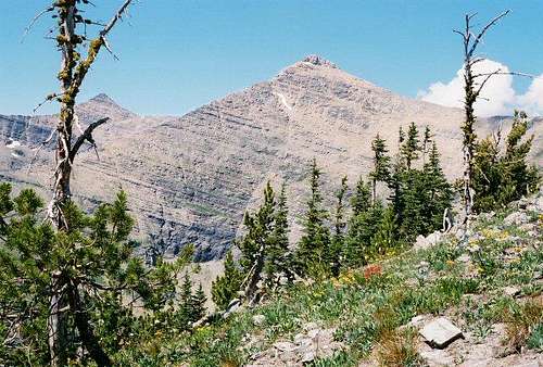
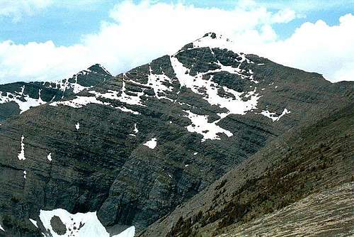
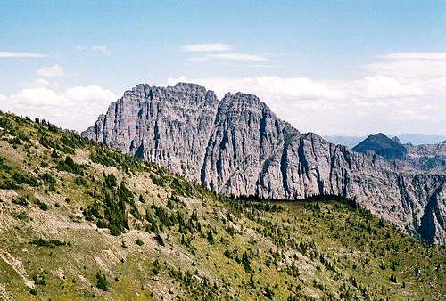
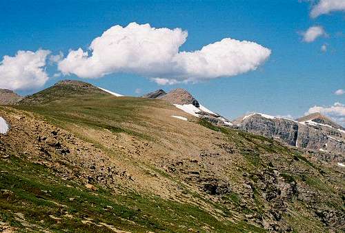
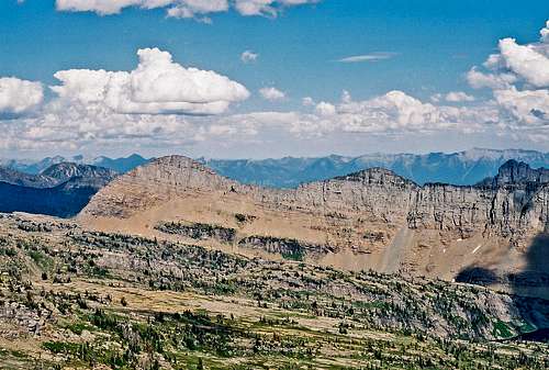
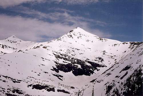
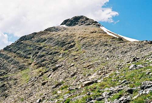
 ESM—early July, 2004  A distant ESM Peak rises through the lush Missions East Saint Marys Peak is located at the southern end of Northwestern Montana's Mission Mountains; it is approximately 28 miles north (as a crow flies) of Missoula, and 8.5 miles east of Saint Ignatius. The Missions are spectacularly big, with a precipitous western wall rising from 3,000 to just over 9,800 feet (when driving U.S. Hwy 93 north through Ravalli on the way to Saint Ignatius, upon reaching the top of the small "summit" between the two towns—known locally as "Ravalli Hill"—you get your first broadside view of the range, a perspective that will most definitely get your attention!), and are relatively inaccessible, with many of the peaks being a two day affair, or even more—if you are going anywhere in these mountains it is because you WANT to. The range has several glaciers (of which the Sunset and McDonald Glaciers are largest), is full of wildlife (except maybe No Fish Lake, which I think is suspect), and will provide all the solitude for which you could possibly wish.
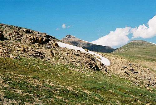
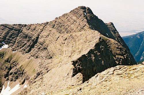
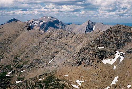
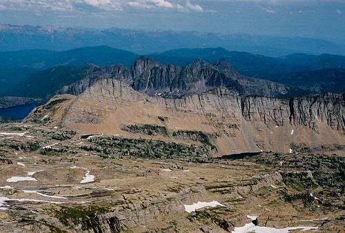
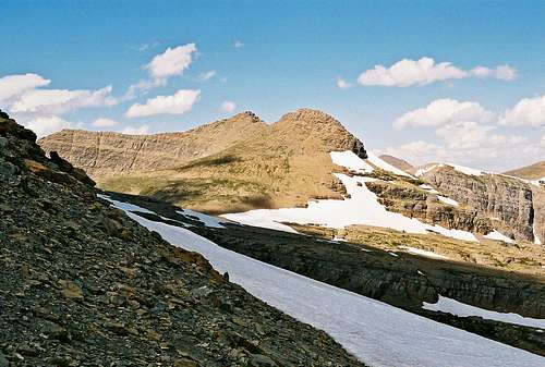
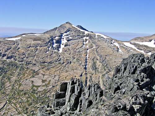
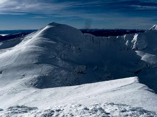
 The graceful summit ridge The Missions have been heavily glaciated, and for the most part are quite rugged, the higher elevations of the southern half more so. It is interesting to note that during the last ice age the continental glacier actually rode over the top of the northern Missions, chopping them down, but did not bury the peaks  ESM, from neighboring Gray Wolf Peak further south—doing, instead, the more "normal" alpine sculpting glacial activity of chewing and hacking at the mountain sides—thus preserving that part of the range's lofty and rugged status, with the demarcation line for this activity being approximately east of the town of Ronan. East Saint Marys, and its companion peak, West Saint Marys (elevation 9372 ft), while on equal terms with their neighbors as regards elevation gain and height, are, however, an exception to the "southern ruggedness," being relatively symmetrical and graceful outposts in a very rough environment, particularly so when viewed from the west and south. The two "Saint Mary" peaks are not technical to climb, but are very much worth the effort expended; the introductory view they provide into the Mission Mountains is one likely to result in further exploration of the entire range.
 Almost there...! Nothing exists in the way of a comprehensive peak guide for this area, and even on the internet I could not find much pertaining to individual mountains, except for an occasional mention of McDonald Peak (at 9,820 ft, the range's highest), but I did find one gem of an article, "Mission Mountains Divide," in the Fall, 2006, issue of Forest Magazine, which does a wonderful job of detailing the coexistence, and differences between, both the Mission Mountains Tribal Wilderness (western half of the range) and Mission Mountains Wilderness (eastern half). The article also gives a historical overview of the Tribal Wilderness; I found this to be one of the best articles of its type I have (ever!) come across, and is well worth your time!
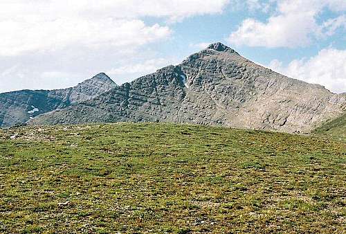
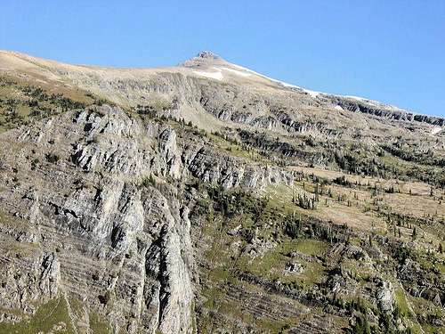
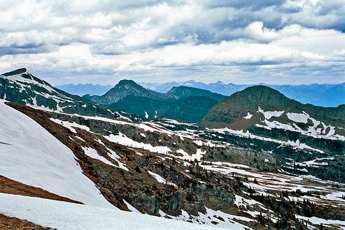
Area views from—and to—East Saint Marys Peak
Winter Ascents
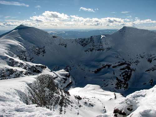
"This is one of the few alpine peaks in the Missoula area that can be climbed in the winter as a "day hike" with relatively low avalanche danger. The road to the trailhead is often passable in winter due to its low elevation (it isn't gated) with an average 4WD and is a popular snowmobile route. However, I have visited the trailhead during most months of the year and seldom do we have to hike very far, if at all, to get to it. The normal (southeast ridge) route is objectively very safe and is a common winter training route for The New Rocky Mountaineers climbing club which is based in Missoula."
Getting There Concrete building marking where you leave the road (see text) Easy. Sort of. Take U.S. Hwy 93 until reaching Saint Ignatius, then take the main turnoff (where you turn, there’s a Sinclair gas station, museum, cafe, and fruit stand on the west side of 93); go east for .3 mile until reaching a "T" junction, whereupon there is no choice but to go either right or left; go right for about a block, cross the small bridge, and immediately turn (angle) left. Stay on that street another .3 mile until coming to a stop sign, where you (again) must go either right or left: turn left. You are now on the St. Mary’s Lake Rd, and after 2.1 miles take a 90 degree right turn (the road is signed, but it’s easy to miss them the first time around), go another mile until the road  Campsite marking beginning of trail (see text) takes yet another 90-degree turn, only this time it’s to the left, and now you’re set—no more tricks. Continue another two miles (still St. Mary’s Lake Rd, remember) until the pavement ends, turning into a good gravel road; at that point it is almost exactly 4.5 miles to St. Mary’s Lake, and another short distance (a quarter mile or less) to the trailhead. There are no signs pointing to St. Mary’s Lake, and you can’t see it from the road, so I’ve provided a picture of the turnoff, with the rather distinctive, easy-to-spot, concrete building (left side of the road) that marks your way. Drive past that building on its right, then immediately take a left for maybe 150 yards, and park your vehicle (it’ll be obvious that you’re there). I’ve provided a picture of the campsite, which is the actual starting point... [text continues in "Route" section] Route...head past the campsite a few yards until encountering a dry stream bed (surprisingly enough, it was dry on my first attempt at ESM, early July); head up the stream bed, and you'll soon begin to see trails forming on the left. Follow these trails, which, within a hundred yards or so, will combine, and you'll be on a (reasonably) good game trail, which will take you up to timberline. At this point the trail becomes sketchy, but the destination is obvious, and it is a matter of simply strolling along a tundra-covered ridge until the final rocky ascent, which is relatively easy scrambling. From St. Mary’s Lake to the ESM Summit is 3.5 miles; elevation gain is just under 5,500 feet, mostly in the first two miles (yes, it's steep—unrelentingly so!).
Red Tape, Wildlife, & Cautions SectionRED TAPE
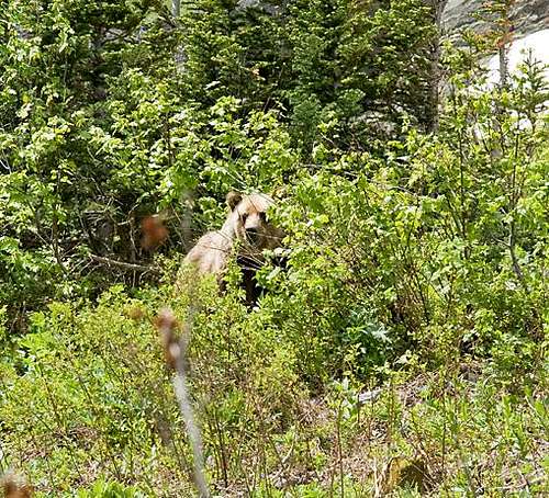
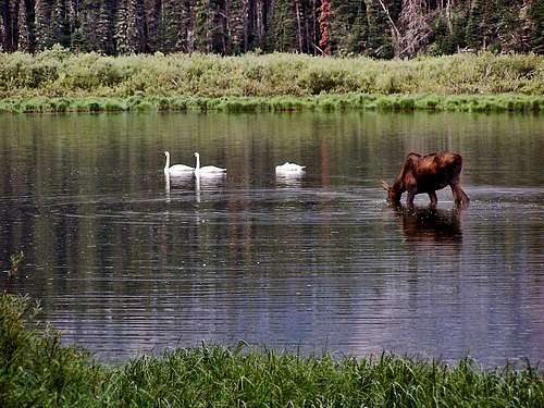
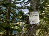 Interesting and unusual sign! Probably anyone prone to climbing in this part of the country already knows this, but the Northern Rockies are full of wildlife, and considerations should be the same as for Glacier National Park. Always be aware, and don't do anything stupid, like—for example—leave food where bears can get at it, think that a mountain lion is even remotely related to your pet cat, or run up to a moose (moose are quite unpredictable, irritable, and very dangerous). And never, ever, EVER forget you’re in grizzly country (this is an excellent, informative link!); they insist on being left alone—disagreement on that point is not an argument you’ll win! Bear spray and noise should be part of every foray you make into the back country. Black bears will be found in the forests, grizzlies commonly venture onto the above-timberline tundra, sometimes, when in pursuit of such delicacies as ladybugs or cutworm moth larva, even to the summits!
When To ClimbJuly, August, September. Late June and Early October may well be okay, but are iffy, and vary from year to year. The Missions get a lot of snow; don’t be mislead by the comparatively quick melt-off on the precipitous western front—the snow doesn’t stick to the steep slopes, and those western faces get a lot of sunlight. Just be aware: There’s a lot of snow in them thar hills, bucko....
CampingThere is camping at the Twin Lakes Recreation Area, which is a mile-and-a-half past where you turn off the road to reach the trailhead. A Reservation Camping Permit is required, which may be purchased when/where you obtain the Hiking Permit, or may be purchased separately, at a later date. These permits are not site-specific, and may be used anywhere in the Mission Mountains Tribal Wilderness (to repeat: one permit per year is all that is necessary, and each is $15.00). The sign at the entrance makes no mention of any length of stay restrictions. In TributeOn March 1, 2011, Vernon Garner, Saintgrizzly, left us after losing a bold, inspiring fight against pancreatic cancer. Or maybe he won, for he is at last free of his pain and has "shuffle[d] off this mortal coil." |

RyanS - Aug 22, 2016 4:22 pm - Voted 10/10
New link for Mission Mountains Divide articlehttp://www.fseee.org/index.php/ground-truth/200198