-
 63812 Hits
-
 97.19% Score
-
 66 Votes
|
|
Area/Range |
|---|---|
|
|
47.38300°N / 113.918°W |
|
|
Hiking, Mountaineering, Trad Climbing, Ice Climbing, Scrambling, Skiing |
|
|
Spring, Summer, Fall, Winter |
|
|
An Absolutely Marvelous Area!
THE "LOWER-48 UNFORGETTABLES"
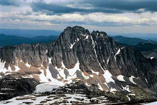
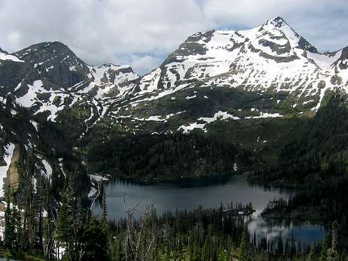
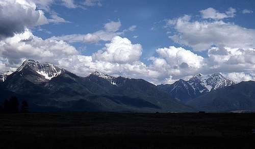
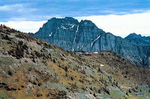
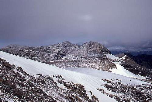
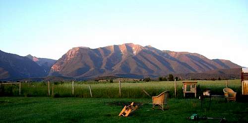
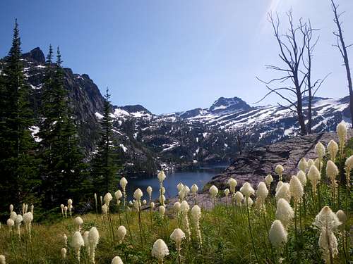
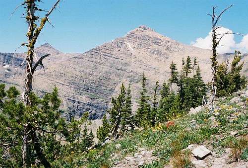
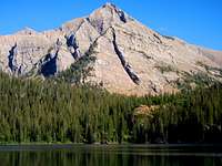 Mountaineer Peak, Lucifer Lake 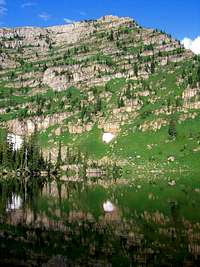 Mission green Those of us fortunate enough to have driven the Intermountain West can bear witness to some remarkable sights, and exposure to views that readily become bits and pieces of a welcome and permanent memory. The sort of thing to be used at work as an inducement to office cabin fever, not to mention real torment! And at a later time, if some occurrence—say, a photograph, or a route retraced—brings with it a reminder of even a long ago encounter, reaction comes along the lines of...Ahhh yes!...I remember that...magnificent...!—as though the vision was last seen just yesterday. And identification (not to mention motivation) is quickly and wonderfully immediate.  This is not an easy country.... we are the better for the pictures they bring. 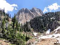 No name, unknown, beautiful! This page is about another member of these magical places, one not so well known yet just as memorable... 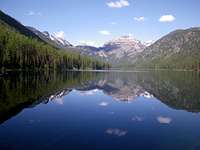 Crystal Lake, Sugarloaf Mountain what the locals call "Ravalli Hill;" after a mile-and-a half you reach the summit, and with no warning have a face to face confrontation with just under 7,000 feet of precipitous and huge upthrust: the (absolutely) unforgettable western flank of the Mission Range. There is a rest stop on top of Ravalli Hill, where it is okay to pull over and deal with the goose bumps because, simply put, slamming into your vision is the monumental side of what mountains are all about. The view is magnificent, and even after being over that crest dozens of times I still stop, engaging in a wonderfully losing battle to cram everything I see into my head. It cannot be done, but the trying is sublime. 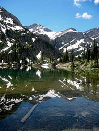 Glacier Peak Well, that is one way to do a visual number on memory retention, but there is another face to these mountains. The east side is a bit less dramatic because for one thing the valley floor is about a thousand feet higher than on the west (and the highway—Hwy 83—is not quite so close), and for another, the Seeley-Swan Valley is so heavily forested that there are miles when nothing can be seen of the Missions to the west (or the also greatly impressive Swans to the east); the trees are lovely and impenetrable, and the mountains are  A landscape whirled and stirred, and not sorted... tucked away and out of sight. An occasional meadow serves as a window, where the natural inclination is to stop, take in the lushness, and fill your camera and mind.
The difference lies easily between innocent and simple-looking lines on a map (in this land of amazing mountains), an area where during the summer no human may go (there will be neither grisly human nor human/grizzly interaction), and trails are steep and without switchbacks (animals don't zigzag up mountains)—and are, anyway, only sometimes cleared of deadfall and rubble (this is not managed wilderness travel: you are on your own)—if you choose this wild and uncivilized place (of very few posted signs) it is because you want to.
MISSION MOUNTAINS WILDERNESS COMPLEX
 Glacier scrapings Our songs come from those mountains. Our dreams, our hopes are taken there in the hope that we will get guidance and support from wilderness.  Information along Hwy 93 (enlarge to read)
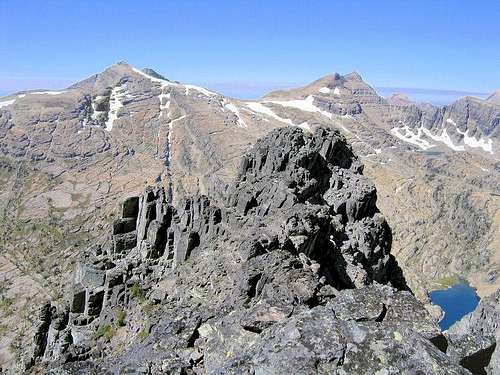
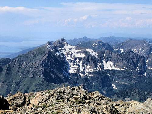
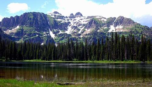
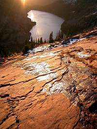 Lost Lake Mission Mountains Tribal Wilderness – 89,500 Acres 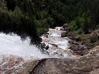 Down the Mission Falls roughest, wildest terrain imaginable, have approximately a paltry 45 miles of trails (mostly not much suited to pack animals, and sometimes not much better for two legs) between them, contain—in McDonald Peak—a member of the Ultra-prominence Club, also are home to two magnificent waterfalls—Elizabeth and Mission Falls—which drop over a thousand feet each, still have several small (but respectable) glaciers holding on to the status of being glaciers, and lastly, the Tribal Wilderness has a most unusual management feature: a substantial chunk of land completely closed to humans during what would normally be the height of summer activity. The southern half of the range is the more rugged because the Continental Ice Sheets rode up and over the northern mountains, grinding those summits into some semblance of submission, while the peaks further south were just encircled, hacked and carved at the sides, and threatened.
The Mission Mountains Wilderness was officially designated as such in 1975, the boundaries for the Tribal Wilderness were set in 1979, and made official in 1982. Prior to the official designation of the Mission Mountains Tribal Wilderness, the tribes had fought the designation of the area as a national park, and after much discussion voted against timber harvesting in the lushly forested area. Both circumstances would have led to increased tribal profits, but it was decided such was not to be the priority.  An unknown Mission Mountain (anyone recognize?) What this has meant over the past twenty-five years or so, and what it means today, is simply that these two wilderness areas are managed quite differently. The Mission Mountains Wilderness is oriented more towards recreational use, the Tribal Wilderness is oriented towards the animals  White Pine and Gray Wolf and land having priority, with the end result being what most think of as a true wilderness experience—trails (game trails, which are completely different from man-made paths) are not often maintained (signage, if existing at all, is minimal), and in fact, over the years many have been allowed to fade away. A permit is required to hike or camp in the Tribal Wilderness; these permits are easily-enough obtained, and the view is that anyone is welcome to use this land—in other words, it is okay if you do, and equally okay if you don't. But if you do, the land managed by the Confederated Salish and Kootenai Tribes is far more like it has always been in its natural state. It is, to make up a word, more "wildernessy." Due to the nature of access into the mountains, trekking and climbing in the wilderness on the Mission's western flank is often considerably more difficult than it is on the east, which has the desired effect of keeping usage down. (So does the grizzly closure area in the McDonald Peak area—see the "Red Tape" section for further information.)
 Mountains and valleys and mountains and... For most of us who climb mountains, one of the reasons we do so is to experience an environment completely different than that of our normal day to day existence. We like the feeling, the depths, of wilderness. But wilderness as managed by the Forest Service is not at all the same as what existed a hundred or two-hundred years ago. The Mission Mountains Tribal Wilderness, an expression of the tribal values and beliefs of the Confederated Salish and Kootenai Tribes, may well be the closest thing left in the Continental U.S. to that quality. Even those habitually and often entering wilderness areas sometimes complain about the physical difficulties—not to mention the restrictions in place—encountered here. As much as is possible this is land left to take care of itself. Entering the Mission Mountains from the west is well worth the effort to enter, but that effort is great.
 Glacier Peaks, from Point St. Charles As should the following section on permits, restrictions, and cautions.
RED TAPE, CAUTIONS, & WILDLIFE
 Afternoon light on a nice ridge Most of the western half of the Mission Range is on the Flathead Indian Reservation (also known as the Confederated Salish and Kootenai Tribes—"Flathead" and "Salish" are one and the same), and a Reservation Hiking Permit is required. If camping, a permit is needed for that, as well—same cost as the yearly license. These are easily obtained at sporting goods stores throughout Western Montana—or you can call the Confederated Salish and Kootenai Tribal 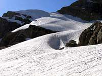 Grace... Recreation Department in Pablo, at (406) 675-2700. The licenses are $15 each, per season, and expire every year on the last day of February—whether you purchase yours in March, May, or December, they expire the end of February. Three-day hiking permits are available for $8.00.
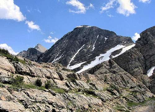
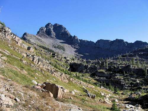
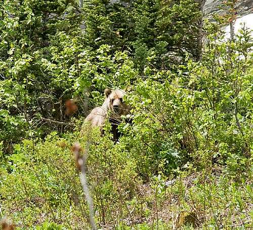
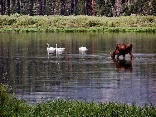
 "Classic" McDonald view "Very early on a July morning as dawn warms this ancient peak and the snowfields take on a pink glow, grizzly bears begin to frolic in the freedom of summer. Damn big and nonchalant they stand, sniffing the air. They then lumber up the slopes to snack on ladybugs and army cutworm moths. After leisurely grubbing through rocks for these seasonal delicacies, the bears begin to overheat as the sun beats down on their thick fur. Since every summer day in the mountains is like a day off from work, the larger bears round up the cubs, and together amble up to the summit snowfields to cool off and have fun, lolling about in the drowsy afternoon hours, from time to time taking a whimsical glance at a good-size chunk of the Western Hemisphere. As the pleasures of the day envelope them, these bears take on a sporting attitude, romping about on slush and loose shale until finally, overwhelmed by exuberance, they take off for the lower elevations, hurtling down steep snowfields at a full gallop, paws slashing out avalanches of slush while long claws serve as crampons. Once off the snow they disappear into lengthening shadows of evening at timberline. These patrols are repeated until September when insect food is no longer found, and the beasts head into the valleys." 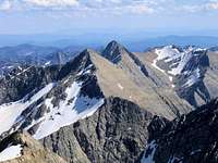 The High Missions, South and East from McDonald's summit That marvelous paragraph comes from the now out-of-print Climbers Guide to Montana, by Pat Caffrey, and while in the book it serves as a lead-in to McDonald Peak and the summer grizzly closure restrictions in that particular area (see below), it also is quite relevant as an overall cautionary introduction to the wildlife inhabiting the entirety of this wild mountain range. 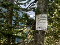 Interesting and unusual sign! Probably anyone prone to climbing in this part of the country already knows this, but the Northern Rockies are full of wildlife, and considerations should be the same as for Glacier National Park. Always be aware, and don't do anything stupid, like—for example—leave food where bears can get at it, think that a mountain lion is even remotely related to your pet cat, or run up to a moose (moose are quite unpredictable, irritable, and very dangerous). And never, ever, EVER forget you’re in grizzly country (this is an excellent, informative link!); they insist on being left alone—disagreement on that point is not an argument you’ll win! Bear spray and noise should be part of every foray you make into the back country. Black bears will be found in the forests, grizzlies commonly venture onto the above-timberline tundra, sometimes, when in pursuit of such delicacies as ladybugs or cutworm moth larva, even to the summits (see McDonald Peak Grizzly Closure information above)!
WHEN TO CLIMB
In TributeOn March 1, 2011, Vernon Garner, Saintgrizzly, left us after losing a bold, inspiring fight against pancreatic cancer. Or maybe he won, for he is at last free of his pain and has "shuffle[d] off this mortal coil." |