
|
|
Mountain/Rock |
|---|---|
|
|
36.39306°N / 118.58449°W |
|
|
Mountaineering |
|
|
Spring, Summer, Fall |
|
|
11760 ft / 3584 m |
|
|
Overview
Though unnamed on the USGS Topo Maps – This peak is known by Falcon Peak according to the summit register. Falcon Peak is the highest granite peak ¼ mile southeast of Vandever Mountain in Sequoia National Park.This peak is over shadowed by Vandever and does not see the traffic that Vandever does. A look through the summit register shows visits about every 2-4 years as opposed to Vandever's 10 a year or so.


This is from page #1 of the summit register:
"Falcon Peak has been named for the beautiful Rusty-crowned Falcon or (American Kestrel) that inhabits this area and is found through-out the State. It is hoped that mountaineers, sportsmen and all persons who have the courage to visit this interesting summit will help to support and to uphold the proposed name of Falcon Peak. Register placed by Sierra Club party who visited the summit, May 29, 1955."

Getting There
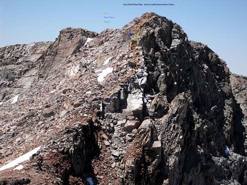
(Note: There are countless ways to approach this area. I'll just talk about the shortest approach being from the Mineral King area.)There are at least two separate routes to summit this peak. This first would be hiking up the east ridge of Vandever from Farewell Gap and descend to the saddle between the two peaks. Then scale the NE ridge class 2. The other way would be approaching from Falcon peak's west ridge (class 2). There is a good notch at to top out the White Chief cirque at its low spot if coming from White Chief. One could then boulder hop the ridge line towards to summit.
 CLICK TO ENLARGE
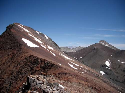


Red Tape
Entrance fee for Sequoia National Park is $20 per private vehicle for 7 days, or $5 per person walking in or on bus for 7 days.Mineral King Ranger Station: On Mineral King Road, 24 up this long road. Call the MK Ranger station direct: (559) 565-3768 for questions.
Check wilderness permit availability for White Chief or Farewell Gap if planning overnight stay in the area.
Wilderness Permit Reservation Availability
 Mineral King....
Camping
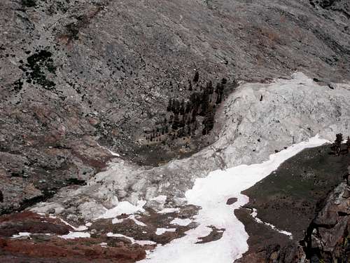
All overnight camping requires a wilderness permit!From many years of backpacking to the White Chief area - The best place to camp is at the 10,000' level just next to the last grove of trees. There is a relatively large flat area with room for many to camp. Water is located over the small hill where the creek goes into Cirque Cave.

External Links
Bob Burd's trip report.Mineral King Webcam