
|
|
Mountain/Rock |
|---|---|
|
|
33.81440°N / 116.659°W |
|
|
Riverside |
|
|
Hiking, Mountaineering |
|
|
Spring, Summer, Fall, Winter |
|
|
9550 ft / 2911 m |
|
|
Overview
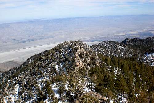 Harvard Peak from Cornell
Harvard Peak is an unnamed peak located in the San Jacinto Mountains, part of the Peninsular Range. It is East of its more popular neighbor, Cornell Peak. Harvard Peak makes a nice side addition when climbing San Jacinto Peak or if you are just in the Round Valley Area. Also, the views from this peak are amazing, with great views of Cornell Peak, the desert, the north face of San Jacinto, and much more.
Although it does not appear as striking as Yale and Cornell Peak, its South face is still steep and rocky. To attain the summit, one has to maneuver an easy Class 3 section, which adds some fun and excitement. The easiest way to approach it is from the tram. If climbing this peak, consider combining it with Yale, Cornell, Miller and San Jacinto. They are all relatively close to Harvard Peak.
Harvard Peak is an unofficial name that has been given to this peak. Like Yale Peak, it most likely attained its name due to the fact that Cornell Peak is named after Cornell College. None-the-less, most refer to it as Harvard Peak. Harvard only has around 60ft of prominence, which, in Southern California, is enough for a peak.
Route Description
By far the easiest way to access this Harvard Peak is by the Palm Springs Aerial Tram. However, it can also be accessed from any other trail that leads to San Jacinto Peak.If your coming from Humber Park (Devil's Slide), you will need to cross over Wellman's Divide down into Round Valley. Continuing a little further you will reach Tamarack Valley. From here, head East (maybe NE) to a saddle that is between Yale Peak).
From any of the trails that come up the South face of San Jacinto, you will need to traverse San Jacinto on down into Round Valley (these routes are probably the longest routes possible to get to this peak).
From Round Valley, you have two options. The first option is to head up to the saddle between Cornell and Harvard. The second option is to head for the saddle between Yale Peak and Harvard.
 The Ridgeline
 The Summitblock
The first route is alot more difficult because of the extensive boulder hopping that is required to attain the summit. Its nothing technical, but it can get a little difficult, especially with snow. From the saddle between Cornell and Harvard, you head East across the ridgeline until you see the summit block (can't miss it).
The second route is obviously easier then the first due to the fact that it is relatively clear of the large boulder fields that are present on the first route. From the saddle between Harvard and Yale, head northeast. If you head straight north, you will hit a head the east South Head wall of Harvard. Its climbable, but most would opt to avoid it. Se head NE until you see the ridgeline (don't go over the ridgeline!) that leads to the steep North escarpment of San Jacinto. From the ridgeline, head west up the ridge and then the summit block (once again, you can't miss it) will come into view.
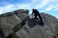 Climbing the Summit Block
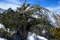 North Face
Both ways to access the summit are Class 2 at the most. However, the summit block requires some Class 3 skills. Looking at the summit block, you will see a fracture in the center of the rock that is about 15-20ft deep at its max. You could choose to chimney up this, however, this is an easier alternative. One the west side of the summit block, there is a nice ridge, probably 20ft long. You can use this ridge along with a series of cracks below to to traverse up. From there, you simply cross the fracture (its about 1-2ft wide) to the actual summit block. When looking to cross the gap, there is a VERY good hand hold basically at its highpoint. Its a pretty basic, yet fun, summit block.
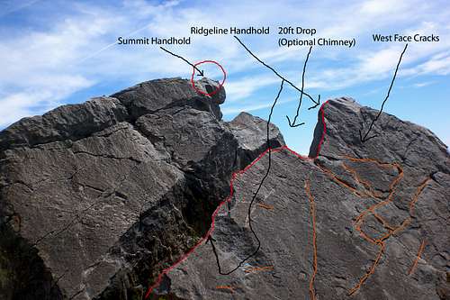 Summit Diagram
Camping
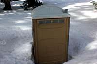 Facilities
Red Tape
A Wilderness Permit is required for entering the Mt. San Jacinto State Park. These can be attained online or at the ranger stations.Also, to park at trailheads (with the exception of the Tram, an Adventure Pass is required.
Getting There
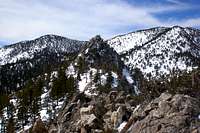 Cornell from Harvard
Humber Park (Devil's Slide)- From Hwy 243, take a right (if your heading north) and take a left (if your head south) onto Pine Crest Ave. Then take a small right at S. Circle Dr. Then take a left at Fern Valley Road. Follow Fern Valley Road all the way to Humber Park.
Marion Mountain Trail- Head North on Hwy 243. After a few miles, there will be a sign on the right side. Follow that to the Trailhead.
For the Palm Springs Aerial Tram, click HERE for directions.
External Links
San Bernardino National ForestSan Jacinto Ranger District
54270 Pine Crest
P.O. Box 518
Idyllwild CA 92549
(951)-659-2117
Mt San Jacinto State Park
29505 Hwy 243
P.O. Box 308
Idyllwild CA
(951)-659-2607
Mt San Jacinto State Park
For info on current condition, check out the Mt San Jacinto Message Board.
Misc
If you have any addition information or pictures not already on this page feel free to post them. Thanks!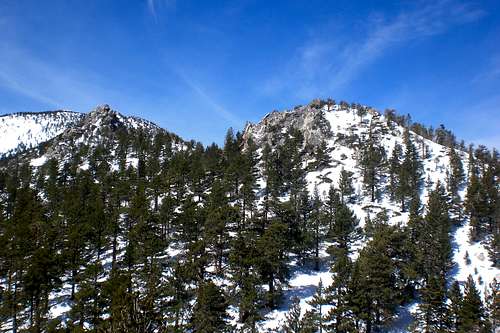 Cornell and Harvard Peaks