
|
|
Mountain/Rock |
|---|---|
|
|
48.40850°N / 121.4601°W |
|
|
5944 ft / 1812 m |
|
|
Overview
Illabot Peak used to be an obscure peakbagger's mountain in the Northwest Cascades just north of the town of Darrington. No longer. Due to a fatality on the mountain that occured shortly after I left the summit, it is now more widely known. For more information on that fatality, see the next section.Ilabot Peak--more properly known as Illabot Peaks--is the highest point of a localized area of mountains bounded by the Suiattle River on the south, the Sauk River on the west, Illabot Creek on the north, and Grade Creek-Bluebell Creek on the east. Furthermore, the low pass between these last two--3,060-ft Bettys Pass--garners Illabot special Washington status: it is one of 144 peaks in the state with over 2,000 ft of prominence. The next-higher peak is 6,103-ft Bettys Jugs on the other side of Bettys Pass.
Like most peaks in this region of the Cascades, Illabot is characterized by forested or logged slopes depending on the elevation and access, open upper basins, and craggy ridgelines or summit areas. Illabot's summit area is definitely cliffy. The easiest way to the top is Class 3 with a few Class 4 moves. Moreover, the rock--Shuksan greenschist--tends to be loose and vegetated.
Illabot is a Native American (upper Skagit tribe) word meaning "painted." Information thanks to Harry Majors:
"The accent is on the second syllable --- I-LLA-bot. The 'i' is short (as in 'it'), the 'a' is as in (bat, cat), and the 'o' is as in (but, cut, shut)--I-laa-but--very roughly similar to 'elaborate'--in fact, that is the only word I can immediately think of that would remotely rhyme with Illabot."
 |  |  |  |  |
In Memoriam
Nigel Aylott, 1966 - 2004On the last day of summer, Sept. 21, 2004, I climbed Illabot Peak. I expected to see no one as it is not a primary or even a secondary destination for climbers. That same day, unbeknownst to me before hand, the area was to be the used as part of the Subaru Primal Quest Adventure Race. The summit of Illabot was one of the team checkpoints. This later explained the strange orange and white flag contraption encountered at the summit. While I was on the summit a helicopter landed in the basin to the NE and dropped off two people. I waved at them and they waved back. They were cameramen for the race.
Though I did not see them, the two leading teams were either on the north side of the mountain or in the Iron Creek drainage approaching the mountain. Approximately two hours after I left the summit, while I was speaking with one of the volunteers at my car, a call came in via walkee-talkee that there had been a Code 3 accident on the mountain. At first they thought that a contestant had suffered a concussion. I found out the next day that Aylott had died. He was hit on the head by a 300 lb rock. A rock of this weight is typically about the size of a microwave oven. The accident occurred on the south side of the peak about 500 feet below the summit while the two teams were downclimbing en route to the next checkpoint not too far away. The event put a heavy damper on an otherwise enjoyable day and area.
Here is an Australian article written about the accident (December 2004).
 |  |
Getting There
There are basically two ways to approach this peak leading to two ways to climb it. Both routes, though they have different starting points, finish the climb on Illabot's West Ridge. The first order of business is to get to the general area of the peak:From Darrington, drive Hwy-530 17 miles northward to Illabot Creek Road (FR-16), which junctions off to the right. The road is marked by a yellow sign. This is the same road as for the Jug Lake approach to Mt. Chaval and the West and Illabot Creek routes to Snowking Mountain. Alternately, if coming from Rockport (North Cascades Highway), drive Hwy-530 2.5 miles south to the Illbot Creek Road turn-off.
 |
Northwest Approach
The road you want for this approach is known as Illabot Peaks Road No. 1620. From the highway, drive Illabot Creek Road for 9.8 miles to 2,880 ft. Here Illabot Peaks Road goes off on the right and climbs 1,200 ft in 3.8 miles to this saddle (c. 4,100 ft). Just before this saddle a spur road leads right in the White Creek drainage along the west flank of Illabot Peak. This spur road is the beginning of your route. Park at the beginning of the spur road. Illabot Peaks Road has many drainage berms in it so a mid-to-higher clearance vehicle is recommended. It's not too bad.Continue as per the NW Approach to West Ridge Route.
Southwest Approach
The road you want for this approach is known as West Boundary Road No. 1610. From the highway, drive Illabot Creek Road for 6.2 miles to 1,500 ft. Here West Boundary Road continues straight where Illabot Creek Road switches back to the left. Drive West Boundary Road past the west side of Suiattle Mountain for 9.3 miles to this saddle (c. 4,100 ft). The road is in fine shape (hardly any drainage berms). A road can be taken a short distance east from the saddle but it is blocked around a steep bend.Continue as per SW Approach to West Ridge Route.
Red Tape
For once there is no red tape to climb this peak. It is located in Mt. Baker-Snoqualmie National Forest but there are no official trailheads. Your start points are from logging roads.When To Climb
The best time to climb Illabot is from spring to fall. Access is the main issue in spring. The summer start points are high (4,100 ft), meaning the approach roads may still be snowed in. This will add walking/snowshoeing time. Furthermore, the summit of Illabot is very steep. Gullies may be choked with snow in spring, making for easier climbing, but I don't know for sure.Camping
Illabot can be climbed in a half-day from the summer start points so there is no need to camp. Even so, the open upper basins would offer nice camping. Running water appears to exist year-round. Also, 4,820-ft Lake Louise SW of the summit might be a nice place to camp. It's not far from the road.Mountain Conditions
Localized ForecastMarblemount Weather Forecast (nearby town).
Darrington Weather Forecast (nearby town).
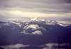 |
Views from the Mountain
 |  |  |  |  |