Overview
Indian Mountain resides on the western slope of the San Jacinto Mountains. It has a unique position in the western slope, a area that is usually overlooked for the higher summits of the range. The peak is granitic with thick stands of chemise and manzanita. The view from the summit encompasses the Palomars, Santa Anas, San Gabriels, San Bernardinos, all the lesser ranges of the Inland Valley, and the high country backbone of the San Jacintos. Indian Mountain has a prominence value of P790 and is on the San Jacinto cell of the California Mountain Atlas.
Getting There
Take Interstate 10 to the city of Banning. Take the exit for SR243 to Idyllwild. Drive along scenic SR243 for 15.5 miles to the Indian Vista turnout.
Red Tape
You will need a National Forest Adventure Pass to park at the Vista turnout. Adventure Passes are available in Banning and Idyllwild at many gas stations and markets.
Route
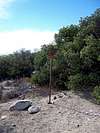
Just to the right of the parking area there is a fireroad labeled 4S21. Hike down and then up this road for 3 miles to the summit area. The first part of the road loses about 500ft. then the second half gains 800ft. At the summitt area, right before the road starts to head dwonhill to the west there is a triangle metal sign on the left. On the right near some manzanita there are rock ducks marking a short path through the summit boulders. The high point is a short, maybe class 3 rock pile.
RT 6 miles and 1300ft. gain
You could drive a four wheeled vehicle to the summit area with little problem.
Also while hiking be alert to motorcycles and other users, many blind dusty turns.
External Links
Go to San Bernardino National Forest for
current conditions.
Indian Mountain is on the
Hundred Peaks List.
Camping
There is tons of camping near Idyllwild. Also in Idyllwild there are great bed and breadfast places to stay.
Dedication
I dedicate this site to my father who passed away on March 5th to kidney cancer at the age of 56. He gave me my love for the outdoors and I will forever be his buddy.