
-
 9656 Hits
-
 71.06% Score
-
 1 Votes
|
|
Mountain/Rock |
|---|---|
|
|
37.93909°N / 22.39579°E |
|
|
Download GPX » View Route on Map |
|
|
Korinthia |
|
|
Hiking, Mountaineering, Ice Climbing, Scrambling, Skiing |
|
|
Spring, Summer, Fall, Winter |
|
|
7789 ft / 2374 m |
|
|
Overview
Mount Killini (2,376m) ["Κυλληνη"] or Zireia is the 14th highest peak in Greek, and the second highest in the Peloponnese after Tygetos (2,405m). The name of the mountain refers to its barren, rocky and couloir filled terrain; it was said in ancient times that the mountain was the home and birthplace of the god Hermes. There are multiple roads leading up to the mountain although they don't lead all the way up to the summit. There are several other interesting sights through the massif, including a gorge and river, a cave, and a few +2,000m peaks. The mountain is designated as a Natura 2000 protected area for the protection of birds with over 19 species of interest making it their permanent or seasonal home. It houses a small ski center with 1 lift.
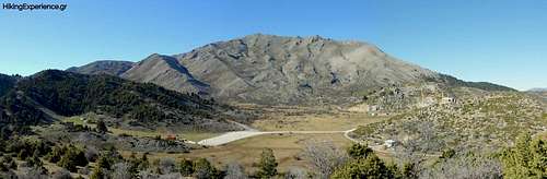
This mountain is both called Killini (Cyllene) and Zireia ("Ζηρεια"), both names are correct although I believe that Zireia refers to both peaks of Killini (here) and small Zireia across the gorge to the East, and Killini only to this on. Mount Killini is the name that refers to this specific mountain, the name is derived from the Greek word "Κυλος" which means "Scars" thus it is referred to as the "Scarred Mountain" due to the wild and very rugged North face, visible in the image above.
History & Area Guide
|
|

|
The area and mountain are attached to the origin story of Greek god Hermes, who was said to have been born in the cave of the same name to the South of the plateau. According to legend, on the day of his birth Hermes left the mountain and headed to Thessaly where he stole the cattle of Apollo. The following day he constructed the first Lyre (“λύρα”) using the shell of turtle and the neurons of one of the cows. Later when angered Apollo makes his way to the mountain, he is gifted the lyre by Hermes. Today one of the summits is still called Chelidorea (“Χελυδορεα”) which mean turtle shell, commemorating the legend.
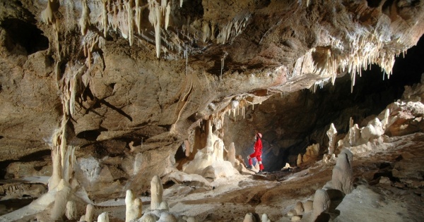
The Cave of Hermes is a cave of area over 1,200m2 located on the South of the mountain overlooking the gorge of Flambouritsa, it has 10 chambers some of which contain water. The cave has a number of unique features including a rare white color on the walls of the second chamber. Due to its age, it also has large ‘columns’ which are formed when stalagmites and stalactites meet vertically. It is thought that this final feature drove the association with Hermes. The cave was recorded in 1971 by geologists and conclusively mapped a year later.
The main villages of the mountain are Oreina Trikala Korinthias (“Ορεινά Τρίκαλα Κορίνθιας”) a set of three located at increasing elevations on the Northern slopes. Ano Trikala (“Άνω Τρίκαλα”) simply “upper”, is the one located closest to the plateau which is around 20 minutes by car. The villages are traditional and have plenty of options for accommodation and dining.
Interactive Area Map
The main point of access to the mountain is the Zireia Plateau at 1,600m located on the North side of the mountain above the villages of Trikala Korinthias. It is about 220km from Athens and less than 2.5 hours drive in total.
Route(s)
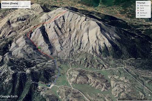
Mainline (North Face)
- Distance: 11km (round trip)
- Duration: 6 hours
- Elevation Gain: ~900m
- Difficulty: Medium
- Water: None
Overview
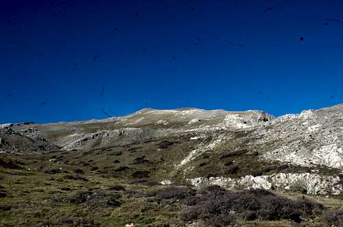
This route begins either at the ski center parking lot or at the end of the dirt road by Hut B, both at 1,500m on the North plateau of the mountain, best accessed from the villages of Trikala Korinthias. It climbs via a gentle ravine and meets the shoulder at 1,900m and then cuts across until under the summit. Max elevation is 2,376m.
There is a GPX file provided on this page following the route. Watch out, we didnt follow the trail during the descent. Please follow the GPX at your own risk.
The Entry
This is the part of the hike which you can skip. The main parking area is the big parking space under the ski resort on the East side of the plateau. By parking there you will have to hike about a one-hour through section towards the refuge that is 2.4km, if you have a 4x4 at your disposal you may be able to drive through the field cutting that hour of your hike. The section ends at the refuge where the second section starts.
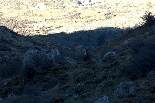
Rock Trail - Hut B Couloir
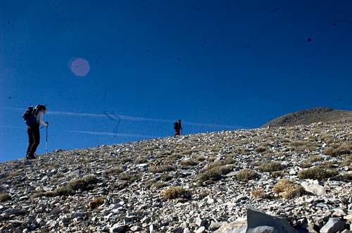
This is a steep rocky section that runs for about 1km, it is easy to navigate with good markings and does not have any exposure. It follows a shallow couloir all the way up the East shoulder. Progress can be very slow, and the section takes about 1 hour. The trail here offers amazing views of the Northern mountains. It is considered the hardest section of the hike in terms of terrain.
|
|
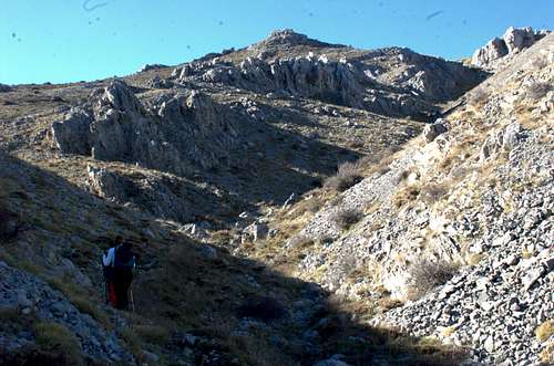
The Grasslands
This is a rather easy section, while it is exposed and there isn't any clear trail outlined on the ground, navigating it is easy and it is not too steep, thus it is a scenic but somewhat uninteresting section. It is usual to it withing 45 mins. This section takes one from the East shoulder to the start of the summit pyramid section, in the middle of the North face. As a marking for the end of this section you may seek out a large info plaque about the local flora and fauna situated by the dirt road at 2,000m.
|
|
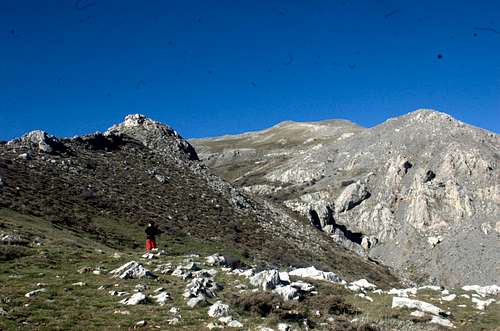
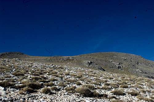
Summit Trail
Starting from the road on the North face at (37.935257, 22.405543) and marked with red this final section is a brutal ascent of the final ~300m of elevation in 1km of distance. It is not exposed from below; however, wind speed and temperature may change drastically here as there is no longer anything higher nearby. The summit is a small bump and has an elevation marker on top. Just under the summit is the foundation of a hut (probably) which can be used to set up tents. There is little to no cover from the wind however.
|
|
When to Climb
It is recommended that hikers attempt between September to November and June (given low snow cover), while mountaineers and skiers should only beware of low snow cover during December and April. It is not recommended that it is attempted during the summer months as there are no springs on the route to the summit, while temperatures can easily exceed 30C. The best window for hiking is May to June and late September to early November.
The mountain ski toured during the winter months. Always remember that there is no avalanche mitigation and poor accessibility to Search & Rescue services however, so venture at your own risk. No accurate snowpack evaluations or weather reports are available for the area.
Weather Conditions & Forecast
View detailed snow forecast for Ziria of Corinth Ski Center at:
snow-forecast.com
Huts & Camping
Like usually in Greece, wild camping is permitted, however, as this is a Natura 2000 area it is not recommended to camp, especially below the tree line. Starting a fire below the tree line is forbidden, and doing so above it is also not recommended. There is little to no water on the mountain. Camping on the mountain as opposed to on the plateau requires bringing supplies.
Hut B
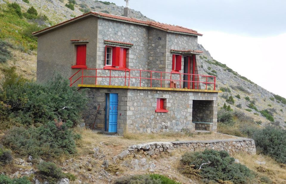
The mountain is home to one maintained hut which is passed on the way to the summit during the couloir section towards the shoulder at an elevation of 1,680m, it is called Hut B. This is the only hut directly on the mountain and is kept locked, it can be opened upon request by contacting the National Mountaineering Club of Korinthos (EOS Korinthou). It is stone built and can sleep up to 16 people in heated rooms – using petrol – and also has an indoor toilet. It does not have drinkable water.
Hut A is located close to the ski center, and thus, further away from the mountain but has been abandoned for some time.
Natura 2000
The broad area of the mountain is subject to two Natura 2000 sites, “Peaks of Zireia and Flambouritsa Gorge” and “Oros Zireia”. The former protects 13 types of habitats and their plants – more than 89 – as well as the Eurasian Otter. The later is designated for the protection of birds, with 17 species being subject. In total the Natura 2000 sites make up over 30,000 ha.
The Zireia Ski Center
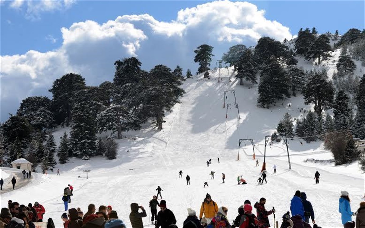
The Zireia Ski Center is located at the Southeast end of the plateau at an elevation of 1,600m, it only has 1 lift, an anchor tow, and two slopes, facing Northwest. The maximum elevation difference is less than 100m. It rarely opens unless there is a large storm in the area. Other winter sports activities such as guided hikes or snowmobile tours are operated by the center.
According to their website a 2023-day ticket costs €10.
The ski center chalet is usually open year-round, and especially on weekends.
In 2018 the mountain, and mainly the shoulder by Hut B, played host to the annual 2018 Snow Leopard Day hosted by Dynafit & Klaoudatos Ski Shop.