Big Plans
Labor Day weekend! Perfect opportunity to get out there! I had big plans: 3 days; 3 hikes.
The first day, I was going to climb Mt. Evans from the West Chicago Creek trailhead, and on the return, time permitting, a short detour up Gray Wolf Mountain. The second day, it was Mt. Edwards from Argentine Pass, then a ridge traverse side tour to climb Grays Peak again. (I originally climbed it 8/4/07; see Trip Report.) The third day was supposed to be a fun Mt. Spalding climb from Guanella Pass, returning over the Sawtooth.
Day 1: Mount Spalding/Gray Wolf Mountain
Spent the night at the campground right next to the trailhead. (By the way, the trailhead is "Hells Hole Trailhead," and not "West Chicago Creek Trailhead," as named in some publications.) We were able to start at 5:30am, and didn't need my headlamp for long.
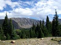
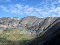
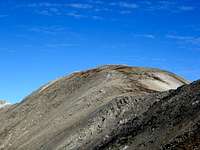
This is an easy trail that affords some great shots of Gray Wolf Mountain's impressive west side:
![The Lonely Wall]()
West Chicago Creek basin is a beautiful place, and the trail is easy to follow. However, the southern part of the trail is not where the USGS topographical map places it, and if you're following Gerry Roach's directions from West Chicago Creek Trailhead), you're going to be in the wrong place. The end of the trail doesn't end just north of Hells Hole; it ends just north of the northern slope of Point 12988. It is very easy to just follow the trail to its end, and miss Hells Hole. Instead of backtracking to Hells Hole, I decided to just ascend Pt 12988, which although at first required navigating some rather unpleasant willows, turned out to be a pleasant slope of grass and solid rock. I ended up reaching the ridge overlooking Hells Hole just north of the summit. If you find yourself here, I suggest just following the ridge over the summit and following it to the unnamed "Upper Scott Gomer Creek Plateau (USGCP)." It is a short jaunt which involves some Class 2+ fun. Plus, because I imagine that Point 12988 is seldom climbed, you get some rather unique views!
![Overlooking Hells Hole]()
![From Pt 12988]()
![Mt Bierstadt]()
So! Here I was, at the plateau an hour later than I had planned. With such a long approach, the delay didn't allow realistically reaching Mount Evans, but I still wanted to salvage what was left of the day. Mount Spalding was right there! Although unranked, it is still a centennial 13er, just like North Maroon Peak and Conundrum Peak are 14ers. I was planning on climbing it on Monday anyway, so why not! Off we went!
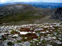
At the nadir between Hells Hole and Mount Spalding, there is a big rock right next to Scott Gomer Creek. Great place for a rest stop. It was here that I had an epiphany. There are a number of specific places in this world of ours that bring us in touch with our inner selves. I'm going to call them "Zen spots." These places are not the same for everyone. Some people are drawn to oceans, some to beaches, some to rivers, some to mountains, and I assume some to cities and other types of locations. Perhaps not even locations, but events. They may permanent or temporarty, where the magic may fade away over time. Regardless, the Zen spots exist, and I had just found one of mine. I wasn't looking at Everest or K2. Hell, I wasn't even looking at Evans or Bierstadt behind me. By chance, I sat down facing Grays and Torrey to the west, overlooking a not-so-special plateau, and the feelings just rushed in. At this point, I can't describe any better, but I may write an article on it soon.
![Zen Spot]() Zen Spot
Zen Spot
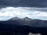
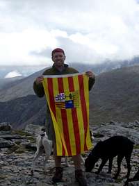
I had to peel myself off of my newly discovered Zen spot, and started climbing Mount Spalding. From this side, it is another gentle climb to the summit of Mount Spalding, at least until the very summit, which looks like a small fortress. We made it just at noon. From here, the throng on Mount Evans was plainly visible. There was only one other gentleman on Mount Spalding, and we were soon joined by two more, but that was it. It seems to me that there are 54 mountains in Colorado that get a lot of traffic, but there are hundreds if not thousands that seldom get a footprint. Too bad. So far, some of my best climbs have been 13ers. From Mount Spalding:
![Gray Wolf Mountain]() Gray Wolf Mountain
Gray Wolf Mountain![Twin Peaks?]() Grays Peak and Torrey Peak...twin peaks?
Grays Peak and Torrey Peak...twin peaks?
Gray Wolf Mountain, a bicentennial 13er, didn't seem so far away, and I had planned on climbing it anyway, so off we went! It is a quick descent off Mount Spalding via the north slopes, and Gray Wolf Mountain's southeast side is nothing compared to its west side.
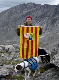
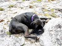
It should've been a quicker ascent, but we were all starting to feel the distance. Once we made it to the top, I got my picture, and Tango and Lexie got a quick respite.
![Climbing Partner #1]() Tango
Tango![Climbing Partner #2]() Lexie
Lexie
From here, I aimed for the southern edge of Hells Hole. I was determined to find and follow the trail through Hells Hole! After quickly reaching the rim, it turns out that the descent into Hells Hole is an easy scree route at the top. However. Although there is a semblance of a trail descending into Hells Hole, it fades often, and disappears altogether in the large willow field at the bottom. Once past the willow field, you have to decide whether to negotiate the marshes or the forest. Although I seldom choose navigating through the forest--they usually make for harsh progress--after dealing with some of these marshes, I chose the forest. (Didn't really matter much, there are some marshes even in the forest, and eventually, it all turns into forest...)
According to my GPS, it wasn't far to the trail from the entrance of Hells Hole. So it turns out the southern end of the trail is not where the USGS topo map says it is. Actually, the trail is actually 800-1000 feet to the west of where the map depicts it. It's all forest, and if you go straight west, it's uphill as well. This part of the day was also slow, because I was searching for the trail. I headed in a North by Northwest direction, assuming that the trail was not far off and I'd reach it soon. After 20-25 minutes, I finally reached the trail, and from there the descent was pretty quick.
If you plan on reaching Hells Hole from West Chicago Creek trailhead, (aka Hells Hole TH,) the point the map and the trail diverge is Lat: 39.64908; Long: -105.67320. South of this point, the actual trail begins to veer west of its depiction on the map.
It took us 11 hours and 20 minutes for 16.2 total miles and 5295 feet of elevation gain, including resting and "zen" time.
After quickly packing up my camp and quenching Tango and Lexie's thirst, we began heading toward the next campsite at Horseshoe Basin. However, since I was driving right by Keystone, I decided to check if there were any dog-friendly hotels there. (Tango is five years old, and for some reason, gets sore after some of our climbs...) There was! The Inn at Keystone will allow pets, and will even provide door signs and treats during check-in! So instead, we "roughed" it here.
Day 2: Mount Edwards/Grays Peak
Sigh...we woke up late--probably wouldn't have happened in a tent--and after checking out, stopping at Starbucks, (hey...it's Keystone,) and reaching the trailhead near the end of Peru Creek, it was 8:35am before we started. No worries. The plan today was to take Argentine Pass trail to the pass, and then follow the ridge to Mount Edwards. It is important to note here that today's primary objective was Mount Edwards, and we were climbing Grays Peak--again--because there was a single picture I needed at the summit. (See Trip Report:
The Lonely Route on Grays Peak)
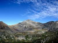
Off we went, up Class 1 Argentine Pass Trail, which by the way, provides many great vantage points for excellent view of Mount Edwards, Grays Peak, and Torreys Peak.
![Even in Summer...]() The Edwardian route
The Edwardian route![Mt Edwards]() Mt Edwards
Mt Edwards![From Argentine Pass Trail...]() Grays Peak
Grays Peak
As I approached the apex of the pass, I heard the unmistakable noise of an engine really close by, too close to be plane. What the hell? I didn't realize that the east side of the pass was a 4WD road! Just as I reached the pass, so did an ATV, followed by a dirt bike shortly thereafter. Argentine Pass is a busy place! The gentleman on the ATV was from Indiana, and was in awe of the beauty surrounding us. I silently nodded agreement. We chatted for about half an hour. For some reason, conversations with people in the mountains tend to be better. Go figure. Being from Indiana, he didn't believe anybody could remember the names of all these peaks. Three years ago, I would've agreed with him. I would listen in disbelief when people would rattle off names of mountains and ranges in Colorado. How could they remember all that? Didn't they have a life? Sigh...since I started climbing two years ago, I have slowly become one of "them." Probably from studying all those topo maps in preparation for climbs, or from reading and rereading Roach's 14er and 13er books, or from researching more peaks on SummitPost. However, it is nothing I regret. :)
From Argentine Pass, we could see mountain goats near the summit of Mount Edwards. In the past, the few mountain goats I'd ever seen had always been elusive up close. Wouldn't it be nice to "sneak up" on them and get some great shots? Alas! Some day, perhaps without Tango and Lexie, who always seem to scare them away...
The jaunt to Mount Edwards from Argentine Pass is quite easy. As I approached the summit, I noticed that the goats were still there. Woohoo! I quickly leashed up Tango and Lexie, and kept going. Sure enough, they ran as I neared, but at least Tango and Lexie weren't going to run off any cliffs chasing them. I finally made it to the lonely summit...um, devoid of people...of Mount Edwards!
Here, I took the opportunity for a quick snack, consisting of a Mojo bar and a banana. As I was eating the banana, my peripheral vision noticed some movement on my right. (I was facing south.) This is what I saw:
Uh oh! I should've known the crazy goat wouldn't be as scared! As we faced each other, other goats began appearing. Apparently, since I was still sitting, they weren't too threatened by me, and kept getting closer. Once they were 10 feet away, I realized that if we had a tiff, I would probably lose, especially since the north side of Mount Edwards is a cliff. I slowly rose, packed up, tied Tango and Lexie--whose leashes I was gripping quite tightly--to my pack, and started walking towards the goats, in the hopes that they would back off. Phew! They did! At first, they just scampered down the ridge, but remained in my path, but eventually they just went over the cliff, and popped up behind me. Alas, my claim to Mount Edwards was short-lived!
![Guarding Grays and Torreys]()
![Reclaimed!]()
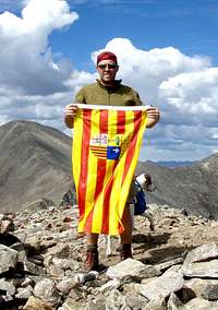
The ridge between Mount Edwards and Grays Peak is solid Class 2, with a couple of 2+ moves added for extra fun. Tango and Lexie needed a hand in a couple of spots, but not many. Due to my late start, I didn't summit Grays Peak until 1:30pm or so, so the summit didn't have many people...I'd say about 10. (I've seen it with at least 50!) I finally got the picture I "missed" last time:
I had been very lucky with the weather so far, and although I could see some nasty clouds in the distance, it was quite pleasant up here at this time. I fully realize that it was too late in the day to be up here, and just to remind me of how late it was, I saw the lightning strike a couple of miles south of me. I was planning on descending Grays Peak's southeast ridge anyway, but not this quickly! We practically ran down! Although a circuitous route to Grays Peak, the trek to here had taken 5 hours; the descent took us 1.5 hours.
Nearing my car, I passed a spot on Peru Creek where the rocks seem unnaturally white.
If anybody can explain why this is, please educate me. :)
So, 8 miles with 3600 feet of elevation gain in 6.5 hours. Hey, we were tired from yesterday...
Day 3: Yeah...no day 3
We had already hiked over 24 miles this weekend, and Tango could barely walk. Returning home today would probably be easier since the holiday traffic was probably going to be Monday. Good idea. Two days, four peaks. Great weekend.
Comments
No comments posted yet.