Trip Report
Wow! What a beautiful route! (If only it had been sunny today...)
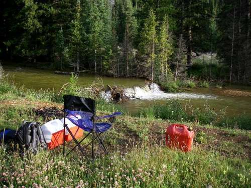
I came out Friday afternoon, because I've become a big fan of camping out to get an early start on my climbs. Found an awesome campsite next to the river.
I even bought what I thought was a functioning alarm clock, since my dogs have become unreliable at waking me up. (See
Holy Cross Ridge Trip Report) After frolicking around the campsite for a couple of hours, once they were inside the tent, they fell asleep right away.
Well, my new alarm clock didn't work as expected. Before I blame it, I will reread the instructions to ensure that I didn't misconfigure it. Anyhow, I managed to wake up at 0440, and was able to start my climb at 0500, with enough moonlight that I didn't need my headlamp. I had my brand new boots--which I bought mere hours before leaving Denver (See
Trip Report: Holy Cross Ridge Lessons Learned)--and although technically still waterproof, when you're up to your knee in water, your feet still get wet. (Should I take them back? Are they properly functional?) Yes, by 0530, the first creek must be crossed, and I haven't been able to find an easy way to cross it dry. Personally, I recommend bringing along other footwear for the crossing. As it turned out, the wet feet turned out to be quite an effective cooling system! So! The path up Chihuahua Gulch is quite easy, and all Class 1, making for a speedy ascent. However, trying to find the path that takes you up Ruby Gulch is not that easy. It turns out I walked right past it twice, because it actually shares the drainage with the creek, and doesn't look like a trail at all. Therefore, on the ascent, I ended up searching for a narrow crossing of the creek, and bushwacked up the forest until I intersected the trail. It turned out to be pretty easy. Again, once on the trail, the ascent was speedy. I finally reached Ruby Cabin--which I'm now officially renaming Ruby Condo--walked past it, and reached what I consider to be the end of the trail and the turn-off, marked by long stick.
![TR: GP IV]()
![TR: GP V]()
At this point, the suggested route is to turn north and reach for the ridge. In my opinion, there are two choices here. Looking up at the ridge, there is a rocky outcropping plainly visible.
You can either choose to reach the ridge on the west side of the rocks, and have three minutes of fun on easy Class 2 rock, or opt for a slightly longer ascent to the ridge and bypass the rock. I opted for the class 2 fun. Just before reaching the outcropping, I was fortunate enough to see three beautiful mountain goats on the rock. However, they weren't there when I got there. (It turns out, mountain goats are pretty good climbers too!) Shortly past the rock, there is a crater. I assume it's from a lightning strike, especially from the charred rock, but can lightning really create such a crater?
![TR: GP VII]()
Just past the crater, there is actually a trail on the ridge itself. (What?) This trail, in my opinion, makes the ridge traverse between the rock outcropping and Grays Peak's summit block a simple Class 1 climb. The trail continues on the summit block, but it is now Class 2, due to loose rock and scree. Regardless, it's a short climb up the summit block. It took me three hours to reach the ridge, and one and a half hours from the ridge to the summit, which included a 20-minute dog-feeding break. On the ridge, looking up towards the summit of both Grays Peak and Torreys Peak, I could see the obvious outlines of other climbers that had already summited.
Okay, I have to say, between 0500 and 0930, I didn't see a soul on my route. Upon summiting, there must have consistently been at least 50 people on the summit of Grays Peak.
Looking at the trail on the east side, I couldn't believe the number of people on it!
I definitely made the right choice by ascending the Southwest Ridge!
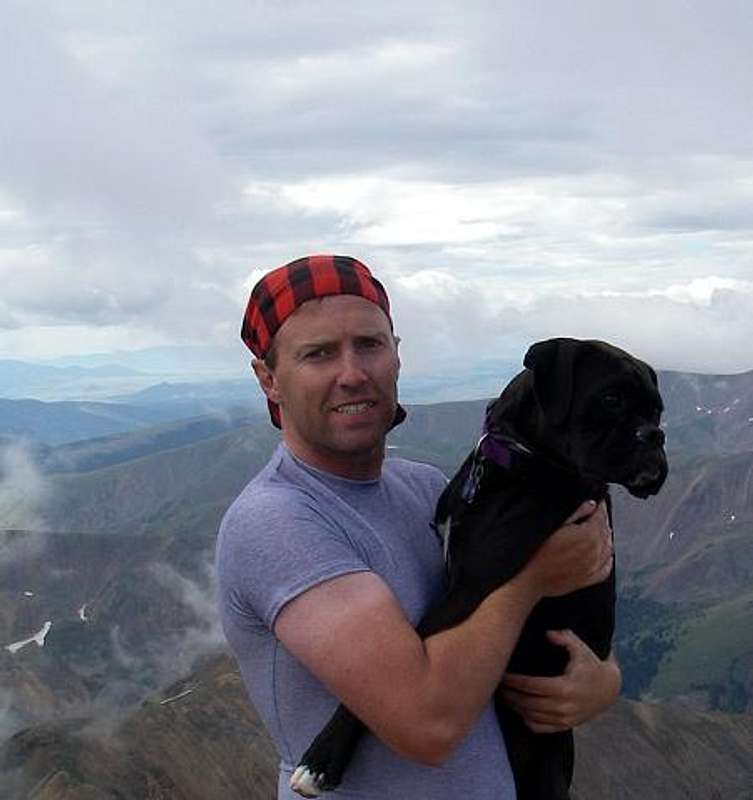
So! I'm on the summit! Perfect opportunity to get my "flag shot." (See
Album) With 50 other people on the summit, what are the odds of finding the one who doesn't know how to operate a camera? (Sigh...no flag shot...now I must return to Grays Peak...probably a traverse from Torreys when I get around to that one...) However, I still did get a summit shot! (Um...someone else took the picture...)
Unfortunately, it was a very cloudy day, and was unable to get pictures of all the nearby summits. Sigh. Perhaps when I do Torreys. Started my descent at 1010. (It was when I reached the bottom of the summit block that I discovered that I didn't have my "flag shot." I could either turn around and summit again, or continue the descent. Re-summiting would require at least 45 minutes, which I just didn't want to add to my trip. (My feet were still wet, and it was windy and cold on the ridge...)
Chihuahua Gulch is pretty impressive from the Southwest Ridge of Grays Peak.
[img:320123:aligncenter:medium:]
During the descent, I encountered one group of three ascending my same route. Smart group! Our paths crossed at the rock outcropping. Descended the slope and regained the trail, which I was able to follow until it joined the Chihuahua Gulch trail. No wonder I didn't see it! Where they meet it is a creek. There is actually a small path through the bushes that puts you right on the trail, but if you're unaware of it...
When I reached the creek crossing that originally got my feet wet, I was determined to find a dry path across it. Um...I failed... Once again, I was up to knees in water. No worries, however; once again it became an effective cooling system. (Okay, my cooling system wasn't so "cool" on the ridge, where it was windy and cold, and I stopped feeling my toes...but at 10,500 feet, it rocks!)
Quickly made it back to the campsite from there. Total descent time was two and half hours. For some reason, after this climb, Tango and Lexie were completely worn out! (They weren't last week...)
I highly recommend this route up Grays Peak.
Details
Roundtrip time: 7.5 hours (including time spent gallivanting on summit and doggie breaks; 6.5 hours actual travel time)
Roundtrip distance: 10 miles
Elevation gain: 3,810 feet
Lessons Learned
-Even with waterproof boots, your feet will get wet if you swim in the creeks!
-Ensure that required pictures are indeed taken prior to leaving the summit!
-Dogs are pretty good at routefinding, especially through bushes.
Random Thoughts
-The path least taken is usually the most rewarding.
-Mosquitoes really bite! (Figuratively or literally; you decide...)
-This route is probably slightly more difficult than the standard route. Perhaps 1 or 1.5 hours of Class 2 climbing.


Comments
Post a Comment