
-
 20251 Hits
-
 85.36% Score
-
 20 Votes
|
|
Canyon |
|---|---|
|
|
39.17250°N / 108.38833°W |
|
|
Hiking |
|
|
Spring, Summer, Fall, Winter |
|
|
Overview
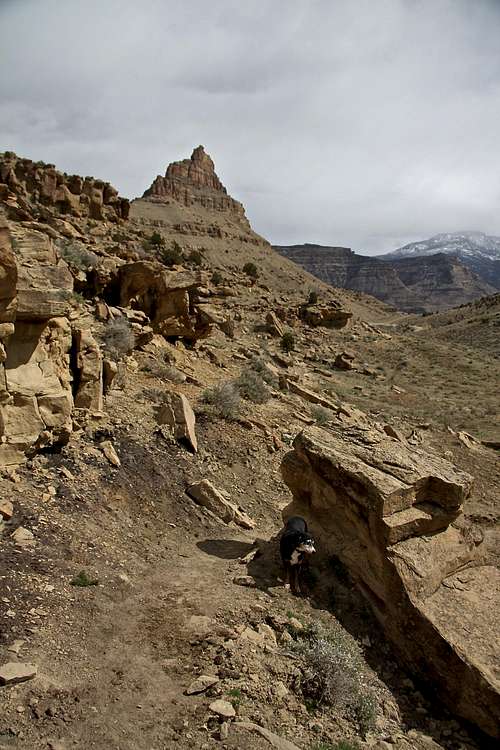
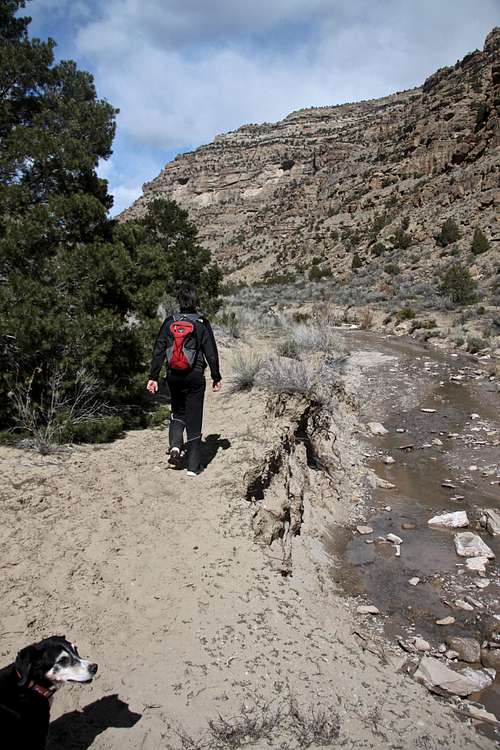
Main Canyon in the Little Bookcliffs Wild Horse Area is a part of the main Book Cliffs range extending from the western Colorado, to the eastern Utah. The canyon is located a few miles east of Mount Garfield and is easily accessible from I-70 (the main interstate from Denver to Utah). The area is specifically designated for wild horses, so wild horse habitat is the primary concern here. The hike itself is interesting, and offers nice views (you can see Grand Mesa nicely), stream crossing(fun for kids) and hodoos formation.
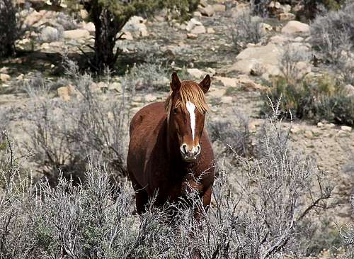
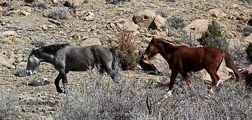 Wild mustangs
The 1971 Wild and Free Roaming Horse and Burro Act provides for the management, protection and control of all unbranded and unclaimed horses and burros on public lands administered by the Bureau of Land Management and U.S. Forest Service. The Little Book Cliffs Wild Horse Range is one of only three ranges in the USA set aside specifically to protect wild and free roaming horses. It encompasses 36,113 acres of rugged canyons and plateaus in the Book Cliffs about eight miles north of Grand Junction. About 150 wild horses roam the sagebrush parks and pinyon-jupiter covered hills. Natural carries such as cliffs and canyons are supplemented with fencing to define the area and control horse movement.
Who brought horses to America? some say that present day wild horses are derived from Spanish explorers, but during the Ice Age the ancestors of the modern horse roamed the North American continent. They were smaller than the horses today and became extinct over 10,000 years ago. Horses were reintroduced to the continent in the 1500s by the Spaniards who explored and began to settle what is now the western United States. These horses were known as "mustanos", and those that escaped to form wild herds were later called "mustangs".
Elevation at the Trailhead: 6,018 feet (=1,834 meters)
Peak 6100 - looms nicely over the parking lot and if you want a little bit scramble/climb on your adventure, summiting this peak is highly recommended. See SP page here.
Getting There
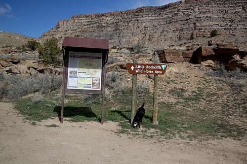 Coal Canyon TH
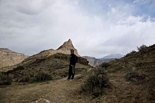 Entry to Main Canyon
Drive across the one lane bridge, with the power plant on your left. You will be traveling on the Coal Canyon Rd. This is a well kept dirt road, accessible by 2 WD vehicles. After about 1.5 miles there will be a fork in the road, bear to the right and shortly you will reach parking lot marked "Coal Canyon Trailhead - Little Bookcliffs Wildhorse Area". It is 2.2 miles from the interstate to the trailhead.
There are restrooms at the parking lot, and an informative board. Parking is free.
Red Tape
Camping, hiking, horseback riding and hunting are permitted throughout the Wild Horse Range. The trails are designated only for foot and horse travel. Motorized vehicles and mountain bikes are not allowed inside the Main Canyon.
Pet should be leashed or under voice control, so they don't tend to chase wild mustangs.
The land is public land managed by BLM. It is designed to protect wild horses. Livestock grazing is not permitted within the horse range. ![Wild Mustang]() Wild Mustang
Wild Mustang
 Wild Mustang
For further information about the range or adopting wild horses, contact:
Bureau of Land Management
Grand Junction Field Office
2815 H Road
Grand Junction, Colorado 81506
(970) 244-3000
or
National Wild Horse and Burro Program
1-800-417-9647
The Hike
Walk to the right of the trailhead and follow a well established trail slightly uphill. Past through a gate and get over a slight ridge to drop into the Main Canyon. The trail is narrow at places at this section, and provides excellent views into the canyon and south towards Grand Mesa. A stream meanders through the Main Canyon, and you will have to cross it several times. Keep your eye for horses. We encountered some within one mile from the trailhead. Count on the trail occasionally disappearing - water erosion from the stream, covered by horse trails etc. We went up the canyon on its east side and returned on its western side. Higher up the canyon becomes more narrow. Several crossings of creek are on this hike, but the water is very shallow. Most people tend to turn around after a couple of miles and return the same way. There are longer options for loop hikes, which add to scenery and views.Wild horses are most frequently seen in sagebrush parks scattered throughout the horse range, traveling in small bands made up of a stud and his harem of mares, or in bachelor bands of young stallions. Be on the lookout for "stud piles" which are piles of manure left by a stud to mark his territory. Main Canyon offers excellent viewing opportunities during the winter and spring. The best viewing times are morning and evening - horses are on the move. Observe animals from a safe distance. If an animal's behavior is changing, you are too close. Don't chase horses, and don't try to ride them.
 Little Bookcliffs Wildhorse Range Little Bookcliffs Wildhorse Range | 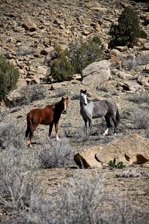 Wild mustangs Wild mustangs | 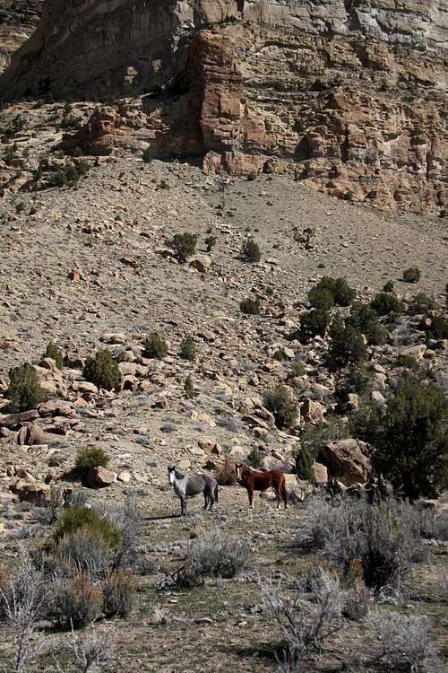 Main Canyon with mustangs Main Canyon with mustangs | 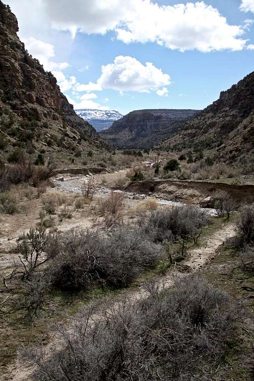 Main Canyon Main Canyon |
 Main Canyon - higher up Main Canyon - higher up | 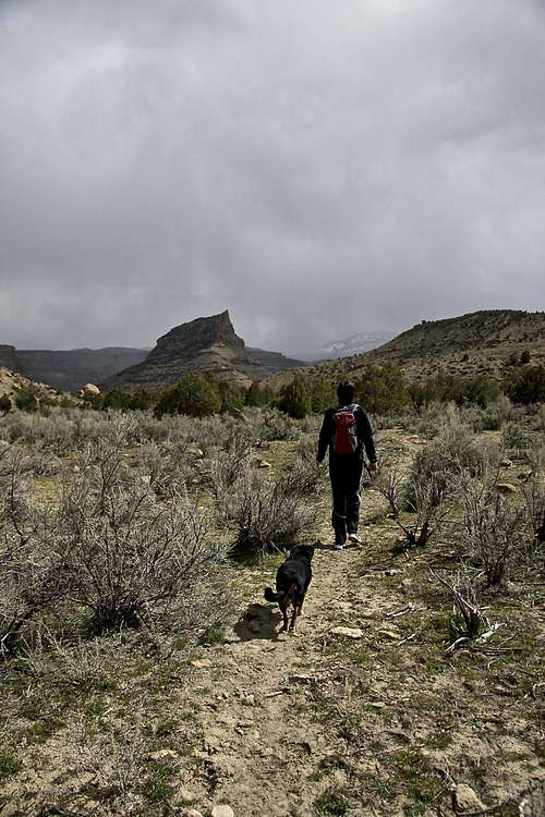 Main Canyon Main Canyon | 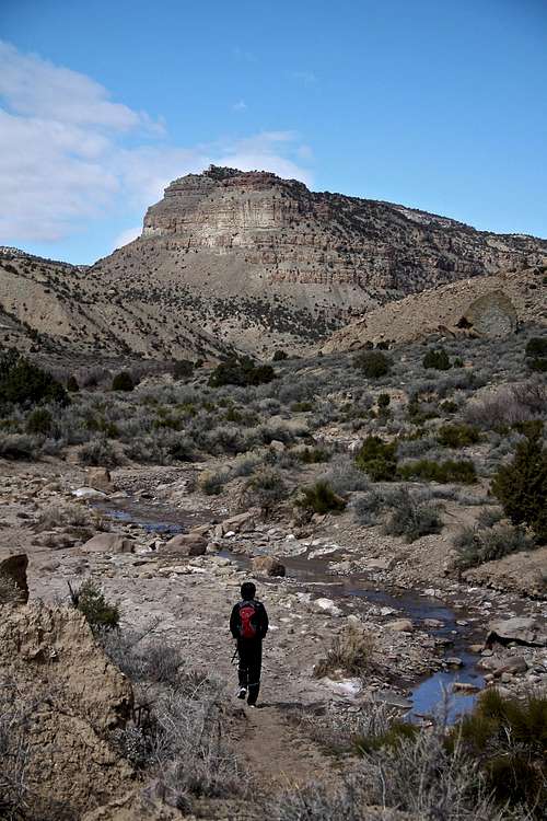 Little Bookcliffs Wildhorse Range Little Bookcliffs Wildhorse Range | 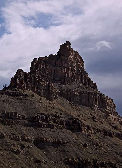 Nice formation located just above the parking lot. Nice formation located just above the parking lot. |