
-
 13061 Hits
-
 86.37% Score
-
 22 Votes
|
|
Mountain/Rock |
|---|---|
|
|
35.31793°N / 24.00255°E |
|
|
Hiking, Skiing |
|
|
Spring, Summer, Fall, Winter |
|
|
6998 ft / 2133 m |
|
|
Overview
 Melindaou and Pachnes Melindaou and Pachnes |
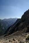
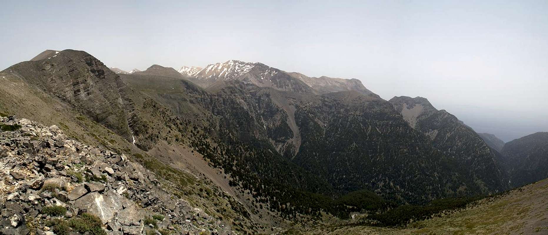
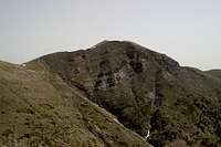
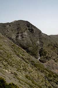
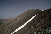
Melindaou / Μελινταου is a remote peak, located in the north of the Levka Ori Mountain Range of Crete. It towers 1500m above the eastern end of the famous Samaria Gorge and is visible from all points of the north-western coast of Crete. The mountain can be barely reached in a day tour if you start your trip from Xyloskalo, the entry point to the Samaria Gorge. Moreover it is the highest mountain of its subrange and its location deep in the Levka Ori means perfect close-up views to the central and north-eastern subranges.
However, reaching the mountain is not quite so easy. It involves about two hours of hiking along dirt roads, the steep climb to one of the lesser summits which encompass the northern part of the Samaria Gorge as well as a beautiful hike along the crest, covering at least one more summit. Alternatively you can extend the road hike for an additional half hour and then climb the mountain via the well marked European long distance trekking trail E4. One way the climb takes 4 - 5 hours with an additional 4h for the round trip. But a majestic roundtrip indeed.
Melindaou is a typical mountain of the Levka Ori - a virtual heap of rubble made up from limestone. Its summit is a wide plateau, ideal for views but also very exposed to winds of any direction. Its east face has broken away into the Samaria Gorge and offers a slightly more impressive aspect than the other three faces. Melindaou - like the other mountains which encompass the gorge - is home to golden eagles and bearded vultures which you can often see glide across the summit. Thanks to its location close to the trekking trail E4, Melindaou sees quite a number of visitors, many of whom pass by summit, however.
|


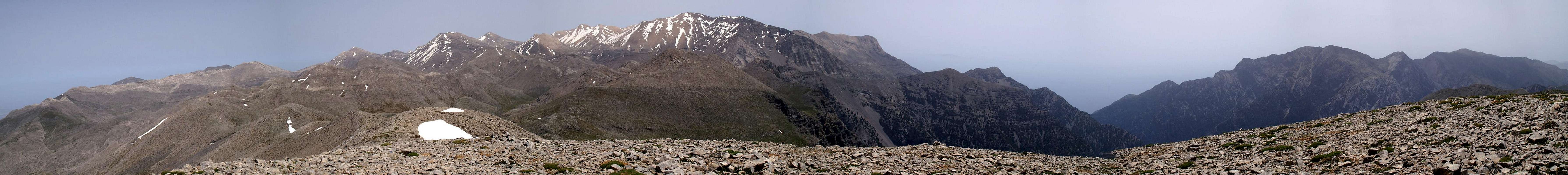
The Levka Ori Summit Panorama
  |
Getting There
 |
The most reasonable starting point for a climb of Melindaou is Xyloskalo, the parking lot at the entry to the Samaria Gorge. The lot is located aat the southern end of the Omalos plain and can be easily reached from Chania, the main city of the north-west of Crete. The road leads through Fournes, from which it climbs to Lakki and onwards to Omalos. At all parts of the road signs lead to either Omalos or to the Samaria Gorge.
|


Red Tape
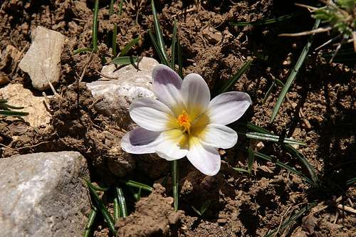 Crocus in May, right beneath the Melindaou summit
Melindaou is located on the western border of the natural park Fysikon Parko Samarias, which encompasses the Samaria Gorge and the surrounding mountains. Staying in the park over night is not allowed and you have to return to the hotels in Omalos or to the Kallergi hut on the eastern side of the gorge. The mountains around the Samaria Gorge are home to the last specimen of the Golden Eagle and Bearded Vulture, which you might see soar above the gorge. Their eyries are located in the steep faces of the mountains above the upper Samaria Gorge but rather far away from the regular climbing routes. Still, take care not to disturb them, especially in the first half of the year when thy raise their little ones.
More information on the park
Accommodation
 |  |  |
You can quite easily find hotel rooms and apartments everywhere on the coasts. All European travel companies offer accommodation so a visit to your nearest travel office will find you some. The closest possible hotel is at Omalos, a one hour hike from Xyloskalo, the trailhead. On the eastern side of the gorge there is the Kallergi Hut, also about an hour away from Xyloskalo and on the route to Melindaou.
Weather Conditions
The weather sites on the web only carry information for the cities on the north coast, which are 2000m lower than the mountain top of Melindaou. Consequently temperatures will be lower by some 15° C on the summit. Also, especially in winter and spring, the White Mountains are often covered in clouds while the coast is clear. On a day like this don't venture in the range - orientation is difficult enough without clouds. The nearest weather link I could find was at Souda near Chania on the north coast of the island, some 60km to the north:Maps & Books
There are quite a number of maps and books out there, which deal with the island of Crete and naturally I don’t know them all. This is the list of maps and books which I used and I appreciate it very much if you can add to itMaps
Unfortunately there are no topographic maps of Crete. The best map I could find is scaled 1:100000 and contains the main hiking routes on the island. In one case the map showed wrong paths and roads (exchanged them) but in general they were quite useful.
- Kreta / Crete / ΚΡΗΤΗ Western Part
Touring Map
1:100000
Harms Verlag
ISBN: 3-927468-16-9
Books
Since there are no good topographical maps of Crete you should take care to get a good guidebook. The one I used have good tour suggestions though the descriptions often are somewhat shortish.
- Kreta West / Crete West
Gert Hirner / Jakob Murböck (translation: Gill Round)
Rother Verlag
ISBN:
3-7633-4221-4 (German)
3-7633-4803-9 (English)