
|
|
Mountain/Rock |
|---|---|
|
|
48.54000°N / 66.12°W |
|
|
3786 ft / 1154 m |
|
|
Overview
Mont Albert is one of the highest peaks in the Chic-Choc mountains of Quebec. Though within a day and a halfs drive from anywhere in the Northeastern US they remain almost completely unknown outside of the backcountry skiing and hardcore hiking communities in the US. Such cannot be said of the French speaking Quebecois who come in large numbers from Quebec city and surrounding countryside to see and experience some of--if not the most--impressive mountain scenery East of the Rockies and south of the Arctic Circle in North America.
What strikes you most about Mont Albert and its neighbors is the way in which they have all had their tops removed. Almost all of these peaks do not continue to go up and up and up till they hit a specific point. Instead they rise rather steeply to about the 3000+ foot level and then are sliced flat as a wedding cake. Glaciers from previous ice ages have certainly been at work here carving out great glacial cirques, large moraines, and huge boulder fields.
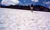
Mont Albert is perhaps the best example of this as its plateau stretches for some 20 square kilometers. This giant, flat mountaintop has become home to some of the few remaining caribou in southern Quebec. It is because of these caribou that even during the summer season when the peak is open for hiking that one cannot truly reach Mont Alberts summit.
The standard hike of Mont Albert is the "Tour du Mont Albert" which is a large loop trail encompasing 17 kilometers of truly great hiking. From the "Tour"'s starting point at the information center the trail climbs steeply and steadily crossing a number of streams. These streams may remain frozen VERY late in the season. I completed this hike in June and even at that time the streams were just patches of snow and ice measuring 10 yards across and 3 yards deep. Near the top and 1/2 way point of the hike you will likely encounter a large snow and ice field on steep terrain. The park has installed a line of rope bolted into the rock to assist hikers in ascending this section. Once to the top of this rope you will be required to traverse across the snowfield to your right to attain the North Summit and observation area.
The North Summit measures some 1083 meters and is thus about 71 meters shorter than Mont Alberts true summit. Once on top however you will realize why you cannot attain the true summit. At the observation area there is a small hut used by park staff and biologists to study and observe the herd of caribou which live there. If you feel like carrying a pair of high power binoculars or telescope you will likely be able to observe the caribou for yourself.
The caribou are the 1st reason you cannot attain the true summit, the second reason is the makeup of the plateau itself. When you combine the flatness of the summit with the enormous amounts of snow that the moutain gets on a yearly basis, and the fact that this summit plateau is not rocky as one may think but instead more like the grassy tundras of Siberia but at a more southerly latitude, what do you get?? Thats right...a 20 square kilometer bog. Bogs, while great habitat for feeding caribou make for poor hiking. Thus in order to protect the caribou, the fragile nature of the tundra enviroment, and hikers themselves, the park has constructed a raised wooden walkway which will take you from one side of the plateau to the other without damaging the grass or getting your feet stuck in the swamp.
Once to the other side of the plateau it is just a matter of following a very rocky trail down a steep incline and then following a stream all the way back down to the information center. All in all it is a long and strenous hike with a number of interesting and possibly challenging sections thrown in. I would not reccomend the "Tour du Mont Albert" to novice hikers but those with some hiking experience will LOVE this mountain and hike.
 |  |  |  |  |
Getting There
Mont Albert is located in along Rte. 299 in the Parc de la Gaspesie on the Gaspe penninsula of Quebec. Access to Rte. 299 can be gained at two spots along Rte 132 which runs around the entire length of the Gaspe pennisula right next to the water(either St. Lawrence seaway or the Atlantic Ocean). On the Northern side of the penninsula Rte. 132 and 299 intersect in the town of St. Anne des Monts which is also the closest town to resupply at before entering the park itself. On the southern side of the penninsula Rte. 132 and 299 intersect between the towns of Maria and New Richmond. The trip in from the Northern side is approximately 25 miles and is quicker but perhaps less dramatic in terms of scenery compared to the southern route. Once in the park one should look out for the Park de la Gaspesie visitor center. It is here that one can park and acces the start of the hiking trails and obtain updated maps/information.
Red Tape
A park entry fee of $3.50CA per adult is required to enter the park. No fee is required to park at the information center/trailhead. Mont Albert is closed to hikers from October 1 through June 14th so as not to interfere in caribou mating season.
When To Climb
Mont Albert is only accessible from June 15th to September 30th during the 2004 season. This limited access is required in order to protect the herds of caribou that live on the giant plateau at the top of this mountain. The park does not want any interference in the breeding and raising of this highly endagered species. This should be the general seaon that the mountain is open but may change on a year to year basis given local conditions.
Camping
There is a very nice campground just south of the information center. Fees here are minimal--$13.95CA a night which includes the parking fee I believe. Camping sites are built for tents--RV's or tent campers will be hard if not impossible to fit into most of these spaces. No electric or water hookups. The showers and bathrooms do have running water and electricity and are VERY clean and new. Though the black bear population is significant in the Chic-Chocs they do not seem to have made the people-food connection, there are bear cans for trash however to keep things this way.
No huts on these mountains but there is a beautiful inn called the "Gite du Mont Albert" which sits at the base of the mountain. If you want luxury this is the place to stay--world class French cuisine and super friendly staff to wait on your needs. The Gite is the only option besides camping in the park and also contains the only restaurant within the park. No grocery stores or resupply beyond small snacks and sandwiches at the information center are available.
 |
Mountain Conditions
I know of no web-cams and suspect there are none as there are no towns, schools, or civilization of any sort within 20 miles or so of the mountain. Current weather conditions I would get from the "theweathernetwork.com"(Canada's version of the Weather Channel) and then look up the weather in the town of Ste. Anne-des-Monts. This should be a fairly accurate representation of the weather in the park as this is the closest town to it.
 |  |
External Links
- Sepaq.com
In both French and English, this page will give you the most up to date information about all parks in Quebec. Mostly a general overview of each park, its location, fees, rules, and activities...
MikeW - Nov 2, 2005 11:30 am - Hasn't voted
Untitled CommentYou can also climb Mont Albert in the winter. It is a popular ski tour to the summit plateau and a great ski descent in the bowl.
nartreb - Jun 8, 2011 2:31 pm - Hasn't voted
locationstill not corrected. Should be N 48.90270 W 66.20464