
|
|
Mountain/Rock |
|---|---|
|
|
47.56000°N / 24.81000°E |
|
|
7083 ft / 2159 m |
|
|
Overview
Varful Gargalau (Varful = Vf. = summit) is the wide peak in the east part of main ridge of Muntii Rodnei. It is a wonderful sightseeing summit that offers panoramatic view not only over Muntii Rodnei, but also over Maramures on the north, and behind it further to south part of Ukraina. The view to the south is also incredible and tens kilometers away long.
The peak is quite popular as it is located near Complex Turistic Borsa and spa Baia Borsa. From the C.T. Borsa a cablecar can be used to the peak Stiol (1607 m) that enables easy walk to the main ridge of Muntii Rodnei. North and north-west walls of Vf. Gargalau fall steeply and rocky to the valley with the lake Lacul Izvoru Bistrita, where the river Bistrita springs too. On the east side there is a couple of beautiful couloirs bounded by rocks leading to the spring inflow of the river Putreda.
South side from Saua Gargalau via Vf. Gargalau to Vf. Clali (2117 m) consist of mostly moderate slopes splitted by narrow valleys of springs of the river Izvoru Cepelor. Forests cover slopes in lower parts. The only excpetation is steeper couloirs from the summit.
General description of Rodnei mountains is at SP Muntii Rodnei Group
 |  |  |  |  |
Getting There
a) by car from Hungary Satu Mare - Baia Mare - Viseu du Sus - Borsa, continue up to Passul Prislop, from the east Vatra Dornei, route No. 18
b) by train to Viseu du Sus, then by bus or hitchike to Borsa or to Passul Prislop
More detailed description about getting there is at
Muntii Rodnei GROUP
Red Tape
Rodnei mountains are part of Rodnei National Park and you are allowed to camp only in several passes. There are also some other reservations with higher protection.
Pietrosul Mare area in UNESCO network of world biosphere reserves
Description of Rodnei National Park at www.parks.ro
When To Climb
Vf. Gargalau is accessible all the year with appropriate equipment, in the summer classic tourist equipment together with waterproofs for rainy June/July period. From Passul Prislop you can also get to Saua Gargalau and further by mountain bike.
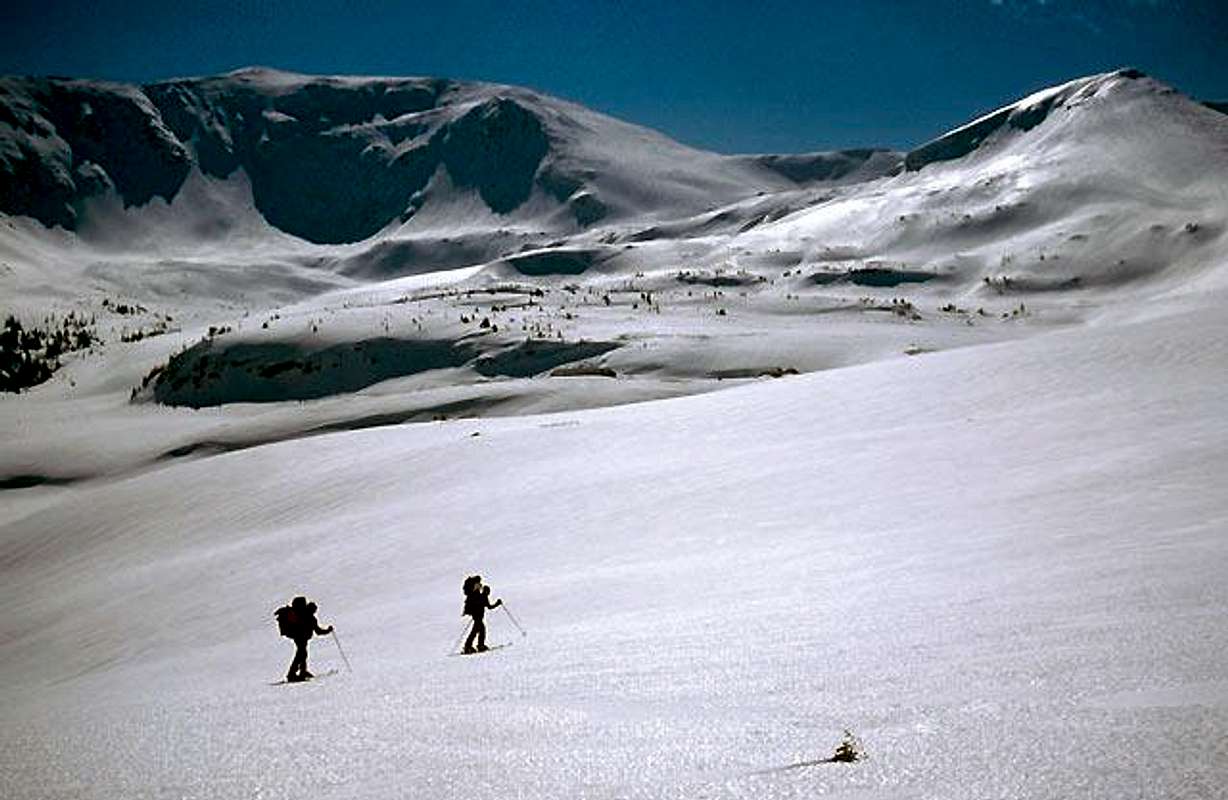
All items of avalanche safety equipment are needed during the winter time as you are riding on skis or snowboard especially
in steep north couloirs. Snowmobilers from the Borsa ski resort can disturb you around Saua Gargalau during the sunny winter weekends.
Do not forget that Romanian mountain rescue team SALVAMONT take care only in summer, whereas in winter you can find them only in ski resorts - here at Borsa ski slopes.
Camping
Cabana Alpin (1413 m) - Passul Prislop, 6 beds, camping site, phone: 0262/342425
tents can be set up near Saua Gargalau (1907 m), below Cascada Cailor
Route overview
Marked tourist paths to Saua Gargalau:
a) Pasul Prislop (1415 m) - Saua Gargalau (1907 m) - red triangle
b) Complex turistic Borsa (845 m) - Cascada Izvoru Cailor - Poiana Stiol (1572 m) - Saua Gargalau (1907 m) - red triangle
c) Complex turistic Borsa (845 m) - Poiana Stiol (1572 m) - Saua Gargalau (1907 m) - blue strip
d) from the south long access from Anies through the valley of the river Anies - blue cross
non-marked path:
from the north through the valley of river Putreda
Highly recommendable is path a) via waterfall Cascada Izvoru Cailor. It is about 80 meters high. In winter we suppose the height of Cascada Cailor is about one rope, i.e. 60 m as the lowest part of waterfall was hidden by avalanche, whereas Romanian told on their Cascada Cailor ice-climbing page that it is about 100 meters high. Marked path to the waterfall was renowated by a group of French and Romanian mountain lovers in 2002.
Weather forecast is only in Romanian: Salvamont weather
Mountain Rescue (SALVAMONT) contact is:
Consiliul Judetean Bistrita - Nasaud
Serviciul Public SALVAMONT
Phone : 0263/215503
Fax : 0263/214750
Email: salvamont_bn@yahoo.com
WWW: Serviciul Public Salvamont Bistrita - Nassaud
Salvamont Rodna - southern part , phone : 0263/377090 or 0740/652854
Salvamont Borsa - northern part , phone : 0262/342322
Salvamont Nasaud - western part , phone : 0740/651941
Maps:
1. Online map:
Harta Muntii Rodnei at alpinet2k.alpine.org
2. Good source of scanned maps that are not available in shops:
Map server
 |  |
Highest peaks of Rodnei mountains
1. Vf.Pietrosul 2303 m
2. Vf.Ineu 2279 m
3. Vf.Rebra 2268 m
4. Vf.Ineut 2222 m
5. Vf.Grohotu 2203 m
6. Vf.Puzdrelor 2189 m
7. Vf.Laptelui Mare 2172 m
8. Vf.Gargalau 2159 m
9. Vf.Omului 2134 m
...
xx. Vf. Galatau (2048 m)
General description of Rodnei mountains
peterbud - May 27, 2008 10:20 am - Voted 10/10
Ski stationsFrom http://www.skimaramures.ro/en/ - Borsa - Baia Borsa - Pricop