Day Trip for 2?
On July 3rd (2009), Melissa and I hiked to the top of Mt. San Gorgonio via Vivian Creek Trail. Not having made this venture in about 15 years, I grew increasingly anxious as time drew near knowing I was somewhat out of shape and that this is a full day with a lot of elevation gain. Our plan was to do it in a day so that we didn’t have to leave our children with someone overnight. To meet this goal, we wanted to be at the top by 12:00 at the latest. This goal we considered reasonable; in high school, I summitted Mt. San Gorgonio via the same route in under 6.5 hours car-to-car. That time my friend, John Harding, accompanied me. And if I remember right, the down-hill leg of that trip involved segments of trail-running. I knew this time would take longer.
We left Running Springs at 4:45 AM and arrived at the trailhead in Forest Falls at 5:40 AM. There was enough light in the sky at that point to notice wisps of fog draping the summits of the higher peaks in a brisk wind, and I already began to wonder if thunderstorms would preclude our success. Like tall mountains just about everywhere, Mt. San Gorgonio is the last place you want to be in an intense storm. Lightning, wind, hail, and cold are just some of the elements I know this mountain is capable of producing. Flash floods in Forest Falls are no joke either. At this point, there was nothing to suggest that we shouldn’t try, so after a photo, we set off.
Pace yourself...this is a steep trail!
We passed the Forest Service lease lands where a few cabins are enjoyed by fortunate lease-holders. Eventually the trail crosses the wide and rocky Mill Creek wash where a good flow was still present. Following the wash, the trail turns steep and about 1.5 miles of switchbacks tested our “first wind.” I knew the trail here was a challenge, so I paced myself and Melissa followed suit. We encountered a volunteer ranger who was checking for the required permits. We displayed ours and he wished us well. I couldn’t believe someone was checking permits at 6:00 AM.
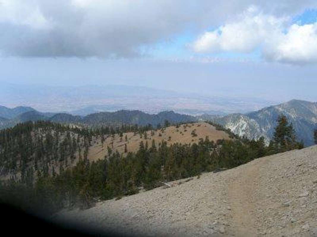
![Vivian Creek 1]() Early morning marine layer over the San Bernardino Valley, San Gabriel Range beyond
Early morning marine layer over the San Bernardino Valley, San Gabriel Range beyond
We soon crested the steep switch backs at Vivian Creek. The meadows were still quite green with a multitude of flowers. The towering Ponderosa were still there as I remembered them, though fewer in numbers by about one-quarter due to bark beetle infestations in recent years. As we had climbed the switchbacks, we gained excellent views of the Forest Falls valley floor, San Bernardino Valley, the San Gabriel Mountains, and Yucaipa Ridge which, at this late date, still displayed avalanche debris snow fields that were quite large. At this point, if you haven't given up, you're probably good to make it to at least "Half Way Camp" (which isn't half way by the way). The first mile and a half of this trail is the worst and will suck up a lot of your ambition, energy, and endurance. Better have a good reserve because there is still several miles to cover and several thousand feet of elevation gain to reach the summit.
About 1.5 miles beyond Vivian Creek camping area, we ate our breakfast which consisted of a muffin. While we were eating, a Sierra Club member passed us hiking solo. Other than some tents at Vivian Creek and the ranger, he was the only person we had seen so far.
![Vivian 2]() Forest "room" just above Vivian Creek campsite.
Forest "room" just above Vivian Creek campsite.Changing Environments
We were enjoying hiking in the shade provided by the early start and by the cloud cover which was developing. I kept a weary eye skyward yet noticed that the clouds were moving much too quickly for serious storm development. Even with this thought, I know the unexpected can happen, so I monitored the clouds continuously in case anything dangerous were to begin to unfold.
The upward progress was consistent and moderate. The trail had been reconstructed (I believe) since my last ascent. Particularly above “Halfway Camp” where I seem to remember a series of short switchbacks, but now found 4 very long switchbacks, which I liked. The newer trail encompasses more and better views and reduces the monotony of typical trail switchback sections. Below the switchbacks, Vivian Creek flowed in segments; everywhere else it was underground. The flow at Halfway Camp was good.
One could easily become discouraged all through this stretch. In the back of your mind, you know you are hiking to the tallest peak in Southern California. So every other peak that you see, you know it is not as high above you as Mt. San Gorgonio. Yet looking up at the peaks above this section of trail begs you to wonder how you can possibly put that much more elevation under your feet just to get to those peaks, let alone to San Gorgonio's summit! While I've never measured, I would guess that the summit ridge above is nearly 3,000 feet overhead.
The Yucaipa Ridge seems endlessly tall from the beginning of the hike, but step by step we gained its altitude.
![Vivian 3]() Just before High Creek campsite. Yucaipa Ridge beyond to the south.
Just before High Creek campsite. Yucaipa Ridge beyond to the south.
We arrived at “High Creek” to find another series of lush green meadows and a good flow of water. Just below the camping areas a handsome waterfall was filling the air with cascade-ish sounds. We took a good break here while we filtered some water, ate some snacks and enjoyed the surroundings. Time was on our side as it was only 9:30. We set off up the painstakingly flat switchbacks above High Creek. Here the terrain becomes more alpine with sparser vegetation and a lot of rock.
![Vivian 4]() High above High Creek campsite, shutter problems, Yucaipa Ridge below, and Inland Empire; looking south from high on San Gorgonio's south face.
High above High Creek campsite, shutter problems, Yucaipa Ridge below, and Inland Empire; looking south from high on San Gorgonio's south face.
The last 2.5 miles leading to the summit offered a variety of landscapes and views, including the macro-photographer’s dream of twisted Lodgepole and Bristlecone (?) Pines, and the intense color of sunlight on differing hews of granite back-grounded by dark clouds, and the long distant panoramas of the Coachella Valley (Palm Springs area). At about 11,0000 feet, the trees are so stunted by the elements that they take the form of low-lying bushes, very few taller than 3 or 4 feet. Yet their trunks are up to 10 or so inches in diameter, implying a will to survive. I guess somehow the conditions allow this growth because numerous “tree-bushes” dot the south slopes, though increasingly sparse the higher up in elevation.
At 11:00, we were at the summit. Mt San Gorgonio: 11,503 ft above sea level. Taller mountains obviously exist, but this peak has significant prominence and our trail approach required about 5,500 feet of elevation gain. We felt accomplished. A few others were around totaling six people, us included. The sky continued to produce just enough grey clouds to warrant weather concerns. We signed the register ate some more snacks, and explored the summit for a few minutes. We tried to make some cell-phone calls, but no reception was available. The far-distant views were obscured by the surplus of moisture in the atmoshpehre, but we could see Mt. Baldy, the high desert (to the north), Butler Peak (to the northwest), and most of the LA basin. Mt. San Jacinto was barely discernable through the haze.
![vivian 5]() Melissa and I, atop San Gorgonio 1 hour ahead of schedule!
Melissa and I, atop San Gorgonio 1 hour ahead of schedule!Back to car, and lasting impressions
After enduring stiff winds and 50-degree temps for about 15 minutes, we decided to descend. We passed some minor snowfields near the top off the trail a bit, and had the reverse view of the San Gorgonio Ridge toward Mt. Jeppson to enjoy. Going down, we passed many people. I am always amazed at the gravity regional high points have on common people who really don’t have the appearance of being hikers, or who (after talking with them) really have no experience at all. I admire their ambition and willingness to embark on such a journey while also feeling concern for their safety. Today, I could encourage people because by this point, the clouds were diminishing and the direction of the clouds wouldn’t support thunderstorms. Other times I have attempted to convince individuals to turn back instead of facing certain storminess and/or terrain beyond their abilities...sometimes without success. Strangers on the trail normally take route information and advice appreciatively, and I am normally glad to share.
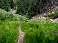
![Vivian 6]() Lovely and green meadow just above Vivian Creek campsite area.
Lovely and green meadow just above Vivian Creek campsite area.
By 4:00 we were back at the car. Melissa is a cautious downhill hiker. After some knee injuries in the past, she doesn’t want to push it, and I am generally okay with that; so the descent was even a little longer than the ascent, time-wise. Truthfully, most trekkers or trail runners can probably shave off at least an hour or two, the most fit being able to rt this in about 6-7 hours.
The San Gorgonio Wilderness is unique and pristine, beautiful and captivating. The San Gorgonio massif is huge; A miles-long summit ridge, steep mountain faces, deep canyons, and it’s vertical magnitude may catch you by surprise. Also surprising in this low-latitude mountain range is the sudden meadows and micro-habitats fed by snowmelt and springs. Throughout the San Bernardino mountains you will notice rivers appear, then disappear; the flows emerge as springs and then reenter the ground as subterranean flow, as does Vivian Creek. Mt. San Gorgonio’s beauty is its own; there truly is not another place with a similar look or feel. While most serious mountaineers would look beyond San Gorgonio for any real adventures, Mt. San Gorgonio never fails to impress me. I hope to do a winter ascent and ski off, and also to do the 9(?) peak traverse from San Bernardino Peak to San Gorgonio.
Comments
No comments posted yet.