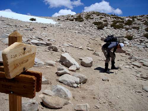
From Los Angeles take Interstate 10 East to Yucaipa then Oak Glen to Bryant into Mill Creek, Hwy 38.
Pass Valley of the Falls Dr. beyond Angeles Oaks to Jenks Lake turnoff and the South Fork Trailhead.
It's been 6 months since Ryan (TacoDelRio) and I last attempted to reach Gorgonio Peak.
We were thwarted by a snowstorm on Dec. 9th, but this trip was to be in fantastic weather.
After parking at the South Fork Trailhead, we proceeded up the 6 miles or so to Dry Lake Camp.
There still were some patches of snow within the tree-cover, but nothing requiring special gear.
Snow blocked a section of the trail at the switchbacks and we needed to scramble up the slope to get back on the path above.
No problems.
Dry Lake
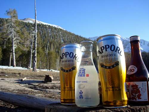
Camping Essentials
At the lake's edge and lit by a beautiful late-afternoon sun we enjoyed our gourmet evening meal consisting of Trialmix, Beef Ramen, fried white Turkey-Spam with Chili Powder accompanied by a selection of Sapporo Premium Reserve Beer and choice filtered Draft Sake to make it all palatable.
A couple arrived at Dry Lake at that time and set up their tent right on the trail heading towards the campsite. Then I seen a large flame of an open wood fire they make right on the path. They were the only other people that Friday night until two US Forest Service Rangers literally tripped over them at 8pm en route to Lodgepole.
We retired to our tents for the night in anticipation of the next day, nervously contemplating what could stand in our way this time. The temperature only dropped to 35F that night, a far cry from the condensate icicles inside my tent back in December.
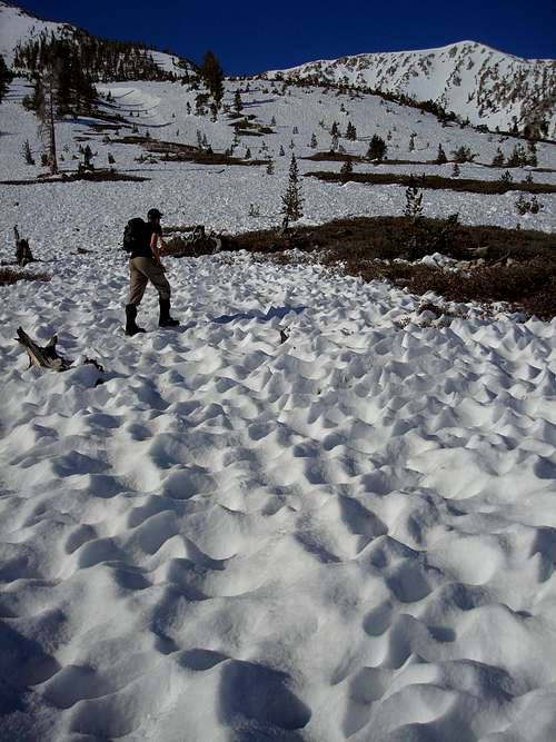
Heading up San Gorgonio
First suncups, then Nieve Penitentes
We depart our camp and follow the main trunk up from Dry Lake to the base of the West Ridge of Gorgonio, alongside the Bid Draw between Jepson. Immediately we notice the poor condition of the spring snow. Suncups had eroded into snow swords. Endless fields of these Nieve Penitentes required careful attention to footwork. As the sun rose higher we started postholeing.
Büsserschnee
Nieve Penitentes covered most of San Gorgonio
Nearing the Ridgetop
The only good snow was near the top of the ridge after slogging through suncups, postholes and some mixed rock sections. At the top winds created hardpacked snow with s crust of thin alpine ice. That's where my new Sabertooths finally had a chance to bite in and do their work. It didn't last long since we were almost on top of the ridgeline.
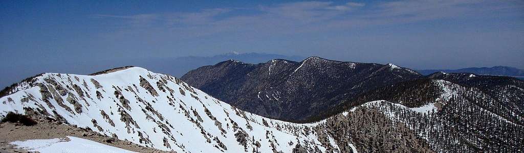
Jepson, Charlton, Alto Diablo, Shields, Anderson and San Bernadino Peaks
San Gorgonio Ridgeline. Mount San Antonio (Baldy) visible in the distance
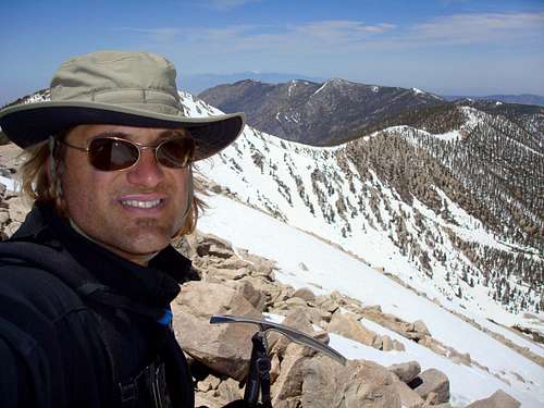
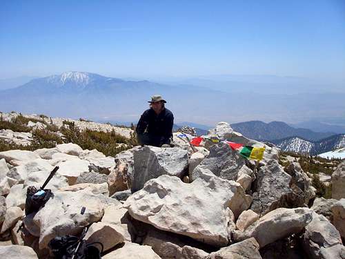
The Summit
Following the trail to the summit
The summit of San Gorgonio is a rock-pile. Yes this large round summit of Southern California surrounded by an expanse of rugged wilderness is topped by large pile of rocks. It doesn't get any less glamorous, but the views are spectacular. This is the highest point in SoCal at 11,500 feet (3505m).
Ryan noticed Old Glory fluttering in the wind, torn to shreds.
It was in terrible condition and since it's sacrilege to have our nation's flag torn to shreds he removed it for proper disposal.
I placed my Tibetian Prayer Flags at the summit to commemorate the plight of ordinary Tibetians under Chinese rule in this year of the Olympics.
With a beautiful Mount San Jacinto clearly visible nearby, this climb proved to be very easy, that is until we started to bushwack it back down via Mineshaft Gulch.
At the summit
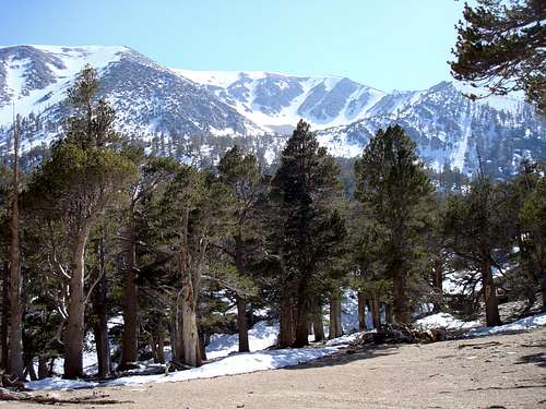
San Gorgonio with San Jacinto in the back
The route home
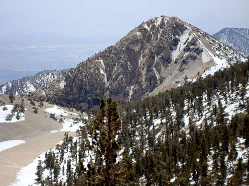
On my next ascent up to San Gorgonio I plan to focus special attention to an outcropping of rock clearly visible while heading down from the summit; Dragon's Head.
The Tarn
Dragon's Head
Dragon's Head is an outcropping of rock at the end of a dry lakebed called the Tarn. This is an old glacial cirque and previous site of one of the southernmost glaciers in California; also known as Tosh's Tarn.
Attempting to take the Mineshaft Flat trail we ran into more Nieve Penitentes. The entire path was obstructed by snow and more ice-swords. Ryan managed to do a standing glissade with crampons on and eventually we reached the Flats. After traversing rocks, boulders, dead trees and another tarn we found the Mineshaft Saddle. From there on it was crampons on down toward Lodgepole. As the trail cleared of snow we followed the Lodgepole spring back to Dry Lake.
San Gorgonio Bowl from Mineshaft Flat
Climbing Essentials
Ice Axe & Crampons, food & water.
You can melt snow but will requie a stove.
If you plan for an overnight, bring a tent, slepping pad & sleeping bag.
Lessons Learned
Never wear Mountaineering Boots for your approach. Pack a pair of light hiking shoes for the slog into basecamp. Once in the alpine environment it's safe to wear mountaineering boots.
Parents refers to a larger category under which an object falls. For example, theAconcagua mountain page has the 'Aconcagua Group' and the 'Seven Summits' asparents and is a parent itself to many routes, photos, and Trip Reports.