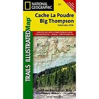
Cache La Poudre/Big Thompson Trails Illustrated Map # 101
| Page Type | Gear Review |
|---|---|
| Object Title | Cache La Poudre/Big Thompson Trails Illustrated Map # 101 |
| Manufacturer | National Geographic Maps |
| Page By | redsplashman23 |
| Page Type | Dec 8, 2011 / Dec 8, 2011 |
| Object ID | 8012 |
| Hits | 3016 |
| Vote |
Product Description
"Coverage includes Arapaho and Roosevelt national forests, Cache La Poudre River and Wilderness, Poudre Park, Pinewood Springs, Midway, Glen Haven and Homestead Meadows, Big Thompson River and Canyon, Pinewood Lake, Lake Estes, Viestenz Smith Mountain Park. Includes UTM grids for use with your GPS unit."Features
MapPublisher: Natl Geographic Society Maps; 03 edition (January 1, 2003)
Language: English
ISBN-10: 1566953901
ISBN-13: 978-1566953900
Product Dimensions: 7.2 x 3.9 x 0.6 inches
Images
 |