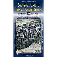
Sangre de Cristo Wilderness & Great Sand Dunes National Park Trail Map 3rd Edition
| Page Type | Gear Review |
|---|---|
| Object Title | Sangre de Cristo Wilderness & Great Sand Dunes National Park Trail Map 3rd Edition |
| Manufacturer | Ken Schulte |
| Page By | redsplashman23 |
| Page Type | Nov 10, 2011 / Nov 10, 2011 |
| Object ID | 7893 |
| Hits | 2746 |
| Vote |
Product Description
"Publication Date: May 5, 2009The original trail and terrain map of Colorado's Sangre de Cristo mountain range & the Great Sand Dunes is now updated with a 3rd edition. Printed on waterproof, tear-tough material. Two maps, at 1:60,000 scale cover the area from Hayden Pass in the north to Blanca Peak in the south. Notable features mapped include Crestone Pk, Crestone Needle, Humboldt Pk, Little Bear Pk, Huerfano Basin, Great Sand Dunes National Park, Electric Pk, Horn Pk, Music Pass, Medano Pass, San Luis Valley, Wet Mountain Valley, Valley View Hot Springs, and much, much more.
Terrain is represented by contours, shaded relief, and color tints. All trails, roads, and historic routes shown. Also mapped: Forest, National Park & Wilderness boundaries. Streams and lakes; newly mapped waterfalls. 8 14,000ft pks, 53 13,000ft pks, numerous other geographic features. Full 5km UTM grid for GPS, Latitude & Longitude as well. Trails rated. Access highlighted with trialheads and gates. Trail descriptions, including location, milage, and elavation gains.
This is a top quality map, the best trail and topographic map of Colorado's Sangre de Cristo. Please note this map does not cover the far northern part of the Sangres near Salida."
Features
Map: 2 pagesPublisher: Sky Terrain; 3rd edition (May 5, 2009)
Language: English
ISBN-10: 0966550838
ISBN-13: 978-0966550832
Product Dimensions: 7.8 x 3.9 x 0.3 inches
Images
 |