|
|
Mountain/Rock |
|---|---|
|
|
40.49030°N / 105.645°W |
|
|
13404 ft / 4086 m |
|
|
Overview
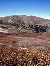
| Rowe Peak is the fifth tallest mountain in the Mummy Range. The Mummy Range spreads across the northern part of Rocky Mountain National Park and consists of six 13ers: Hagues Peak (13,560 ft), Fairchild Mountain (13,502 ft), Ypsilon Mountain (13,514 ft), Mummy Mountain (13,425 ft), Rowe Peak (13,404 ft), Mount Chiquita (13,069 ft). Rowe Peak is not spectacular; in fact climbing it from the Icefield Pass side is pretty anticlimactic (you just climb up the valley until you reach the top and you’re there). However, the view of Hagues Peak, Rowe Glacier, and the ridge that connect Hagues Peak and Rowe Peak are pretty spectacular. Rowe Glacier is one of only five true glaciers in Rocky Mountain National Park. It was discovered in 1880 during the great grasshopper plague when millions of the pests flew over from Utah and lodged on high mountain snow fields. The grasshoppers attracted greedy bears, and the bears attracted hunters. One such hunter was a homesteader named Israel Rowe. He came upon the glacier while guiding guests of Lord Dunraven on a hunting trip. His name was later given to the glacier and Rowe Peak. |
Getting There
Rowe Peak is not close to any trailhead, however it is about equidistant from three trailheads (as the crow flies): Emmaline Lake Trailhead, Chapin Creek Trailhead, and Lawn Lake Trailhead.
|
Red Tape
| No permit is required to climb Rowe Peak. If you begin your hike from either of the trailheads inside Rocky Mountain National Park you'll have to pay the park entrance fee. Access to the Chapin Creek Trailhead is limited, so contact Rocky Mountain National Park before planning to use that trailhead. Camping within Rocky Mountain National Park is only allowed in designated campsites and requires a permit. |
Camping
| Camping within Rocky Mountain National Park is only allowed in designated campsites and requires a permit. You don't need a permit to camp in Comanche Peak Wilderness. In Comanche Peak Wilderness, there are Travel Zones where stove camping is allowed only in designated campsites. If you're not in a Travel Zone, camping and campfires are allowed wherever you want. |
Mountain Conditions
| Contact Rocky Mountain National Park for the latest weather conditions. The rangers there are super-friendly and are happy to answer all your questions. |
Contact Rocky Mountain National Park
The rangers at Rocky Mountain National Park are super-friendly and are happy to answer all your questions. Here is the contact information I pulled off of their website (www.nps.gov/romo).
|
Contact Canyon Lakes Ranger District
For information regarding Comanche Peak Wilderness, Roosevelt National Forest, and Pennock Pass contact the Canyon Lakes Ranger District. Here is the contact info I pulled off of their website (www.fs.fed.us/arnf/districts/clrd).
|
External Links
- Rocky Mountain National Park Official Website
The offical website of Rocky Mountain National Parks has maps, news, contact information, and other info about the park.
- Unoffical Rocky Mountain National Park Site
This site contains all the information from the official site, plus much more. You can find trip reports, photos, and all kinds of other information here.


