
-
 29925 Hits
-
 90.48% Score
-
 32 Votes
|
|
Area/Range |
|---|---|
|
|
48.07972°N / 114.98778°W |
|
|
Hiking, Mountaineering |
|
|
Spring, Summer, Fall, Winter |
|
|
6991 ft / 2131 m |
|
|
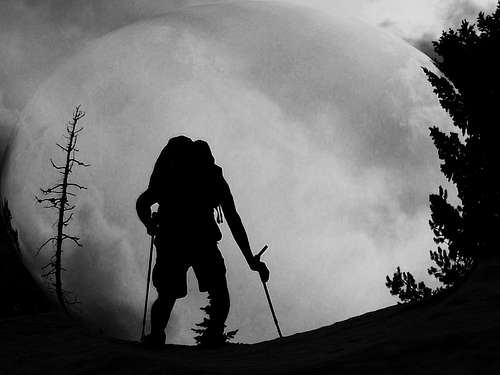
Overview:
Layout designed for best viewing on a "1024 x 768" screen.

|
|---|
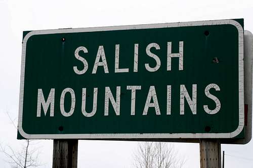 The Salish Range of Northwestern Montana
With peaks ranging from just under 7,000 feet tall to named hills that are a little short of 3,600 feet in elevation the Salish Mountain range is a lesser known mountain range in northwestern Montana. As seen in the accompanying photos many of these peaks are rounded tree covered summits but occasionally the mountain summits are found open grassy slopes that afford great views into the surrounding valleys and neighboring mountain ranges. The Salish Mountains cover a triangle shaped land mass of about 4,125 square miles of lush forests and peaks.
Featured in this report is all of the information on the mountains, history of how the range was named, a look at the Lookout system that dotted this range, information on Blacktail Air Force Base and a brief introduction to the The National Bison Range which is located just south of the Salish Range.
There are also links to the national forests and information on the campgrounds as well.
History and Background:
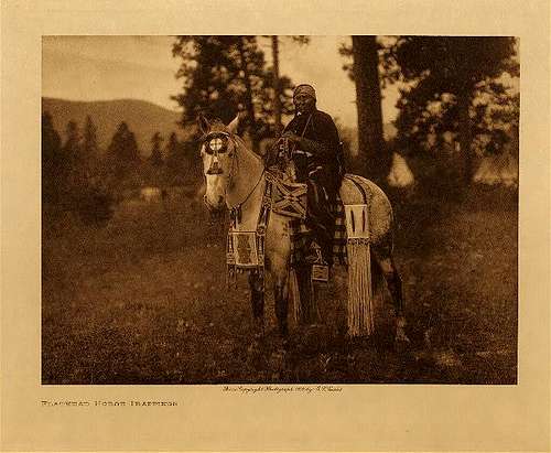 A Salish (Flathead) Tribal Member
The Salish Indians:
The Salish Mountains are named for the Native Americans who called this area their home for centuries before white man settled here. The Salish originated in the Pacific Northwest and were called the Flathead Indians by the first white men who came to the Columbia River. The Flatheads call themselves Salish meaning the people.
The name Flathead is often said to derive from the flat skull produced by binding infants' skulls with boards. However, this is mistaken folk etymology, as this tribe never practiced head flattening. In fact, the Salish were called "flat head" because the tops of their heads were not pointed like those of neighboring tribes people who practiced vertical head-binding. The sign language used by neighboring tribes to distinguish the Flatheads consisted of "pressing each side of the head" with the hands.
Although never a large tribe, the Salish had a reputation for bravery, honesty, and general high character and for their friendly disposition towards the whites. When first known, about the beginning of the last century, they subsisted chiefly by hunting and the gathering of wild roots, particularly camas, dwelt in skin tipis or mat-covered lodges, and were at peace with all tribes excepting their hereditary enemies, the powerful Blackfeet who lived across the continental divide on the Great Plains.
Historically the Flathead or Salish tribe occupied the area around Flathead Lake. Form more information on the Native Americans and their history especially associated with Glacier National Park please see the article: Centennial Series: A History of Glacier National Park’s Passes, Part I.
The Salish Tribe still lives in the area to the south of the Salish Mountains. The Confederated Salish and Kootenai Tribes are comprised of the Bitterroot Salish, the Pend d’Oreille and the Kootenai tribes. The Flathead Reservation of 1.317 million acres in northwest Montana but their ancestors lived in the territory now known as western Montana, parts of Idaho, British Columbia and Wyoming.
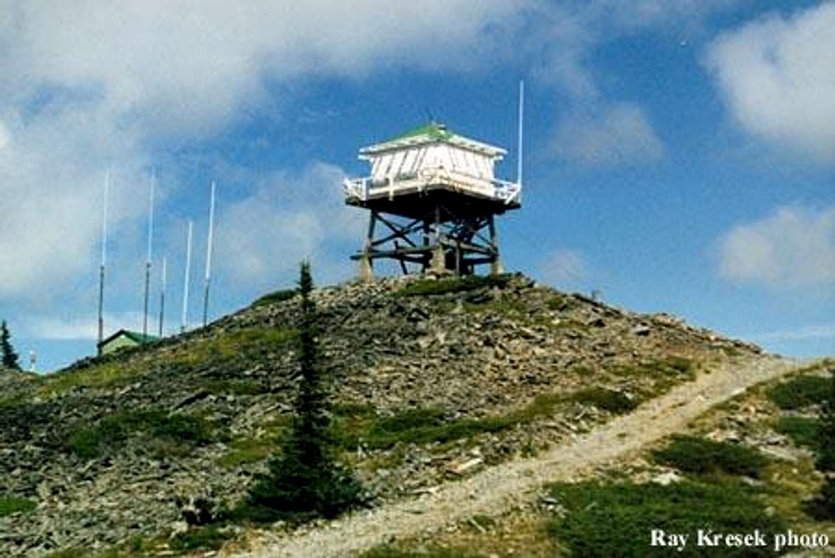
Fire Lookout System:
The Salish Mountains are laced from north to south and from east to west with an extensive network of forest (logging) roads as well as numerous trails that lead from the valley floors to most of the named summits. Some of these roads are maintained and others have been closed to protect the wildlife populations in the area. This road and trail network was established to maintain the fire lookouts that served to watch for forest fires from the 1920s to before World War II. A brief review of public records indicates that at least 50 lookouts operated in this range. It is truly amazing to see the map literally covered with Fire Lookouts.
There are lookouts in both the Kootenai and Flathead National Forests.
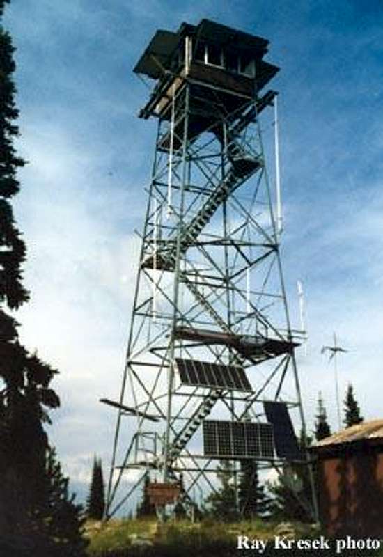
Some of the lookouts are still in operation but most of them are closed or destroyed. With the advent of satellite monitoring and more reliable airplane observation there has been a dramatic decrease in the need for lookouts. Here is a brief sample of the lookouts.
Meadow Peak (ABOVE PHOTO), at 6,709 feet (2,045 m), served as a fire lookout in 1928 with a cupola cabin, followed by a 15' L-4 in 1936, the present 10' treated timber tower with L-4 cab was built in 1957. It has been staffed by the state, and is listed on the National Historic Lookout Register.
Calx Mountain (PHOTO ON LEFT) also serves as a fire lookout. The first lookout structure here was a crow's nest tree platform, built in 1921, and still there 1/8 mile south of the present lookout. In 1934, a 40' pole L-4 tower was built on the middle of 3 summits. This was apparently destroyed in 1974. In 1984, the present steel tower was moved from Johnson Peak near Whitefish. The lookout has been staffed in recent years.
Warland Peak lookout was developed in 1934 with a 100' steel tower with 7x7' cab and accompanying 10' pole tower with L-4 cab for living quarters, Warland has not been used since the late 1960's. The L-4 is in very poor shape.
An Air Force Base:
![Blacktail Radar Station]() Blacktail Radar Tower
Blacktail Radar Tower
One mountain in the Salish Range, Blacktail Mountain, has served in defense of our homeland. During the Cold War, the U.S. Air Force had a radar base just above Lakeside. When the USAF no longer needed it the base’s barracks and other buildings near Lakeside sat unoccupied until they were bought by Youth With A Mission (YWAM) as a missionary training base in June of 1985. The radar installation was located at the top of Blacktail Mountain. I remember touring it as a child while it was still operational.
Blacktail Mountain now serves as a ski resort with 1,440 vertical feet of runs on a little over 1,000 acres in the Flathead National Forest. The average 250 inches of snowfall help this resort stay open later in the year than many other resorts in Montana. On sunny days skiers enjoy views down to Flathead Lake and the Flathead Valley. One of the unique features of Blacktail is that all of the runs start from the top of the mountain. This is an "upside-down hill" where the parking lot is located at the top of the resort. Before heading off to Blacktail Mountain Ski Area make sure to look at their official web site for pertinent details regarding closures and hours of operation.
![National Bison Range]() National Bison Range
National Bison Range
A Home on the Range (for buffalo):
Also located just south of the Salish Mountains near Moiese, Montana is the National Bison Range Wildlife Refuge. The “Bison Range” is administered by the U.S. Fish and Wildlife Service as part of the National Wildlife Refuge System. At present time the refuge supports 350 to 500 bison.
It was established in 1908 and is one of the oldest Wildlife Refuges in the nation. The refuge consists of over 18,000 acres and is home to over 200 species of birds in addition to bison, elk, bighorn sheep, pronghorn antelope, white-tail deer, mule deer and black bear.
The Bison Range Web site states,
![American Bison]() American Bison“While true buffalo are the Cape Buffalo of Africa or the water buffalo of Asia, the American Bison has been called "Buffalo" for so long that we now use the names interchangeably. The bison's only relative are remnants of another bison species, called the wisent, which survives in small numbers on reserves in Europe.
American Bison“While true buffalo are the Cape Buffalo of Africa or the water buffalo of Asia, the American Bison has been called "Buffalo" for so long that we now use the names interchangeably. The bison's only relative are remnants of another bison species, called the wisent, which survives in small numbers on reserves in Europe.
Bison are well adapted to life on the open grasslands. Their heavy coats protect them from both summer sun and winter winds. Their thick winter coat is so well insulated that snow can lie on their backs without melting.
They are strong, hardy beasts who suffer few diseases in the wild. The brucellosis attributed to bison herds today is really a cattle disease which was transmitted to bison in some areas. The Bison Range herd is vaccinated against this and other cattle diseases, and is certified brucellosis-free.
Bison are unpredictable and can be very dangerous. They appear slow and docile but really are quite agile and can run as fast as a horse; so don't try to out run one. A bison's tail is often a handy warning flag. When it hangs down and is switching naturally, the animal usually is unperturbed. If it extends out straight and droops at the end he/she is becoming mildly agitated. If the tail is sticking straight up, they are ready to charge and you should be somewhere else....but do not run.
Bison bulls weigh about 2,000 lbs. and have heavy horns and a large hump of muscle which supports their enormous head and thick skull. They have a thick mass of fur on their heads and a heavy cape of fur even in summer. This enhances their size and protects them when fighting. They are especially ill-tempered and roar and battle during the breeding season from mid-July through August.
Cows weigh about half as much as bulls. Their horns are narrower and are slightly curved. Horns on older females almost meet above their heads. Cows have smaller humps and a smoother summer coat. Calves are born from mid-April through May and are a bright rust red color for the first month or so. Cows are very protective of their young and can be even more dangerous than a bull when they have a calf at their side.”
Because of its open grasslands, the Bison Range is a place for the public to enjoy some excellent wildlife observation and photography. There are several driving loops as well as walking loops.
![Diamondback Rattle Snake]() Diamondback RattlesnackWhen visiting the Bison Range please be cautious. These are WILD animals. Do not approach them on foot or you will risk being injured. Also be cautious when walking the paths. The Bison range is also home to the Western Diamondback Rattlesnake. This area is rather unique as most rattlesnakes exist east of the Continental Divide in the Great Plains. This writer has heard of people who have been bite while visiting the Bison Range. Look before you step over logs and do not put your hands in places that you have not inspected.
Diamondback RattlesnackWhen visiting the Bison Range please be cautious. These are WILD animals. Do not approach them on foot or you will risk being injured. Also be cautious when walking the paths. The Bison range is also home to the Western Diamondback Rattlesnake. This area is rather unique as most rattlesnakes exist east of the Continental Divide in the Great Plains. This writer has heard of people who have been bite while visiting the Bison Range. Look before you step over logs and do not put your hands in places that you have not inspected.
Northwestern Montana also hosts numerous Wildlife Refuges and Waterfowl Protection Areas that are designated to support Montana’s vast numbers of Canada geese, mallards, redheads, pintails, American Widgeon, Northern shovelers, blue and green winged teal. Upland birds such as Ring-necked pheasants and gray partridge and is nesting habitat for savannah sparrows, meadowlarks and song sparrows. There is one area that supports a peregrine falcon hacking tower which has had a nesting pair of birds for the past ten years. Young falcons are regularly fledged from this nest. These areas also support high nesting concentrations of short-eared owls and northern harriers, plus are important wintering areas for rough-legged hawks, red-tailed hawks, and northern goshawks. Killdeer, American avocet, black-necked stilts, Wilson’s phalaropes and yellowlegs are also found in large numbers on most of the units. Smaller mammals include muskrat, striped skunk, mink, badgers, meadow voles and porcupines are also frequently seen. Geographic Boundaries:
![Salish Range]() Geographic Boundaries
Geographic Boundaries
The approximate geographic boundaries of the Salish Mountains are the area to the west of U.S. Highway 93 between Polson and Eureka and to the East of the Kootenai and Clark Fork rivers in northwestern Montana.
On the southern boundary of the Salish Mountain lies the Flathead Indian Reservation and the National Bison Range near Moise, Montana.
Red Tape:
![Report Wildfires]() Only you can prevent forest fires!
Only you can prevent forest fires!
The Salish Mountains are located in the Flathead National Forest. Please refer to their web site for rules and regulations.
A permit is not needed to camp within The Salish Mountains.
When choosing a campsite find one away from trails, meadows, lakes and streams to reduce your impact on fragile areas. “Leave No Trace” camping and hiking needs to be observed. Do not cut switchbacks and remember to “Pack It In - Pack It Out.”
The Peaks:
![Salish Range]() The Salish Range
The Salish Range
There are at least 82 named peaks in the Salish Mountains. Some of them have rather interesting names such as Redemption Hill, Ant Hill and Surprise Hill. Other mountains carry the names of Warex, Bar Z, Warland and Ketowke. Perhaps the most interesting named mountain is Inch Mountain which stands more than a few inches above sea level at 6,210 feet (1,893 m).
The tallest named peak in the Salish Mountains is McGuire Mountain which stands at an elevation of 6,991 feet (2,131 m) above sea level. It has Montana ranking of 47th in prominence with 3,071 feet. McGuire Mountain has a fire lookout and the building is available for nightly rental on a reservation basis.
Peaks that are added will be hyperlinked from the table below to the mountain page when they are submitted. There are a lot of peaks to submit so why not submit 1 or 10 peaks per year to SummitPost!
Rank Summit Name Elevation in Feet Lookout on Summit Rank Summit Name Elevation in Feet Lookout on Summit
1 McGuire Mountain 6991 Yes 44 Sheep Mountain 5761 Yes
2 Sutton Mountain 6872 No 45 Pleasant Valley Mountain 5690 No
3 Murr Peak 6763 No 4 Blacktail Mountain 6757 Yes 46 Lion Mountain 5685 No
5 Meadow Peak 6709 Yes 47 Skillet Mountain 5650 No
6 Lydia Mountain 6703 No 48 Ketowke Mountain 5635 No
7 Little Sutton Mountain 6654 No 49 Beartrap Mountain 5624 Yes
8 Elk Mountain 6587 Yes 50 Martin Divide 5604 Yes
9 Elk Divide 6581 Yes 51 Satire Mountain 5595 Yes
10 Calx Mountain 6550 Yes 52 Mineral Mountain
5588 No
11 Pinehill 6410 Yes 53 Wolf Point
5553 Yes
12 Mount Swaney 6349 Yes 54 Paul Mountain
5553 Yes
13 Bold Peak 6339 Yes 55 Sunday Mountain 5485 Yes
14 Pinkham Mountain 6322 Yes 56 Grubb Mountain 5455 No
15 Bar Z Peak
6304 Yes 57 Hornet Ridge 5452 Yes
16 Ashley Mountain 6297 Yes 58 Helmer Mountain 5438 No
17 Haskill Mountain 6290 Yes 59 Sugarloaf Mountain 5432 Yes
18 Castle Rock 6242 Yes 60 Boorman Peak 5432 No
19 Warex Peak 6242 Yes 61 Cripple Horse Mountain 5422 No
20 McGovern Mountain 6235 Yes 62 Adams Mountain 5380 No
21 Pleasant Benchmark 6230 No 63 Snell Mountain 5341 No
22 Sheppard Mountain 6216 No 64 Tally Mountain 5325 No
23 Mount Conner 6211 No 65 Keith Mountain 5300 No
24 Inch Mountain 6210 No 66 Hog Heaven
5277 Yes
25 Dunsire Point 6181 No 67 McGregor Peak
5213 Yes
26 Fox Mountain 6163 No 68 Swamp Mountain 4993 Yes
27 Ingalls Mountain 6125 Yes 69 Horse Hill 4963 Yes
28 Kerr Mountain 6121 Yes 70 Riverview Mountain 4941 Yes
29 Wolf Mountain
6104 No 71 Baldy Mountain 4868 No
30 Davis Mountain 6051 Yes 72 Edna Mountain 4605 Yes
31 Huckleberry Mountain 6045 No 73 Marion Benchmark 4592 No
32 Sanders Mountain 6019 Yes 74 Surprise Hill 4550 Yes
33 Johnson Peak 6009 Yes 75 Virginia Hill 4528 Yes
34 Richards Mountain 6005 Yes 76 Redemption Hill 4445 No
35 Boundary Mountain 5955 Yes 77 Hubbart Mountain 4351 Yes
36 Warland Peak 5950 Yes 78 Pilot Knob 4272 Yes
37 Reid Divide 5928 Yes 79 Bald Mountain 4251 No
38 Ellsworth Mountain 5917 No 80 Lightning Peak 4124 Yes
39 Teepee Mountain 5850 No 81 Black Butte 4064 Yes
40 Stenerson Mountain 5828 No 82 Ant Hill 3845 Yes
41 Mount Sterling
5774 No 83 Roberts 3790 Yes
42 Weigel Mountain 5765 Yes 84 Dog Mountain 3682 Yes
43 Dunn Peak 5762 No
Stone Hill Rock Climbing Area:
![Stonehill Location Map]() Stonehill Location
Stonehill Location
Another area of particular interest to readers of SummitPost is Stone Hill. Stone Hill is located on the west side of the Salish Mountains and overlooks Lake Koocanusa. It boasts over 300 established routes.
Stone Hill offers climbers of all levels an opportunity to challenge themselves on some routes. Many of the crags are excellent for top-roping, and include permanent bolts for easy rigging. Most routes also provide easy walk-off descents as well. Approach distance is usually less than the height of the crags, and bumper belays have been known to occur on roadside bluffs.
Much of the development in the area, just under half the total routes, can be attributed to the efforts of Steve Stahl, who, during the years of 2000-2003 established over 260 lines.
Routes and Ratings:
![Stonehill Climber s Guide]() Stonehill Guidebook
Stonehill Guidebook
Stone Hill is primarily facework/edging with some crack climbing as well. There are 9 main crags both above and below the highway which provide some seclusion and variation in your routes. Routes are available from beginner "stairstep" climbs, all the way to pumpy overhangs.
Stone hill is an area of mostly single pitch bolted and gear routes. Most of the 300+ routes are 5.10 to 5.11, but there are many 5.6 to 5.8 routes and a few 5.12 and 513s. 20 to 50 new routes are going up each year. The rock is quartzite and the routes are generally very safe. All routes
feature top anchors and most are top rope ready. This is a great area for single pitch, mixed sport and trad climbing.
The rock is an extremely hard quartzite derivative, and is characterized by painfully sharp edges, vanishing cracks, steep slabs and small horizontal roofs. The cracks tend to be very protectable, and as a result over half the routes in the area are protected by a combination of bolts and traditional means.
A Guidebook is available at Rocky Mountain Outfitter (RMO) in Kalispell, Montana. The guidebook is called The Complete Stone Hill Climber’s Guide by Tyler Hawk.
Stonehill Photos on Photos 1 and Photos 2.
Kila Crags:
![Kila Crags]() Kila Crags Guidebook
Kila Crags Guidebook
Another option of less intensity close to Kalispell are the Kila Crags. The Crags are located along U.S. Highway 2 about four miles west of Kila, Montana. The crags are located above the highway along an abandoned railroad grade. There are established bolted routes. Rocky Mountain Outfitters also carries the guidebook for the Kila’s Crags by Tyler Hawk. Tyler also includes routes for climbs at the Somer’s Dump just north of Flathead Lake. The Lakes:
![Hole-in-the-Wall Lake]()
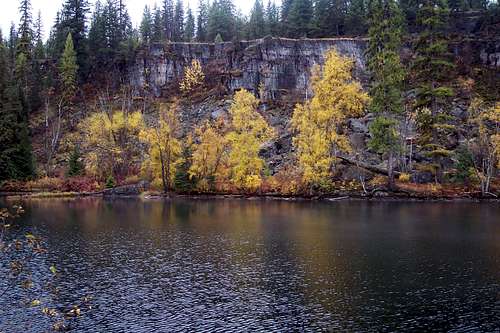
The Salish Mountains contain numerous small lakes that dot the landscape. Most of these lakes are small and many of them have decent fishing. There are 4 larger lakes that garner the attention of anglers. Those lakes are Little Bitterroot Lake, Ashley Lake and McGregor Lake. Tally Lake is Montana’s deepest lake, is 1350 acres in size and is 492 feet deep. It also offers fishing but is not known locally as a fishing hotspot. If the reader desires more information please contact this writer via PM.
Flora and Fauna:
![Ponderosa Pines]() Ponderosa Pines
Ponderosa Pines![Montana Common Loon]() Montana Loon
Montana Loon
These mountains hold numerous species of trees and flowers. They abound in color and variety.
The Salish Mountains are home to most of Montana’s ungulates including elk, mule deer, shiras moose, mountain goats, grizzly bear, black bear wolves and mountain lions.
This is bear and mountain lion country. So exercise caution while spending time here.
Camping and USFS Rental Facilities:
![Clouds during Montana s 2007 Fire Season]() Smoke over the Salish Range during a Montana Fire Season
Smoke over the Salish Range during a Montana Fire Season
Rental Cabins:
Rental cabins or lookouts are a unique way to experience Montana’s back country. Cabins are generally equipped with the bare basics; a table, chairs, wood stove, and bunks (some have mattresses, some don't). Bedding is not furnished. Cooking utensils are available at some cabins but not all. Electricity and piped-in water are not available. Bring safe drinking water or be prepared to chemically treat or boil drinking water. At some cabins, you will need to find and cut your own firewood. Expect to use outdoor toilets. Telephones are not available!
Star Meadows Guard Station:
The Flathead National Forest has a rental cabin available for $40 per night to groups no larger than 6. It is located near Tally Lake and is pretty much smack dab in the center of the Salish Mountains. The USFS web site describes the Star Meadows Guard Station as:
“The Star Meadows Guard Station was built in 1941 to replace the building that was located on the site in 1901. The site operated as a work center until the 1960's, housing fire suppression cress, contractors, timber camps, and as a staging area for engineers designing and building the roads on the Tally Lake District. The site was inaccessible during the winter months. In 1991 a cultural survey indicated that the facility was historically significant and placed on the National Historical Register.”
McGuire Mountain Lookout:
The Kootenai National Forest has this cabin available for $25 per night for groups of 4 or less. This cabin affords the possibility to sleep on the tallest mountain in the Salish range.
The USFS web site describes the McGuire Mountain Lookout as:
“This lookout was built in 1924 and was actively used as an obervation point for detecting forest fires for over 30 years. It was abandoned in the 1950's and renovated in 1998 under a Pit Project, making it eligible for the National Register of Historic Places.”
USFS Campgrounds:
Kootenai NF campgrounds (Interactive Map)
Flathead National Forest Campgrounds (PDF File)
East side Campgrounds:
Tally Lake
Sylvia Lake
Stillwater Lake
Ashley Lake North
North Dickey Lake
Rock Lake
West side Campgrounds:
Peck Gulch
Rocky Gorge
Camp 32
South side Campgrounds:
McGregor Lake
Little McGregor Lake
North side Campgrounds:
Tobacco River
Rexford Bench
Other Campgrounds:
Little Bitterroot Lions CampMaps and Trails:
![Salish Range]() A trail in the Salish Range.
A trail in the Salish Range.
There are numerous trails in this mountain range. The best way to locate them is to purchase the Flathead National Forest and the Kootenai and East Half Kaniksu National Forests maps from a local sporting goods store.
Maps can also be ordered on line
from the USFS.
Or download a brochure
with a basic map here. Large file and takes some time to download.Seasons and Conditions:
![Salish range]() Snow Shoes and Mountains
Snow Shoes and Mountains
Winter generally arrives in Montana’s high country in October and maintains its icy grip until at least April.
The duration of the year generally allows access to the mountains depending upon location and amounts of snow. If traveling away from the main roads do not expect the roads to be plowed or maintained. The USFS does not include this as part of the service they offer the general public.
The Salish range is not known for avalanches but they can and do happen in Montana’s mountains. Please refer to the Glacier Country Avalanche Center
for the latest information.
There are also multiple opportunities for cross country and back country skiing as well as snowmobiling. The areas designated by the National Forest are Black Butte and McGuire Mountain.
Sources, Guidebooks and External Links:
Kootenai National Forest
Flathead National Forest
An Air Force Base:
 Blacktail Radar Tower
One mountain in the Salish Range, Blacktail Mountain, has served in defense of our homeland. During the Cold War, the U.S. Air Force had a radar base just above Lakeside. When the USAF no longer needed it the base’s barracks and other buildings near Lakeside sat unoccupied until they were bought by Youth With A Mission (YWAM) as a missionary training base in June of 1985. The radar installation was located at the top of Blacktail Mountain. I remember touring it as a child while it was still operational.
Blacktail Mountain now serves as a ski resort with 1,440 vertical feet of runs on a little over 1,000 acres in the Flathead National Forest. The average 250 inches of snowfall help this resort stay open later in the year than many other resorts in Montana. On sunny days skiers enjoy views down to Flathead Lake and the Flathead Valley. One of the unique features of Blacktail is that all of the runs start from the top of the mountain. This is an "upside-down hill" where the parking lot is located at the top of the resort. Before heading off to Blacktail Mountain Ski Area make sure to look at their official web site for pertinent details regarding closures and hours of operation.
![National Bison Range]() National Bison Range
National Bison Range
A Home on the Range (for buffalo):
Also located just south of the Salish Mountains near Moiese, Montana is the National Bison Range Wildlife Refuge. The “Bison Range” is administered by the U.S. Fish and Wildlife Service as part of the National Wildlife Refuge System. At present time the refuge supports 350 to 500 bison.
It was established in 1908 and is one of the oldest Wildlife Refuges in the nation. The refuge consists of over 18,000 acres and is home to over 200 species of birds in addition to bison, elk, bighorn sheep, pronghorn antelope, white-tail deer, mule deer and black bear.
The Bison Range Web site states,
![American Bison]() American Bison“While true buffalo are the Cape Buffalo of Africa or the water buffalo of Asia, the American Bison has been called "Buffalo" for so long that we now use the names interchangeably. The bison's only relative are remnants of another bison species, called the wisent, which survives in small numbers on reserves in Europe.
American Bison“While true buffalo are the Cape Buffalo of Africa or the water buffalo of Asia, the American Bison has been called "Buffalo" for so long that we now use the names interchangeably. The bison's only relative are remnants of another bison species, called the wisent, which survives in small numbers on reserves in Europe.
Bison are well adapted to life on the open grasslands. Their heavy coats protect them from both summer sun and winter winds. Their thick winter coat is so well insulated that snow can lie on their backs without melting.
They are strong, hardy beasts who suffer few diseases in the wild. The brucellosis attributed to bison herds today is really a cattle disease which was transmitted to bison in some areas. The Bison Range herd is vaccinated against this and other cattle diseases, and is certified brucellosis-free.
Bison are unpredictable and can be very dangerous. They appear slow and docile but really are quite agile and can run as fast as a horse; so don't try to out run one. A bison's tail is often a handy warning flag. When it hangs down and is switching naturally, the animal usually is unperturbed. If it extends out straight and droops at the end he/she is becoming mildly agitated. If the tail is sticking straight up, they are ready to charge and you should be somewhere else....but do not run.
Bison bulls weigh about 2,000 lbs. and have heavy horns and a large hump of muscle which supports their enormous head and thick skull. They have a thick mass of fur on their heads and a heavy cape of fur even in summer. This enhances their size and protects them when fighting. They are especially ill-tempered and roar and battle during the breeding season from mid-July through August.
Cows weigh about half as much as bulls. Their horns are narrower and are slightly curved. Horns on older females almost meet above their heads. Cows have smaller humps and a smoother summer coat. Calves are born from mid-April through May and are a bright rust red color for the first month or so. Cows are very protective of their young and can be even more dangerous than a bull when they have a calf at their side.”
Because of its open grasslands, the Bison Range is a place for the public to enjoy some excellent wildlife observation and photography. There are several driving loops as well as walking loops.
![Diamondback Rattle Snake]() Diamondback RattlesnackWhen visiting the Bison Range please be cautious. These are WILD animals. Do not approach them on foot or you will risk being injured. Also be cautious when walking the paths. The Bison range is also home to the Western Diamondback Rattlesnake. This area is rather unique as most rattlesnakes exist east of the Continental Divide in the Great Plains. This writer has heard of people who have been bite while visiting the Bison Range. Look before you step over logs and do not put your hands in places that you have not inspected.
Diamondback RattlesnackWhen visiting the Bison Range please be cautious. These are WILD animals. Do not approach them on foot or you will risk being injured. Also be cautious when walking the paths. The Bison range is also home to the Western Diamondback Rattlesnake. This area is rather unique as most rattlesnakes exist east of the Continental Divide in the Great Plains. This writer has heard of people who have been bite while visiting the Bison Range. Look before you step over logs and do not put your hands in places that you have not inspected.
Northwestern Montana also hosts numerous Wildlife Refuges and Waterfowl Protection Areas that are designated to support Montana’s vast numbers of Canada geese, mallards, redheads, pintails, American Widgeon, Northern shovelers, blue and green winged teal. Upland birds such as Ring-necked pheasants and gray partridge and is nesting habitat for savannah sparrows, meadowlarks and song sparrows. There is one area that supports a peregrine falcon hacking tower which has had a nesting pair of birds for the past ten years. Young falcons are regularly fledged from this nest. These areas also support high nesting concentrations of short-eared owls and northern harriers, plus are important wintering areas for rough-legged hawks, red-tailed hawks, and northern goshawks. Killdeer, American avocet, black-necked stilts, Wilson’s phalaropes and yellowlegs are also found in large numbers on most of the units. Smaller mammals include muskrat, striped skunk, mink, badgers, meadow voles and porcupines are also frequently seen. Geographic Boundaries:
![Salish Range]() Geographic Boundaries
Geographic Boundaries
The approximate geographic boundaries of the Salish Mountains are the area to the west of U.S. Highway 93 between Polson and Eureka and to the East of the Kootenai and Clark Fork rivers in northwestern Montana.
On the southern boundary of the Salish Mountain lies the Flathead Indian Reservation and the National Bison Range near Moise, Montana.
Red Tape:
![Report Wildfires]() Only you can prevent forest fires!
Only you can prevent forest fires!
The Salish Mountains are located in the Flathead National Forest. Please refer to their web site for rules and regulations.
A permit is not needed to camp within The Salish Mountains.
When choosing a campsite find one away from trails, meadows, lakes and streams to reduce your impact on fragile areas. “Leave No Trace” camping and hiking needs to be observed. Do not cut switchbacks and remember to “Pack It In - Pack It Out.”
The Peaks:
![Salish Range]() The Salish Range
The Salish Range
There are at least 82 named peaks in the Salish Mountains. Some of them have rather interesting names such as Redemption Hill, Ant Hill and Surprise Hill. Other mountains carry the names of Warex, Bar Z, Warland and Ketowke. Perhaps the most interesting named mountain is Inch Mountain which stands more than a few inches above sea level at 6,210 feet (1,893 m).
The tallest named peak in the Salish Mountains is McGuire Mountain which stands at an elevation of 6,991 feet (2,131 m) above sea level. It has Montana ranking of 47th in prominence with 3,071 feet. McGuire Mountain has a fire lookout and the building is available for nightly rental on a reservation basis.
Peaks that are added will be hyperlinked from the table below to the mountain page when they are submitted. There are a lot of peaks to submit so why not submit 1 or 10 peaks per year to SummitPost!
Rank Summit Name Elevation in Feet Lookout on Summit Rank Summit Name Elevation in Feet Lookout on Summit
1 McGuire Mountain 6991 Yes 44 Sheep Mountain 5761 Yes
2 Sutton Mountain 6872 No 45 Pleasant Valley Mountain 5690 No
3 Murr Peak 6763 No 4 Blacktail Mountain 6757 Yes 46 Lion Mountain 5685 No
5 Meadow Peak 6709 Yes 47 Skillet Mountain 5650 No
6 Lydia Mountain 6703 No 48 Ketowke Mountain 5635 No
7 Little Sutton Mountain 6654 No 49 Beartrap Mountain 5624 Yes
8 Elk Mountain 6587 Yes 50 Martin Divide 5604 Yes
9 Elk Divide 6581 Yes 51 Satire Mountain 5595 Yes
10 Calx Mountain 6550 Yes 52 Mineral Mountain
5588 No
11 Pinehill 6410 Yes 53 Wolf Point
5553 Yes
12 Mount Swaney 6349 Yes 54 Paul Mountain
5553 Yes
13 Bold Peak 6339 Yes 55 Sunday Mountain 5485 Yes
14 Pinkham Mountain 6322 Yes 56 Grubb Mountain 5455 No
15 Bar Z Peak
6304 Yes 57 Hornet Ridge 5452 Yes
16 Ashley Mountain 6297 Yes 58 Helmer Mountain 5438 No
17 Haskill Mountain 6290 Yes 59 Sugarloaf Mountain 5432 Yes
18 Castle Rock 6242 Yes 60 Boorman Peak 5432 No
19 Warex Peak 6242 Yes 61 Cripple Horse Mountain 5422 No
20 McGovern Mountain 6235 Yes 62 Adams Mountain 5380 No
21 Pleasant Benchmark 6230 No 63 Snell Mountain 5341 No
22 Sheppard Mountain 6216 No 64 Tally Mountain 5325 No
23 Mount Conner 6211 No 65 Keith Mountain 5300 No
24 Inch Mountain 6210 No 66 Hog Heaven
5277 Yes
25 Dunsire Point 6181 No 67 McGregor Peak
5213 Yes
26 Fox Mountain 6163 No 68 Swamp Mountain 4993 Yes
27 Ingalls Mountain 6125 Yes 69 Horse Hill 4963 Yes
28 Kerr Mountain 6121 Yes 70 Riverview Mountain 4941 Yes
29 Wolf Mountain
6104 No 71 Baldy Mountain 4868 No
30 Davis Mountain 6051 Yes 72 Edna Mountain 4605 Yes
31 Huckleberry Mountain 6045 No 73 Marion Benchmark 4592 No
32 Sanders Mountain 6019 Yes 74 Surprise Hill 4550 Yes
33 Johnson Peak 6009 Yes 75 Virginia Hill 4528 Yes
34 Richards Mountain 6005 Yes 76 Redemption Hill 4445 No
35 Boundary Mountain 5955 Yes 77 Hubbart Mountain 4351 Yes
36 Warland Peak 5950 Yes 78 Pilot Knob 4272 Yes
37 Reid Divide 5928 Yes 79 Bald Mountain 4251 No
38 Ellsworth Mountain 5917 No 80 Lightning Peak 4124 Yes
39 Teepee Mountain 5850 No 81 Black Butte 4064 Yes
40 Stenerson Mountain 5828 No 82 Ant Hill 3845 Yes
41 Mount Sterling
5774 No 83 Roberts 3790 Yes
42 Weigel Mountain 5765 Yes 84 Dog Mountain 3682 Yes
43 Dunn Peak 5762 No
Stone Hill Rock Climbing Area:
![Stonehill Location Map]() Stonehill Location
Stonehill Location
Another area of particular interest to readers of SummitPost is Stone Hill. Stone Hill is located on the west side of the Salish Mountains and overlooks Lake Koocanusa. It boasts over 300 established routes.
Stone Hill offers climbers of all levels an opportunity to challenge themselves on some routes. Many of the crags are excellent for top-roping, and include permanent bolts for easy rigging. Most routes also provide easy walk-off descents as well. Approach distance is usually less than the height of the crags, and bumper belays have been known to occur on roadside bluffs.
Much of the development in the area, just under half the total routes, can be attributed to the efforts of Steve Stahl, who, during the years of 2000-2003 established over 260 lines.
Routes and Ratings:
![Stonehill Climber s Guide]() Stonehill Guidebook
Stonehill Guidebook
Stone Hill is primarily facework/edging with some crack climbing as well. There are 9 main crags both above and below the highway which provide some seclusion and variation in your routes. Routes are available from beginner "stairstep" climbs, all the way to pumpy overhangs.
Stone hill is an area of mostly single pitch bolted and gear routes. Most of the 300+ routes are 5.10 to 5.11, but there are many 5.6 to 5.8 routes and a few 5.12 and 513s. 20 to 50 new routes are going up each year. The rock is quartzite and the routes are generally very safe. All routes
feature top anchors and most are top rope ready. This is a great area for single pitch, mixed sport and trad climbing.
The rock is an extremely hard quartzite derivative, and is characterized by painfully sharp edges, vanishing cracks, steep slabs and small horizontal roofs. The cracks tend to be very protectable, and as a result over half the routes in the area are protected by a combination of bolts and traditional means.
A Guidebook is available at Rocky Mountain Outfitter (RMO) in Kalispell, Montana. The guidebook is called The Complete Stone Hill Climber’s Guide by Tyler Hawk.
Stonehill Photos on Photos 1 and Photos 2.
Kila Crags:
![Kila Crags]() Kila Crags Guidebook
Kila Crags Guidebook
Another option of less intensity close to Kalispell are the Kila Crags. The Crags are located along U.S. Highway 2 about four miles west of Kila, Montana. The crags are located above the highway along an abandoned railroad grade. There are established bolted routes. Rocky Mountain Outfitters also carries the guidebook for the Kila’s Crags by Tyler Hawk. Tyler also includes routes for climbs at the Somer’s Dump just north of Flathead Lake. The Lakes:
![Hole-in-the-Wall Lake]()
The Salish Mountains contain numerous small lakes that dot the landscape. Most of these lakes are small and many of them have decent fishing. There are 4 larger lakes that garner the attention of anglers. Those lakes are Little Bitterroot Lake, Ashley Lake and McGregor Lake. Tally Lake is Montana’s deepest lake, is 1350 acres in size and is 492 feet deep. It also offers fishing but is not known locally as a fishing hotspot. If the reader desires more information please contact this writer via PM.
Flora and Fauna:
![Ponderosa Pines]() Ponderosa Pines
Ponderosa Pines![Montana Common Loon]() Montana Loon
Montana Loon
These mountains hold numerous species of trees and flowers. They abound in color and variety.
The Salish Mountains are home to most of Montana’s ungulates including elk, mule deer, shiras moose, mountain goats, grizzly bear, black bear wolves and mountain lions.
This is bear and mountain lion country. So exercise caution while spending time here.
Camping and USFS Rental Facilities:
![Clouds during Montana s 2007 Fire Season]() Smoke over the Salish Range during a Montana Fire Season
Smoke over the Salish Range during a Montana Fire Season
Rental Cabins:
Rental cabins or lookouts are a unique way to experience Montana’s back country. Cabins are generally equipped with the bare basics; a table, chairs, wood stove, and bunks (some have mattresses, some don't). Bedding is not furnished. Cooking utensils are available at some cabins but not all. Electricity and piped-in water are not available. Bring safe drinking water or be prepared to chemically treat or boil drinking water. At some cabins, you will need to find and cut your own firewood. Expect to use outdoor toilets. Telephones are not available!
Star Meadows Guard Station:
The Flathead National Forest has a rental cabin available for $40 per night to groups no larger than 6. It is located near Tally Lake and is pretty much smack dab in the center of the Salish Mountains. The USFS web site describes the Star Meadows Guard Station as:
“The Star Meadows Guard Station was built in 1941 to replace the building that was located on the site in 1901. The site operated as a work center until the 1960's, housing fire suppression cress, contractors, timber camps, and as a staging area for engineers designing and building the roads on the Tally Lake District. The site was inaccessible during the winter months. In 1991 a cultural survey indicated that the facility was historically significant and placed on the National Historical Register.”
McGuire Mountain Lookout:
The Kootenai National Forest has this cabin available for $25 per night for groups of 4 or less. This cabin affords the possibility to sleep on the tallest mountain in the Salish range.
The USFS web site describes the McGuire Mountain Lookout as:
“This lookout was built in 1924 and was actively used as an obervation point for detecting forest fires for over 30 years. It was abandoned in the 1950's and renovated in 1998 under a Pit Project, making it eligible for the National Register of Historic Places.”
USFS Campgrounds:
Kootenai NF campgrounds (Interactive Map)
Flathead National Forest Campgrounds (PDF File)
East side Campgrounds:
Tally Lake
Sylvia Lake
Stillwater Lake
Ashley Lake North
North Dickey Lake
Rock Lake
West side Campgrounds:
Peck Gulch
Rocky Gorge
Camp 32
South side Campgrounds:
McGregor Lake
Little McGregor Lake
North side Campgrounds:
Tobacco River
Rexford Bench
Other Campgrounds:
Little Bitterroot Lions CampMaps and Trails:
![Salish Range]() A trail in the Salish Range.
A trail in the Salish Range.
There are numerous trails in this mountain range. The best way to locate them is to purchase the Flathead National Forest and the Kootenai and East Half Kaniksu National Forests maps from a local sporting goods store.
Maps can also be ordered on line
from the USFS.
Or download a brochure
with a basic map here. Large file and takes some time to download.Seasons and Conditions:
![Salish range]() Snow Shoes and Mountains
Snow Shoes and Mountains
Winter generally arrives in Montana’s high country in October and maintains its icy grip until at least April.
The duration of the year generally allows access to the mountains depending upon location and amounts of snow. If traveling away from the main roads do not expect the roads to be plowed or maintained. The USFS does not include this as part of the service they offer the general public.
The Salish range is not known for avalanches but they can and do happen in Montana’s mountains. Please refer to the Glacier Country Avalanche Center
for the latest information.
There are also multiple opportunities for cross country and back country skiing as well as snowmobiling. The areas designated by the National Forest are Black Butte and McGuire Mountain.
Sources, Guidebooks and External Links:
Kootenai National Forest
Flathead National Forest
 National Bison Range
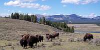 American Bison
 Diamondback Rattlesnack
 Geographic Boundaries
 Only you can prevent forest fires!
 The Salish Range
| Rank | Summit Name | Elevation in Feet | Lookout on Summit | Rank | Summit Name | Elevation in Feet | Lookout on Summit | |
|---|---|---|---|---|---|---|---|---|
| 1 | McGuire Mountain | 6991 | Yes | 44 | Sheep Mountain | 5761 | Yes | |
| 2 | Sutton Mountain | 6872 | No | 45 | Pleasant Valley Mountain | 5690 | No | |
| 3 | Murr Peak | 6763 | No | |||||
| 4 | Blacktail Mountain | 6757 | Yes | 46 | Lion Mountain | 5685 | No | |
| 5 | Meadow Peak | 6709 | Yes | 47 | Skillet Mountain | 5650 | No | |
| 6 | Lydia Mountain | 6703 | No | 48 | Ketowke Mountain | 5635 | No | |
| 7 | Little Sutton Mountain | 6654 | No | 49 | Beartrap Mountain | 5624 | Yes | |
| 8 | Elk Mountain | 6587 | Yes | 50 | Martin Divide | 5604 | Yes | |
| 9 | Elk Divide | 6581 | Yes | 51 | Satire Mountain | 5595 | Yes | |
| 10 | Calx Mountain | 6550 | Yes | 52 | Mineral Mountain | 5588 | No | |
| 11 | Pinehill | 6410 | Yes | 53 | Wolf Point | 5553 | Yes | |
| 12 | Mount Swaney | 6349 | Yes | 54 | Paul Mountain | 5553 | Yes | |
| 13 | Bold Peak | 6339 | Yes | 55 | Sunday Mountain | 5485 | Yes | |
| 14 | Pinkham Mountain | 6322 | Yes | 56 | Grubb Mountain | 5455 | No | |
| 15 | Bar Z Peak | 6304 | Yes | 57 | Hornet Ridge | 5452 | Yes | |
| 16 | Ashley Mountain | 6297 | Yes | 58 | Helmer Mountain | 5438 | No | |
| 17 | Haskill Mountain | 6290 | Yes | 59 | Sugarloaf Mountain | 5432 | Yes | |
| 18 | Castle Rock | 6242 | Yes | 60 | Boorman Peak | 5432 | No | |
| 19 | Warex Peak | 6242 | Yes | 61 | Cripple Horse Mountain | 5422 | No | |
| 20 | McGovern Mountain | 6235 | Yes | 62 | Adams Mountain | 5380 | No | |
| 21 | Pleasant Benchmark | 6230 | No | 63 | Snell Mountain | 5341 | No | |
| 22 | Sheppard Mountain | 6216 | No | 64 | Tally Mountain | 5325 | No | |
| 23 | Mount Conner | 6211 | No | 65 | Keith Mountain | 5300 | No | |
| 24 | Inch Mountain | 6210 | No | 66 | Hog Heaven | 5277 | Yes | |
| 25 | Dunsire Point | 6181 | No | 67 | McGregor Peak | 5213 | Yes | |
| 26 | Fox Mountain | 6163 | No | 68 | Swamp Mountain | 4993 | Yes | |
| 27 | Ingalls Mountain | 6125 | Yes | 69 | Horse Hill | 4963 | Yes | |
| 28 | Kerr Mountain | 6121 | Yes | 70 | Riverview Mountain | 4941 | Yes | |
| 29 | Wolf Mountain | 6104 | No | 71 | Baldy Mountain | 4868 | No | |
| 30 | Davis Mountain | 6051 | Yes | 72 | Edna Mountain | 4605 | Yes | |
| 31 | Huckleberry Mountain | 6045 | No | 73 | Marion Benchmark | 4592 | No | |
| 32 | Sanders Mountain | 6019 | Yes | 74 | Surprise Hill | 4550 | Yes | |
| 33 | Johnson Peak | 6009 | Yes | 75 | Virginia Hill | 4528 | Yes | |
| 34 | Richards Mountain | 6005 | Yes | 76 | Redemption Hill | 4445 | No | |
| 35 | Boundary Mountain | 5955 | Yes | 77 | Hubbart Mountain | 4351 | Yes | |
| 36 | Warland Peak | 5950 | Yes | 78 | Pilot Knob | 4272 | Yes | |
| 37 | Reid Divide | 5928 | Yes | 79 | Bald Mountain | 4251 | No | |
| 38 | Ellsworth Mountain | 5917 | No | 80 | Lightning Peak | 4124 | Yes | |
| 39 | Teepee Mountain | 5850 | No | 81 | Black Butte | 4064 | Yes | |
| 40 | Stenerson Mountain | 5828 | No | 82 | Ant Hill | 3845 | Yes | |
| 41 | Mount Sterling | 5774 | No | 83 | Roberts | 3790 | Yes | |
| 42 | Weigel Mountain | 5765 | Yes | 84 | Dog Mountain | 3682 | Yes | |
| 43 | Dunn Peak | 5762 | No |
Stone Hill Rock Climbing Area:
 Stonehill Location
Another area of particular interest to readers of SummitPost is Stone Hill. Stone Hill is located on the west side of the Salish Mountains and overlooks Lake Koocanusa. It boasts over 300 established routes.
Stone Hill offers climbers of all levels an opportunity to challenge themselves on some routes. Many of the crags are excellent for top-roping, and include permanent bolts for easy rigging. Most routes also provide easy walk-off descents as well. Approach distance is usually less than the height of the crags, and bumper belays have been known to occur on roadside bluffs.
Much of the development in the area, just under half the total routes, can be attributed to the efforts of Steve Stahl, who, during the years of 2000-2003 established over 260 lines.
Routes and Ratings:
 Stonehill Guidebook
Stone Hill is primarily facework/edging with some crack climbing as well. There are 9 main crags both above and below the highway which provide some seclusion and variation in your routes. Routes are available from beginner "stairstep" climbs, all the way to pumpy overhangs.
Stone hill is an area of mostly single pitch bolted and gear routes. Most of the 300+ routes are 5.10 to 5.11, but there are many 5.6 to 5.8 routes and a few 5.12 and 513s. 20 to 50 new routes are going up each year. The rock is quartzite and the routes are generally very safe. All routes
feature top anchors and most are top rope ready. This is a great area for single pitch, mixed sport and trad climbing.
The rock is an extremely hard quartzite derivative, and is characterized by painfully sharp edges, vanishing cracks, steep slabs and small horizontal roofs. The cracks tend to be very protectable, and as a result over half the routes in the area are protected by a combination of bolts and traditional means.
A Guidebook is available at Rocky Mountain Outfitter (RMO) in Kalispell, Montana. The guidebook is called The Complete Stone Hill Climber’s Guide by Tyler Hawk.
Stonehill Photos on Photos 1 and Photos 2.
Kila Crags:
 Kila Crags Guidebook
Another option of less intensity close to Kalispell are the Kila Crags. The Crags are located along U.S. Highway 2 about four miles west of Kila, Montana. The crags are located above the highway along an abandoned railroad grade. There are established bolted routes. Rocky Mountain Outfitters also carries the guidebook for the Kila’s Crags by Tyler Hawk. Tyler also includes routes for climbs at the Somer’s Dump just north of Flathead Lake.
The Lakes:
The Salish Mountains contain numerous small lakes that dot the landscape. Most of these lakes are small and many of them have decent fishing. There are 4 larger lakes that garner the attention of anglers. Those lakes are Little Bitterroot Lake, Ashley Lake and McGregor Lake. Tally Lake is Montana’s deepest lake, is 1350 acres in size and is 492 feet deep. It also offers fishing but is not known locally as a fishing hotspot. If the reader desires more information please contact this writer via PM.
Flora and Fauna:
 Ponderosa Pines
 Montana Loon
These mountains hold numerous species of trees and flowers. They abound in color and variety.
The Salish Mountains are home to most of Montana’s ungulates including elk, mule deer, shiras moose, mountain goats, grizzly bear, black bear wolves and mountain lions.
This is bear and mountain lion country. So exercise caution while spending time here.
Camping and USFS Rental Facilities:
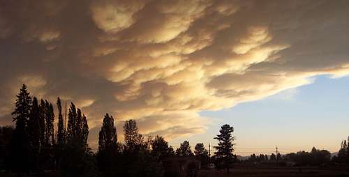 Smoke over the Salish Range during a Montana Fire Season
Rental Cabins:
Rental cabins or lookouts are a unique way to experience Montana’s back country. Cabins are generally equipped with the bare basics; a table, chairs, wood stove, and bunks (some have mattresses, some don't). Bedding is not furnished. Cooking utensils are available at some cabins but not all. Electricity and piped-in water are not available. Bring safe drinking water or be prepared to chemically treat or boil drinking water. At some cabins, you will need to find and cut your own firewood. Expect to use outdoor toilets. Telephones are not available!
Star Meadows Guard Station:
The Flathead National Forest has a rental cabin available for $40 per night to groups no larger than 6. It is located near Tally Lake and is pretty much smack dab in the center of the Salish Mountains. The USFS web site describes the Star Meadows Guard Station as:
“The Star Meadows Guard Station was built in 1941 to replace the building that was located on the site in 1901. The site operated as a work center until the 1960's, housing fire suppression cress, contractors, timber camps, and as a staging area for engineers designing and building the roads on the Tally Lake District. The site was inaccessible during the winter months. In 1991 a cultural survey indicated that the facility was historically significant and placed on the National Historical Register.”
McGuire Mountain Lookout:
The Kootenai National Forest has this cabin available for $25 per night for groups of 4 or less. This cabin affords the possibility to sleep on the tallest mountain in the Salish range.
The USFS web site describes the McGuire Mountain Lookout as:
“This lookout was built in 1924 and was actively used as an obervation point for detecting forest fires for over 30 years. It was abandoned in the 1950's and renovated in 1998 under a Pit Project, making it eligible for the National Register of Historic Places.”
USFS Campgrounds:
Kootenai NF campgrounds (Interactive Map)
Flathead National Forest Campgrounds (PDF File)
East side Campgrounds:
Tally Lake
Sylvia Lake
Stillwater Lake
Ashley Lake North
North Dickey Lake
Rock Lake
West side Campgrounds:
Peck Gulch
Rocky Gorge
Camp 32
South side Campgrounds:
McGregor Lake
Little McGregor Lake
North side Campgrounds:
Tobacco River
Rexford Bench
Other Campgrounds:
Little Bitterroot Lions Camp
Maps and Trails:
 A trail in the Salish Range.
There are numerous trails in this mountain range. The best way to locate them is to purchase the Flathead National Forest and the Kootenai and East Half Kaniksu National Forests maps from a local sporting goods store.
Maps can also be ordered on line
from the USFS.
Or download a brochure
with a basic map here. Large file and takes some time to download.
Seasons and Conditions:
 Snow Shoes and Mountains
Winter generally arrives in Montana’s high country in October and maintains its icy grip until at least April.
The duration of the year generally allows access to the mountains depending upon location and amounts of snow. If traveling away from the main roads do not expect the roads to be plowed or maintained. The USFS does not include this as part of the service they offer the general public.
The Salish range is not known for avalanches but they can and do happen in Montana’s mountains. Please refer to the Glacier Country Avalanche Center
for the latest information.
There are also multiple opportunities for cross country and back country skiing as well as snowmobiling. The areas designated by the National Forest are Black Butte and McGuire Mountain.
Sources, Guidebooks and External Links:
Kootenai National ForestFlathead National Forest