
|
|
Area/Range |
|---|---|
|
|
44.88257°N / 112.12648°W |
|
|
Scrambling |
|
|
Spring, Summer, Fall, Winter |
|
|
10581 ft / 3225 m |
|
|
Overview
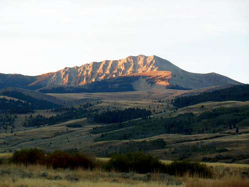
The Snowcrest Range is a small, scarcely known mountain range located in southwestern Montana. It lies entirely within the Beaverhead/Deer Lodge National Forest. The Snowcrests are bounded on the North and East flanks by the Ruby River,by Blacktail Deer Creek’s branches on the west , and the Centennial Valley with the Red Rock River to the South. Although the tallest peaks rise above 10,500’, these mountains get surprisingly little attention. This is a pity as they teem with wildlife, afford great long distance views from their isolated vantage points, and offer true isolation. Since there is precious little out there as far as information regarding hiking or scrambling in this range, a person kind of has to explore for themselves. An exception is the summit post page for Sliderock Peak. I hope this addition to summit post will point the way to a few nice spots while implying others,perhaps encouraging mountain wanderers to give this solitary though fairly accessible area a try!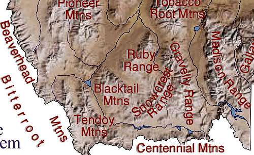
Southwest Montana mountain ranges
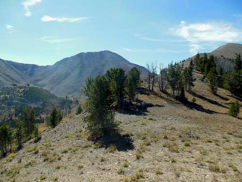
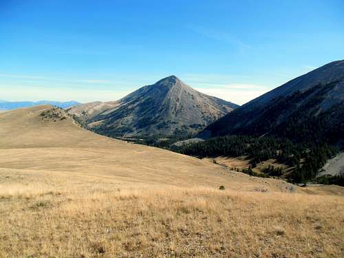
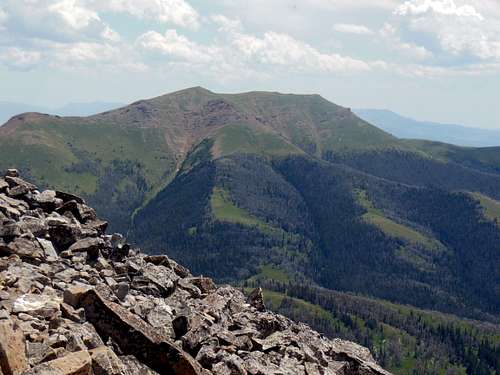
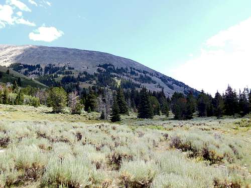
The Snowcrests themselves cover roughly twelve miles west to east and twenty miles north to south for an area of about 240 square miles, with most of it being mountainous and road less. Nearby mountains include the small Ruby Range to the northwest, the Blacktail Mountains to the west, and the Gravelly Range to the east. The distant tableau includes the entire Madison Range to the east, all of the Centennial Range to the south, while looking west the Beaverhead Mountains are visible from the Lima Peaks to Baldy Mountain and points further northwest. To complete the picture, the flank of the Tobacco Root Mountains to the north are also visible on a clear day from the airy summits.
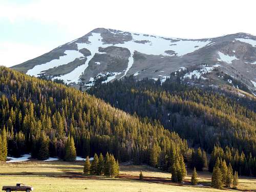
The foothills consist of grasses and sagebrush along with open pine forests. This gives way to Douglas and Alpine Firs which can reach nearly to the summit on most of the peaks. This range is well known for its deer and elk hunting; there is also a small herd of mountain goats that inhabit the upper regions.
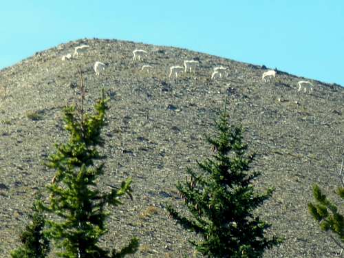
A gang of mountain goats
History-
There doesn’t appear to be much mineralization in this area; according to the U.S. Mining.com website,only a phosphorus mine on Sliderock Mtn.’s south eastern flank , a phosphate mine on Hogback Mountain’s east side and phosphate (?) deposits around Olsen Peak are the only mining attempts known to happen in this range. There is also an unnamed pumice mine on Robb Creek where efforts were also made.
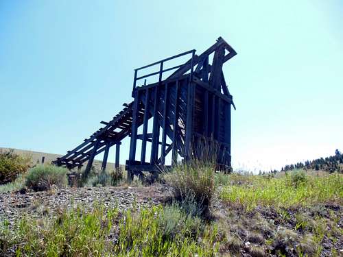
Mine ruins
PLACES OF INTEREST-
The Ruby River reservoir and dam, located 9 miles south of Alder, Montana, was constructed in 1938 to provide irrigation water to nearby ranches and for general use in the Ruby River valley. Reconstruction of the spillway and the gate works was begun in 2010, and completed in 2014. The reservoir created impounds about 37,000 acre feet of water; there have been rainbow trout stocked here and a population of brown trout also exists. A boat ramp is located on the east side along with a primitive, free campground. One can also sift small red garnets from the shoreline when the water isn’t high such as early spring or in late summer. Bring a shovel and screened sifter with you. This area is free of snow pretty early in the year, so early camping and rock hounding are possible. Overall a pleasant place to stay that gets you close to the Snowcrest Mountains.
The Robb/Ledford wildlife management area is located along the western flank of the Snowcrest Range and covers a little over 28,000 acres. It is home to many large mammals including about 800 head each of wintering elk and deer, antelope, some black bear, and a few moose frequenting the lower riparian zones. There may also be a stray grizzly bear or two present, so be advised. Plenty of birds are present here with birds of prey soaring the thermals overhead, with grouse and smaller species nearer the ground to be seen here. A lot of these animals wind up summering in the mountains nearby; the mountain goats pictured above probably never leave the safety of the summits all year round. Although the area is closed to all human activity from December 2 through May 15th, it still provides the best access to Hogback Mountain’s western flank via the Robb Creek/Notch road. By the way, the old mine ruins pictured above are located at the junction of the Ledford Road and the road leading off to Robb Creek. There is a nice older gentleman caretaker of the wildlife area who is fun to chat with. His cabin is about one-half mile south of the Notch Road junction along Robb Creek.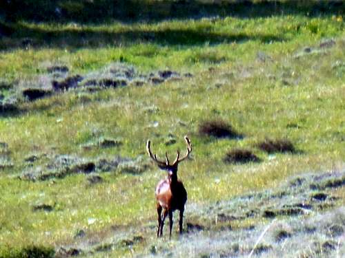
Nice bull elk in velvet
Getting There.
Glancing at a map detailing southwestern Montana, approaching the Snowcrest Range is seen to be fairly straight forward. With I-15 running north out of Idaho Falls, Idaho to Dillon, Montana; the western portions of the range are accessible.
Traveling US-287 going from West Yellowstone to Ennis, Montana, the eastern and northern sides become available. More obscure routes from the south include the Red Rock Road which can be navigated from either Monida on I-15 to the west or the other end of the road coming out of Island Park, Idaho.
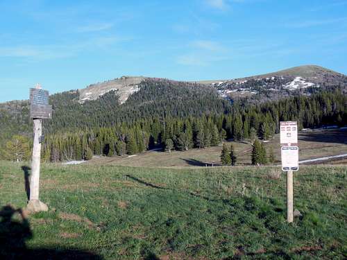
The Trails
THE TRAILS---
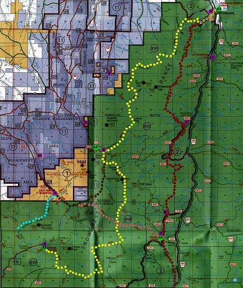
Snowcrest Range area map
GILBERT TRAIL-(FST-6051)
Other than the fact that this trail exists,there is little out there on this one. The author has been on a few miles of this trail in the cow camp area. Looking at the map one can surmise that the Gilbert Trail travels at a lower altitude and generally parallels the higher Snowcrest Trail.
SNOWCREST TRAIL-(FST-6004)
From Alder, drive south on the road to Ruby Reservoir. Continue on the Upper Ruby Road past the reservoir about 30 miles to the turnoff for the Romy Trail head(952), about a mile before Vigilante Guard Station. Drive about a mile down this road (closed April 1 - July 1 for mud season and not suitable for horse trailers) to the sign for the Romy trail head. The Snowcrest Trail was reconstructed in 2013.
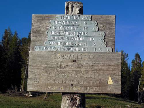
Old signpost at the Notch
To Antone Cabin:
From Romy Creek trail head on Lewis Creek Road you head up Trail 6004 and a series of switch-backs to the top of Snowcrest Mountain.Heading south down this scenic trail about 15 miles brings one to the Notch Cabin. From here its up through Honeymoon Park and over Stonehouse Mountain, passing very close to the summit. Might as well climb it while passing by. The trail then turns generally south for several miles staying high before dropping down through Peterson Basin. Just downstream from the basin is a trail junction, with the Snowcrest Trail bearing to the right. From here the route ascends to the west for more walking at altitude, before descending northwest to the trails end at Antone Cabin. Total distance is about 40 miles.
INDIAN CREEK (SAWTOOTH MOUNTAIN) TRAIL- (FST-6068)-
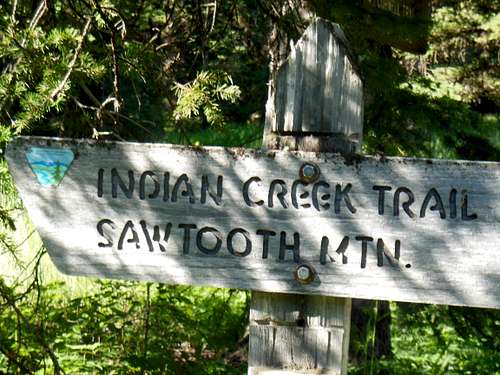
Sawtooth Mountain trail head
This trail starts out good, but as the hike goes on there are sections which have no tread at all. Sometimes there are old blazes on prominent trees, sometimes an educated hunch is needed to travel through the interconnected, steep meadows and forested patches. In other words a totally enjoyable little puzzle of a trail. This should appeal to the seasoned mountain traveler, but maybe not so much to the casual hiker who would want a clear, well-trod path. When the determined hiker finally makes it to the high saddle at the start of the north by northwest ridge of Sawtooth Peak, it is clear what to do! From this point the trail traverses southwest at high altitude across to the next saddle, then down to the Cornell Trail (FST-6067) and Cornell Camp. The facility associated with the fine upstate New York university is just about a mile west of Antone Cabin.
EAST FORK BLACKTAIL DEER TRAIL (FST-6069)
The East Fork Trail shares the same trail head as the Sawtooth Trail. Just stay on path by the stream and bypass the Sawtooth trail to the right. About one and a half miles in is a junction;stay to the left by the stream on trail 6069. Total length of the trail is approximately 5 miles and should be considered easy to moderate in difficulty. This is a fine route along the south and eastern flanks of Sunset and Olsen Peaks which are above and to the left or west, with Stonehouse Mountain being to the right. The hiker passes modestly uphill through lush meadows lining Blacktail Deer Creek to its head where it meets the Snowcrest Trail (FST-6004) a short distance south of the Notch. Utilizing this trail, one can envision either:
A) Journey up the old Crow’s Nest Trail(FST-1807t) to its head; a passable old route that’s fairly clear, look for ancient tree blazes. Stay above and to the southeast (right) of the drainage bottom, especially in the upper reaches near timberline. Then down picturesque upper Robb Creek around to the Notch to return via the East Fork Blacktail Deer Trail, downhill all the way.
Upper Robb Creek
-or-
B) Ascending the wooded ridge which rises above and east of the Crow’s Nest Creek-East Fork Blacktail Deer junction. This long southwest ridge of Sunset Peak looks to hold some interest. Down to connecting saddle then up and over Olsen Peak. One could drop straight east off of Olsen Peak and make for the above mentioned Snowcrest-Blacktail trail junction. The fun would be seeing how sharp the dead reckoning skills are! ;)(note: if this sounds like fun, pm me; planning to do this in 2016)
USGS MAPS--7.5’QUADS----Antone Peak Home Park Ranch Iron Creek Spur Mountain
----Stonehouse Mountain Swamp Creek Warm Spring Creek
Other Maps---Lima, Montana 30’ quad (VIRTUALLY ENTIRE RANGE ON THIS ONE)
---Dillon,Montana 30’ quad (for northern section and approaches)
---Dubois, Idaho +Montana 1x2 degrees quad (for the big picture)
---Lima,Montana 30’ quad geologic map
.The Peaks
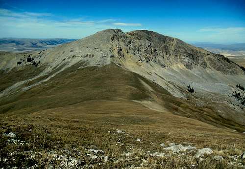
THE PEAKS:
Sunset Peak—10,581’---Antone Peak 7.5’ quad
Sunset Peak from Peak 9,903' final slopes
Hogback Mountain---10,560+’---Spur Mountain. 7.5’ quad
Hogback Mountain from Sawtooth grassy lower ridge
Olson Peak----10,482’---Antone Peak 7.5’ quad
Olson Peak from the Notch
Sliderock Mountain--10,439’—Spur Mountain 7.5’ quad (NICE PAGE BY Castlereagh on sp)
Antone Peak—10,247’—Antone Peak 7.5’ quad
Antone Peak from Sawtooth Mountain summit
Sawtooth Mountain-10,090’—Antone Peak 7.5’ quad
Sawtooth sunset
Spur Mtn.---10,076’---Spur Mountain, 7.5’ quad
Stonehouse Mtn.—10,075’---Stonehouse Mountain. 7.5’ quad
Stonehouse Mountain from the Notch
Peak 10,008'--Spur Mountain 7.5' quad (.5 mile north northeast of Sliderock Mountain)
Peak 9,903’---Antone Peak 7.5’ quad (.5 mile northwest of Sunset Peak)
Peak 9,903' from Sunset slopes
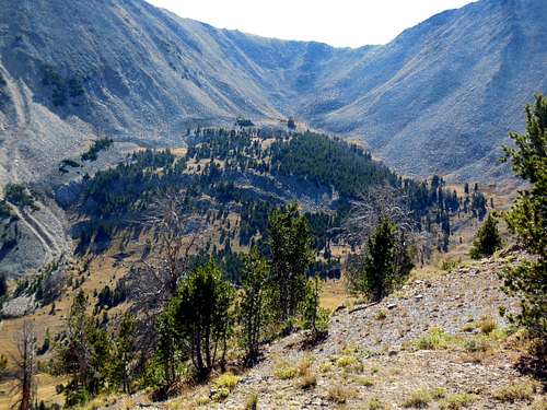
1/21/17- This past summer the author made a combined climb of Spur Mountain and Sliderock Mountain. This turned out to be an enjoyable hike, with trail running high up on Spur Mountain. From there it is no problem to go on over to claim Sliderock Mountain via its west slopes. This pair of summits stand away from the main crest , so great panoramic views of the Snowcrest Range are afforded.
Camping
CAMPING-
Ruby Reservoir CG (5,400’)-pit toilet,no water, free
From Alder, Montana, travel south on the Ruby River Road 9miles.
Cottonwood CG (6,300’)-pit toilet. no water, free
From Sheridan travel South on Highway 287 for about 8miles. When you reach Alder, take Ruby Reservoir Road south for approximately 36 miles. Follow the signs to the campground. Access to Sliderock Mtn, and the Gilbert Trail from this area.
USFS CABINS-
Antone cabin- (8,080’)
Antone Cabin
From Dillon, travel about 40 miles southeast on Forest Road 202 ( the Blacktail Road), to Antone Station turnoff. This turnoff is just north of the Clover Divide. Turn left onto Forest Road 325 and continue about 6 miles to the cabin. You can also approach this cabin from the south via the Red Rock road out of Monida, Montana. About thirteen miles east on this Red Rock Road is the junction with the Blacktail Road. Travel north 20 miles to the Antone Station turn off, that is right onto road (FR 325). This is a really beautiful area with great views of Antone Peak and the rugged southern slopes of Sawtooth Mountain. Fee is $35/night.
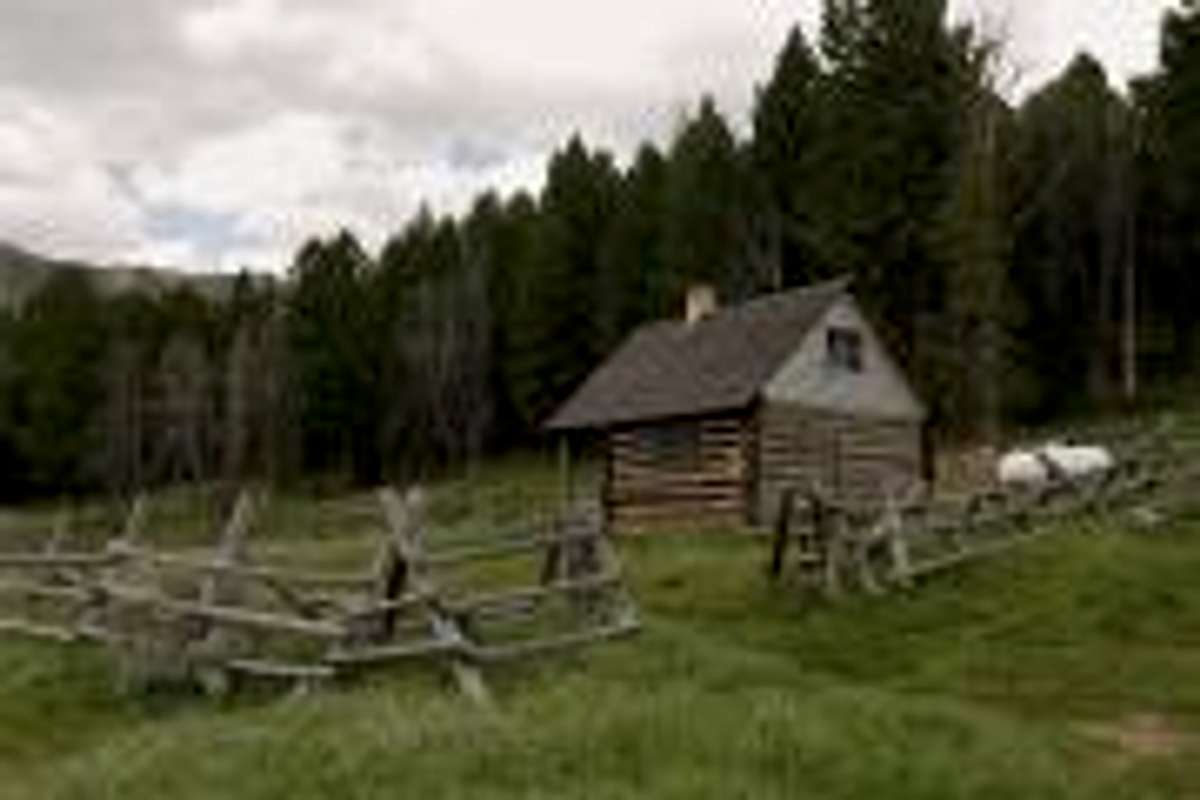
Notch cabin- (8,440’+)
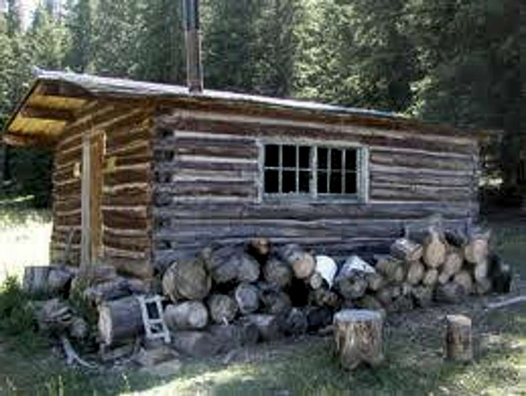
Notch Cabin
This cabin was built by a miner in the early 1900s. What he was mining wasn’t immediately apparent.Eleven miles southeast from the reservoir, on the Ruby River Road, brings one to the Ledford Road(Madison County Road 50). Turn right on this road and travel about 3.5 miles to a junction. For dispersed camping site 2, continue on along Ledford Creek for about 8 miles to the end of the road. Otherwise turning right at this junction takes you immediately over Ledford Creek then southwest three miles to reach Robb Creek. Five miles further south along Robb Creek gets you to the Notch Road turn off to the right. Follow this road high up above the creek across grassy hills six miles to the high crossing of Robb Creek. This is dispersed camping spot number 3. Unless traveling in a 4wd vehicle, it may be best to stop here. The cabin is only a few more rough miles ahead. Fee is $25/night
Vigilante cabin- (6,100’)
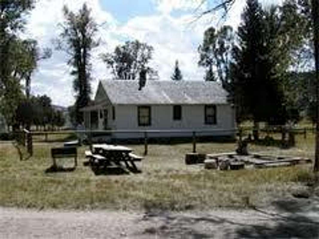
Vigilante Cabin
Turn south on Ruby River Road and continue about 22 miles to Vigilante Station. The cabin and two adjacent buildings were built by the Civilian Conservation Corps in the early1920s. Has electricity, and running water in summer only. Fee is $50/night. This camp provides direct access to the northern termini of the Snowcrest and Gilbert Trails.
Dispersed (truck) camping--
1 Vigilante Guard Station Area- (6,300-6,900’)
Just before the guard station turn right on Romy Trail head access road (FSR-952). At the end of this mile plus of road is found the trail heads for both the Snowcrest Trail (FST-6004) and the Gilbert Trail(FST-6051). Once onto forest service lands, camp almost anywhere you like, keeping proper distances from streams and roads of course.
2 Ledford Creek- (6,760’)
For directions to this locality, please see Notch cabin driving directions above. This is the closest access for those wishing to climb Spur Mountain. Southeast three miles on Ledford Creek Trail (FST-6057) brings one to the Snowcrest Trail (FST-6004) junction. One mile north on the Snowcrest Trail leads into Devil’s Hole. Following the trail up brings the hiker to Spur Mountain’s southwest ridge. Probably possible to climb Sliderock Mountain in conjunction with Spur Mountain with less trouble than from the Gilbert Trail on the east flank. Maybe summer 2016 will settle this question.
3 Robb Creek- (7,840’)
Robb Creek, Hogback Mountain
Just west of the Robb Creek crossing on the Notch Road there are flat areas to camp just above the creek. This provides decent access to the western slopes of Hogback Mountain.
4 The Notch- (8,660’)
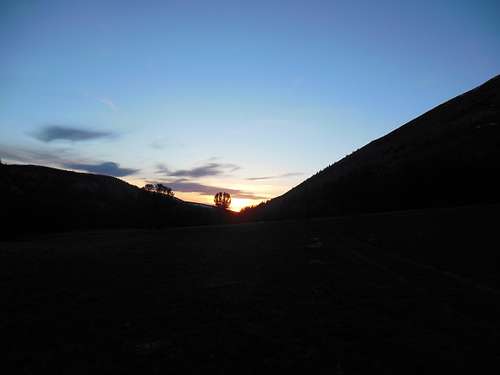
Hogback Mountain and Notch at sunset
Traveling a mile past the Notch cabin on FSR 623 brings one to the saddle between Hogback Mountain and Olsen Peak called the Notch. This is a spectacular camping spot with access to the southwest end of Hogback Mountain, Olson Peak, and Stonehouse Mountain. The Snowcrest Trail system is accessible directly from here as well. To make it here requires some four- wheel driving, especially above the Notch Cabin.
5 East Fork Blacktail Creek- (7,200’)
Drive the Blacktail Road either 30 miles southeast from Dillon, Montana or 10 miles north on the Blacktail Road from the Antone cabin turnoff, to the East Fork Road(FSR-963). Follow this road east about four miles where you’ll see a little bridge on the right; turn here. This is FSR-1808/963 which leads southeast another 6 miles, staying on the right or west side of the creek, to the trail head. There is a pit toilet but no other amenities. The Sawtooth Trail and East Fork Trail starts right here.
5a East side, East Fork Blacktail Creek- (7,040’)
Instead of turning right at the little bridge mentioned above, continue on around the creek bend driving down a worsening road about 5 miles to the road closure sign. Nice soft grass here to pitch a tent on. There is actually an old forest trail (FST-1825t) which leads quite away up the creek below Peak 9,903’. There is a good chance to see mountain goats on this grassy expanse, but harder if they see you first. Of course from the summit of this wonderful little peak, it’s a simple matter to make one’s way down to the saddle separating this mountain from the easily climbed northwest ridge of Sunset Peak. Also from this 9,500’ saddle one can contour east and up through the fantastic upper valley at Robb Creek’s head to the Olson Peak- Sunset Peak saddle.
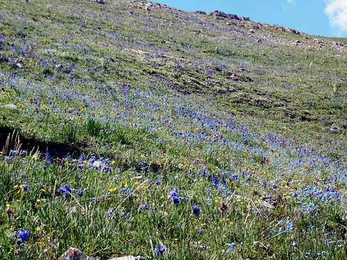
blue lupine
6 Notch area (8,080’)
Follow the driving directions to the Notch Cabin as in above. There is plenty of room up here to camp with a spring near the cabin. This is a very scenic area which has fine access to both Antone Peak and the south flanks of Sawtooth Mountain.
7 +8 Divide Creek Guard Station Area-
This guard station may still be in use by the forest service as the cabin doesn’t appear to be for rent to the public. Staying in this area affords one the opportunity to catch the FST-6417 or FST-612 up over Mount Carey and on to Stonehouse Mountain. Also at Divide Creek GS is the start of the scenic trail leading up Divide Creek to meet in a few miles with the Snowcrest Trail. From here its west and down to the East Fork trail head.
9 Three Forks Cow Camp area-
This is a working cow camp during the summer season. If you want to talk to real cowboys and not poseurs, this might be a good spot. Right on FSR-9655 off of the Ruby River Road(RD100) just past the camp gives access to the Gilbert Trail. FST-6059 leads into the upper Ruby River drainage to eventually connect with the Snowcrest Trail south of Ledford Pass.
Note: There appears to be no red tape involved with visiting this area. :)

Click for weather forecast