
|
|
Route |
|---|---|
|
|
41.18300°N / 123.41°W |
|
|
hike, bushwhack, scramble |
|
|
Half a day |
|
|
Walk-up (class 1) |
|
|
Approach
Vital route stat’s:
· Length: Round trip is approximately 7 miles.
· Elevation gain: 1,600 ft.
· Length of trip: Half day
Approach: For this route, the drive is the approach, & the approach is the actual climb. You will be delighted (or very disappointed, depending on your masochistic tendencies) to learn that the brunt of ascending this mountain will be taken by your vehicle- ascending Red Cap Road from its junction with highway 96 until reaching the trailhead raises your elevation 5,000 ft. Give yourself ample time to drive this stretch, as you’ll likely average 30 mph or less.
From Orleans, cross the Klamath River via the bridge north of town (after getting your fire permit from the ranger station, should you plan to use a stove or start a fire if camping in the area). Take an immediate R onto Red Cap Road, and set your odometer. Keep on following this road, which at some point amazingly morphs into Forest Road “10N01.”
You’ll first go through a residential area, also passing by some sort of vacation/camp/school/prison facility with barbed wire protecting its lawns (or the outside world from what occupies them), on the L. Continue on “10N01,” bypassing numerous intersections, & taking the more prominent road the whole time (any place where there might be any question a sign designating the roads will point you in the right direction). You’ll eventually leave all traces of civilization (except for the road), & be driving through the woods (probably alone). Aside from potential rockfall from above (or a tree or 2), the road should be in good shape. A few miles before reaching the trailhead, the road will turn to well-groomed dirt. At 19.1 miles, after gaining around 5,000’ elevation, you’ll finally get to a saddle, where a sign on the L proclaims “SALMON SUMMIT TRAIL 6E03.” This is the trailhead.
 |
Route Description
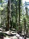
Take the trail from the trailhead through some high bushes for a brief stretch before emerging into the woods. This part of the hike is characterized by the trail undulating through a forest with many Douglas firs. Go straight past a 90 degree trail intersection on the L reading “Orleans Mtn.”
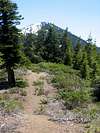
At 1.3 miles, you’ll run into Baylor camp, designated by a large sign proclaiming the area as part of the Trinity Alps Wilderness & Six Rivers National Forest. Take a L here, where a sign reads “Red Cap Lake.” You’ll emerge from the forest eventually to have some nice views of the peak ahead.
At approximately 2 miles (maybe a little more), the trail forks. Take the L branch.
At 2.7 miles, the trail forks again, this time with a sign indicating “Red Cap Lake.” Choose the L-hand branch again.
At about 6,200 ft., you’ll reach a ridge with views of Mt. Eddy, & Mt. Shasta behind. Once past this point, between 6,200 & 6,400 ft., leave the main trail & shoot for the ridge. Go cross-country until encountering a faint trail that stays around 20 ft to the R of the ridge crest. Follow this trail, traveling over friable (read: somewhat crappy) class 2 (or class 3, if you look for it) rock to the summit, which is marked by a 5-ft. high cairn with a large stick protruding from it.
Descend the way you came.
 |  |  |  |  |
Essential Gear
Bring a camera, water, & hiking boots.
Miscellaneous Info
If you have information about this route that doesn't pertain to any of the other sections, please add it here.
 |