

-
 26454 Hits
-
 92.97% Score
-
 41 Votes
|
|
Mountain/Rock |
|---|---|
|
|
41.83860°N / 103.7°W |
|
|
4649 ft / 1417 m |
|
|
Overview
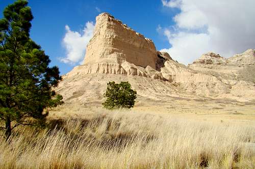
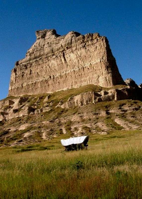
One of the most significant summits in the state of Nebraska, is ScottsBluff. At 4,649 feet, it is not the highest summit in Nebraska, but it does have the most prominence at 474 feet, according to Lists of John. The summit towers close to 800 feet above the North Platte River, which flows along the northern base of the bluff. The summit was a major landmark for centuries to the Native American tribes that lived in the area, and later on to the pioneers from eastern USA who passed by while traveling on the Oregon, Mormon and California Trails between 1843 and 1869.
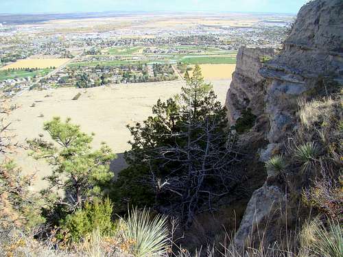 View of Scottsbluf from the summit
Scotts Bluff is at the heart of the 3,000-acre Scotts Bluff National Monument. The monument has a visitors center and several hiking trails. While the 1.6-mile Saddle Rock Trail gives visitors a chance to hike to the summit, climbing the other summits in the monument is not allowed. Those summits would include Dome Rock, Sentinel Rock, South Bluff, Crown Rock, Saddle Rock and Eagle Rock. Monument officials' position on this is based on their concerns for the safety of both the summits and all climbers, due to the crumbly nature of the sandstone and clay composite of these summits.
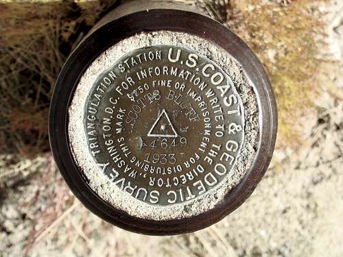 Scotts Bluff Benchmark
On clear days at the summit, hikers can see Laramie Peak (10,272 feet), over 100 miles west-northwest in Wyoming. Though Scotts Bluff is one of the very steepest summits in Nebraska, the grade of the Saddle Rock Trail makes hiking to the top something that almost anyone can accomplish. The towns of Gering and Scottsbluff are next to thenational monument.
Getting There
Scotts Bluff is west of the Gering-Scottsbluff area. To get to Scotts Bluff go south from Gering on Highway 71, then turn west on Highway 92. It is just a short drive to the Visitors Center, where you will find the trailhead for the Saddle Rock Trail. Visitors are required to pay an entrance fee for this historic site. The trail to the summit is about 1.6 miles long and will take you over 400 feet higher than the Visitors' Center. The trail is unique for western Nebraska hiking, because it is graded and paved, even having a scenic tunnel to get from one side of the butte to the other side. At the summit, hikers will find spectacular views in all directions.
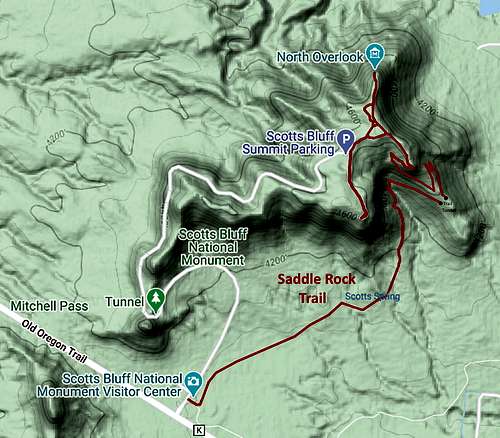 Saddle Rock Trail Map
Red Tape
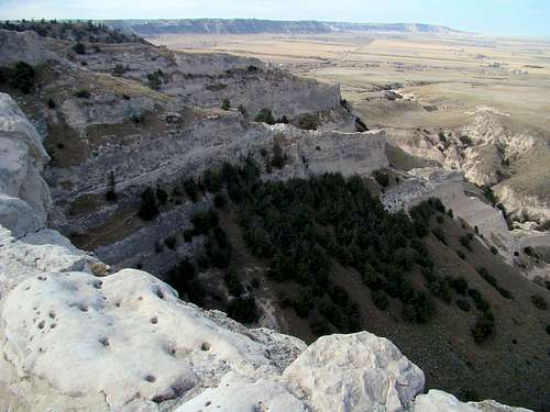 Summit View Northwest
Scotts Bluff National Monument has fees and regulations you will need to know and comply with. You can access their information site by clicking here:
Scotts Bluff National Monument Regulations & Visitor Information
A special caution is warranted in regards to picking up fossils anywhere in the monument. Fines can be pretty hefty for anyone caught taking a fossil.
When to Climb
 Eagle Rock
While the monument is normally open year-around, barring weather-related closures, warmer weather can bring storms with hail, lightning and tornadoes. Warmer weather also brings out the prairie rattlesnake population, as well at plenty of ticks in the long grasses. Plan your outing carefully, and be sure to call headquarters for advice when you need it. Their number is:
(308)436-9700
You can access the latest area weather forecast and conditions here:
Area Camping
Camping is not allowed at Scotts Bluff National Monument, but there are nearby campgrounds you can stay at. Camping opportunities are not abundant in the area, especially with the closure of the Riverside Campground (hopefully temporary). However, you may click on either of the links below to learn more about what is available:
Lake Minatare State Recreation Area Campgrounds
Captain Critters Country Campground
 Scott's Bluff