
|
|
Area/Range |
|---|---|
|
|
47.03070°N / 11.02688°E |
|
|
Hiking, Mountaineering, Skiing |
|
|
Spring, Summer, Fall, Winter |
|
|
11027 ft / 3361 m |
|
|
Overview
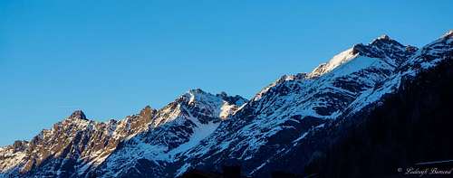 Sulztal Ridge in Winter | 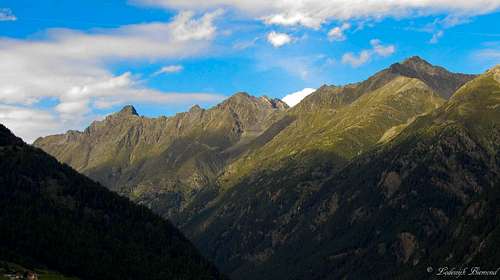 Sulztal Ridge in Summer |
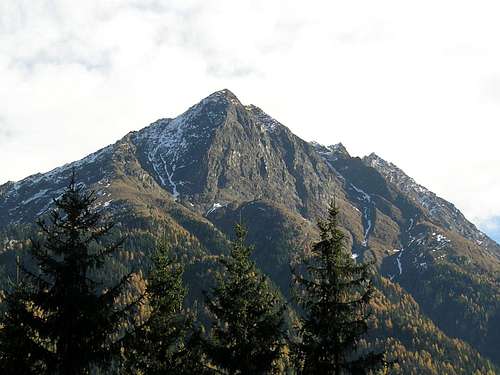
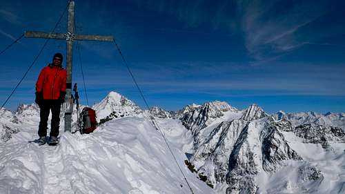
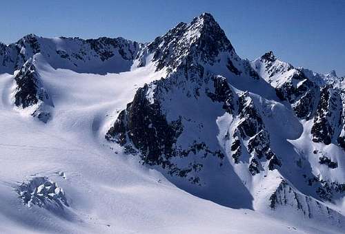
The Sulztal Ridge is small subgroup of the Stubai Alps hovering above the Ötztal Valley. The Sulztal ridge consists of a chain of rugged and sharp mountains with the Wilde Leck being the highest at 3365 meters. The mountains of the Sulztal ridge, although many of them well above the 3000 meter barrier, are seldomly climbed. The subgroup is not developed, not even for hiking - only two hiking trails cross the ridge to the north and south respectively. Climbing the sharp peaks of this ridge requires some good climbing skills, because many of the 3000meter + peaks do not offer any easy way up. The most popular and most visited peak of the area is the Wilde Leck. The normal route of this fine pyramid shaped mountain leads up the east ridge and is graded PD+ (II-III). Another popular objective is the Kuhscheibe (3189m). This peak is a popular ski-touring destination in winter. The Gamskogel (2815m) at the northern barrier of the Sulztal ridge is a primary goal for hikers. A marked trail leads to the summit of this mountain with great views towards the Otztal and Subai Alps. All other peaks of this range are much less frequently visited.
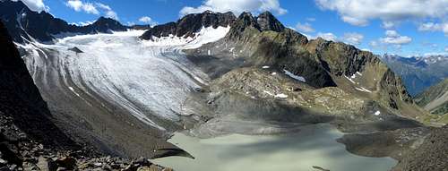
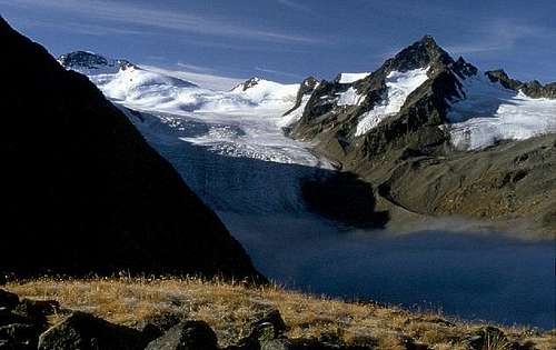 Sulztalferner glacier and Wilde Leck by Mathias Zehring | 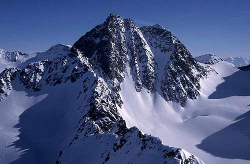 Wilde Leck seen from NNW by Mathias Zehring |
The boundaries of the Sulztal ridge are the Sulztal valley in the north and east, the Ötztal valley to the west and Wütenkar, Wütenkarsattel and Sulztalferner to the south. The group consists of a single ridge which runs from north-west to south-east and ends close to the highest mountains of the Stubai Alps. In the west the ridge is bounded by the Geigenkamm ridge. In the North by the Lastiger Berge, in the east by the Alpeiner Berge and in the south by the Stubaier Main ridge.
The ten highest mountains of the Sulztal ridge are (in order ofdescending height): Wilde Leck (3361m), Atterkarspitzen (3255m, 3175m, 3180m), Wütenkarspitzen (3244m, 3220m, 3209m), Zahme Leck (3226m), Wannenkogel (3187m, 2982m, 2976m), Murkarspitze
(3148m), Muschenspitze (3092m), Gamezwart (3044m), Lochkogel (3043m) and Roter Kogel (3037m).
 Bachfallenferner with Sulztal by GijsJ | 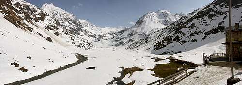 Sulztal from Amberger Hut by dedo |
Directly to the west of the Sulztal ridge lies the Otztal valley with its main villages from north to south: Langenfeld, Huben, Totterschrofen, Armelen, Granstein, Rechenau and Solden. Directly to the northeast of the ridge lies the Sulztal valley with the main village being Gries.
The Sulztal ridge is home to the following mountain huts: Vordere Sulztalalm, Hintere Sulztalalm, Amberger Hutte (2135m)and Nisslalm
Sulztal Ridge on SP
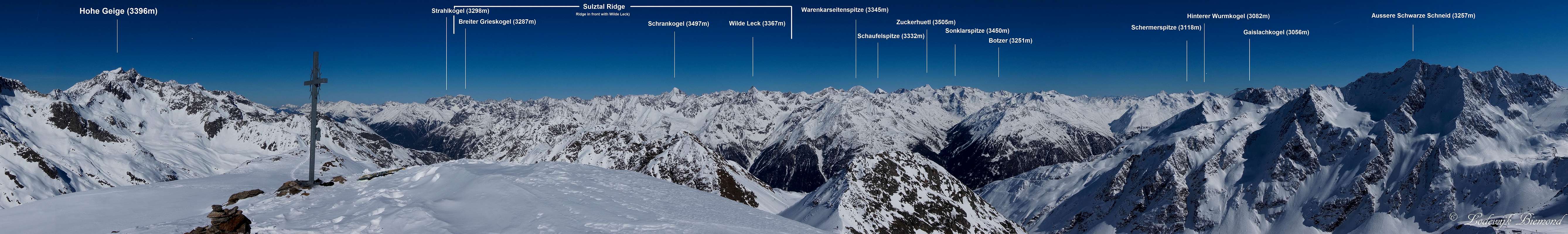  Annotated Sulztal Panorama with a part of the Stubai Alps; as seen from Schwarzkogel (3016m) |
The Summits
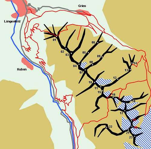 Hand drawn schematic map of Sulztal Ridge by Gangolf Haub | 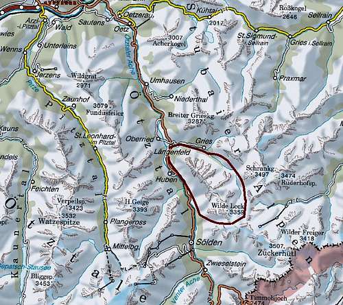 Sulztal Overview Map |
- Gamskogel (2815m)
- Kleiner Lochkogel (2921m)
- Lochkogel (3043m)
- Reichenkarspitze (2971m)
- Hoher Kogel (2889m)
- Reichlehnkögel (2516m, 2583m)
- Gamezwart (3044m)
- Schwarzwanter (3073m, 3080m)
- Bachleitenspitze (2734m)
- Tonigenkogel (3013m)
- Muschenspitze (3092m)
- Muschenkarschneid (2990m)
- Hoher Sulzkogel (2906m)
- Niederer Sulzkogel (2795m)
- Murkarspitze (3148m)
- Roter Kogel (3037m)
- Kuhscheibe (3189m)
- Wannenkogel (3187m, 2982m, 2976m)
- Zahme Leck (3226m)
- Wilde Leck (3361m)
- Atterkarspitzen (3255m, 3175m, 3180m)
- Felderlaskogel (2950m)
- Wütenkarspitzen (3244m, 3220m, 3209m)
 1) Gamskogel (2815m) | 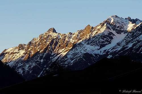 3.Lochkogel (3043m) & 4. Reichenkarspitze (2971m) | 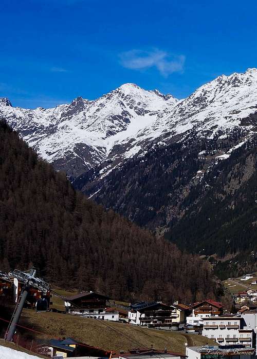 7. Gamezwart/ Legerkogel (3044m) | 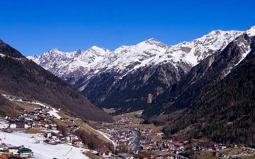 10. Tonigenkogel (3013m) | 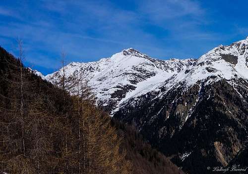 15. Murkarspitze (3148m) |
 17. Kuhscheibe (3189m) | 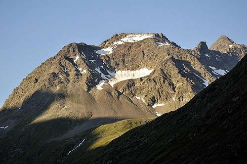 18. Wannenkogel (3187m) | 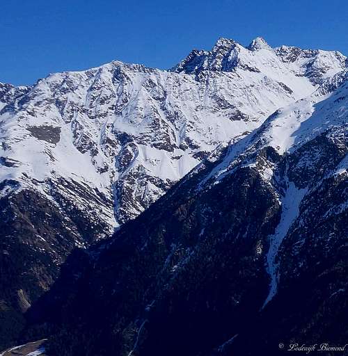 19. Zahme Leck (3220m) & 22. Felderlaskogel (2950m) | 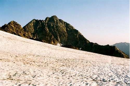 20. Wilde Leck (3361m) | 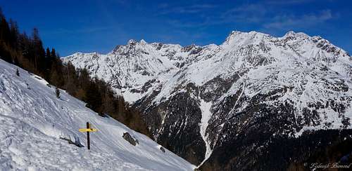 21. Atterkarspitzen (3255m) & 23. Wutenkarspitzen (3244m0 |
Main Mountains to be climbed
 Wilde Leck (3361m) | Wilde Leck (3361m) Difficulty: PD+(III) Altitude Gain: 1230m StartingPoint: Amberger hutte (2135m) Duration(up& Down): 5-7 hours |
Accomodation
| Hut | Height | Summer | Winter | Telephone | Photo |
| Amberger Hutte | 2135m | june - okt; 10 beds, 60 Lager | openend from jan- may | 0043(0)676 9523426 | 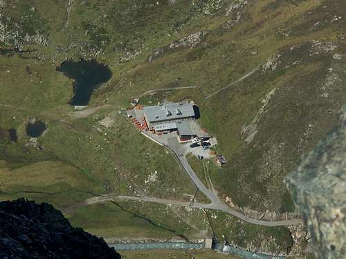 |
| Vordere Sulztalalm | 1915m | n.a.; 17 Lager | Closed | +43 5253 5634 | 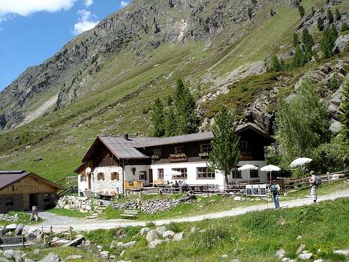 |
| Hintere Sulztalalm | 2085m | n.a | n.a. | n.a. | |
| Nisslalm | 2054m | n.a. | n.a. | n.a. | 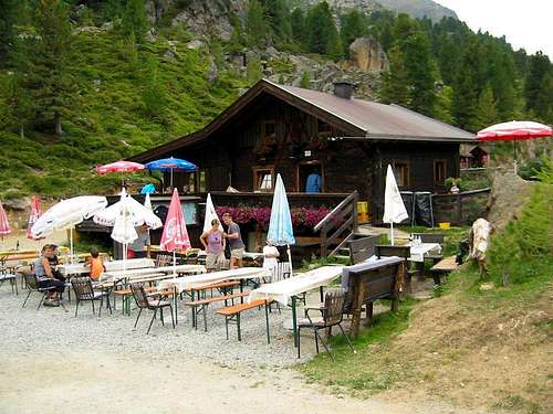 |
Weather Conditions
How to get there
Route Map Sulztal Ridge
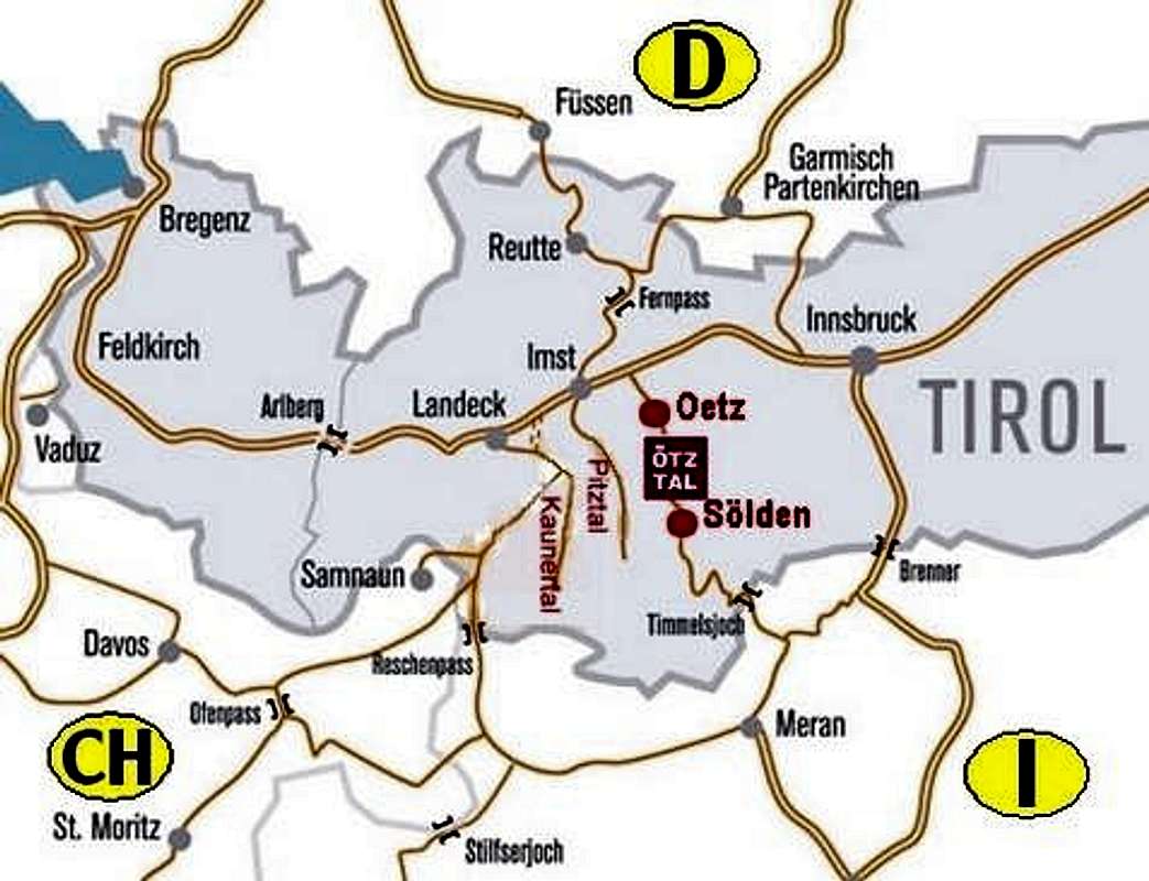
1) Take motorwayA12 / E60 to Arzl/Pitztal
2) Take motorway A12 / E60 to Otztal; Switchto B186 into the Otztal valley
From Italy:
1)Take Motorway A22 to Bozen / Bolzano
2) Switch to SS38 to Sponding / Spondinga
3) Take SS44 and SS44bis to the Timmelsjoch Hochalpenstrasse The passroad is opened from the start of June until the end of Oktober; Tollroad. Passroad is closed in Winter! At the border with Austria take B186 into the Otztal valley
From Switzerland:
1)Take motorway A3 and A13 to Landquart
2)Switch to B28 across Flüelapass to Susch
3)Switch to B27 to Vinadi
4)Across the border the road turns into B180 through Inntal Valley
5)Take motorway A12 / E60 to Otztal; Switch to B186 into the Otztal valley
Maps and Books
Maps
 |  |  |
- Stubaier Alpen
Map No: 31/1
1:25000
ISBN:9783928777445 - Ötztaler Alpen
Kompass Map WK43
1:50000
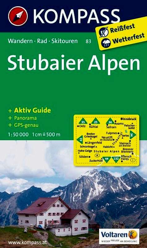
ISBN: 3-85491-049 - Stubaier Alpen
Kompass Map WK83
1:50000
ISBN: 9783850267052
Books
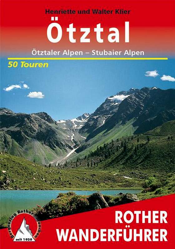 |  |  |
Ötztaler Alpen
W. Klier
Alpenvereinsführer
Rother Verlag
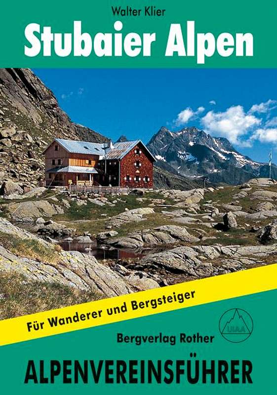
ISBN: 3-7633-1123-8Stubaier Alpen
Walter Klier
Rother Verlag
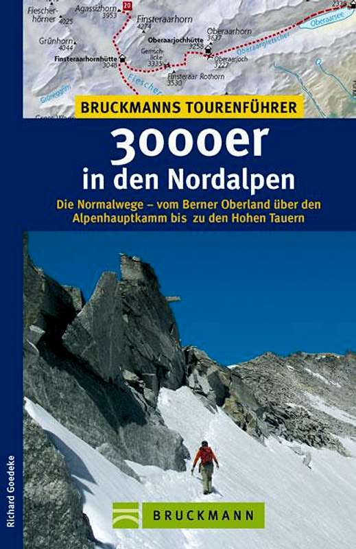
ISBN:97837633127193000er in denNordalpen
RichardGoedeke
ISBN13:9783765455438
Bruckmann