
-
 13401 Hits
-
 82.48% Score
-
 15 Votes
|
|
Area/Range |
|---|---|
|
|
47.03901°N / 11.13067°E |
|
|
Hiking, Mountaineering, Trad Climbing, Sport Climbing, Ice Climbing, Mixed, Scrambling, Via Ferrata, Skiing |
|
|
Spring, Summer, Fall, Winter |
|
|
11473 ft / 3497 m |
|
|
1 - Overview
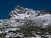
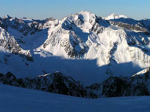 Ruderhofspitze Ruderhofspitze |
The Alpeiner Berge Group (Alpein Mountains) is the central subgroup of the Stubai Alps, enclosed in the midst of the group. Access to the group is lengthy, ensuring that most of the area is tranquil and solitary. Moreover, only a few mountains can be reached by hiking trails, most of which can be found at the outskirts of the group. There is one notable exception, however: Schrankogel, the highest mountain of Alpeiner Berge.
Alpeiner Berge are imbedded in the other subgroups of the Stubai Alps and separated by them mostly by very high mountain passes. The eastern boundary of the group is Stubaital Valley, which in its upper parts is called Unterbergtal and later Ruetztal. The saddle of Mutterberger Joch at 3011m separates Alpeiner Berge from the Stubai Alps Main Ridge in the south. On the western side of the saddle the upper Sulztal Valley separates Alpeiner Berge from the Sulztal Ridge. Schrankar Cirque leads to the next high pass, Längentaljoch at 2988m, which serves as separation to the Larstig / Bachfallen Group. Längental and Großes Horntal are the north-western boundaries with Großes Horntaler Joch (2817m) being the pass to Oberbergtal Valley in the north-east.
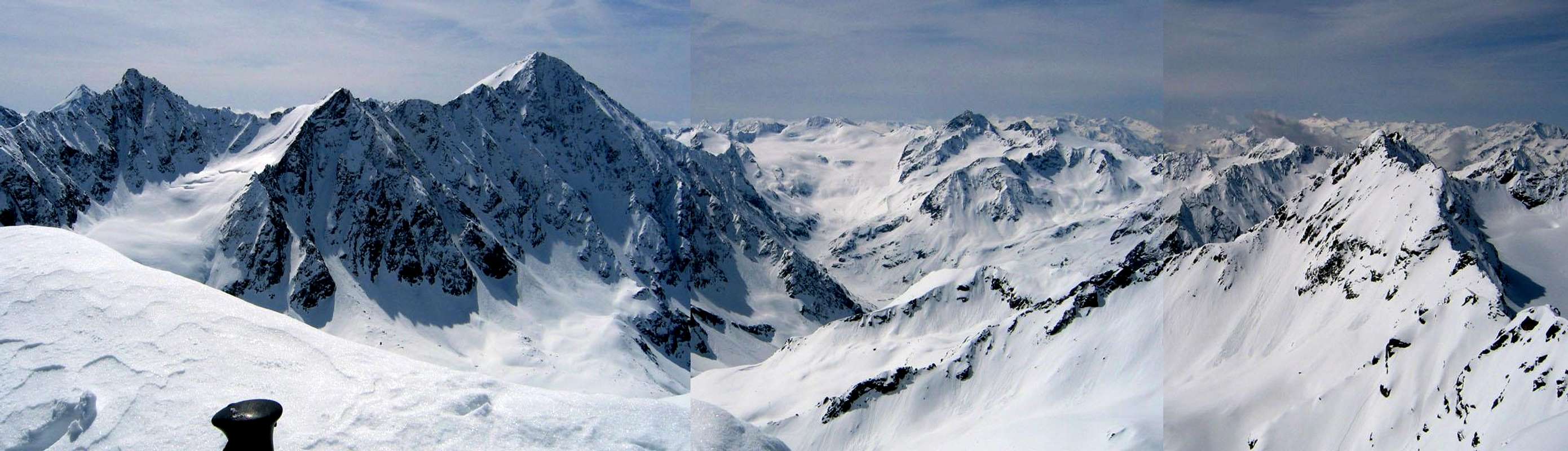
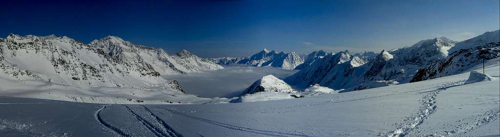
The Alpeiner Berge Group is one of the most glaciated groups of the eastern Alps. Huge glaciers accompany the four ridges, which make up the group. Ruderhofkamm, the crest which runs from Bockkogel across Ruderhofspitze westward is the southernmost of the crests. The longest one, Knotenspitzkamm, runs from Ruderhofspitze north-westwards and ends at Seeblasspitze, where Oberbergtal and Unterbergtal join. Schrankogelkamm, the highest of the ridges runs from south to north, starting at Schrankogel and ending at Lüsener Fernerkogel. Finally, short Alpeiner Kamm runs north-westward to the north of Alpeiner Bach, the creek which gave its name to the whole group.
As noted above, there are only few hiking trails in the group. Just before Alpeiner Bach ends, in Höllenrachen (Hell’s Throat) three Klettersteige (Vie Ferrate) have been established. Also the Stubaier Höhenweg trekking trail runs through the eastern part of the group. Apart from this there are trails to Schrankogel, Rinnenspitze, Knotenspitze and Mittergratspitze. All the other summits require alpine experience, sometimes quite a lot. Five alpine huts serve the group, Dresdner Hütte in the south, Amberger Hütte in the west, Neue Regensburger Hütte in the east as well as Franz-Senn Hütte and Westfalenhaus in the north.
2 - Alpeiner Berge on SP
3 - The Summits
  Schematic map of the Alpeiner Berge Group |
- Bockkogel (3095m)
- Mutterberger Seespitze (3305m)
![]()
- Hölltalspitze (3277m)
- Schwarzenbergspitze (3378m, 3362m)
- Ruderhofspitze (3473m)
![]()
- Nockwand (3091m)
- Pfandlspitze (3025m)
- Greitspitze (2785m)
3.2 - Knotenspitzkamm
- Westliche Seespitze (3355m)
- Östliche Seespitze (3416m)
- Südliche Kräulspitze (3289m)
- Mittlere Kräulspitze (3302m)
- Sommerwände (3122m, 2904m, 2847m, 2677m)
![]()
- Nördliche Kräulspitze (3292m)
- Alpeiner Knotenspitze (3233m)
![]()
- Falbesoner Knotenspitze (3120m)
- Östliche Knotenspitze (3100m)
- Kreuzspitze (3082m)
- Uelasgratspitze (3039m)
- Schrimmenkopf (2907m)
- Basslerjoch (2830m)
- Kerrachspitze (2918m)
- Brennerspitze (2877m)
- Mittergratspitze (2746m)
- Gamsspitze (2706m)
- Seblasspitze (2502m)
3.3 - Schrankogelkamm
- Südliche Wildgratspitze (3272m)
- Nördliche Wildgratspitze (3320m)
- Schrandele (3393m)
![]()
- Schrankarkogel (3332m)
- Schrankogel (3496m)
![]()
- Wilder Turm (3294m, 3177m)
![]()
- Wildes Hinterbergl (3288m)
- Hinterer Brunnenkogel (3325m)
![]()
- Vorderer Brunnenkogel (3306m)
- Lisenser Spitze (3230m)
![]()
- Rotgratspitze (3273m)
- Lisenser Fernerkogel (3299m)
![]()
3.4 - Alpeiner Kamm
- Berglasspitze (3125m)
- Rinnenspitze (3003m)
![]()
- Kreuzkamp (3008, 3005m)
- Blechnerkamp (3000m)
- Schafgrübler (2921m)
3.1 - Ruderhofkamm


4 - Getting There
Being the geographical centre of the Stubai Alps, the Alpein Group is not exactly easy to get to. Best access is from the east through Stubaital Valley, from the west through Ötztal Valley or from the north through Lüsenser Tal Valley. The following itineraries are from Innsbruck.
Stubaital
- Take Brenner Motorway E45 from Innsbruck.
- At Schönberg turn off onto B183 into Stubaital.
- At Milders decide whether you go to Ranalt (straight) or Oberberg (right)
Ötztal
- Take Inntalautobahn A12 west
- At the Ötztal exit turn off onto B186 south
- At Längenfeld turn left into Sulztal
Lüsenser Tal
- Take Inntalautobahn A12 west
- At the exit Zirl / Kematen turn off and take the road to Sellrain
- At Gries turn left into Lüsenser Tal
5 - Accommodation
As for mountain huts, you can find the complete list on the Stubai Alps main page
6 - Red Tape
Parts of Alpeiner Berge belong to the “Ruhegebiet Stubaier Alpen”, a nature preserve, which at certain times of the year is closed to the public. Within the area there are no ski runs, which ensures tranquillity for those who venture there.7 - Weather Conditions
8 - Maps & Books
8.1 - Maps
Kompass has some very good overview maps, scaled 1:50000 which show all the necessary trails but don't go into too much detail:
- Stubaier Alpen
Kompass Map WK83
1:50000
ISBN: 3-85491-092-4
Better are the maps by the German Alpine Club, available for the nothern (Austrian) part of the Stubai Alps. They are scaled 1:25000 and can be obtained by The DAV-Shop (look under "Zentralalpen"). Both hiking and ski-touring trails are marked on these maps.
- 31/1 Stubaier Alpen, Hochstubai
8.2 - Maps Online
8.3 - Books
- Stubaier Alpen
W. Klier
Alpenvereinsführer
Rother Verlag
ISBN: 3-7633-1271-4