
|
|
Mountain/Rock |
|---|---|
|
|
25.23321°S / 48.82454°W |
|
|
Hiking, Mountaineering, Bouldering, Scrambling |
|
|
Winter |
|
|
5682 ft / 1732 m |
|
|
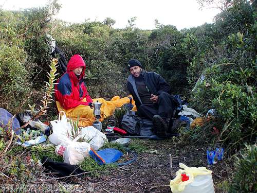
Bivy at the summit.
Taipabuçú Peak is a 3 summits mountain in the north side of Ibitiraquire range. Not very popular mountain, but often visited by southern mountaineers in the brazilian state of Paraná.
The biggest summit is the middle one, where sits the box with contains the book of visitors. That mountain is also half way to the distant Ferraria peak, way less visited, even by natives.
I've waited too long to get there since the rain season is really wet, it rains 6 days of the week and most of the people give up once they reach Caratuva Peak, first summit to get to Ferraria Peak, wich makes Taipabuçú the second Peak to overcome.
I consider that mountain one of the most beautiful peaks in south region of my country, it has a huge canyon on it's right side, and that great walls stop the clouds from cross the mountains, it is quite a sight!
In the winter it can get cold for brazilian standards, around -5°C. Some ice can show up in the morning but they melt down before 10am.
Getting There
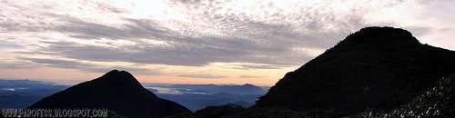
Sunset panorama from its summit.
Like another mountains of that range, the start point is Curitiba, the capital of Paraná state. From Curitiba, you must go North, by BR 116 highway, heading to São Paulo. After 40 km, you must look for Tio Doca gas station, at the left side from the highway. Drive away by the highway, and just before the second bridge after the gas station, there is a steep road. You must drive more 6 km, and you will find the gate of Pico Paraná Farm. One more km and you'll be there. Speak with Dilson, the owner, who is gonna ask you to fill out a form for your own security, and go to the trail.
In the first kilometers you'll walk in the Pico Paraná trail. Just when this one goes into the forest (around one hour), you will see a bifurcation on the left side, demarked with a yellow tape. This is the trail to Caratuva. After ten minutes, the trail crosses a creek. In this place there are two or three bifurcations, but the main trail is well marked. Be sure to carry up all water you'll need. There is no other water at Caratuva’s trail after the creek!
The way goes up, and it is an arduous walk, around 1 – 2 hours till the summit. Just before the top, the trail goes, from the forest, into the caratuvas sea, a plant that gives the mountain its name. The camp site is at the summit.
You can camp at this summit or keep going to Taipabuçú peak, now very easy to see and wuite close. From Caratuva's summit it is around 60 minutes to cross the nebular jungle, and a very nice walk...protected from the sun and a little bit cold.
Here's a video you can see that beautiful mountain and its three summits:
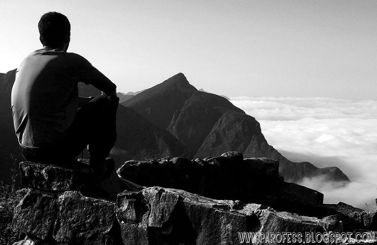
Taipabuçú in the front, Ferraria on the back.
Camping
Camping is allowed anywhere you want at Ibitirati Sierra, feel free! There is specific places ready for camping such as Caratuva summit, and the first summit of Taipabuçú Peak, i would advise to use them. Ibitiraquire Sierra has a lot of animals like venomous serpents and the feared brown recluse spider!
Be careful out there...
Camping available at these places:
1 - Paraná Peak farm;
2 - Getúlio Hill;
3 - False summit of Itapiroca Peak;
4 - Caratuva Peak summit;
5 - Taipabuçú 1st summit;
Red tape
As soon as you get to the Paraná Peak Farm, register yourself and pay a fee of R$ 10,00 (about USD 6.00) for the hike.Parking lot at the farm just before the trailhead;
Well marked trails (just to Taipabuçú, after that, keep looking or you'll be lost);
What’s forbidden:
To make fire; Deforest any places. Respect the nature and wildlife please! Sometimes the farm owner walks around to check if everything's okay and to check for violations, if he sees you making fire, he'll call the cops!
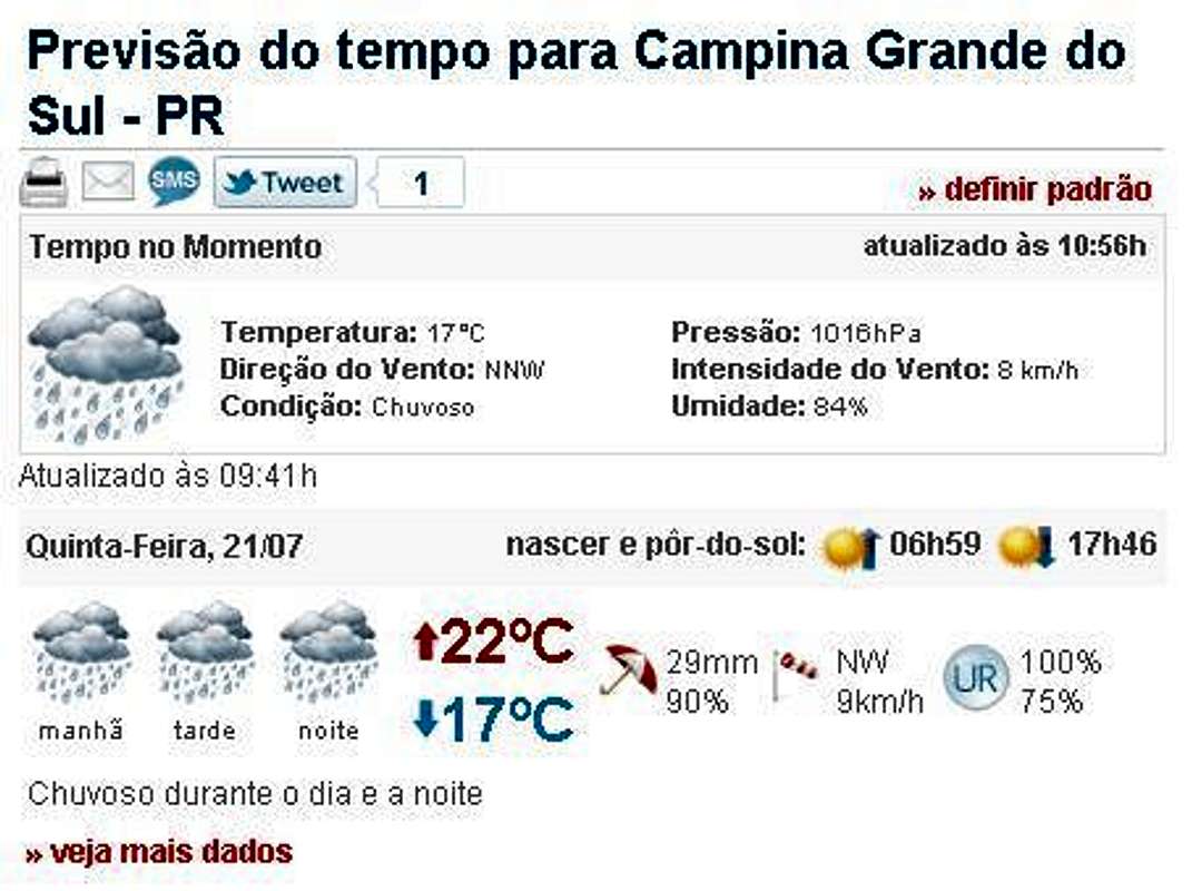
Weather forecast
You can hike this mountain in all seasons, but in summer there are rains every day. In winter is cold, but the days are clearer. The temperatures going from -10°C to 15°C.Best time to climb: April to September.
Legal Issues
To hike/ climb is a dangerous activity and requires proper equipment and clothing, the owner of this page cannot be blamed by injuries caused to anyone who read this page for its info about the mountain, and eventually got hurt by doing so with reckless behaviour or bad weather conditions.
Paulo Roberto Felipe Schmidt – AKA: PAROFES
External Links
My youtube channel: www.youtube.com/parofes - Now with 270+ videos online!
The biggest brazilian website about climbing and mountaineering, for which I'm a columnist: