
|
|
Mountain/Rock |
|---|---|
|
|
33.55750°N / 117.7608°W |
|
|
Orange |
|
|
Hiking |
|
|
Spring, Summer, Fall, Winter |
|
|
1038 ft / 316 m |
|
|
Overview
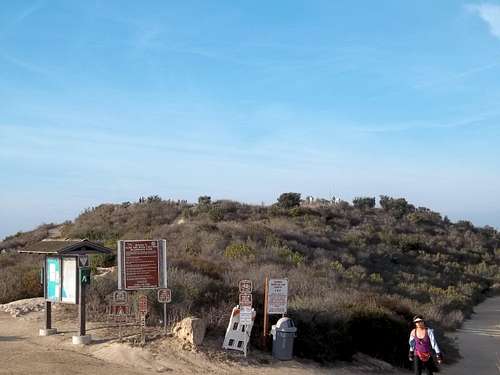
 Hey this summit has views
Being the highest summit in the Laguna Beach area Temple Hill is a very popular summit in the area. There is a good reason for Temple Hill being very popular with locals in the area. Amongst the biggest reasons is that to get to Temple Hill only takes a drive up until the last 100 feet or so which just requires a short walk up to what appears to be the true summit. After looking a map there was at one time a higher point on the summit. This point appears to have been flatten due to the expansion of the Top of the World community with the former high point area now a location of an upper income home.
Another reason is the fact that it is very close to the Top of the World Development in Laguna Beach. Often it is referred to as the top of the world and not as it's true name. The actual community lies only a hundred yards from the true summit. Views from this summit are decent to the ocean (though not as good as nearby Aliso Peak) and excellent toward peaks such as Santiago Peak, Old Baldy and the San Bernardino Range.
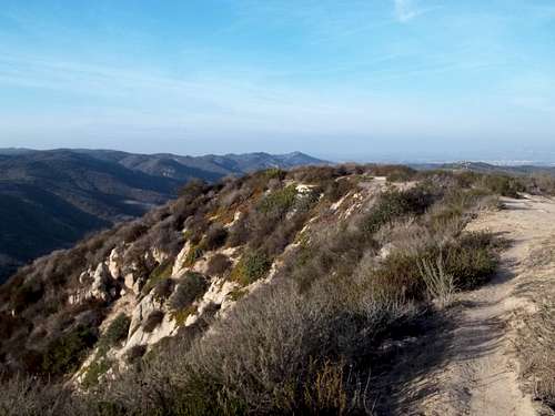 Interesting ridgeline that has its own unique beauty
 Heading up
There are a lot better ways to up this peak than from the basic drive up and light walk up. There is the Canyon Acres Trail which is better, more challenging and steeper way to get to the summit. From the end of Canyon Acres Road take this trail roughly one mile to the summit of Temple Hill. The trail itself attains 900 feet in one mile with plenty of great views along the way.
 The easy way!
The another way is to combine the West Ridge Trail is very gradual with the Stair Steps Trail which is very steep and rough and head down that way. The West Ridge is very scenic and as great views of many of the nearby summits as well ocean and the canyon views. There is even a small cave located on the West Ridge Trail just a ½ mile from the summit of Temple Hill. The Stair Steps Trail is probably one of the roughest trails in the Laguna Beach area and will require some caution.
 The West Ridge
Getting There
VIA CANYON ACRES DRIVE: From downtown Laguna Beach head east roughly two miles on Laguna Canyon Road (Route 133) until you reach Canyon Acres Drive on your right. Turn on Canyon Drive and take the road to the obvious trailhead at the very end of the road.VIA THE TOP OF THE WORLD: From downtown Laguna Beach find Park Street and take Park as it rises steeply up from Laguna Beach. It will continue to rise roughly 3 miles until it crest out onto Alta Laguna Boulevard. At that intersection make a left onto Alta Laguna Boulevard and take 0.3 miles to the end where an obvious parking area will lie ahead. For the most part this is a drive if you go this route, with only several hundred yards of walking to the true summit.
Red Tape
Trail will not usually be open after a major rainstorm due to severe erosion and mudslide risk.Camping
Camping is not allowed on Temple HillExternal Links
Good information on the West Ridge TrailGood information on the Canyon Acres Trail