
|
|
Route |
|---|---|
|
|
45.83270°N / 6.86430°E |
|
|
mixed, most snow |
|
|
A few days |
|
|
TD (Winter ascent) |
|
|
Approach
Torino Hut to bivouac hut on the Col de la Fourche, or at the Ghiglione hut which is just above the Fourche hut.
 |
Route Description
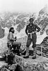
We (Randy Janoski, Bill Menning and Dan Matheson) climbed this route in winter November 21-24, 1976. And used the route discription from the fine Gaston Rebuffat book. The main difference was the amount of snow and the serac action. It took us two days longer than during a summer ascent. We reached the summit late on the 24th and started down the Bosses Ridge where we had to bivouac once more. Got back into Chamonix the afternoon of the 25th. This is truly a "high major face of vast expanse" and very committing in winter.
Route from Torino Hut:
(Please note that this was a winter ascent and the length of time dealing with sections of the route was much longer than a normal summer ascent as we encountered heavy snow and ice conditions at various stages of the climb.) From theTorino Hut work your way up the Glacier du Geant passing under Aig. de Toule and then la Tour Ronde (leaving the Torino Hut late this distance was made slow by deep snow and crevasses and we bivouaced aprox. half way between la Tour Ronde and the Col de la Fourche on a large serac) and make your way up to the Col de la Fourche bivouac, there you will see over the crest The Brenva cirque, that great semi-circular wall. Very early leave the la Fourche bivouac decend the snow couloir or the rocks on its right bank to the upper plateau of the Brenva glacier. Contour across the glacier to the wall under the Col Moore. It is at the foot of the prominent spur that sweeps down on the W of the glacier. A short but very steep snow/ice slope leads to the col. From the col go up the ridge to a small step which is avoided on the L. Continue up the ridge to a large rock buttress with a 45% rake, then chimneys and a few short and east neves lead back to the ridge. Follow the crest of the ridge until it narrows to the famous ice arete. Follow the ice ridge and continue the long snow and ice slopes above, keeping in line with the rocks that define the arete on the R. This leads to the highest rocks, the upper rock band ( a good bivouac spot can be found here to be protected from the upper seracs). Turn this rock band on the L and find your way through the final wall of seracs, with deep and narrow burgschrunds toward the top to reach the snow plateau that goes up to the Petits Rochers Rouges ( it is posible to go R under the serac barrier on ice ledges from this rock level which is known to have abseil points on the rocks to start your traverse, on our ascent the rocks were snow and ice covered). From here follow the slope to the summit of Mont Blanc.
 |  |  |  |  |
Essential Gear
A good supply of ice screws, 10 -16.
Winter clothing and good bivouac bags and/or a tent.
Miscellaneous Info
If you have information about this route that doesn't pertain to any of the other sections, please add it here.
as - Aug 31, 2006 1:54 pm - Hasn't voted
Beware !This route description is totally out of date. The Giglione hut does not exist any more, the lower rocky section of the route collapsed in 1997. The only way to reach the spur is by the Gussfeld couloir (exposed to serac falls).
BigLee - May 31, 2007 12:19 pm - Voted 6/10
Agreed!The route has been somewhat abandoned following landslides on the SW flank.