The range of Nízke Tatry (Low Tatras) is usually divided into two parts: the Ďumbierske Tatry, which extends west from Čertovica Saddle, and the Kráľovohoľské Tatry east from it. The latter is lower and less interesting to the hiker, the former contains the highest summits and a limestone-and-dolomite area north of the main ridge. The name Ďumbierske Tatry (Ďumbier Tatras) comes from their highest peak. (Similarly, the eastern part of the Low Tatras is named after Kráľová hoľa.) Slovak geographers usually divide the Ďumbierske Tatry into four quarters (and the Lúžňa Basin):
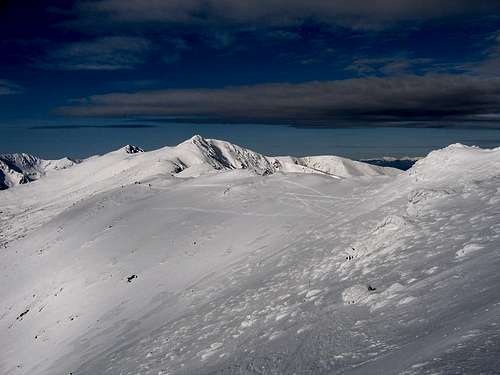
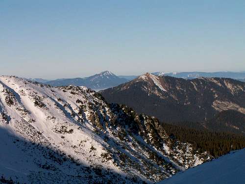
The highest summits lie in the SE part of the area, called the Ďumbier Group, which contains the highest section of the main ridge of the Low Tatras – between sedlo (sedlo = saddle/pass) Čertovica at 1232m in the east and sedlo Zámostskej hole (the Pass of Zámostská hoľa) at 1591m in the west, south of the historic mining hamlet of Magurka – the parts of the side ridges running north from it which are, like it, formed of crystalline rocks (mainly granite and gneiss) and the long lateral ridges running south from it. There are about fifteen summits there which beat the highpoints of the other parts in elevation. The main ridge rises well above the treeline and features post-glacial cirques and a couple of tiny tarns.
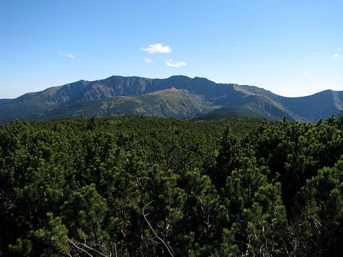
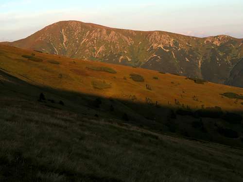
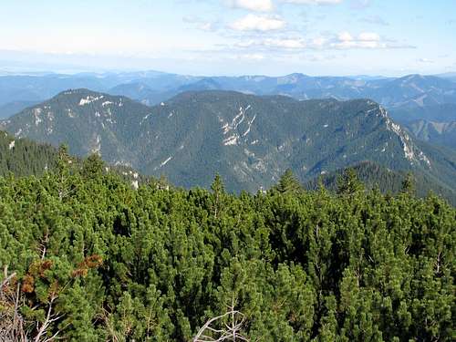
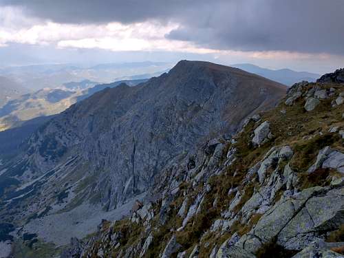
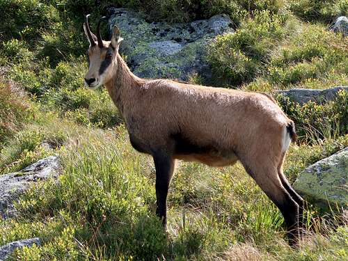
Photo by Tomek Lodowy
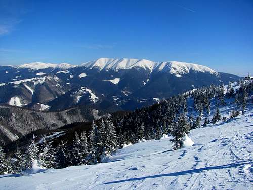
The SW quarter, Prašivá Group, named after its most imposing massif, whose highest summit is Veľká Chochuľa at 1753m, extends west from the Ďumbier group. Less than four kilometres away from Zámostská hoľa Pass the main ridge, pushed southwards by the Lúžňa Basin, angles south-west to carry on in this direction as far as Hiadeľské sedlo at 1099m, beyond which lies the range of Starohorské vrchy.
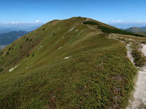
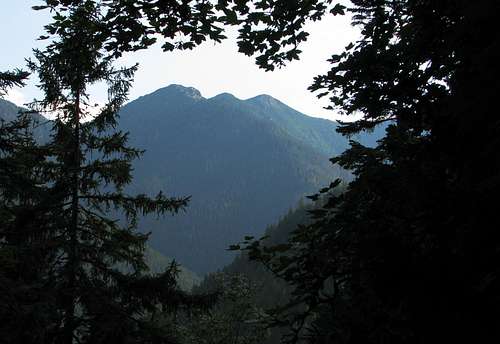
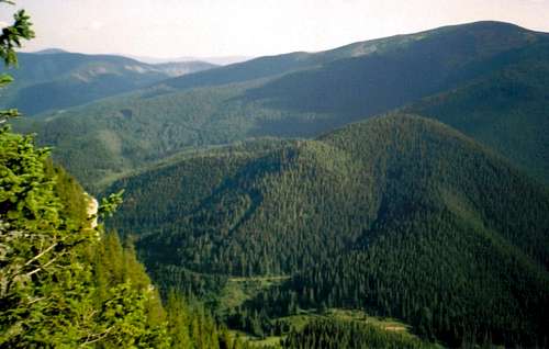
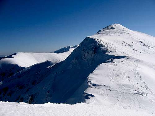
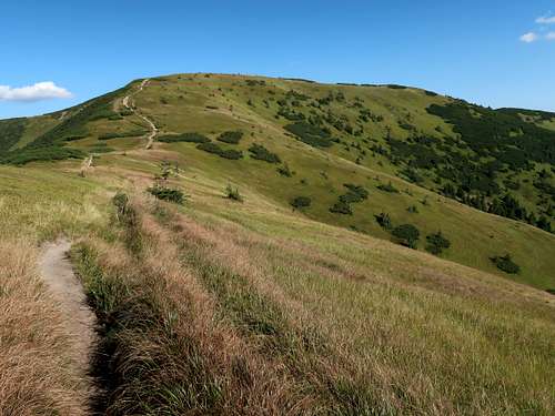
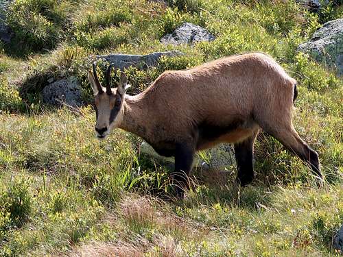
Photo by Konrad Sus
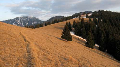
Salatín at 1630m, with 530m of prominence, is the grandest mountain in the NW quarter, i.e. the Salatín Group, separated from most of the Prašivá Group by the Lúžňa Basin. The domination of Salatín in its group is undisputed. It is the only summit in the group that rises above the natural treeline, but it has more assets than that – please see its SP page. The second highest mountain in the group, Tlstá at 1555m, is much more mundane and there is no waymarked trail to its summit. Most of the trails in the Salatín Group lead to Salatín. The group is believed to extend east as far as the Krížska dolina, which is the valley of Palúdžanka brook. The eastern chunk of the group, between the valleys of Ľupčianka and Palúdžanka, which logically should be classified as part of the NE quarter of the Ďumbierske Tatry as it is adjacent to the SE quarter, lies outside the national park and is hardly ever visited by hikers – it is the land of hunters, woodcutters and bears.
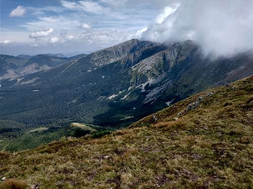
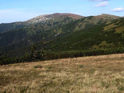
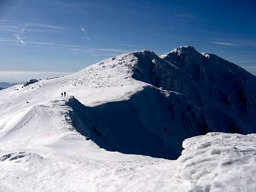
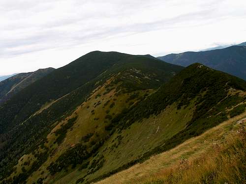
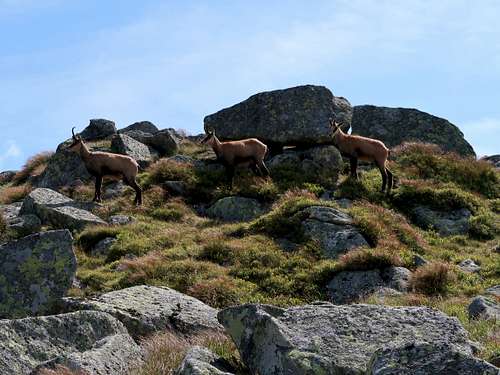
Photo by LukZem
The NE quarter is known as the Demänovské vrchy (vrch = peak). It is full of karst landforms, of which the most famous is the largest cave in the Demänovská Valley, Demänovská jaskyňa slobody. The highest summit is Krakova hoľa at 1752m.
Interesting Summits
Since the area of the Ďumbierske Tatry is vast, with plenty of summits, it made me think hard which of the summits are the most attractive and why. When I had made a list of summits which seemed the most interesting to me, I asked myself what traits made them more attractive than others. The answer was the following three factors: elevation, ‘boldness’ and topographic isolation. One more thing I have done, which I suppose most of you will find weird while my mathematical mind found it fun, was look for a formula (containing the three variables) that would result in a top ten list similar to my intuitive choices but a little more objective. The result of that trial and error search is the following table. Apart from the usual problem what weight should be applied to each criterion, the main issue was how to measure the ‘boldness’ of a summit. I couldn’t think of anything better than prominence, and the first thing I did was rule out summits whose prominence is less than a hundred metres.
The peaks in the table (with prominence of >100m) were ranked by my own, specially developed for this area, following formula: Elevation (in metres) + Prominence (in metres) + Topographic Isolation (in km) multiplied by 50.
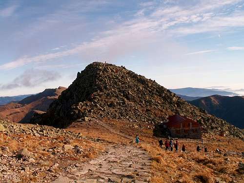
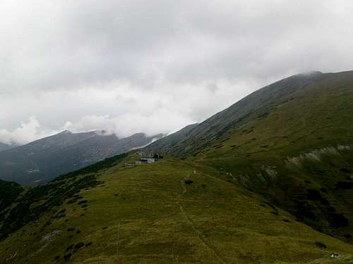
Ďumbier Group (SE), main ridge, 4km west of Ďumbier; cable cars and ski lifts plus a mountain hut near the summit - see the mountain page for more info
Demänovské vrchy (NE), large rock arch near the summit - see the mountain page for more info
Rovná hoľa
1723
218
2.9
2086
Ďumbier Group (SE), north of main ridge, 5km east of Ďumbier; aptly named Flat Pasture
And here is a list of the eight highest summits including those with a prominence of 30 to 100m (in italics):
Ďumbier 2046m, Štiavnica 2025m (over 30m of prominence), Chopok 2024m, Dereše 2004m (72m of prominence)
Skalka 1980m, Chabenec 1955m, Kotliská 1937m (72m of prominence), Zákľuky 1915m (78m of prominence)
Štiavnica is part of the Ďumbier massif, located in a nature reserve east of the main summit, away from the waymarked trail. Dereše sits on the main ridge nearly 1.5km west of Chopok. Kotliská lies farther west, about 6.5-km walk from Chopok. Zákľuky is the highpoint of a lateral ridge which forms the western border of the Demänovská Valley.
Dereše
Zákľuky
Štiavnica
Kotliská
Some of the peaks haven’t been mentioned yet although they do stand out of their surroundings (and were not far from qualifying into the top ten). These are Besná/Králička at 1807m (nearly 100m of prominence) sitting on the main ridge between Ďumbier and Čertovica Pass, Veľký Gapeľ at 1776m (over 100 of prominence) south of Ďumbier (away from the waymarked trail), Siná at 1560m (250m of prominence) in the Demänovské vrchy and Latiborská hoľa at 1648m (over 100m of prominence) on the main ridge near the west end of the Prašivá Group.
You are supposed to stick to the waymarked trails.
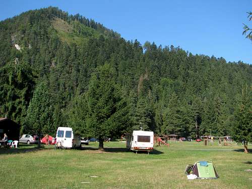
Within the national park camping is only allowed in designated places, namely at Hiadeľské Pass, by Ďurková Hut, at Čertovica Pass and in the settlement of Magurka 'by 'Chata na Panskej lúke'.
In recent years there have been several bear attacks on people. Most resulted in serious injuries. In June 2021 a local man was killed by a bear outside the village of Liptovská Lúžna. In March 2024 another fatal attack happened near the summit of Sina: Bears
In Slovakia those who do not carry commercial insurance have to pay for any rescue services rendered by Mountain Rescue Service (HZS). The emergency phone number is 18 300
Getting There & Accommodation
To the north of the area lies the Liptov Basin with the towns of Ružomberok and Liptovský Mikuláš, a motorway (E50) and a major train line (one of the oldest railway lines in Europe, with several Intercity and fast trains a day). Similarly, National Road 66 and a railway line run along the south fringe of the Ďumbierske Tatry linking the towns of Banská Bystrica and Brezno. Along the eastern border of the area, including Čertovica Pass, runs NR 72. Access from the west is provided by NR 59. By car you can also get very near the summit of Chopok, either from the north (up the Demänovská Valley) or from the south. (From where the roads end you can travel to the summit by cable car.) The other local roads will not take you far into the mountains, except for the one connecting the villages of Liptovská Lúžna and Partizánska Ľupča, which can bring you near Salatín and from which a side road will take you to the settlement of Magurka, on the boundary between the Prašivá and Ďumbier groups, just about 2km away from the main ridge.
There are hundreds of guesthouses, dozens of hotels, and several campsites around the area (some inside): to be found e.g. on nizketatry.sk.
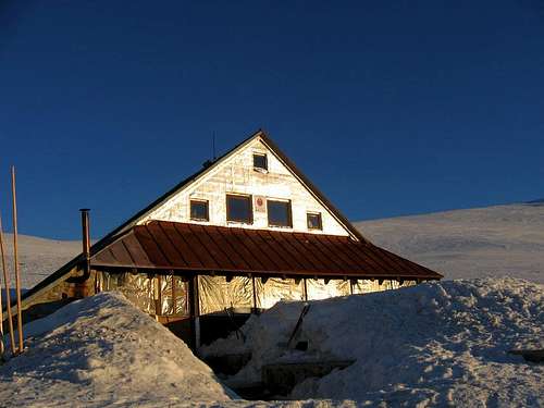
There are a few mountain huts, including the following three on the main ridge: Útulňa Ďurková pod Chabencom - cheap (own sleeping bag needed), at 1623m half a kilometre south of the main ridge, at the west end of the Ďumbier Group; Kamenná chata pod Chopkom - pricey, at the summit of Chopok; Chata M.R.Štefánika - pricey, at 1740m SE of Ďumbier, no mobile signal.
Children refers to the set of objects that logically fall under a given object. For example, the
Aconcagua mountain page is a child of the 'Aconcagua Group' and the 'Seven Summits.' The
Aconcagua mountain itself has many routes, photos, and trip reports as children.
Parents refers to a larger category under which an object falls. For example, theAconcagua mountain page has the 'Aconcagua Group' and the 'Seven Summits' asparents and is a parent itself to many routes, photos, and Trip Reports.