
-
 1635 Hits
-
 75.81% Score
-
 6 Votes
|
|
Mountain/Rock |
|---|---|
|
|
44.85600°N / 109.302°W |
|
|
Trad Climbing |
|
|
Spring, Summer, Fall |
|
|
5286 ft / 1611 m |
|
|
Overview

There aren't a lot of people who are keen on multi-pitch limestone trad in remote locations (or really anywhere else), but if you're one of the relative few, you'll love this crag.
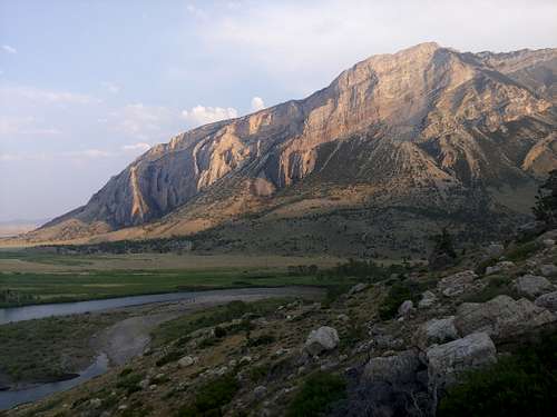
The Clarks Fork River winds through the valleys of northern Wyoming and appears tame at first, but later it cuts through dramatic canyons and wild landscapes that few people have ever seen, and where it begins to do so, there is a fine crag overlooking it.
There's a ton of climbing potential here, but there's very little information available. The route I climbed here was one I came across on Mountain Project, but a commenter has noted that there are other routes that not many seem to know about.
This page will establish the crag here on SP and detail Valley Boys, the route my friends and I climbed on it.

|

|

|
Getting There
About 10 miles south of the Montana line on WY 120 is Edelweiss, a combination bar/restaurant/campground. Across from it is WY 292, signed for Clark. Take it. Staying on 292, drive through Clark and then into the canyon. Using pictures on this page, pull off the road as close as you safely can to the formation. The hike up to the base of the climb is steeper than it looks but not that long; figure on 15-45 minutes depending on the party.
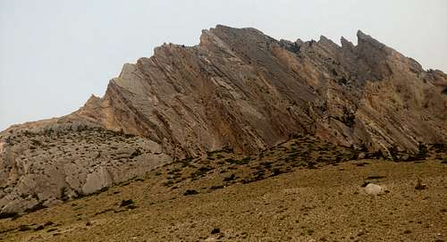
In the first picture below, notice the long, clean-looking slab on the left. That's the route.
Route
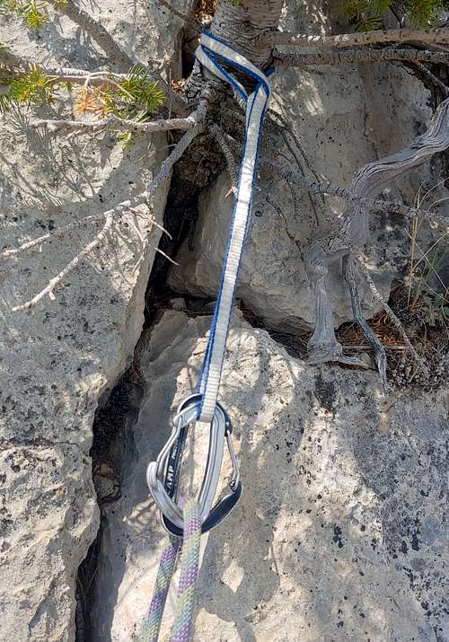
The route we climbed was called Valley Boys, and it goes at 5.5 for 5 or 6 pitches. We chose to do it in 6, but if you want to do it in 5, please see this picture.
All pitches have bolted anchors. Some have very little pro. Some of the belay stances, including the last one, are uncomfortable. And the only way off is rappelling it. A single 70 is not sufficient. While I don't recall whether it was a 60 or a 70 I led on, I do remember that one of my partners was attached to me with a 40 and that on one of the pitches (I think the last), she had to start climbing before I reached the anchors. So you will need 2 ropes to rappel the route uness you know some tricks or have an Escaper.
Nevertheless, it's a fun route in a great setting.

|

|

|
Red Tape
None, but be aware of private property boundaries. My old Shoshone National Forest map indicates this climb is on BLM land, but there are ranches in the vicinity, so avoid trespassing.
When to Climb
Due to the relatively low altitude, spring and fall would be best, though we climbed it on a summer morning with a good deal of overcast conditions. The climb faces northeast; that and its low-angle nature probably seeing a lot of snow accumulation probably make it a bad winter choice.
Camping
The road ends and becomes a Jeep trail shortly after the formation. There may be dispersed camping there, but otherwise, there is no public camping available anywhere close by.