

-
 31113 Hits
-
 89.06% Score
-
 29 Votes
|
|
Mountain/Rock |
|---|---|
|
|
46.40120°N / 10.62480°E |
|
|
11959 ft / 3645 m |
|
|
Overview
Geographical structure: Eastern Alps > Ortlers – Cevedale group
Monte Vioz is located in the beautiful chain of mountains that belong to Ortles – Cevedale group. Monte Vioz is located somewhere in the southern part of the chain that comes from the north, from Ortler, Monte Zebru, König-spitze, Monte Cevedale, Palon de la Mare and continues from Monte Vioz in the west direction over the Punta Taviela, San Matteo to the last big mountain in this long ridge Pizzo Tresero.
From the top of Monte Vioz goes to the north ridge that is connected with Palon de la Mare (3703m) and the second ridge goes to the west that is connected with Punta Taviela (3612m) . The lowest point between Monte Vioz and Punta Taviela is the pass Colle Vioz (3330m) and the lowest point between Monte Vioz and Palon de la Mare is the pass Passo della Vedreta Rossa (3405m). On the west side has Monte Vioz a big glacier that is called Forni glacier (Ghiacciaio dei Forni) that falls then in to the valley Valle dei Forni. To the east side falls down the second glacier called Vedretta Rossa and the third glacier is the smallest and falls from the summit of Monte Vioz to the south side and is called glacier Vedretta di Vioz.
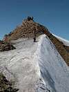
Around 100 meters below the summit of Monte Vioz there is a hut Rif. Mantova del Vioz (3535m) that has a beautiful position and this hut is very popular by hikers because you can easily reach it from the south side from the village Peio (1392m). You walk over the nice path, in snowless time you needn`t walk over glaciers so you can easily reach the summit of Monte Vioz from this side. But be careful on quick weather changes. (When I was there with my father we had a bad snow storm in the middle of Summer!) But in good weather you will never be alone on the top of Monte Vioz. For more routes check the Routes overview section.
 |  | 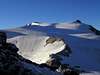 | 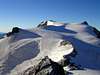 |  |
Summit View
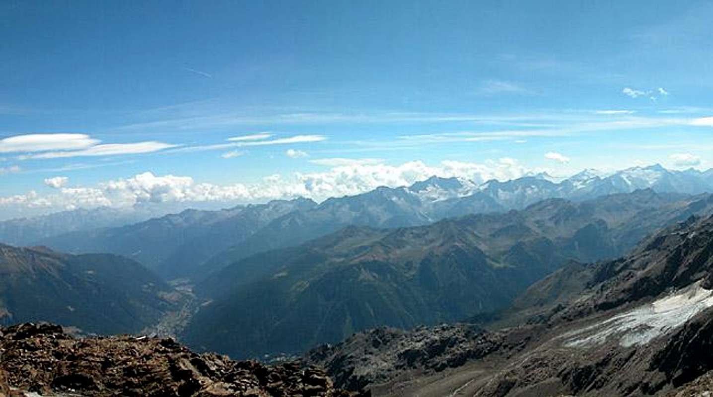 | 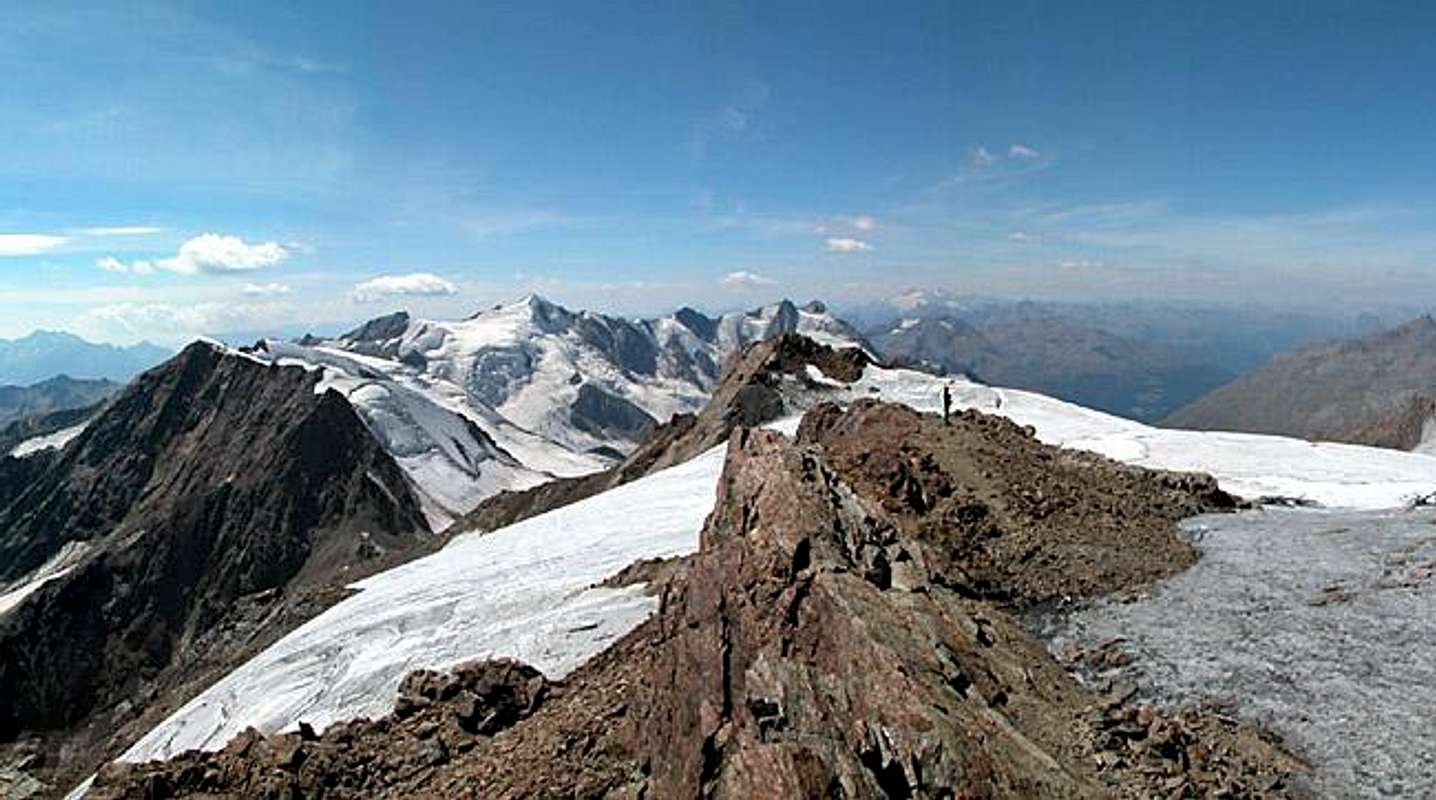 |  |  |
360° summit view from Monte Vioz taken on August 27th 2003. Note the shrinking glaciers - in August 2003 torrents of water came down from these mountains. Hide / Show Annotations. Thanks to Gangolf Haub
 ..
.. ..
.. ..
.. ..
..
The view from the summit of Monte Vioz is breathtaking. In good weather you will just sit on the top and look to the beautiful mountains all around you. If you look to the ridge that goes to the north side you see Palon de la Mare and behind it Monte Cevedale and Gran Zebru. To the west side you observe the last mountains in Cevedale group that ends with the pretty Pizzo Tresero. From Pizzo Tresero on the right side you see in distance Bernina group with the highest mountain Piz Bernina. If you look to the south your view stops on the mountains of Adamello group with powerful Monte Adamello and Monte Care Alto and of course a view on amazing Cima Presanella. In the SE direction you see Northern Brenta Dolomites and more to the east far away the main mountains of Dolomites.
 |  |  |  |  |
Getting There
The description of the roads for the south approach.
From Bolzano/Bozen and Verona:
- A22 Brenner Motorway to the exit Mezzolombardo
- SS43 northwest direction Cles until Ponte Mostixxolo
- SS42 west to Ossana
- SP87 northwest to Pèio Fonti
From Bormio:
- SS300 over Passo di Gavia to Ponte di Legno
- SS42 east to Ossana
- SP87 northwest to Pèio Fonti
From Milano:
- A4/E64 to Bergamo
- SS42 north to Ponte di Legno, then east to Ossana
- SP87 northwest to Pèio Fonti
From Lago di Como:
- SS36 north to Colico
- SS38 east to Tresenda
- SS39 east to Edolo
- SS42 west to Ossana
- SP87 northwest to Pèio Fonti
For coming on Monte Vioz from the north side by the hut Rif. C. Branca you have to drive from the branch for Peio forward to Passo Tonale and then over the Passo di Gavia to the village Santa Caterina Valfurva and from there you turn in to the valley Valle del Forni.
 |  |
Routes Overview
 |  |  |  |  |
When to climb
The best time for climbing on Monte Vioz is from June to September for not expered mountaineers and they use the normal route from the village Peio.
For climbing there in Winter time you must be good climber.
 |  |
The consequence of WW1
In the whole are you can see the consequence of the World War 1. Some old huts, barbed wires... Be careful on the north ridge of Monte Vioz on barbed wires because they are hidden in snow just before the summit.
 |
Camping and huts
The nearest campings are in Santa Caterina Valfurva and in Bormio. They are opening during all the summer period. There is also a very nice campground near the crossroad to Pejo.
Refuge Branca Martinelli (2493 meters): +39-0342-935501.
Refuge Mantova al Vioz (3535m).
 |  |
Maps 'n' Books
Maps
Kompass Map WK72
1:50000
Kompass Verlag
ISBN: 3-85491-081-9
Tabacco 1/25.000
Books
P. Holl
9th edition 2003
Rother Verlag
ISBN 3-7633-1313-3
Weather conditions
For weather conditions check this page. You can also see the situation there in webcams.
External Links
- Mantova al Vioz
You can read something about the hut. This site is in german.
Bor - Jun 18, 2005 9:06 am - Hasn't voted
Untitled CommentThanks for all your information. Very useful. Come back today when I will renew page.
Cheers!
Claude Mauguier - Jun 16, 2005 3:44 am - Voted 10/10
Untitled Comment35 years ago, there were no cable cars, so one had to follow the track followed by austrian troops during WW1
Rifugio Vioz was old Bremer Hütte, built in 1911 by DÖAV (Deutscher-Österreicher Alpen Verein). This was used by the Command Staff units of K.u.K. army, as Vioz was the core of the southern Ortler front. The main ridge, running N-S from Cevedale, suddenly turns E-W, as this summit forms the south-eastern angle of Forni glacier system. Thus the view from the top was including the whole ridge towards Taviela, San Matteo, Tresero and San Giacomo peaks. A direct attack from N was therefore almost impossible, a pair of machine guns beeing sufficient to stop any attempt. All the surroundings are filled by old war ruined buildings. In val degli Orsi, more to the west under Pta Cadini SW flanks, the remainings of a main Field Hospital of the zone may be encountered (around 2500 m. along path n° 122).
I think that starting from Pejo provides a good training approach, as well as nice views. By the far western extremity of the village (near San Rocco) starts a little local road where one should find the landmarks of path n° 105. This progressively bends N then NE, and due N again, in order to reach a suddent turn (end of the little stone covered road) near point 2007 m. Now you just have to follow the unending track, sometimes carefully covered with flat rock slabs, as heavy mule and men traffic used this way between 1914 and 1918. Taking a glance upwards, a sharp profile comes progressively more present : dente del Vioz, as you are following now the right (NE) flank of the loose SE rock ridge aiming to the top. As well as another companion, always looking at you from Pejo already, and seeming to escape more and more from your grasp...: Mantova Hut. Allow 6 hours from Pejo, or 7 taking it quietly, and start early, as you are on the S flank, with absolutely no shadow to hide from the sun....
See books section for more tips.
Claude Mauguier - Jun 16, 2005 3:56 am - Voted 10/10
Untitled CommentIn italian : "Ortles-Cevedale", by Gino Buscaini, in the Guida dei Monti d'Italia series, published by CAI/TCI
The most convenient map (unless you hire a sherpa to carry the large amount of traditional little square shaped official IGM local 1/25000 maps, useful for the whole area...:-) is : Tabacco 1/25.000 "Ortles-Cevedale", n° 8 sheet. Taking into account that the far western (Braulio), eastern (Zufritt-Hasenhörl), southern (Redival) outliers are cut off from this sheet.
Claude Mauguier - Jun 16, 2005 4:17 am - Voted 10/10
Untitled CommentThe literature titles covering the period and the area as well are...astronomic in number !
Just a very few indications :
1 -To have a good picture general overview :
Carlo Artoni "Gletscher und Täler der Ortler-Cevedale Gruppe" - Reihe berge u. Gletscher der Rhätischen und der Ostalpen - Manfrini Verlag - Trento (with bibliography).
The same title must be available in italian.
ISBN 88-7024-259-5
2 - As a general local WW 1 good summary :
Heinz von Lichem "Gebirgskrieg 1915-1918"
equivalent of :
"La guerra in montagna 1915-1918" (Ortles, Adamello, Giudicarie, Garda Ovest), also with a sufficient bibliography to keep on searching...
Editrice Athesia/Athesiadruck, Bozen/Bolzano
ISBN 88-4014-619-7
Local bookshops (Trento, Bolzano, Bormio, Merano, Malè, and all along Sole or Vinschgau valleys) should be crowded with such references, and also brand new titles !
Bor - Jun 18, 2005 9:06 am - Hasn't voted
Untitled CommentThanks for all your information. Very useful. Come back today when I will renew page.
Cheers!