
|
|
Mountain/Rock |
|---|---|
|
|
46.96643°N / 12.94601°E |
|
|
Hiking |
|
|
Spring, Summer, Fall |
|
|
8543 ft / 2604 m |
|
|
Overview
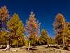
Mohar is a 2.604m high summit in the Goldberg group of the Hohe Tauern in the Austrian destrict of Carinthia. The summit is high above the Asten valley, a side valley of the Mölltal (valley). The Asten valley area is perfect for hiking: the summits are smooth and the ways are mostly on meadows. Nevertheless you have perfect views to the Goldberg group (Hoher Sonnblick; north), the Glockner group (highest summit of Austria Großglockner north-west), the Schober group (west) and to Sadnig, 2.745m on the opposite side of Asten valley (south-east). On the ‘Waschgang’ (the way to Kluid notch) you can find remains of the ‘gold rush’ in this area: old buildings and galleries.Views


 Sadnig
 Stellkopf
Routes
For the fastest route you drive from Mörtschach, 972m via the Asten valley to Sadnig hut, 1.880m. From there you can make a round-tour: you take way Nr. 153 northwards until Göritzer Törl, 2.463m. From there you take the north-west ridge to the summit of Mohar, 2.604m. From the summit down the south-east ridge you get to the Mohar-cross at 2.451m and on to Glocknerblick hut at 2.046m. The way back to Sadnig hut is a broad bath (direction east). Mohar
Mohar Mohar, North-west ridge
Other ways start in the Mölltal (valley) in Mitteldorf, 1.116m and Sagritz, 1.131m (both south of Döllach im Mölltal, 1.009m). You can go south-east to Glocknerblick hut, 2.046m and take the south-east ridge up to Mohar. Or the way in direction east via Göritzeralm, 1.846m and Göritzer Törl, 2.463m. From there you take the north-west ridge to Mohar. You can combine this ways to a long round-tour.
‘Waschgang’ and Hilmers Berg, 2.658m
‘Waschgang’On the way you can find remains of the ‘gold rush’ in this area (old buildings and galleries). It leads from Göritzer Törl, 2.463m north-east until Kluidscharte, 2.546m.
Hilmers Berg, 2.658m
From Göritzer Törl, 2.463m you can follow the ‚Waschgang’ and then turn north to get to Hilmers Berg. You reach a plateau at 2.561m, go on north up to 2.673m and then follow the smooth ridge north-west to the ‘top’ of Hilmers Berg.
 Hilmers Berg
 Hilmers Berg
Getting there
By Public transport: bus from Lienz (East Tyrol) or train and bus from Spittal an der Drau (Carinthia)By car: From Lienz federal road 107 north (direction Mölltal/Großglockner) to Mörtschach. From Spittal an der Drau federal road 106 until Winklern, then federal road 107 north (direction Mölltal/Großglockner) to Mörtschach. From Mörtschach, 972m there is a road up the Asten valley to Sadnighaus, 1.880m.
Huts
(Neues) Sadnighaus, 1880mGlocknerblick, 2.046m
 Sadnig Hut
Maps
Freytag & BerndtWK 181 Kals-Heiligenblut-Matrei-Lienz
1:50.000