-
 10491 Hits
-
 86.85% Score
-
 23 Votes
|
|
Route |
|---|---|
|
|
37.69278°N / 107.61006°W |
|
|
Hiking, Mountaineering, Scrambling |
|
|
Summer, Fall |
|
|
A long day |
|
|
Class 3 |
|
|
Overview
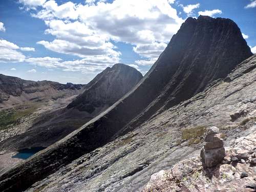
Grenadiers - Vestal (left) and Arrow Peak (right).
The Grenadiers exemplify the best that the San Juans have to offer. They are remote, rugged, and beautiful. Steep face and hard quartzite make for the highest concetrantration of quality rock climbs in the San Juans.
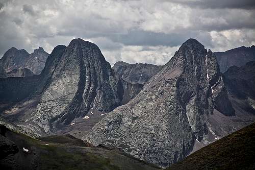
The main spine of the Grenadiers runs west to east from Electric Peak, Arrow, Vestal, the Trinities, Storm King Peak, and Mount Silex to the Guardian. Arrow and Vestal are the most celebrated of the Grenadiers. Arrow had for some time been reputed to be the most difficult major mountain in Colorado to climb. This was believed because early mountaineers accessed Arrow from the south; later on a less demanding route has been established on Northeast Face (Rosenbrough in his The San Juan Mountains A Climbing and Hiking Guide calls the route Northeast rib).
Climbing History:
The Grenadiers were one of the few areas in the San Juans which were not climbed by either the Wheeler or Hayden survey teams. Although the surveyors did not climb in the Grenadiers, the range occupied their thoughts. The surveyors generally referred to the Grenadiers and neighboring Needles as the “Quartzites”.
Rhoda of the Hayden Survey reported: The group of quartzite peaks stood out as boldly as ever about thirty miles to the southeast. In fact, I may state here that we have never yet seen a group from any station without feeling both deep respect and awe for their terrible ruggedness. The fact already stated, that the storm clouds seem to hover about them before starting on their meandering ways, only served to add to our other feelings of uneasiness.
The first climbers to reach the Grenadiers were William S. Cooper and John Hubbard in 1908. From the summit of Pigeon Peak in the Needles, Cooper’s attention had been drawn to “that wonderful line of quartzite peaks dominated by Arrow and Vestal.” They climbed Vestal by a rock gully on the south face which proved interesting, but fairly easy. The south face of Arrow was an entirely different matter. Cooper noted that “Arrow Peak proved to be really difficult. Several times our holds depended on the strength of our fingers. I rather think, too that we found the easiest route”.
Cooper and Hubbard did not write an account of their climbs at that time and hence, when Carleton Long and John E. Nelson climbed Arrow Peak twenty four years later in 1932, they thought that they were the first party to do so. Long and Nelson also approached Arrow from the south. “Difficult, and at times precarious climbing,” eventually lead them to what Long described as a “perfectly delicious overhang.” They named the route “Long’s Overhang”. Long and Nelson are also credited with naming Vestal’s north face Wham Ridge. After studying Wham Ridge from the top of Arrow, Nelson muttered, “I still don’t believe it!”
After several years of neglect, summer of 1941 brought some action to the area. The Colorado Mountain Club held its annual summer outing in the Grenadiers. Again, they came from the south - along the Tenmile Creek drainage. During the outing, first ascents were made of West and Middle Trinity peaks, Storm King Peak, Peak Four, Peak Five, and Peak Seven. The biggest outing was the first ascent of Wham Ridge by Rit Burrows, Wener, Schnackenberg, and Jim Patterson. And finally after some more neglect, September 1962, John C. Ohrenschall and Doug Ward were lured to the area and did several ascents, including NE face of Vestal, the east face of Arrow and the north face of West Trinity Peak.
Getting There
Molas Trail
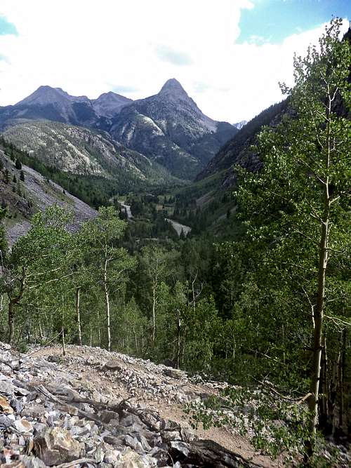
The obligatory photo spot
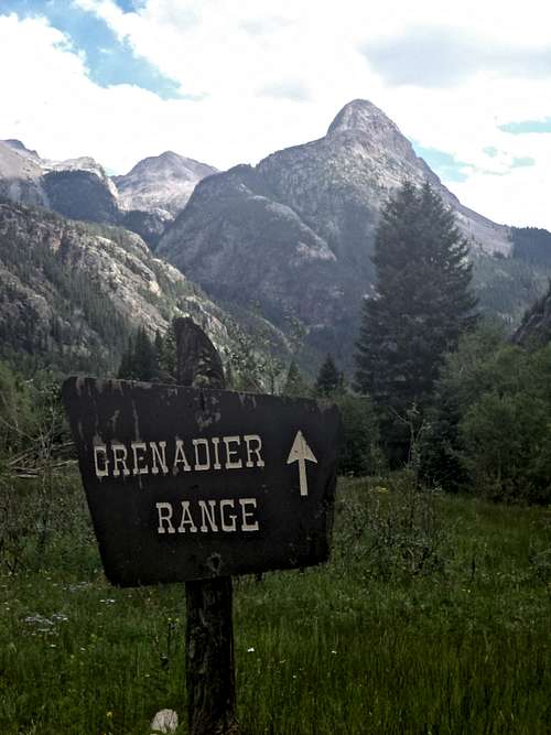
Molas Trail - Lower Elk Creek Trail - Vestal Creek: This is the most popular access. You can either hike from Molas Lake to Elk Park TH, or you can take Durango & Silverton Narrow Gauge Train and exit at Elk Park TH. Elk Park is at 8,860 feet elevation, and is located on Animas River. It is a regular stop for the train. You are not allowed to take dogs on the train, so if you own a pet, hike in. The hike is on scenic Molas Trail (= part of the Colorado Trail) and it descends through many switchbacks down to the Animas River. The start is at Molas Lake off Highway 550 (well signed). The starting elevation is 10,620 feet, and you descend 1,700 feet over 3.5 mile distance. You cross the river on a good pedestrian bridge, and walk about 0.2 miles along the railroad to reach the turn off for Elk Creek (there is a sign). Don't forget to stop by an old sign "Grenadier Range" with an incredible view of Mount Garfield.
Lower Elk Creek Trail: From the trail register, hike 2.7 miles east above Elk Creek’s north side to a large beaver pond on a good trail. This trail is Colorado Trail - trail running from Denver to Durango, and is easy to follow. There are a few small campsites on this section. At the beaver pond, you get a great views into Grenadiers, and also a reflection of these peaks in its waters. At the end of the pond the trail splits: the larger one going northeast = continuation of Colorado Trail, and the smaller one going southeast, contouring the pond leads into Vestal Basin. There are good campsites along the beaver pond. After about 200 yards you drop into Elk Creek Gorge and cross the creek on some logs. There is no bridge, but log crossing is not that hard.
Once on the creek’s south side, hike south up the steep hill and find the beginning of the Vestal Creek Trail - easy to follow. The trail is high on the slope east of the Vestal Creek. There are many fallen trees on this trail you have to climb over or under.
The trail leads steeply uphill and south all the way to the Vestal Basin at 11,400 feet. Continue on the trail, which winds through some willows and there are some puddles to cross. Hike about 0.5 miles to reach the meadows and split in the trail - one section continues straight = towards Trinities, and the other one turns southeast, crosses the creek and leads towards the Vestal and Arrow Peaks. This turn off is not signed, but is pretty obvious. You can see Vestal Peak and to the right off it Arrow Peak. Follow this steep trail up to 12,000 feet, where you will get a great view of Arrow's Northeast face with its huge ramp.
Tenmile Creek: This is the old and historical approach, rarely used nowadays. Tenmile Creek is named not for its length but for its distance from Silverton. The Colorado Mountain Club built a trail in 1941 as a part of its outing in the Grenadier area. The trail has since been unmaintained and is reported to be very difficult to find in places. To reach Tenmile Creek you hike two and half miles south on the railroad track from Elk Park. The railroad tracks are located on the east side of Animas River at Elk Park but cross over to west side of the Animas about 3/4 of a miles south of Elk Park. Don't be tempted to leave the tracks and stay on the east side of the Animas as it is "nearly impassable". You will have to wade the Animas and in the spring and early summer its waters can be high. The best time for crossing is August/September.
Once across the Animas, the trail up Tenmile Canyon starts on the south side of Tenmile Creek and continues up the creek for 1.5 miles where it crosses over to the north side. The total distance from the Animas to Balsam Lake is four miles. You climb from 8,200 feet elevation at the Animas to 11,400 feet at Balsam Lake. Balsam Lake provides access for climbs of the Trinity Peaks, Peak Seven, Peak Eight, Peak Nine, and Storm King; and the south face of Arrow. You can scramble between Arrow and Vestal and climb NE face.
Upper Elk Creek Trail: Again, this is a less common approach, and provides more solitude. From the beaver pond, three miles east of Elk Park, the trail continues up the north side of Elk Creek for 7.5 miles from the Animas. From this point the trail turns north toward the Continental Divide Trail. This trail bring you to Beartown Trailhead, which requires a 4WD vehicle for access.
![NE Face Route Illustration]()
Approximate illustration of the route - there are several small variation, and frequent small cairns. I did not find route finding to be a problem.
| Trailhead | Altitude | RT Distance | Elevation Gain | Difficulty |
| Elk Park Trailhead | 8,860 feet | 11.8 miles | 5,183 feet | Class 3 |
| Molas Lake Trailhead | 10,620 feet | 18.4 miles | 6,863 feet | Class 3 |
| Beartown Trailhead | 11,700 feet | 18.8 miles | 7,623 feet | Class 3 |
| Elk Creek (beaver pond) | 9,980 feet | 5.8 miles | 3,903 feet | Class 3 |
| Vestal Basin | 11,400 feet | 2.0 miles | 2,403 feet | Class 3 |
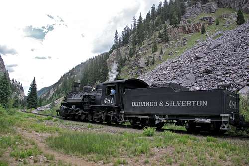 Durango Silverton Train | 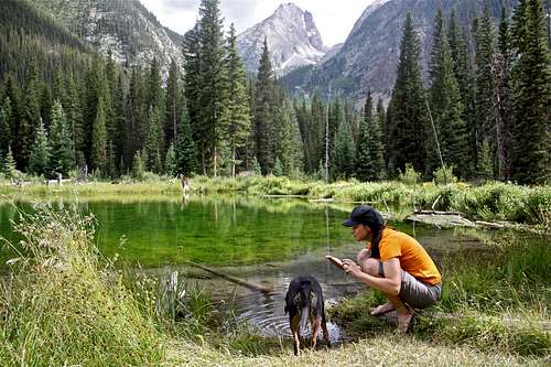 beaver pond | 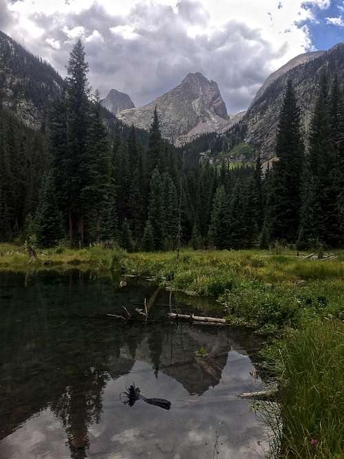 Arrow Peak as seen from Beaver Pond | 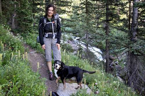 Trail to Vestal Basin | 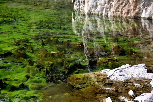 Algea in beaver pond |
Route Description
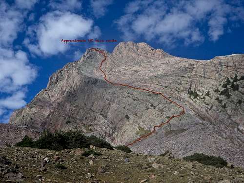
Approximate illustration of the route - there are several small variation, and frequent small cairns. I did not find route finding to be a problem.
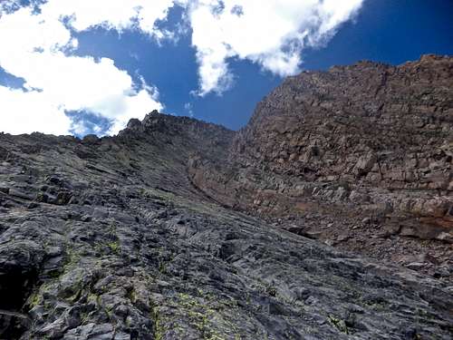
Northeast Face “Classic” is the easiest route on Arrow Peak. The rock is mostly solid and if you keep searching for the easiest route, you should not run into any major difficulties.
The ramp is wide and easy to ascend.The route is not visible from the Vestal Basin by the Vestal Creek, but as soon as you climb up to 12,000 feet the view opens up and the routes is clearly seen. There is a climber’s trail leading all the way to the start of the ramp, but even if there would not be one, you could easily find your way around. What I liked about this route, that you don’t have to deal with much scree. Even the approach is mostly on grassy slopes and a good trail.
Stop at 12,000 feet, there is a nice resting spot near a large cairn. Look at your destination - the prominent north facing ramp starting from 12,200 feet and leading to a saddle just north of the summit. This will be the start of your route. Higher up there will be a smaller ramp, and you will eventually leave the main (lower) ramp and move onto the higher one. The spot is marked with cairns, and all this is clearly visible from 12,000 feet. Beyond this point the route is not much clear, but becomes clearer as you approach it.
From 12,000 feet hike 0.2 miles southwest across grass and talus to 12,200 feet at the east end of a grassy ledge system leading to the huge ramp. There are cairns marking the trail. Ascend 150 feet and gain the ramp. You can either stay on grassy eastern end of the ramp and hike up along, or get closer to its wall and climb on easy slabs with good friction. As you move up, check out the views of Wham Ridge! You can move so much faster on Arrow’s ramps compared to climbers on Wham’s Ridge.
The upper part of the huge ramp is broken into two ramps. Ascend into the higher ramp, the point is pretty obvious and marked with cairns. Zigzag higher up through small gullies, with careful route finding, the route should not be more difficult class 3. Soon you will get above the northern sub summit and the finish is obvious. Again, there are cairns marking the easiest way up, and the route should not exceed class 3 if you look for the easiest path up. The summit is not that big, and offers excellent views in all directions, especially the views of Vestal Peak, and south to Needles and peaks in Chicago Basin.
Descent the same way. Be careful with some loose rock.
Essential Gear
Comfortable shoes, good spirit.I did this as a day hike and carried minimal supplies with me, I drank water from the streams using water purification tablets to save on extra weight (I had only 1 liter nalgene bottle). I always carry with me wind and waterproof jacket, hat and gloves, first aid kit, some food, and camera.