
|
|
Mountain/Rock |
|---|---|
|
|
46.71065°N / 11.01203°E |
|
|
Hiking |
|
|
Spring, Summer, Fall |
|
|
9308 ft / 2837 m |
|
|
The Blasiuszeiger towering over the Lodnerhütte. It's the leftmost one of the three high peaks.
Prologue
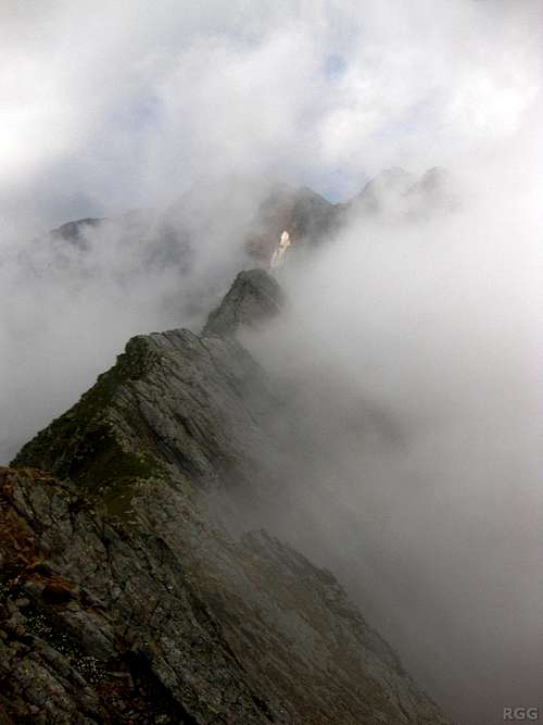
Descending the Johannesschartl
First encounter
The first year that I visited the Texel Group, I was on a trip with the Dutch alpine club. The schedule had been well thought out, and after a very long day traversing Similaun, a short day followed, to recover a bit. But when we arrived at the Lodnerhütte early afternoon, I wasn't tired yet.Right next to the hut was a mountain that looked inviting. The map showed a trail to the top, and it was 'only' some 600 m higher. I was keen to have a go at it, and so I asked if anybody else was interested, but the others were content to have an easy afternoon. And so I headed out on my own.
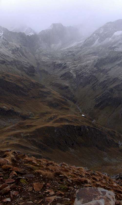
Summit view to the north, as the front arrives. The tiny white dot is the Lodnerhütte.
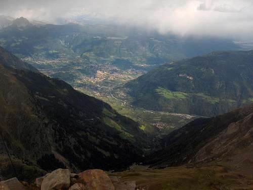
Meran still looks sunny and inviting
But at the Lodnerhütte, we didn't know that just yet. Earlier today we had seen the first signs, when there was a bit of snow on the trail over the Johannesschartl. It wasn't anything serious, but in an effort to beat the possible arrival of more seriously bad weather, as well as making sure to be back in time for dinner, I hiked up at a brisk pace.
By the time I reached the summit, I enjoyed rather contrasting views. To the southeast lay the city of Meran, more than 2 km below. It was still basking in sunshine, and the green valley looked inviting. But up on the summit itself it was gloomy, the thermometer showed -3 °C and the views to the north were very different. I didn't stay long. By the time I was back at the refuge, it had started snowing.
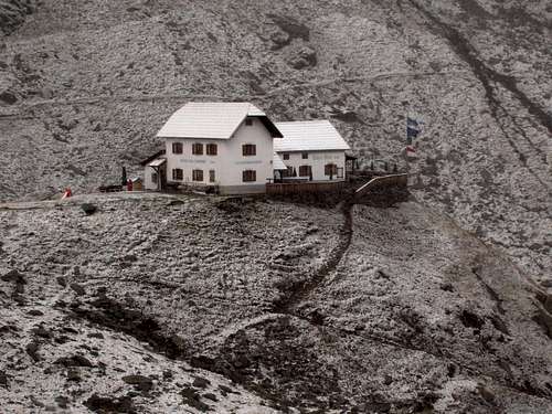
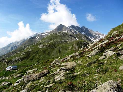
Summertime at the Lodnerhütte
A second visit
Years later, I was back at the Lodnerhütte. This time I was alone, with a full day ahead of me. My plan was to climb the Zielspitze and then make the long way down to the Vinschgau valley. And since the trail from the Lodnerhütte to the Zielspitze traverses the slopes of the Blasiuszeiger, passing not all that far below the summit, I decided to have another look.Alas, once more the weather did not cooperate. It was nothing serious this time, but the cloud base dropped down to hide the higher peaks of the range, including the summit of the Zielspitze. Still, at least I got up the Blasiuszeiger again, and below the clouds the weather was fine.
Overview
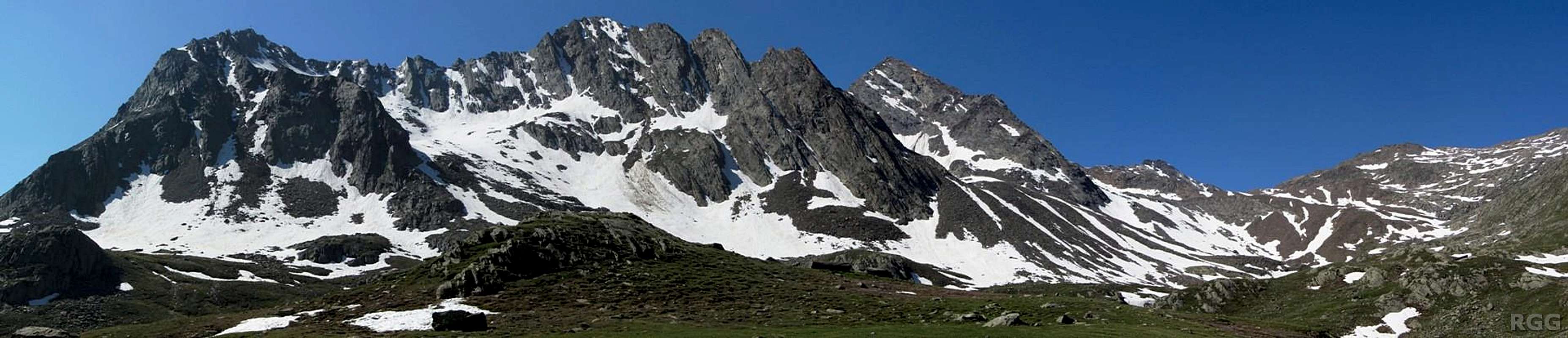
The impressive Hühnerjochkamm as seen from the Lafaistal, the valley north of the ridge. The Blasiuszeiger is the leftmost peak. The high one on the right is the Schwarze Wand (3065m); the still higher Gfallwand is behind the Schwarze Wand and won't be visible until higher up in the Lafaistal.
Gfallwand
As it isn't one of the highest summits in the Texel Group, the views in most directions are not very far. The one big exception is towards the southeast, and that view alone is worth getting up there if visibility is good: With nothing blocking the way to the southeast, you can look down on Meran, and to the mountains far, far beyond.
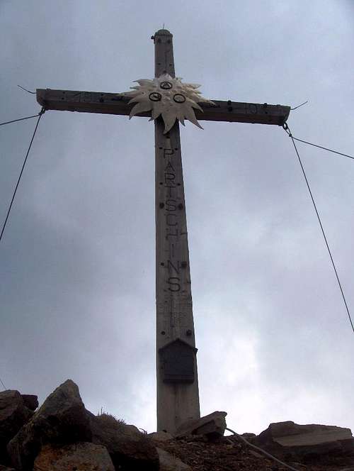
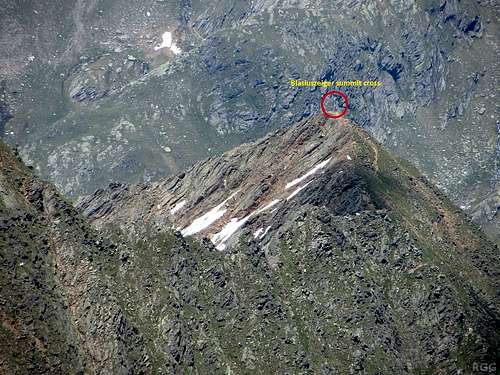
The big summit cross
The green paddle points at the Blasiuszeiger. The terrain view clearly shows the Hühnerjochkamm, the 2 km ridge towards the SW, from Blasiuszeiger to Grallwand.
Click here to view a larger map
Getting There
Getting to the area
The nearest city is Meran, a pleasant place southeast of the Texel Group. Well shielded by the Alps from bad weather coming in from the north, it has a very nice climate. In summer, the area attracts a lot of visitors and for a small city it is well connected.Partschins, just west of Meran, is the nearest village to the Blasiuszeiger and therefore the most obvious starting point.
By car
- From the north there are three options:
- Along the provincial road over the Reschenpass via Nauders and then down the Vinschgau valley;
- Via the mountain road over the Timmelsjoch (closed in winter), down the Passeiertal and turn right at Meran, into the Vinschgau valley;
- Over the Brenner motorway via Sterzing, and then also down the Passeiertal.
- Along the provincial road over the Reschenpass via Nauders and then down the Vinschgau valley;
- From the south, the only way is by the motorway from Bozen / Bolzano.
- From Switzerland, in the west, the Ofenpass and then down the Vinschgau valley is the most logical route
By public transport
Meran has regular train connections with Bozen / Bolzano, which is well connected to the rest of the Italian rail network as well as to Austria and Germany to the north. In addition, a regional train heads up the Vinschgau valley, west of Meran, as far as the small village of Mals. The station nearest to Partschins is Rabland. Alternatively, buses go from Meran up the Vinschgau valley, stopping at Partschins.
From the north, from Austria, regular buses come over the Reschenpass to Mals. And likewise, from the west, from Switzerland, regular buses come over the Ofenpass to Mals.
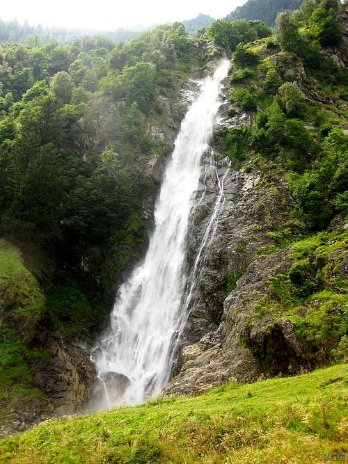
The Partschinser Falls
Getting to the Lodnerhütte
The Lodnerhütte lies in the center of the Texel Group, directly northwest of the the Blasiuszeiger, where the Lafaistal joins the Zieltal. Of the many ways to get there, the shortest one is from the south, hiking up the Zieltal. From the Birkenwald car park (980m), still fairly low in the Zieltal above the village of Partschins, it's about 4 hours to the refuge. Early on you'll pass by the impressive Partschinser Falls.
Alternatively, to save an hour and some energy, you can start by taking the Texelbahn cable car from Partschins up to the Giggelberg (1535m) and hike north on the Meraner Höhenweg to the Nassereithhütte (1523m) and from there up the Zieltal to the Lodnerhütte.Routes
Normal route from the Lodnerhütte
A steep hiking trail, clearly signposted and normally well maintained, leads all the way up. The slopes are loose though, and prone to erosion. When I visited in 2012, shortly after a whole lot of rain, the trail had suffered.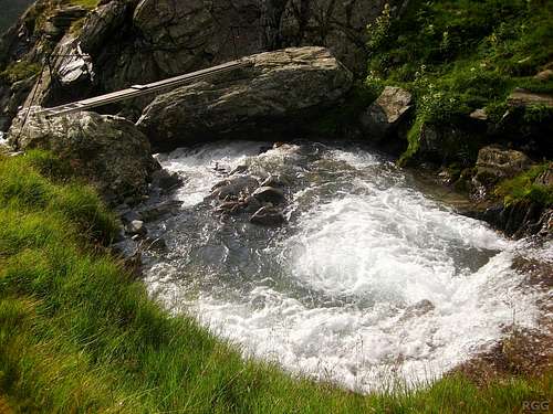
A small foot bridge over the wild Lafaisbach
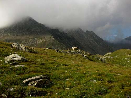
A few sheep grazing on the grassy slopes
Count on 1.5 to 2 hours from the refuge to the summit and 1 hour for the descent.
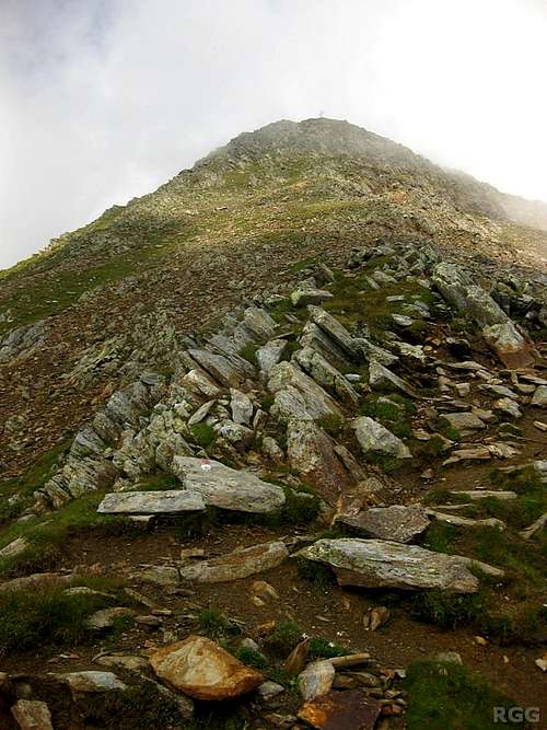
The summit cross beckons
The Königshof route
Judging by the state of the trail, where there is one that is, this route isn't used much. However, when not starting at the Lodnerhütte but down in the Vinschgau valley, this is a good alternative, albeit a more strenous one, with the added advantage that you'll find yourself in a very quiet part of the Texel Group. No scrambling is required, this is still a hiking route.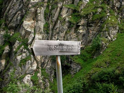
The turn off to the Zielspitze
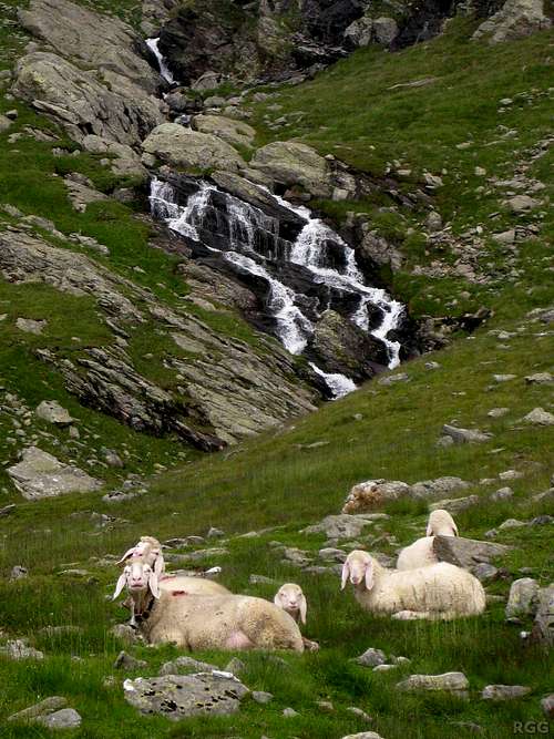
Sheep near the former Königshof
You're getting close now, and it's much shorter to leave the trail to the Zielspitze and head straight up the grassy slopes of the Blasiuszeiger to the northwest. Aim for a high shoulder slightly to the right of the summit. Before getting there, you may very well find the trail (nr 3A this time) again, but if you don't, on the shoulder you can turn left and follow the normal route.
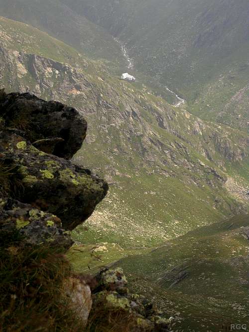
Looking down on the Lodnerhütte from the Blasiuszeiger shoulder
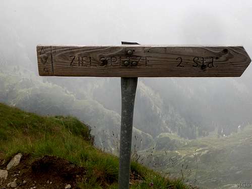
Route sign at the junction on the Blasiuszeiger shoulder, pointing to the Zielspitze. When descending towards the Königshof, start by following this trail, which traverses the southern slopes of the Blasiuszeiger. As soon as the slopes are not too steep anymore, leave the trail and head south to the green valley below. Near the Königshof you shouldn't have any trouble picking up the trail (nr 3) again; rocks with characteristic white and red paint marks show the way.
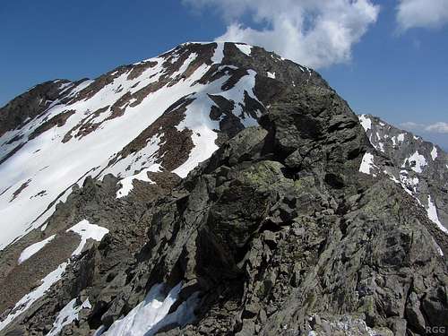
Looking across the Hühnerjochkamm from Blasiuszeiger
The Hühnerjochkamm
From the Gfallwand (3175m) the Hühnerjochkamm stretches 2 kilometers to the northeast with the Blasiuszeiger marking the end. Although it looked inviting, I haven't traversed this ridge (yet). According to the guidebook, it's UIAA grade III.See also the panoramic image of the ridge at the top of this page.
Zooming in on the Blasiuszeiger summit from the Gfallwand. Only a short part of the Hühnerjochkamm is visible
When to Climb
The best period is from late spring to early fall.In wet conditions, the Königshof route is not a very good idea because the steep grassy slopes high up on the Blasiuszeiger can be slippery and dangerous.
Accommodation
The nearest refuge is the Lodnerhütte.Meran and the many nearby villages offer countless accommodation options.
Wild camping is not allowed.
Red Tape

Flowers on the summit
Maps and books
- The 1:25000 Tobacco map Parco Naturale Gruppo di Tessa covers the whole national park. It is the most detailed map, but considering its scale, it gives relatively poor information.
- The 1:50000 Freytag&Berndt map WK S8, Passeiertal * Timmelsjoch * Jaufenpass is fine, even if the 100m contours are rather coarse.
- Excellent free topographic maps are available at the base station of the Texelbahn cable car. The map covers a somewhat smaller area than the others, and highlights the the Meraner Höhenweg, but it has all the other trails and many details. Just one minor point: The map legend claims it is scale 1:50000, but it is close to 1:60000.
- Alpenvereinsführer Ötztaler Alpen, Walter Klier. 14th ed. Bergverlag Rother, 2006, ISBN 978-3-7633-1123-1. In German.