|
|
Route |
|---|---|
|
|
39.58860°N / 105.6428°W |
|
|
Hike/scramble |
|
|
Most of a day |
|
|
Class 2 |
|
|
Approach
Start from the Guanella pass trailhead. Hike along the Mt. Bierstadt trailhead down into the flats below Bierstadt and the Sawtooth. Leave the trail at about the low point of the trail and start hiking toward the prominent gully that cuts through the Sawtooth. The going is very rough through this section because of the infamous and often impassable Bierstadt willows and the swampy ground. Try looking fro trails that cut a path through the willows. Eventually hike into the basin below the Sawtooth and the north face of Mt. Bierstadt. You are know at the base of the climb.
Route Description
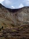
Starting from the basin below hike up the cliffs that lead right up to the base of the gully. I was unable to find a trail when i hiked up this section of the route, but your best bet is to look for some gullys that cut through the rock. Climb up onto the ledge right at the base of the gully. Start climbing into the gully. There should be a trail somewhere in there, that switchbacks its way up through the talus. The trail is extremely slick, be careful not to roll your ankle. The gully itself is nearly a thousand vertical feet tall, and it is definitely a strenuous climb.
Just above 13,000 ft. you start climbing out of the gully and onto the broad rockstrewn western slopes of Mt. Evans and Spalding. A trail winds its way up between the rocks up to about 13,800 ft. where it climbs onto Mt. Evans' long west ridge. The ridge is about 3/4 of a mile to the actual summit of Mt. Evans. Here the trail becomes faint, and you might have to scramble along your own trail. Stay to the south (right) of the ridge crest so that you don't have to climb over the three sub peaks. In some places the exposure is startling as you can look nearly two thousand ft. straight down to Summit Lake below. THIS RIDGE IS VERY LONG AND HARD TO RETREAT FROM, MAKE SURE THE WEATHER HOLDS. Continue hiking until you hit the wide groomed trail that leads tourists from the parking lot to thre true summit. Hike the final fifty feet to the summit from there.
Another longer but less steep alternative includes climbing around the gully on the shallower slopes to the north. Sometime before entering into the basin below the gully, a trail should branch off up this slope. The trail climbs up these slopes above the cliffs north of the gully, and joins the slopes where you would otherwise exit the gully. This alternative is longer, but may actually save you time since it's more of a hike than a climb. This is the route that should be used when conditions in the gully can be very slick or prone to avalanche.
Essential Gear
This climb is a fairly straightforward climb. You may however want to consider waterproof hiking boots for the bogs leading up to the climb.
In the early season an ice ax and crampons might be helpful in the gully.
Finally in winter you should bring full avalanche gear, and maybe skis which you could stash before climbing onto the final ridge.
Miscellaneous Info
If you have information about this route that doesn't pertain to any of the other sections, please add it here.


Brad Snider - Mar 18, 2005 11:36 pm - Hasn't voted
Route CommentIf the gully is unsafe due to snow conditions, which is sometimes the case, or if you simply want a gentler alternative to this gully, the slopes to the north (left) of the gully and surrounding cliffs provide a nice option. These gentle slopes may be a little longer, but can be more practical in certain situations, especially for descent.
bigwilly - Mar 22, 2005 9:49 pm - Hasn't voted
Route CommentThanks for the comment, i've integrated it into the text.
kheatwol - Jan 24, 2006 3:18 pm - Hasn't voted
Route CommentThe west gully route usually does not hold much snow in winter. Avalanche danger should not usually be a major issue unless there is recent heavy snow, so bring avy gear as needed accordingly. Snowshoes or skis are all but required for this approach which can be alot easier in the winter.