
|
|
Mountain/Rock |
|---|---|
|
|
49.23755°N / 20.03031°E |
|
|
Spring, Summer, Fall, Winter |
|
|
6847 ft / 2087 m |
|
|
Overview
Żółta Turnia - Žltá turnia - Gelber Berg / Gelber Turm - Sárga-hegyŻółta Turnia – the last summit in the side ridge of High Tatras leading from Skrajny Granat in the northern direction. This ridge separates Dolina Gąsienicowa Valley from Dolina Pańszczycy Valley.
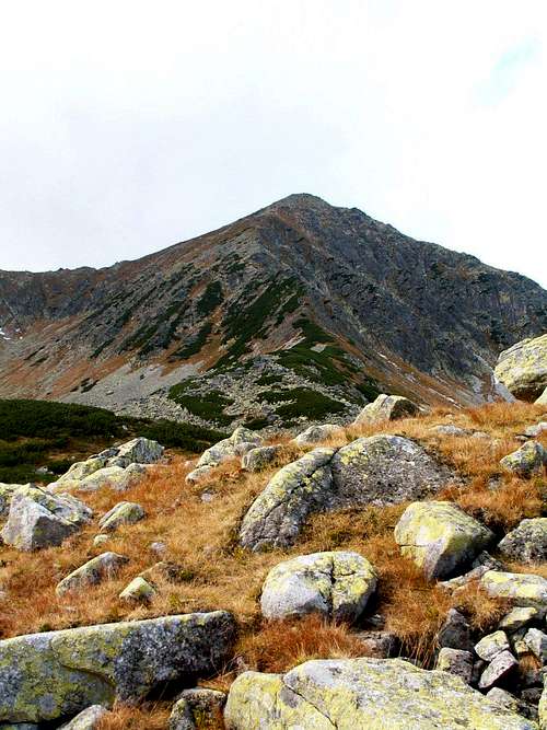
Żółta Turnia from Dolina Pańszczycy Valley
This ridge consists of:
- Pańszczycka Przełączka Wyżnia - 2171 m; from this saddle leads a couloir which is enclosing the western side (360 m high) of Skrajny Granat from the north.
- Zadnia Pańszczycka Czuba - 2174 m, summit in the ridge separating Dolina Gąsienicowa from Dolina Pańszczycy Valleys. First ascent: Walenty Gadowski, Franciszek Zbyszycki - 1903
- Pańszczycka Przełączka Pośrednia - 2145 m
- Skrajna Pańszczycka Czuba - 2155 m
- Pańszczycka Przełęcz – 2155 m
- Wierch pod Fajki – 2135 m
- Żółta Przełęcz – 2028 m
- Żółta Turnia – 2087 m
- Dubrawiska - northern, much lower and by dwarf pines covered part of the slopes of Żółta Turnia
- Żółta Igła – a tower rising from the crest on the western slope of Żółta Turnia, first ascent: Mieczysław Szczuka (3.7.1925).
This is pyramid-shaped mountain(from the north) built from granites and sandstones. Often visited after 1860. Nowadays, it is non-accessible for tourist.
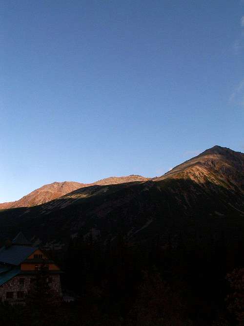
Mała Koszysta (2014 m), Wielka Koszysta (2193 m) and Żółta Turnia (2087 m) from Murowaniec hut
First winter ascent:
Mieczysław Karłowicz and Roman Kordys in 1908.
In 1931 the State Meteorological Institute placed on the summit of Żółta Turnia device for measuring the rainfalls.
Żółta Turnia is named after Acarospora oxytona (bright yellow growth), which covers its slopes. Through the northern slopes of Żółta Turnia (through Dubrawiska) and further through the Dolina Pańszczycy Valley leads a path from Dolina Gąsienicowa Valley to Krzyżne Saddle.
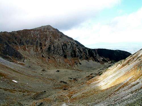
Żółta Turnia from the slopes of Krzyżne
Getting There
The summit is not accesible for tourists.Red Tape
Tatra National Park RegulationsCamping
Murowaniec hutPięć Stawów hut
Weather
Mountain Rescue TeamZakopane web cam

SzaniUherkovich - Sep 29, 2013 4:07 am - Voted 9/10
Sárga-hegyHi, the correct Hungarian name is Sárga-hegy. Sárga-hágó is the name of the neighbouring saddle
Gorzi - Sep 30, 2013 3:57 am - Hasn't voted
Re: Sárga-hegyThank you, corrected.