
|
|
Area/Range |
|---|---|
|
|
49.07000°N / 20.03000°E |
|
|
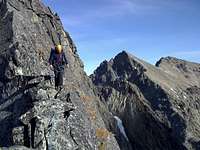
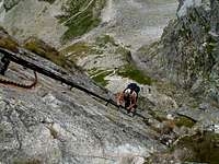
Hiking, Mountaineering, Trad Climbing, Ice Climbing, Mixed, Skiing |
|
|
Spring, Summer, Fall, Winter |
|
|
8710 ft / 2655 m |
|
|
Overview
| Vysoké Tatry - Tatry Wysokie - Hohe Tatra - Magas-Tátra |
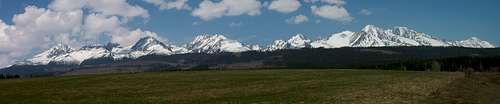
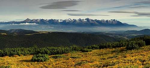 The High Tatras viewn from the Low Tatras, September 2007photo: Martin Tinak The High Tatras viewn from the Low Tatras, September 2007photo: Martin Tinak |
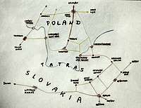
The High Tatras (Slovak: Vysoké Tatry, Polish Tatry Wysokie, German Hohe Tatra, Hungarian Magas-Tátra) is the smallest big mountain range in Europe. They are situated on the border between Slovakia and Poland, although majority of the peaks and valleys lie in Slovakia. Vysoké Tatry are located between latitudes 49-49.20, and longitudes 19.55-20.25. Main ridge starts on the west by pass Ľaliové sedlo (1952 m) and ends up on the east by pass Kopské sedlo (1756 m).
Vysoké Tatry continue on the west with Západné Tatry (Liptovské hole, Rohace), whereas on the east with Belianské Tatry, whose main ridge is almost perpendicular to the main ridge of Vysoké Tatry. Direction of the main ridge is south-east from pass Ľaliové sedlo, approximately in the middle there is a turn to north-east. Length of the main ridge of Vysoké Tatry is about 26 km and width about 17 km. The whole area is about 260 square kilometers.
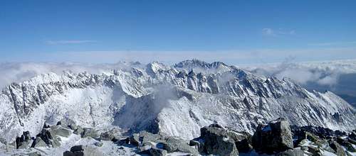
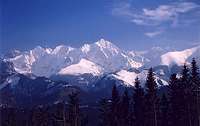 Snowy peaksphoto: Tomek Lodowy Snowy peaksphoto: Tomek Lodowy |
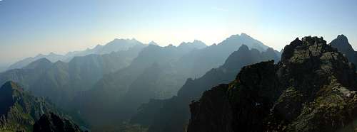
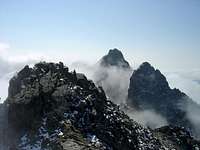 Mysty peaksphoto: peterbud Mysty peaksphoto: peterbud |
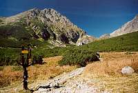 Trail in the High Tatrasphoto: lenik Trail in the High Tatrasphoto: lenik |
Vysoké Tatry was formed by diluvial glaciers and consists of granite, gneiss, and crystalline shale. There are not any glaciers today, just several all year long firn snow fields. The north walls are steeper in comparison with the south ones, however the higher peaks are on the south. There are about 300 peaks and spires in Vysoké Tatry and only several of them is accessible by marked tourist paths (see Allowed Peaks section).
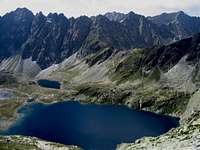
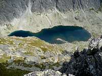
Out of the main ridge lead a lot of extra ridges forming valleys, on step terraces many mountain lakes (tarns) can be found. The three biggest are located on the Polish side: Wielki Staw (in Dolina Pięciu Stawów Polskich - Five Polish Lakes Valley), Morskie Oko and Czarny Staw (in Dolina Rybiego Potoku - Fish Creek Valley), with an area of 34.4 ha, 34 ha and 20.5 ha, respectively. Wielki Staw is also the deepest of all: 79 m. The biggest and deepest tarn on the Slovakian side is Veľké Hincovo pleso: 18.19 ha and 53.7 m. The highest located tarn is Modré pleso (2180 m, in Malá Studená dolina, above chalet Téryho chata), followed by Vyšné Wahlenbergovo pleso (2154 m, in Furkotská dolina). SP album about High Tatra Tarns.
 Veľké Hincovo plesophoto: stjepan Veľké Hincovo plesophoto: stjepan |
 Kriváňské zelené plesophoto: Tomas Kristofory Kriváňské zelené plesophoto: Tomas Kristofory |
 Polish Five Lakesphoto: peterbud Polish Five Lakesphoto: peterbud |
Getting There
With help from SP members dynercia and peterbud
By air

The main international airports in the broader area are: Bratislava (SK), Wien/Vienna (AT), Budapest (HU) and Praha/Prague (CZ). There are two further airports much closer, although with less connections: Poprad (SK) and Kraków/Cracow (PL).
From the airports you shall take train, bus or car to get further.
By train and bus
Slovak side: There are direct trains and buses to Poprad from all major cities of Slovakia (direct trains are also available from Budapest and Prague). Up-to-date international train search can be easily done on the DB website. From Poprad you can get to all major southern entry points (Tatranská Lomnica, Starý Smokovec, Tatranská Polianka, Štrbské pleso, Podbanské) by rail or bus. If coming by train, it is also possible to get off at the station of Štrba, which is connected with Štrbské pleso by a cog railway. The Tatra electric railway (Tatranská elektrická železnica), a separate system from the national railway that connects Poprad with Štrbské pleso through Starý Smokovec and Tatranská Polianka, is an obvious choice of public transportation along the southern side of the mountains.
Polish side: From Cracow, you shall get to Zakopane. There are a lot of buses, operated by PKS (time table) and also private companies: Frey (time table) and Szwagropol (time table). By train the road is much longer and expensive (train search: Polish Railways or DB website).
By car
The most convenient way to plan your trip is to use a route planner like ViaMichelin or similar. There are parking opportunities on both the Slovak and the Polish side (fees will be charged). Slovak motorways are toll roads (vignettes can be bought at border crossings and petrol stations), however the ordinary highways (toll-free) are pretty good and the traffic is usually far from unbearable.
Scaleable map of Slovakia.
 |
 |
 |
 |
 |
Red Tape
Slovakia
Source: Information for visitors of TANAP
Members of any of UIAA member can climb, ski, etc. in specified areas, see below. Non-UIAA members are permitted to use ONLY MARKED TOURIST TRAILS or to be accompanied by TATRA' MOUNTAIN GUIDE.
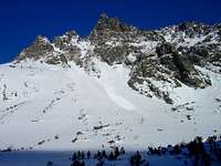
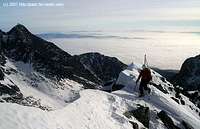 Skier just near the summit of Maly Ľadový štít (on the left is the second highest High Tatra peak - Lomnický štít) photo: palic |

The National Park is the heritage of all mankind. Mount Kriváň (2495 m) is the national symbol of the Slovak people. Since 1993 the mountain range Tatras, together with the Polish part of the National Park, has been identified as natural, biospheric, reserve of UNESCO. Whilst enjoying your visit in the National Park, please help us to protect its natural beauty. Information notice boards about the National Park serve you, the visitor - please do not damage them.
1. In order to enjoy your visit please use marked hiking tracks, footpaths and cycling tracks as well as Tourist Information Centres.
Cycling tracks
2. Picked flowers will wither, captive butterflies will die, chicks of an eagle could fall from their nest if disturbed. Therefore touch the nature by your heart only.
3. In order to protect the nature and to ensure your safety, hiking tracks in the mountains are not accessible to public between 1 November and 15 June.
Closure of hiking paths
4. Enjoy your hiking in the daytime, between an hour after sunrise and hour before sunset.
5. Hiking away from marked tracks, under the supervision of experienced guides, is available between 16 June and 31 October.
Hiking away from the marked tracks
6. In order to protect endangered species of birds of prey, paragliding and using rogallo is permitted only in specifically designated areas.
Gliders and paragliders
7. It is not permitted to camp or bivouac anywhere in the National Park. It is prohibited to light fires anywhere in the National Park other than in designated sites in tourists villages.
8. If you are enjoying your stay in the National Park with your pet dog then the dog should always be on a lead and muzzled. In specifically designated nature reserves dogs are not permitted to enter at all.
9. Peacefulness of nature is there for you to enjoy. It should not be polluted either by lights effects or loud music, or any other noises.
10. The National Park provides also for winter sports such as alpine and cross-country skiing on designated slopes and tracks as well as mountain and rock climbing, and ski-alpinism in purposely built facilities where picnic areas are set aside for an open fire barbecues.
Alpine skiing
Cross country skiing
Ski-alpinism
Climbing and rock-climbing
11. Please do not pollute the environment. Take your rubbish home with you. To avoid fires please refrain from smoking during dry periods.
12. Protect the underground beauty of the nature. Do not try to enter inaccessible caves and gullies.
It is IMPORTANT to note that some areas are closed even to UIAA members:

Map of closed areas (encircled by purple dashed lines) linked from this external source (SVTS - Slovak mountaineering club).
Please also note that despite both Slovakia and Poland have joined the Schengen zone in December 2007, regulations have not changed in the High Tatras. The only point where border-crossing is legal in the nature conservation area is through the peak of Rysy.
Other climbing regulations are at SP page for Gerlachovský stít
Poland
Climbing is permitted only in two regions: the Orla Perć ridge, and around Morskie Oko - see this map.
Peaks of High Tatras
Table with the highest peaks adapted by peterbud
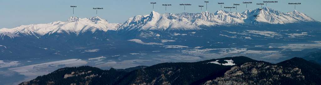
 The High Tatras viewn from Štrba - photo: gorzi
The following table presents the highest peaks of the range. Polish, German and Hungarian toponimes are listed in italic below the official Slovak names. The geographical names of Tatra Mountains is actually very complicated (and sometimes chaotic) - not just because there are names in four languages, but also because often there are (were) different variants within one or more of the languages. Tatra toponimes have a long and intricate history. Several times an expression of one language got used in an ill-traslated form in the other language. Occasionally, names were mistakenly recorded or mixed up in some of the basic publications. And last, but not least, a handful of peaks were attempted to be renamed for different reasons (honour, politics). All this created considerable confusion (partly present on SP as well). A very good and extensive online Tatra-toponimes dictionary is available for speakers of Slovak, Polish, German and Hungarian to ease the situation.
| Rank | Photo | Name of the peak (slo-pol-ger-hun) |
Height | First ascent |
| 1. |
 |
Gerlachovský štít Gierlach Gerlsdorfer Spitze Gerlachfalvi-csúcs |
2655 m | Reportedly in 1834 J. Still, J. Gellhof and M. Spitzkopf. Probably in 6th decade of 19th century by M. Urban. First ladies - P. Knerr and J. Fillunger (July 28, 1877) In 1896 the peak was renamed after Franz Joseph Austrian emperor until WW-I. Between 1949-1956 it was named after J.V. Stalin. |
| 2. |
 |
Zadný Gerlachovský štít Zadni Gierlach Hintere Gerlsdorfer Spitze Hátsó-Gerlachfalvi-csúcs |
2638 m | J. Stolarczyk, with guides from Zakopane (around 1870) |
| 3. |
 |
Lomnický štít Łomnica Lomnitzer Spitze Lomnici-csúcs |
2634 m | Robert Townson (August 7, 1793) For long time this peak was thought to be the highest of the High Tatras. |
| 4. |
 |
Ľadový štít Lodowy Szczyt Eistaler Spitze Jég-völgyi-csúcs |
2627 m | summer - J. Ball and W. Richter with hunters (August 31, 1843) winter - T. Wundt and J. Horvay (December 28, 1891) (probably already in the 18th century by hunters) |
| 5. |
 |
Pyšný štít Durny Szczyt Schwalbenturm Fecske-torony |
2621 m | summer - Ö. Téry, M. Spitzkopf (August 8, 1877) winter - E. Hruby, O. Jordán, R. Komarnicki and J. Serényi (1910) |
| 6. |
 |
Malý Ľadový štít Lodowa Kopa Markasitturm Markazit-torony |
2603 m | J. H. Blasius, G. Hartlaub and A. Keyserling with hunters (September 22, 1835) |
| 7. | Malý Pyšný štít Mały Durny Szczyt Téry-Spitze Téry-csúcs |
2592 m | Gy. Dőri (July 17, 1901) | |
| 8. |
 |
Kežmarský štít Kieżmarski Szczyt Kesmarker Spitze Késmárki-csúcs |
2556 m | first thoroughly documented - E. Wołoszczak (August 9, 1858) before that probably by D. Fröhlich (June, 1615) and D. Speer (1654) (Fröhlich reports the peak has been climbed even before him) winter - G. O. Dyhrenfurth and A. Martin (1906) |
| 9. |
 |
Vysoká Wysoka Hochberg Tátra-csúcs |
2547 m | M. Déchy, J. Ruman and U. M. Spitzkorf (September 3, 1874) |
| 10. |
 |
Končistá Kończysta Hochkammspitze Koncsiszta |
2538 m | A. Münnich and his fellows (around 1874) |
| 11. |
 |
Baranie rohy Baranie Rogi Grünseespitze Zöld-tavi-csúcs |
2526 m | summer - J. Stolarczyk and A. Trausyl with four guides (September 17, 1867) winter - T. Kregczy, L. Rokfalusy and Z. Votisky (1911) |
| 12. |
 |
Draci štít Smoczy Szczyt Déchy-Spitze Déchy-csúcs |
2523 m | A. Martin and J. Breuer (August 13, 1905) |
| 13. |
 |
Veľká Vidlová veža Widły Grosse Gabelspitze Nagy-Villa-csúcs |
2522 m | M. Szontagh junior and J. Hunsdorfer (August, 1903) |
| 14. |
 |
Malý Kežmarský štít Mały Kieżmarski Szczyt Weber-spitze Wéber-csúcs |
2514 m | summer - A. Gábriel, F. Koromzay, Gy. Koromzay, A. Nikázy and S. Wéber (August 21, 1889) winter - G. O. Dyhrenfurth and A. Martin (March 8, 1906) (earlier probably together with Kežmarský štít in June, 1617) |
| 15. | Zadný Ľadový štít Lodowy Zwornik Eistaler Schulter Jég-völgyi-váll |
2507 m | K. Englisch with guide J. Hunsdorfer senior (July 16 or 17, 1902) (probably earlier by mapping surveyors) |
|
| 16. |
 |
Rysy Rysy Meeraugspitze Tengerszem-csúcs |
2503 m | summer - E. Blasy and J. Ruman (August 20, 1840) winter - T. Wundt and J. Horvay (April 10, 1884) |
| 17. |
 |
Ťažký štít (Český štít) Ciężki Szczyt Martin Roth-Spitze Róth Márton-csúcs |
2500 m | E. Dubke and J. Francz (July 7, 1904) |
| 18. |
 |
Kriváň Krywań Ochsenhorn/Krummhorn Kriván |
2495 m | first known - J. A. Czirbesz (August 8, 1773) (probably earlier by miners - gold mines were in the upper region between the 15th-18th cent.) |
| ... | ||||
| XX. |
 |
Slavkovský štít Sławkowski Szczyt Schlagendorfer Spitze Nagyszalóki-csúcs |
2453 m | G. Buchholtz senior and others (July 16, 1664) |

SP pages image map
Prepared by peterbud
The following image map gives an overview of the High Tatras and its current SP pages, except the newest additions:
- Soliskový hrb
- Divá veža
- Popradský Ľadový štít
- Veľka Svišťovka
- Opalony Wierch
- Belianska Kopa
- Miedziane
- Żabi Szczyt Wyżni
- Żabi Koń
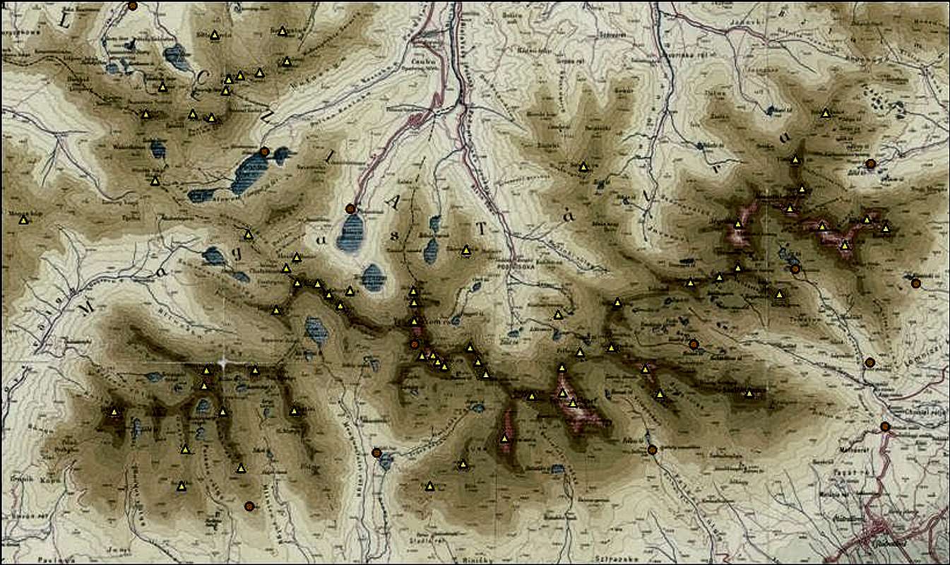
Click the peaks to open their SP page in a new window.
Names of peaks appear according to which country they belong to (on the border: Polish / Slovak).
Underlay image is a vintage tourist map from 1910.
Allowed peaks
Prepared by peterbud
 View from Kriváň to the rest of the High Tatras' peaks - photo: peterbud
For non-UIAA members, only the peaks listed below are allowed to be climbed without permission (on marked tourist routes):
- from the Slovak side (only in the summer period, from 15/Jun until 1/Nov):
| Name (slo) | Height | Name (pol-ger-hun) |
| Kriváň | 2495 m | Krywań, Krivan, Kriván |
| Predné Solisko | 2093 m | Skrajne Solisko, Vorderer Salzberg, Elülső-Szoliszkó-kúp/Mellső Sóhegy |
| Kôprovsky štít | 2363 m | Koprowy Wierch, Koprovaspitze, Kapor-csúcs |
| Rysy | 2503 m | Rysy, Meeraugspitze, Tengerszem-csúcs |
| Východná Vysoká | 2428 m | Mała Wysoka, Kleine Visoka, Kis-Viszoka |
| Slavkovský štít | 2452 m | Sławkowski Szczyt, Schlagendorfer Spitze, Nagyszalóki-csúcs |
| Veľká Svišťovka | 2037 m | Rakuska Czuba, Grosser Ratzenberg, Nagy-Morgás |
| Jahňačí štít | 2229 m | Jagnięcy Szczyt, Weisseespitze, Fehér-tavi-csúcs |
- from the Polish side (throughout the year):
| Name (pol) | Height | Name (slo-ger-hun) |
| Kozi Wierch | 2291 m | Kozi Vrch, - , Zerge-hegy |
| Świnica | 2428 m | Svinica, Seealmspitze, Svinica |
| Szpiglasowy Wierch | 2172 m | Hrubý štít, Liptauer Grenzberg, Liptói-határhegy |
| Rysy | 2503 m | Rysy, Meeraugspitze, Tengerszem-csúcs |
When To Climb
Hiking and climbing in Vysoké Tatry is available all over year, but there are several regulations - see the Red Tape section.
Accommodation
Compiled with help from SP members dynercia and peterbud
Camping
On the Slovak side camping is not permitted in the area of National Park Vysoké Tatry. Public camp is only in Tatranská Lomnica, otherwise you must sleep at Mountain Chalets or Hotels. In the touristic season the High Tatras get quite crowded, so it is highly advisable to book beds in advance.
On the Polish side there is a camping in Zakopane. If you are a member of any climbing club you can camp in 3 places in mountain, too:
- horolezecke taborisko in Bielovodská (Białej Wody) Valley (by blue marked route) - ordering in advance
- obozowisko taternickie PZA “Szalasiska” in Rybiego Potoku Valley (not far from Morskie Oko)
- obozowisko taternickie PZA in Suchej Wody Valley (by black marked route)
Mountain chalets - Slovakia
Chata pod Rysmi (2250 m)
| Chata pod Rysmi is the highest located chalet in Vysoké Tatry, opened only during the summer season from May till October, as a result of a series of huge avalanches that fell down from the wall of Ťažký štít (Český štít) and destroyed chalet several times since 2000. Chalet was opened for winter climbing and ski-alpinism from the end of January till the end of March up to year 1999. It is located bellow the pass Váha under Rysy (2503 m). The stone one floor chalet was built in 1932. The second floor was added in 1977 and was got off to the valley by the first huge avalanche in January 2000. The chalet has been rebuilt temporarily after the incident, but major reconstruction did not start until 2010. The process will last over 2011 as well, until then the hut does not offer accommodation, only food and drink service. The toilet is located outside the hut - it takes about 1 minute walk to get there (the view compensates for the effort). Access from: 1. Chata pri Popradskom plese - red/blue marked trail, 2 h 20 min 2. Schronisko przy Morskim Oku - red marked trail, crossing the Polish-Slovak border (since both countries joined the Schengen zone in Dec/2007, this is just a formality now), 5 h Contact: Chata pod Rysmi, Štrbské Pleso, 059 85, Slovakia Telephone: +421/(0)52/4422314 |
 Chata pod Rysmiphoto: peterbud Chata pod Rysmiphoto: peterbud |
Chata pri Zelenom plese (Brncalova chata) (1551 m)
| Chata pri Zelenom plese is situated on the eastern bank of the Zelené pleso (Green Tarn). The first small cottage, Egidova /Egyed/ Chalet (named after Egyed Berzeviczy, contemporary president of the Hungarian Carpath Association), arose in Rakúska poľana in 1876. The former Friedrich's Cottage (named after Friedrich archduke) on the northern bank was opened in 1897. After renovation in 1924 the current design was gained. The chalet was called Brncalova chata after 1950 to commemorate the name of Albert Brncal (1919-1950), the professor of physical education and at the same time a member of Tatra's Mountain-climbers Committee (IAMES), who tragically died under pass Jastrabie sedlo in valley Malá Zmrzlá Dolina as a climbing instructor. Nowadays, both names are used, although officially in maps the first one can be found. Open all year around. Access from: 1. Tatranské Matliare - yellow/blue marked path, 3 h 30 min 2. Skalnate pleso - red marked trail, 2 h 45 min Contact: Telephone: +421(0)911-552-419 /booking/, +421(0)901-767-420 /information/ E-mail: tatry(at)chataprizelenomplese.sk |
 Chata pri Zelenom plesephoto: radovan01 Chata pri Zelenom plesephoto: radovan01 |
Téryho chata (2015 m)
| Téryho chata is situated in the Malá Studená dolina by the Päť Spišských plies (Five Spiš Tarns). The chalet was opened on the 21st of August, 1899. Since the beginning it has been named after Ödön Téry (1856-1917), one of the most remarkable pioneers of Hungarian alpinism and hiking, first ascender of Prostredný hrot, Pyšný štít, Posledná/Jordánova veža and Lomnická vežička. Open all year long for hiking, climbing and ski mountaineering. Access from: 1. Zamkovského chata - green marked trail, 2 hours 2. Skalnate pleso - red marked trail, 2 h 50 min 3. Hrebienok - red/green marked trails, approx. 3 h 4. Zbojnícka chata, via Veľká Studená dolina and pass Priečne sedlo - yellow marked trail - PROHIBITED direction - 3 h 5. Tatranská Javorina - via Javorová dolina and pass Sedielko, green marked trail, 6 h Contact: Téryho chata, 062 01 Starý Smokovec, Slovakia Telephone: +421/(0)52/4425245; +421/(0)905/893233 E-mail: teryhochata(at)gmail.com |
 Téryho chataphoto: julesblaidd Téryho chataphoto: julesblaidd |
Zbojnícka chata (1960 m)
| Zbojnícka chata is located in Veľká Studená dolina (the first shelter was built here 100 years ago). Chalet is opened all the year for hiking, climbing and ski mountaineering. Marked turist path to Východná Vysoká (2428 m). Map of Veľká Studená dolina with Zbojnícka chata. Access from: 1. Hrebienok, via the classic route - red/blue marked trail 2. Téryho chata, via Malá Studená dolina, over pass Priečne sedlo - yellow marked trail, 3 h. 3. Sliezsky dom, via Velická dolina, over pass Poľský hrebeň and pass Prielom - blue/green marked trail, 3 h 45 min. 4. Lysá Poľana, via Bielovodská dolina - blue marked trail, 6 h 15 min. Contact: Zbojnícka chata, 062 01 Starý Smokovec, Vysoké Tatry, Slovakia Telephone: +421/(0)903/638000 (preferred), +421/(0)903/619000 (if the previous doesn't work) E-mail: info(at)zbojnickachata.sk |
 Zbojnícka chataphoto: peterbud Zbojnícka chataphoto: peterbud |
Chata pod Soliskom (1840 m)
| Chata pod Soliskom is located on the southern end of the Solisko ridge, at the head of the Solisko ski run. The first hut was built in 1944, it was rebuilt in 2003. Open all year around, accommodation costs 300 SKK per night (2007). Access from: Štrbské pleso, along the ski lift - blue marked trail, 1 h 30 min Contact: Telephone: +421/(0)905/652036, +421/(0)907/949442 E-mail: info(at)chatasolisko.sk |
 Chata pod Soliskomphoto: Tomáš Krištofóry Chata pod Soliskomphoto: Tomáš Krištofóry |
Mountain hotels - Slovakia
Chata pri Popradskom plese (1494 m)
| The first shelter by the Poprad Lake was built in 1871, which repeatedly burned down and reconstructed several times. Today's mountain hotel Chata pri Popradskom plese is situated in the picturesque surroundings of Mengusovská Valley on the bank of mountain lake Popradské Pleso. A memorial of victims of the High Tatras mountains Symbolický cintorín is located on the other side of the lake. Access from: 1. Štrbské pleso, via the Tatranská Magistrála trail - red marked trail, about 1 h 2. Hotel Sliezsky dom, via the Tatranská Magistrála trail - red marked trail, 3 h 30 min Contact: Horský hotel Popradské Pleso, P.O.Box 12, 059 85 Štrbské Pleso, Slovakia Telephone: +421/(0)908/761403, +421/(0)910/948160 E-mail: recepcia(at)popradskepleso.sk |
 Chata pri Popradskom plesephoto: peterbud Chata pri Popradskom plesephoto: peterbud |
Hotel Sliezsky dom (1680 m)
| Hotel Sliezsky dom is situated at the threshold of the valley Velická dolina, on the bank of mountain lake Velické pleso. The first stone chalet was on the eastern end of the lake (1871). A snow avalanche destroyed it in march 1874. Four years later another small wooden shelter was built on the southeastern bank of the lake. This was rebuilt several times (especially between the years 1957 - 1960), but it completely burned down in 1962. Since 1968 at the same place, there is a modern mountain hotel with the same name. Access from: 1. Tatranská Polianka - green marked trail, 2 h 2. Chata pri Popradskom plese - red marked trail, 3 h 30 min 3. Štrbské pleso - red marked trail, 4 h 45 min 4. Starý Smokovec - yellow marked trail, 2 h 25 min 5. Zbojnícka chata, via passes Prielom and Poľský hrebeň - blue marked trail, 3 h 45 min Contact: Sliezsky dom, 059 82 Tatranská Polianka, Slovakia Telephone: +421-52-4425261 E-mail: mail(at)sliezskydom.sk |
 Morskie Oko Chaletphoto: Tomek Lodowy Morskie Oko Chaletphoto: Tomek Lodowy |
Mountain chalets - Poland
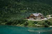
Schronisko przy Morskim Oku (1410 m)
| Schronisko przy Morskim Oku is situated in the Rybiego Potoku Valley by the Morskie Oko (Sea’ Eye). Chalet is opened all the year for hiking, climbing and ski mountaineering. There are two options the new hut (rather mountain hotel) and the old hut (this is cheaper). Hot shower is available. In the new building there's a restaurant, in the old there's a kitchen where you can cook your own food. Access from: 1. Polana Palenica przed Morskim Okiem - red marked trail, 3 h (in high season there are a lot of buses from Zakopane to Palenica, but in low season you can only depend on PKS - time table) 2. Schronisko w Dolinie Pięciu Stawów Polskich (Hut in Five Polish Lakes Valley) - blue marked trail (by Swistówka), 1 h 40 min - blue/yellow marked trail (by Szpiglasowa pass), 2 h 45 min 3. Chata pod Rysmi - red marked trail, crossing the Polish-Slovak border (since both countries joined the Schengen zone in Dec/2007, this is just a formality now), 4 h Contact: Schronisko przy Morskim Oku, skr. poczt. 201, 34-500 Zakopane, Poland Telephone: +48/18/2077609 |
 Five Polish Lakes' Chaletphoto: peterbud Five Polish Lakes' Chaletphoto: peterbud |
Schronisko w Dolinie Roztoki (1031 m)
| Schronisko w Dolinie Roztoki is situated by mouth Roztoki Valley to Białej Wody (Bielovodská) Valley. Chalet is opened all the year for hiking, climbing and ski mountaineering, but in winter time it’s better to phone earlier. Access from: 1. Polana Palenica przed Morskim Okiem – red/green marked trail, 1 h (in high season there are a lot of buses from Zakopane to Palenica, but in low season you can only depend on PKS - time table) 2. Schronisko w Dolinie Pięciu Stawów Polskich (Hut in Five Polish Lakes Valley) - green marked trail, 2 h 3. Schronisko przy Morskim Oku - red marked trails, 1 h 30 min Contact: Schronisko w Dolinie Roztoki, skr. poczt. 200, 34-500 Zakopane, Poland Telephone: +48/18/2077442 |
Schronisko w Dolinie Pięciu Stawów Polskich (1670 m)
| Schronisko w Dolinie Pięciu Stawów Polskich (in the Five Polish Lakes Valley) is opened all the year for hiking, climbing and ski mountaineering. Rooms for 4-10 persons per room. Shower (cold) and toilet (standing) is inside the building. There's a busy kitchen with good food for reasonable prices, hot water is available from here. For cooking you own meal there's a separate tourist kitchen. Access from: 1. Polana Palenica przed Morskim Okiem – red/green marked trail, 3 hours (in high season there are a lot of buses from Zakopane to Palenica, but in low season you can only depend on PKS - time table) 2. from Gąsienicowa Valley – there are a lot of trails and variants (check on map) 3. Schronisko przy Morskim Oku: - blue marked trail (by Swistówka), 1 h 40 min - yellow/blue marked trail (by Szpiglasowa pass), 4 h Contact: Schronisko w Dolinie Pięciu Stawów Polskich, skr. poczt. 196, 34-500 Zakopane, Poland Telephone: +48/18/2077607 |
 Murowaniec Chaletphoto: Tomek Lodowy Murowaniec Chaletphoto: Tomek Lodowy |
Schronisko Murowaniec (1500 m)
| Schronisko Murowaniec is situated in Gąsienicowa Valley. Chalet is opened all the year for hiking, climbing and ski mountaineering, but in winter time it’s better to phone earlier and reserve place – it’s very popular ski area. Access from: 1. Kuźnice (there are a lot of buses from Zakopane to Kuźnice) - blue marked trail (by Boczań), 2 h - yellow/blue marked trail (by Jaworzynka Valley), 2 h 2. Schronisko w Dolinie Pięciu Stawów Polskich (Hut in Five Polish Lakes Valley) - there are a lot of trails and variants (check on map) Contact: Schronisko Murowaniec, skr. poczt. 193, 34-500 Zakopane, Poland Telephone: +48/18/2012633, +48/18/8016176 E-mail: murowaniec(at)e-tatry.pl |
Maps
Compiled by peterbud with help from jck and palic
- Polish #1: PPWK-Copernicus' Tatry Wysokie in scale 1:20 000 (ISBN 978-83-7329-992-44) - description in 4 languages
- Polish #2: Sygnatura-Polkart's Tatry Wysokie in scale 1:25 000 (ISBN 83-87873-26-8) - description in 6 languages, available in all shops in Zakopane, also has an online version
- Online map with tourist paths in Slovakia in coopearation with VKÚ Harmanec
- Hungarian: Szarvas-Faragó's Magas Tátra in scale 1:30 000 (ISBN: 9789632148120) - Hungarian toponimes also presented besides the Slovak and Polish ones, hiking trails are classified according to difficulty
- Online map with Slovak and Hungarian toponimes
- Online sketches of several areas in the High Tatras
- Ortophoto map (1:15 000) by the Czech firm Geodis
- If you like vintage maps, several of those are accessible at this site, along with a dozen of panoramic maps
Mountain Rescue
| Slovakia On the Slovak side acts HZS: Horská Záchranná Služba Starý Smokovec 23, 059 60 Vysoké Tatry tel.: 052/4422820, fax: 052/4422855, mobil: 0903624869 e-mail: vtatry(at)hzs.sk www.hzs.sk Poland On the Polish side acts TOPR: Tatrzanskie Ochotnicze Pogotowie Ratunkowe adress: 34-500 Zakopane, ul.Pilsudskiego 63a tel.: (+48)(18) 2014731 fax : (+48)(18) 2015560 e-mail: topr(at)topr.pl www.topr.pl rescue phone: (+48) 601-100-300 |
Avalanche danger Avalanche forecast Slovakia Avalanche forecast Poland (in English) |
Weather
Actual weather
Online weather information from AccuWeather (idea borrowed from Nanuls):

Please note that these are data for villages at the feet of the mountains, they're good to get a general feeling of what's around. In the high regions the situation may be quite different.
Actual weather on the Slovak side (situation at this moment) from HZS website.
Web forecast
- On the Slovak side: on HZS website and from Slovak meteorological office
- On the Polish side: English version (fancy, with charts) and Polish version (ordinary forecast table)
Publications
Compiled by peterbud with help from Tomáš Krištofóry and jck
The following list introduces some of the most important publications about the High Tatras (in chronological order), but it is far from complete. A more in-depth essay of the High Tatra's literature can be found here in Hungarian.
Books
 |
Adam Piechowski: A Tátra főgerince (2007, Magyar Hegy- és Sportmászó Szövetség, Budapest) - guide book of the complete main ridge of the Western/High/Belian Tatras, in four volumes (this Hungarian edition is complete, in Polish only the first volume has been published) |
 |
Colin Saunders and Renáta Nározná: The High Tatras (2006, Cicerone Press - 2nd edition) - general guide book (available from Cicerone, Amazon and probably elsewhere as well) |
|
Stanislav Samuhel: High Tatra - The finest valley and mountain walks (2001, Rother - 3rd Edition) - description of 55 hikes on 128 pages, with photos and maps (available from Rother) |
|
László Scheirich: Emberek, sziklák, századok (2001, Nap Kiadó, Dunaszerdahely/Dunajská Streda) - monography about the Tatra's history, toponyms, mountain societies, famous guides, climbers and other notables (cover visible here) |
|
Ákos Neidenbach: Tátrai legendárium (2000, Kornétás) - a collection of old legends and tales about the Tatra (cover and table of contents visible here) |
 |
Ivan Bohuš: Od A po Z o názvoch Vysokých Tatier (1996, Vydali Štátne lesy TANAP-u, Tatranská Lomnica) - a book (cover visible here) by the famous Tatra historian (the author published many other books about the High Tatras) |
 |
Witold Henryk Paryski: Wielka Encyklopedia Tatrzańska (1995, Wydawnictwo górskie - Poronin) - a 1500-page encyclopaedia about the Tatras (cover visible here) |
|
Ivan Vološčuk (ed.) et al.: Tatranský národný park. Biosférická rezervácia. (1994, Gradus Martin press) - 552 pages about the Tatra National Park |
 |
Július Andráši and Witold H. Paryski: Vysoké Tatry - Výber horolezeckých výstupov (1974, Bratislava) - description of selected climbing routes (Hungarian translation is available online) |
 |
Alfréd Grósz (Alfred Groß): Die Hohe Tatra. Geschichte des Karpatenvereins (1961, Arbeitsgemeinschaft der Karpatendeutschen aus der Slowakei) - an old book (cover image visible here) from the great alpinist of the High Tatras, a.k.a. "the last Zipser" (biography in Hungarian) |
|
Arno Puškáš: Vysoké Tatry (1957-1989) - a 10-volume monography by one of the best Slovakian climbers (the author wrote a number of further Tatra books) |
|
František Kroutil: Vysoké Tatry pro horolezce (1956, Státní tìlovýchovné nakladatelství, Praha) - climbers' guide (available online, part I and part II, but also translated to German) |
|
Witold Henryk Paryski: Tatry Wysokie (1951-1988) - the 25-volume climbing guide is perhaps the broadest opus about the High Tatras, describing 3941 routes, with historical information |
|
Gyula Komarnicki: A Magas-Tátra hegymászó kalauza (1926) - climbing guide (online version) by a remarkable climber (biography in Hungarian) who accomplished a record number of first climbs in the High Tatras along with his brother (Román Komarnicki) - reprinted in 1978 and 1985 (online version) under the title A Magas-Tátra hegyvilága |
|
János Vigyázó - Gyula Andor Hefty: A Magas-Tátra részletes kalauza (1914, reprinted in 1917 and 1931) - tourist and climbing guide in three parts. Vigyázó (originally Büttel, biography in Hungarian) was one of the founding fathers of UIAA, while Hefty (biography in Hungarian) was one of the most knowledgeable about Belianske Tatry at that time. |
Periodicals
|
Tatry - quarterly magazine of the Polish Tatras National Park (TPN) - contents of the newest number |
|
Tatry - magazine of the Slovak State Forests - more info here |
External Links
Compiled by peterbud with help from Tomáš Krištofóry
- homepage of Tatranský národný park (TANAP - National Park on the Slovakian side)
- homepage of Tatrzański Park Narodowy (TPN - National Park on the Polish side)
- homepage of certified Tatra guides
- Online descriptions of several climbing routes (in Slovak) at ta3guide and tatry.nfo.sk
- Rudolf Kukura's High Tatra page with much information, available in a wide range of languages
- Ján Šimon's climbing and skialpinism page with route topos and description in Slovak
- cycling information on the MbPost High Tatra page
- Eric Visentin's French/English page about the High Tatras and some other places in the Carpathians
- High Tatra page in Hungarian and German, with the English version currently under construction.
- another good High Tatra-page, but this one is only in Hungarian
- High Tatra-page in Polish (has not been updated since a while)
- Gallery of 1000+ photos from Tatras (both Polish and Slovak)
- palic's skialpinism photos from December/2007
- Slovak mountaineering clubs: JAMES, SVTS
Page History and Plans
Page History
- Oct 1, 2010: update of mountain huts info by peterbud
- Dec 9, 2009: picture additions by peterbud
- Nov 6, 2009: Red Tape section amended by peterbud
- Oct 6, 2009: Publications presented in table-format, plus an addition to the External Links section by peterbud
- March 24, 2009: Peaks of High Tatras and SP pages image map sections updated by peterbud
- May 19, 2008: addition of thumbnail images to Peaks of High Tatras section
- Apr 04, 2008: addition to Maps section based on recommendation by Tomas Kristofory
- Mar 04, 2008: additions to Mountain Rescue and Getting There sections based on recommendations by dmiki
- Jan 18-22, 2008: picture additions by palic and peterbud, important info added to Red Tape section
- Jan 14, 2008: important additions to the Publications section by peterbud
- Jan 13, 2008: Page History and Plans section added by peterbud
- Jan 10, 2008: additions to Publications and External Links sections, Mountain Rescue and Weather sections reworked by peterbud
- Dec 18, 2007: Publications section added
- Dec 14, 2007: Maps and External Links sections reworked by peterbud, some new pics added as well
- Nov 08, 2007: Overview, Getting there sections reworked by peterbud
- Oct 26, 2007: Camping, Mountain Chalets and Hotels section reworked by peterbud
- Oct 20, 2007: SP pages image map and Allowed peaks sections added, online weather stickers added
- Oct 12, 2007: Peaks of High Tatras section reworked in table format, Maps section extended
- Jul 07, 2007: link updates for some of the huts
- Mar 31, 2006: links to new SP mountain pages added
- Oct 25, 2005: additions to Overview, Getting there, and Camping, Mountain Chalets and Hotels sections based on information by dynercia and jck
- Jun 06, 2005: initial page release
Plans
- Section about the dreadful Kalamita windbreak
- addition of yet unlisted huts (Zamkovského, Bilíkova, Skalnata/Encián)
dynercia - Oct 24, 2005 2:15 pm - Hasn't voted
Untitled CommentOn Polish side there is a camping in Zakopane.
If you are a member of any climbing club you can camp in 3 places in mountain, too:
-horolezecke taborisko in Bielovodska (Bialej Wody) Valley (by blue marked rout)
-obozowisko taternickie PZA “Szalasiska” in Rybiego Potoku Valley (not far from Morskie Oko)
-obozowisko taternickie PZA in Suchej Wody Valley (by black marked rout)
dmiki - Mar 20, 2012 3:58 am - Hasn't voted
Some nice overview mapshttp://www.vysoketatry.com/mapy/p/zvt.html http://www.vysoketatry.com/mapy/p/vt.html
DamianG - Mar 26, 2015 3:58 am - Hasn't voted
Practical info about climbing in TatrasHello I wrote text about climbing in Tatras (eng.). There you will find lots of info about mountaineering, multi-pitch climbing and some other info :) http://winterclimb.com/climbing-base/item/34-climbing-in-tatra-mountains-poland-slovakia I hope that will be helpful ;) Best regards Damian Granowski
AK1 - Jul 26, 2015 8:58 pm - Hasn't voted
Confirm camping locations...What do you mean if you are a "member of ANY hiking club" you can tent camp? I'd like to hike in the Tatras and tent camp. I don't have an issue following the rules and camping in a designated spot; can anyone elaborate on the accessibility of these tenting areas? Can you pay at the refuges to setup a tent? I plan to visit the Polish side via Zakopane. I see you can tent in Zakopane, but I want to get into the mountains and do a multi-day hike.
peterbud - Jul 28, 2015 12:11 pm - Hasn't voted
Re: Confirm camping locations...I'm only familiar with the regulation on the Slovak side and that's pretty clear. As for those campsites on the Polish side, you may turn to the CE Europe tread in the forum and ask around colleagues there about what's the current regulation.