
-
 6515 Hits
-
 87.31% Score
-
 24 Votes
|
|
Mountain/Rock |
|---|---|
|
|
45.01943°N / 6.48159°E |
|
|
Cerces, Hautes-Alpes |
|
|
Trad Climbing, Sport Climbing, Scrambling, Via Ferrata |
|
|
Spring, Summer |
|
|
8566 ft / 2611 m |
|
|
Overview
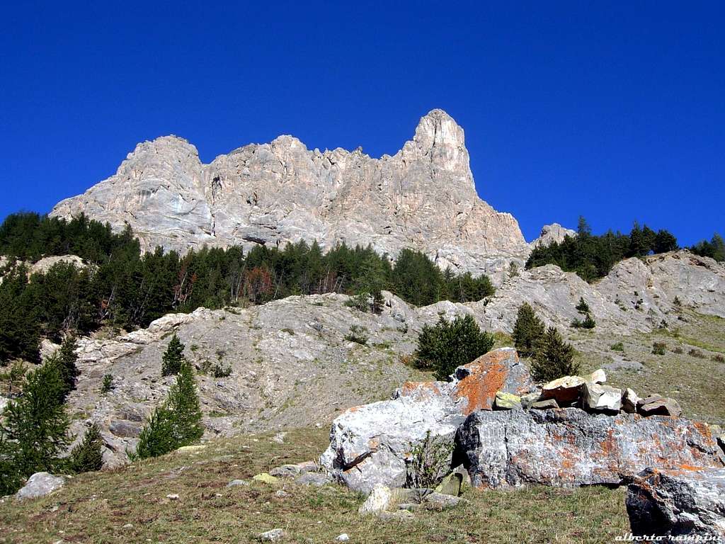
Aiguillette du Lauzet, a limestone tower in the Western Alps
Aiguillette du Lauzet is a slender limestone tower belonging to the group named "Massif des Cerces", situated North-West to the town of Briançon; it’s the steepest and finest peak in the right-hand side of a group of three ones overlooking the Alpe du Lauzet.
Getting There
Road access
- From Turin follow the road to Colle del Monginevro on Italy-France border, then the road N94 to Briançon, reaching the town. Carry on towards Col du Lautaret following the road N91, reach Le Lauzet and then Pont de l’Alpe m. 1668, a little settlement situated some kilometres before the Col du Lautaret on Briancon side (Guisane Valley). Parking.
- From Grenoble follow the road to Col du Lautaret, reach the col, then down along Guisan Valley toward Briançon, reaching Ponte de l'Alpe m. 1668. Parking.

|

|
Walking approach to SW and S walls
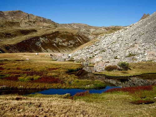
From Pont de l’Alpe follow a good trail rising towards East and reaching the suggestive Alpe du Lauzet. Carry on and nearby a sign turn to right and follow a level trail becoming very narrow and starting to rise steeply toward the obvious peak with several hairpins. The trail leads to another path named “Chemin de Roy”; follow it towards right, reaching a grassy gully on the right-hand side (1,30 hour from the parking).
A great classic route on SW face

Davin Route Report – UIAA scale
Summit altitude: m. 2611
Difficulty: D, max V UIAA
Climbing length: 250 m.
Exposure: South-West
First ascent: Abbots Davin and Blanc in 1942
Starting point: Pont de l’Alpe m. 1668
The greatest classic route in the range of the V grade UIAA in Cerces Group. The climb is beautiful on very good limestone running on a steep face. A curious peculiarity: the first ascent was realized by the two abbots Davin and Blanc during the II World War.
From the bottom of the tower scramble a bit along the grassy gully, then exit it towards left to a saddle (cairn), where a large ledge hanging over the bottom of the tower starts. Follow the ledge towards left (cairns), then head toward right to a narrow rocky gully (pegs and slings). Rope up. Climb the rocky gully. Traverse towards left on easy ground and climb directly towards a bolt. From here 8 pitches re-equipped with bolts and following a direct line on very fine limestone lead to a narrow ledge which exit the ending wall towards left. An abseil lead to a wide scree gully. Scramble on the gully, reaching an obvious saddle. Easy rocks lead to the beautiful summit. Summit cross.
If you are lucky you can see an ibex on the top; it’s surprising to meet him after having climbed a steep rocky tower...but the opposite side is easy, so ibexes can reach the summit simply scramble on..... Descent: from the summit scramble down back to the saddle, then head to right descending along easy slopes, leading to a wide saddle where a good path starts going down to the starting point.

|

|

|
Other routes on SW and S faces

South-West Face
- Les beaux quartiers TD+, F6b, 300 m. , modern route, bolts
- Voie de l’Etoile TD+, F6b/A0, 300 m., modern route, bolts
South Face
- Pilier SW TD, V+, A2, 200 m., trad route, pegs
- La ligne oublièe TD+, 6b, 150 m., modern route, spaced bolts
- No future ED+, 6c+, 150 m., modern route, spaced bolts
- Magnifica ossessione TD+, 6b, 150 m., spaced bolts
- Il Muro del Pianto ED, 7a+/A1, 150 m. spaced bolts
Via Ferrata

In addition to the various challenging routes, the Aiguillette du Lauzet also hosts an interesting "Via Ferrata".
Check here for the full description of this route: Aiguillette du Lauzet Via Ferrata (page edited by markhallam)
Red tape
")
No particulary restrictions in climbing and hiking.
When to climb
Best season goes from June to October.
Meteo
Guidebooks and maps


“Oisans Noveau, Oisans Sauvage”, Book East by Jean Michel Cambon