
-
 7099 Hits
-
 88.91% Score
-
 28 Votes
|
|
Mountain/Rock |
|---|---|
|
|
45.06604°N / 6.48738°E |
|
|
Hautes-Alpes/ Savoie |
|
|
Hiking |
|
|
Summer |
|
|
10161 ft / 3097 m |
|
|
Overview
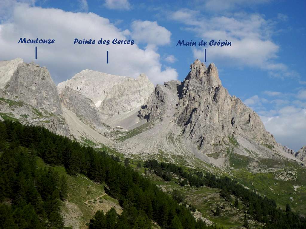
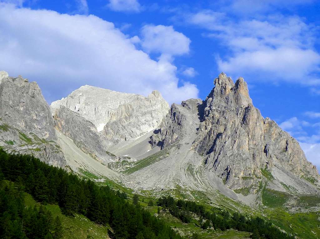
Pointe des Cerces 3097 m
With its elevation of 3097 metres above sea level, Pointe des Cerces is one of the Threethousanders belonging to the Cerces Massif (French Alps), a small range located in the Western Alps, on the France-Italy border, North-West to the town of Briançon. From the administrative point of view the peak is shared by the two departments of Hautes-Alpes and Savoie. This fine and panoramic summit is lying in Haute Névachie, the upper part of the superb Val Clareé, a protected environment well deserving a visit in reason of its natural beauties. The Normal route of ascent - which starts from the Chalets de Laval - is an easy but very interesting and popular itinerary, in reason of the wonderful views that can be seen from the summit and the amazing lakes that are encountered during the climb.
Getting There
Road access
A - From Turin (Italy) Via Monginevro Col
In Turin follow the ring road then take the A32-E70 Motorway entering Val di Susa and exit to Oulx, reach Cesana Torinese and Claviere, then Monginevro Col m. 1854, on Italy-France border; from here the road N94 descents towards Briancon. Some kilometres before getting to the town of Briancon, leave the main road turning right and entering Val Clareé. Follow the road, reach Nevache and the Chalets de Laval, when the paved road ends. Parking area at the end of the paved road.
B - From Turin (Italy) Via Scala Col
In Turin follow the ring road then take the A32-E70 Motorway entering Val di Susa and follow it, exit Bardonecchia. Once in Bardonecchia we head to France via Melezet and on the Italy-France border turn to left to Colle della Scala; passed Colle della Scala, reach Nevache and then continue straight (road - no entry from 9 onwards) to the Chalets de Laval parking at the end of the paved road.
C - From Grenoble (France)
Follow the road N85 to Vizille, then the road N91 rising to Col du Lautaret; reach the Col du Lautaret m. 2057 and the town of Briancon. Follow the road N94 for a few kilometres, then turn to left and enter Val Clareé. From Val Clareé reach the Chalets de Laval as the previous points.
Pointe des Cerces Normal route
Normal route from Chalets de Laval
Difficulty: EE - Good trail, then easy scramble
Difference in level: 1065 m. from Chalets de Laval
A fine and interesting itinerary amongst considerable natural beauty and inside a wonderful environment


Leave the car in the parking at an altitude of 2030 meters and take the dirty road that goes gently up the valley to reach the Refuges des Drayères m 2167, where a path begins, following the stream and subsequently heading the left, winding amongst numerous beautiful limestone towers. The trail leads to the first lake, the Lac de la Clarée at an altitude of 2433 m. After a short distance, reach another beautiful lake, the Lac Rond 2459 m. Skirting the right shore, reaching a third lake, the Lac du Grand Ban. Climb up briefly to the Col des Rochilles 2495 m., where they appear the evocative military fortifications of Camp des Rochilles. Without reaching those, from the col turn sharply to the left to climb to the Col des Cerces 2574 m.


Here leave the main trail (GR57) - that descends from Col des Cerces to the Lac des Cerces - to take on the left a track at first not much obvious, then more evident, crossing mainly on level along the steep slopes below the Pointe des Banchets, in order to reach the large debris circus - snow present until late in the season - at the foot of the Pointe des Cerces. The trail performs a semicircle from left to right, between debris and rocks, reaching the base of a gully frequently snowy. Crossed the gully, climb a rocky spur, reaching the vast summit scree slope. Go up the scree slope along the track with several hairpins until you reach the summit cross. The view on the near Ecrins Massif, just opposite, is magnificent.
Descent: the descent is done reversing the same route
Red Tape


No permit no fees required. During summer the traffic of the private vehicles rising to the upper part of Val Clareeè is subject to regulation from 9 o clock to 18 o’clock. A service of public minibus is available.
When to Climb
The best season are summer and early fall
Huts and campsites
- Refuge de Laval 2030 m.
- Camping de Fontcouverte
Bibliography
Map IGN 3535 OT Nevache/Mont Thabor/Cols du Galibier et du Lautaret
Meteo forecast
Meteo France Briancon
Meteo Regione Piemonte