T=Tourist – Itineraries on footpaths, mule tracks or wide paths. Don't present orienteering problems.
E=Excursion route without technical difficulty – Itineraries on footpaths or trails on different ground types (grassy meadows, rocky ground). Orienteering capacity and good training to walk some hours are required.
EE=Trekking routes for expert hikers – Sign-posted itineraries with some difficulties: slippery, grassy or rocky ground, rocky or snowy slope or easy climbing passage (use of hands necessary). Only for experienced mountain hikers with at secure step, a good feeling for balance. Physical training for 1-day walk required.
EEA=Trekking routes for expert hikers with equipment – Equipped tracks or "vie ferrate". Technical equipment required.
Alpine REFUGES
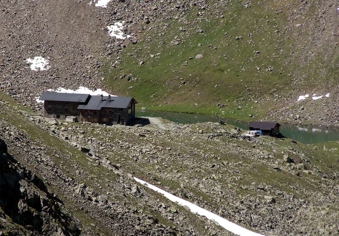
Denomination:Refuge ALPE ARBOLLE (Laghi di Arbolle)Altitude:2.507m
Route: From Aosta (583m) - Charvensod (766m) - Pila (1.800m) - Chamolé (2.309m) - Arbolle Lake (2.500m) - Refuge (2.507)
Time: 1h'30 - 1h'45 from Chamolé (2.300m) – 2h'30 from Pila (1.800m)
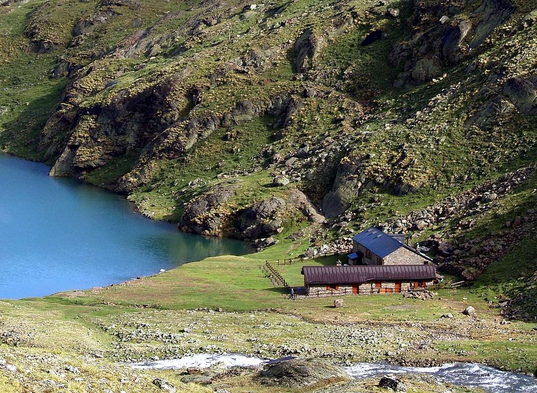
Denomination:Refuge ERNESTO MENABREAZ (Laghi di Laures)Altitude:2.542m
Route: From Aosta (583m) – Brissogne (894m) – Laures inf. Lake (2.541m) - Refuge (2.542m)
Time: 5h'00 - 5h'30 from Brissogne (583m)
Difficulty:E
Opening period: Private
Owner: Comune di Brissogne (Ao)
Keeper: Comune di Brissogne (Ao), tel. 0165 762611
Refuge phone: -
Places: Private
Local winter: places 6 always opens
Climbs and excursions: Monte Emilius (3.559m), Punta Garin (3.456m), Punta di Leppe (3.306m), Becca di Seneva (3.086m), Becca di Salè (3.137m), Colle di Laures (3.036m)
Internet: -
Email: -
Denomination:Refuge MONT FALLERE (Les Crottes)Altitude:2.385m
Route: From Aosta (583m) – Saint Pierre (650m) - Saint Nicolas (1.200m) – Vetan (1.671m) - Refuge (2.385m)
Time: 1h'30 - 2h'15 from Vetan (1.671) - 5h'15 - 6h'00 from Saint Oyen (Flassin)
Difficulty:E
Opening period: half June - half Octobre
Owner: Siro Viérin
Keeper: Viérin François Rue La Montée, 2 Saint Oyen (Ao), tel. 339.1791023 - 338.6162618
Refuge phone: 366.1745090
Places: 46
Local winter: places 5 always opens
Climbs and excursions: Mont Fallére (3.061m), Lago Fallére (2.415m), Becca France (2.348m), Monte Rosso di Vertosan (2.950m), Punta Ouillette (2.616m), Punta Leissè (2.771m), Col Fenetre (2.600m), Col Vertosan (2.698m), Punta Chaligne (2.608m)
Parents refers to a larger category under which an object falls. For example, theAconcagua mountain page has the 'Aconcagua Group' and the 'Seven Summits' asparents and is a parent itself to many routes, photos, and Trip Reports.


 4241 Hits
 74.01% Score
 4 Votes