Mount Hood Trip Report
Summit: Mount Hood (Wy'east), OR, Elevation 11,249 feet (3,429 m)
Trip Date: June 27-28, 2010
Trip Start/End: Approx. 10:45PM June 27 to ~12:00PM June 28
Distance: Approx. 7 miles round trip (17.8 km)
Starting Elevation: 5,960ft (1,817m)
Elevation Gain Total: 5,300ft (1,613m)
NWHikers.net Members:
EastKing
Flow
Nartreb
Jimbopo
Equipment:
Winter/down coats
Rain Jackets/Pants
100%UVA/B Sunglasses/glacierglasses
Mountaineering Boots
Gaitors
Winter Gloves
10 or 12 point Crampons
Ice Axes (one each)
Synthetic undergarments
Helmets (one each)
Map and Compass
Headlamps (one each)
4 Two-way multi-channel Radios (one each)
2 Ice Tools (Flow shared one with me)
Blue Bags
2 cameras (only one was functional past 8,000')
Route Map:
![Mount Hood Map]() Rough depiction of route
Rough depiction of route
Began at the Timberline Lodge following the climber's trail to the right of the ski area boundary to the top of the Palmer Lift 8,540ft (2,603m) and continued to follow Palmer Glacier to the East side of Crater Rock staying between the rock and fumeroles. We continued on towards and across the crater to be in line to ascend the Old Chute at 10,600ft (3,230m) and climbed up wind hardened firn to the summit ridge at 11,200ft (3,412m) which was moderately corniced. A brief knife edge on an exposed cornice and a quick jaunt brought us to the summit of 11,249ft (3,429m). We descended via the same route.
The Drive:
Started around 8:00AM from Kirland,WA headed for Timberline,OR. We drove nice and easy taking in the good weather. It was mostly boring.
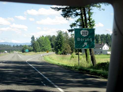
![Boring]() Boring
Boring
Our first views of the volcano were fantastic. The snowline was still lingering at around 6,000'. Conditions looked good from here, resembling mid to late spring. Hood was almost within my grasp.
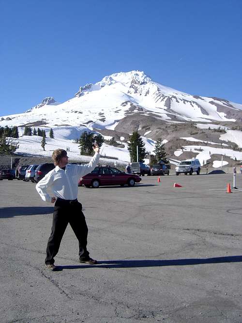
![Hood from Timberline]() Dressed for Success
Dressed for Success
We decided to car camp and get some breif rest before attempting the summit at around 10:00PM. I awoke a little early and after a breif poll it was clear that we weren't going back to sleep. We grabbed our gear and headed up right behind another group to set pace. The sky was clear and the moon was rising red through the volcanic dust clouds pushed up by a soft breeze.
![Getting Ready 4 Hood]() Getting Ready 4 Hood
Getting Ready 4 Hood![Moonrise over Mount Hood s southern flank]() Moonrise over Mount Hood's southern flank
Moonrise over Mount Hood's southern flank
The snow was still in the process of re-freezing from the previous day so it was an hour of steep hiking before we stopped posting 8 inches or so. Nartreb had mentioned a headache earlier on and we maintained that we would monitor his condition. He seemed determined at least to see how far he could go. Because of the early hour we were afforded the opportunity to go up through the ski park and admire the impressive jumps and half-pipes. This shortened the distance between us and the summit a little. At the Palmer lift the slope became too steep to maintain a good pace so we went to the climbers path on the east boundary of the park. About 45 minutes later we arrived at the top of the Palmer lift at 8,450'. Nartreb didn't seem to change in condition and it was obvious to us that he would be turning around at some point. We took notice of stashed gear that lay everywhere at this juncture. A few bites to eat and some water had us ready to go for more. We continued on swapping leads to conserve energy and moderate our pace. After about 600' more elevation gain, it was clear that Nartreb wasn't going much farther. Sleepy, anxious and full of headache, we had to make a decision.
Originally, I had asumed we were all going to summit together or not at all, but since we had all brought radios and had adequate gear and somewhat sufficient training, EastKing agreed to tend to Nartreb's descent while Flow and I continued on. If we ran into route finding trouble, we could radio back to EK and ask for directions (fortunately, it never came to that as the route is pretty strait forward.)From this point on we made good time and gained over a thousand feet before calling back to report our position to make sure we were on route. We passed through the "Devil's kitchen" and got a good view of all the "knives" piercing into the starry sky.
![Devil s Kitchen]() Devil's Kitchen
Devil's Kitchen
The snow started to become more solidified as we came up the final steps to the summit crater. From here, we could see the Bergshrund that had opened up about two-thirds the way up the "Hogsback" snow ridge route to the "Pearly Gates" chute. We had discussed going up the "Old Chute" earlier on and it seemed solidified in my mind as the right decision by this point. The bergshrund was too much of an obstacle and besides, the "Hogsback" in general had shifted to the west due to changes in seasonal wind patterns leaving a large icy gap between it and the "Pearly Gates" chute. We saw a couple climbers descending the "Old Chute" and inquired on their route. Apparently they had gone up the "Hogsback" and jumped the Bergshrund then dodged oven sized blocks of falling ice to traverse to a gully adjacent to the "Old Chute". That helped me make up my mind about which way to go and so we continued towards the "Old Chute", staying away from the other gullies.
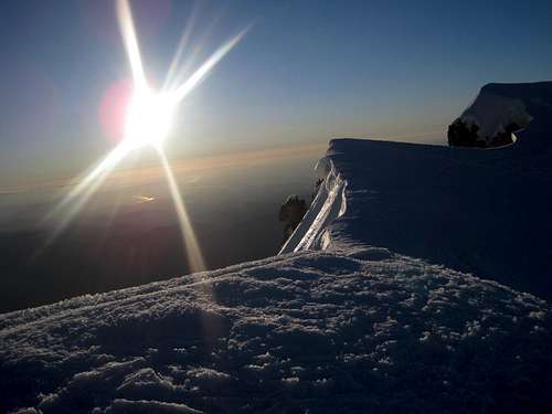
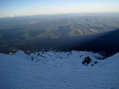
I remembered from a previous climb of Mount Shasta, that these types of gullies tend to ice up, so as a precaution, Flow shared an ice tool with me so we could climb the chute with stronger purchase. At around 10,600' the snow was loosely frozen with hard wind-packed snow underneath. It is also steep. Most route information will say around 40 degrees but I found it to be 45-50 degrees. A fall here could end seriously. I took my time to make each step solid while flow snapped a shot of the volcano's shadow.
![The Roof of Oregon]() Oregon's Roof
Oregon's Roof
The sun rose and stirred up a brief wind which knocked some ice loose. Luckily nothing big fell our way, but Flow still got hit by a softball size chunk. He gave out a shout and a painful look, and then, being the tough climber he is, continued on. I remember being somewhat frightened comming up this chute. My every step counted. When I crested the ridge, my heart almost sank into my stomach. Apparently the top of the gully juts out north onto an overhangin cornice with a 2,000' drop to the glacier down below. There is no way to avoid it, however, because to the south are very steep and icy flutings that are way off route and dangerous to climb. Only a few yards ahead of me was the knife edge to the summit plateau and it was corniced as well. To think, this is the dog route! I can't imagine the horror of trying to summit a different way! I waited for Flow to catch up before deciding. We were going to proceed very slowly, one person at a time. I tried to stay as far windward as I could to avoid hitting a weak point in the cornice and possibly being able to bail out onto my right if the cornice gave away. When we both made it safely to the summit plateau I stopped to study the summit, only a few dozen yards away. Most reports had told me it was corniced, but from my perspective it was not. Instead, there were steep fluttings that fell down to solid rock below. It was a welcome sight after crossing the corniced knife edge. I got a call from EK urging me to continue and I told him we'd be on the top in less than a minute. As we casually strolled to our destination, I noticed a "T" shaped anchor/belay trench that led down a gully to the east of our route. It was interesting to see the remnants of the previous climber's adventure up there in that desolate place. When we arrived at the summit, Flow took some shots of the surrounding peaks, some for me since my camera wouldn't function because of the cold.
![West Face in darkness]() West face in darkness
West face in darkness![Summit Ridge]() Summit Ridge
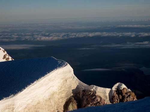
Summit Ridge![Rainier and Adams from Hood s summit]() Rainier and Adams from Hood's summit
Rainier and Adams from Hood's summit![Hood s Summit plateau with ski park in background. Jefferson in distance]() Hood's Summit plateau with ski park in background. Jefferson in distance
Hood's Summit plateau with ski park in background. Jefferson in distance![Flow]() Flow
Flow
I said a breif prayer for the fallen who had attempted this climb on their own spiritual journeys, hoping that it guided them in some positive way. Then, realizing that I was not yet out of the very same danger, I said another for myself and my brother. A small army of people was apparently following us and it turned into a little traffic jam on the summit. A couple took our photo and they plan on sending it to us within this week so I can post it up here. This will have to do in the interim.
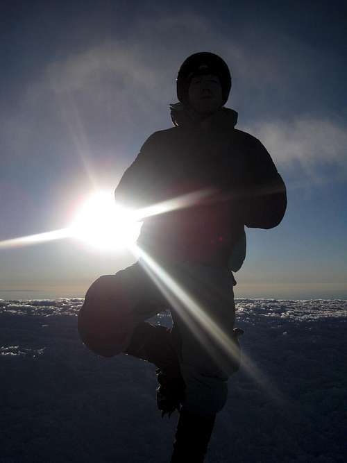
![Myself in pose on Hood]() Myself in pose on Hood
Myself in pose on Hood![Traversing the Crater]() The traverse across the crater
The traverse across the crater
The Descent: (terrible movie by the way)
Downclimbing the "Old Chute" was for me the most difficult and frightening part of the climb. Flow seemed to be doing all right but he constantly gave me encouragement. I made my movements very slow and deliberate. Many people passed me by while I was working away. Eventually I got the idea to ask some opinions. I knew I could ice-axe arrest here, but a headlong tumble would not end well. I asked some folks whether they thought glissading was safe and it turns out none of them thought so. I ended up downclimbing over half the chute. I was kind of embarrassed about it, as everyone else managed to plunge step pretty confidently. Perhaps it's a confidence I will have to earn.
![Climbers trail down to Timberline]() Climbers trail down to Timberline
Climbers trail down to Timberline
Flow patiently waited for me at the base of Crater Rock and then we went off together down to around 10,000' where we had stopped on the way up in the flattened snow remnants of a winter bivvy. We were right next to a glissade chute, and since we had thousands of feet of run-out we decided to remove our crampons. After a few feet of rock hard snow glissading and heavy ice-axe braking, it became apparent that this glissade was not yet safe to speed down. We stopped at some point where the sun had just begun to hit the slope, peering over the Steel Cliffs. I radioed in that we would wait there about 45 minutes until the snow thawed enough for a descent and safe glissade. We anchored ourselves to the slope and took a brief nap.
Sometime later I awoke and realized that this was not a good idea. We were tired and cold and this was simply not the best place to rest. I roused Flow and we tried to glissade some more. I found that if I braked really hard, I could go the entire run. My brother, however, was pretty drained and had difficulty enduring the uncomfortably solid snow. When the ski park was in view the snow conditions changed very suddenly from solid to mush. There was absolutely no transition at all and we began post-holing about a foot until we reached the top of the Palmer lift. The park was full of skiers, snowboarders and would-be athletes. I was a little envious of their easy travel down the mountain. I had actually fantasized about bringing my snowboard up the mountain earlier but I knew it wasn't going to happen.
[img:634387:aligncenter:medium:Climbers trail down to Timberline]
Flow and I continued down the climber's path. It was grueling trudgery to be moving down the nasty snow while watching winter sports enthusiasts tear up the slopes in style. I kept telling myself that next time I would come with a board. Aside from my own problems the weather was fair and the people I met on the way were cheerful. We arrived at the car, wet, tired and a little dehydrated, sometime around noon. After a three hour nap, Nartreb was doing great and EK was glad to see us back from a successful summit.
The drive back to Washington was uneventful and began our next destination to Mt.St.Helens. I had not purchased a permit for the climb, so I would be waiting it out at camp. That trip report can be viewed here EastKings_Mount_Saint_Helens_TR. My brother also wrote a trip report of both climbs on nwhikers.net
Thanks to Nartreb for driving us the distance and to EastKing for his valuable support.


Comments
Post a Comment