
-
 12255 Hits
-
 82.48% Score
-
 15 Votes
|
|
Mountain/Rock |
|---|---|
|
|
38.11070°N / 107.68117°W |
|
|
Ouray |
|
|
Hiking |
|
|
Spring, Summer, Fall |
|
|
10603 ft / 3232 m |
|
|
Overview
Baldy Peak is a distinct summit seen from highway 550 as one drives into a small historic town of Ouray. Baldy is a very common name for a mountain, and as it name suggests, the summit is bald and free of trees. This provides amazing views of surrounding 13ers in the Sneffels and Cimarron Range, and an outstanding view of 14,150 foot Mount Sneffels.The peak is not very high in elevation, at only 10,603 feet, but it a nice hike on an established trail, free of any infamous San Juan scree. It is dog friendly, and one can expect solitude here.
The area has a network or trails and you can do it as a loop, or return the same way. I will describe the shortest way, which involves about 6.5 miles of hiking.
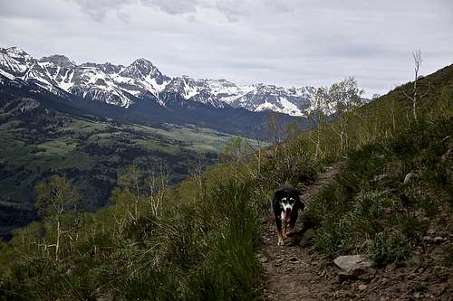
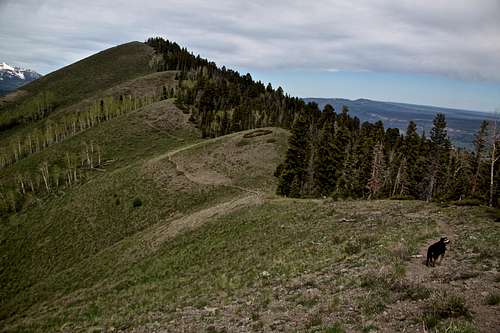 Baldy Peak as seen from the approach - top of the ridge Baldy Trail | 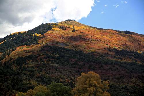 Baldy Peak in fall colors as seen from Hwy 550 |
Getting There
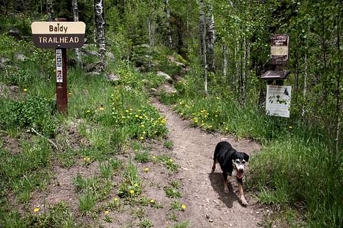
Baldy Trailhead
Baldy Trailhead you have to take a smaller road to the left (right before the start of the field). You do need 4WD for this road. Descend steeply down, cross the creek, continue for another 1/4 mile and cross another smaller creek. There will be a well marked trailhead for Baldy Trail. I chose to hike this section since the road was once covered with snow, and second time very muddy.
Route
The trail is easy follow, it climbs through some mature scrubs of oak and juniper, passing several meadows. After about one hour it winds around to the left and comes to a little divide at 9,700 feet. It continues to climb up on a ridge in and out of trees. The views start to open up - first Sneffels area, then a little higher up both Uncompahgre and Wetterhorn peaks. The trails enters again dense spruce, and higher up it goes through some grassy areas. Soon you will reach a top of a ridge at 10,490 feet. You can see nice views of Baldy's summit from here. It still takes another 20 min, or 0.6 miles to reach its summit from here. The trail becomes less distinct pass this point, but your route is obvious. Summit has a small cairn with a register and the views as mentioned above are excellent.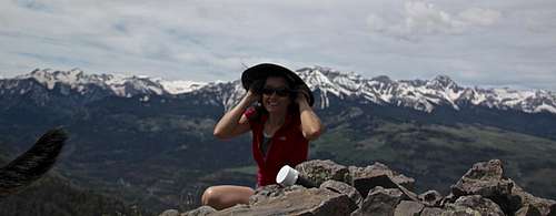
Summit of Baldy Peak
You can return back via the same way, or make a loop via Storms Gulch. There are signs at intersections.
Start at Elevation: 8,700 feet
Summit Elevation: 10,603 feet
Distance: 6.5 miles
Estimated Time: 3-5 hrs
 Baldy trail | 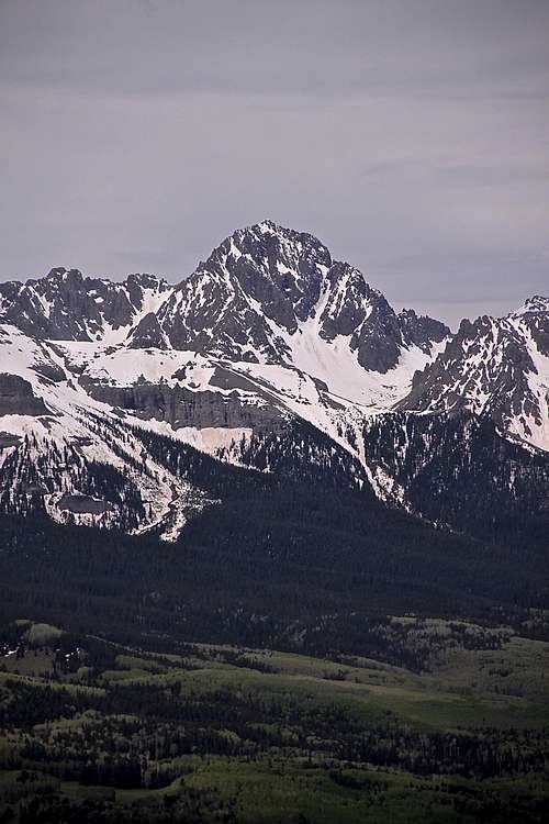 Mt. Sneffels as seen from the summit | 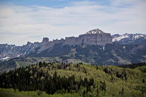 Courthouse and Chimney Peak as seen from Baldy Trail |
Red Tape
There is no red tape - parking and hiking are free.When to Climb
The county roads to access this trailhead are not maintained in the winter, this would add another 3-4 miles to your hiking if you would want to hike it in the winter.Best times are end of May to October.
Camping
The trailhead is located in Uncompahgre National Forest and primitive camping is available around, as well as backpacking.Nearby Ouray provides multitude of accommodations, including developed campgrounds.