
|
|
Area/Range |
|---|---|
|
|
43.85112°N / 114.58054°W |
|
|
Hiking, Mountaineering, Ice Climbing, Scrambling, Skiing |
|
|
Spring, Summer, Fall, Winter |
|
|
11714 ft / 3570 m |
|
|
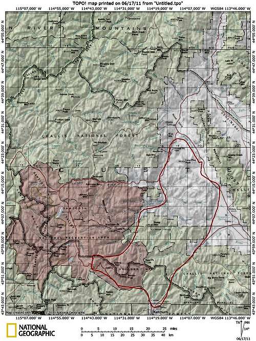
The Heart of Idaho
 The Boulder Front
Geography
The Boulders rank as one of Idaho's highest mountain ranges with at least 12 summits topping 11,000 ft. and more than 16 other peaks over 10,000 ft. Most of the highest peaks are located in the southern portion of the range along what is known as the Boulder Front. This is the impressive wall of peaks that can be seen along the East side of highway 75 as one travels between Ketchum and Stanley. Here elevation gains can be as much as 4,000+ ft. and there are no intervening foothills. At 11,714 ft., Ryan Peak is the highest peak in the Boulders but it is not visible from any major road.
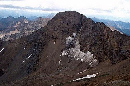
 Ryan Peak
Geologically the range is quite complex and contains everything from granite to Challis Volcanics. The Boulders were once extensively mined and at one time the mining town of Boulder was Idaho’s highest town at 10,000 ft. Galena, the source of lead, was one of the most heavily mined minerals in the range. There are many landmarks named after the ore including the town of Galena, Galena Peak, and Galena Summit, where Idaho’s highest paved road is.
There is little in the way of technical climbing (although if you know where to go and who to talk to there are a few good snow and ice climbs) because the rock is so loose and rotten. As Tom Lopez puts it in his book, Idaho: A Climbing Guide, “Although there is stiff competition for the honor, the Boulder Mountains win the prize for being Idaho’s most rotten mountains. Even rock that appears solid will crumble in your hands.”
Climate
The area near the Boulder Front is heavily forested and is green and verdant. As you go to the North the range becomes more desert like and there a lot fewer trees. During the winter the Boulder Front can receive a large amount of snowfall that can linger on into the summer months.
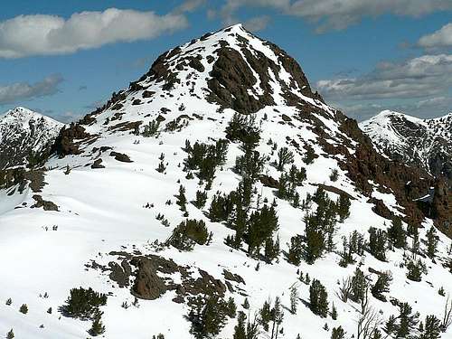
 Snowy Peak 10,941, June 2011
All the typical Idaho wildlife is present in the Boulders including a very large population of Mountain Goats. They can commonly be seen on the steep slopes of the peaks along the Boulder Front. In fact, there is a mountain goat viewing site along the highway to the West of Boulder Peak.
Weather

Management
 The Boulders Area
As of August 2015 Rep. Mike Simpson's Wilderness bill for this area has passed creating nearly 300,000 acres of new Wilderness in the Boulder-White Cloud area. More info will be added as it becomes available.
Peaks
The range is divided into four major divides by Tom Lopez in Idaho: A Climbing Guide. Those divisions will be followed here. The class column refers to the easiest route to the summit.
Northern Divide
 Kent Peak
| Peak | Elevation (ft.) | Class | USGS Quad |
|---|---|---|---|
| Lone Pine Peak | 9,658 | 2 | Lone Pine Peak |
| Anderson Peak | 9,339 | 2 | Horse Basin |
Sheep Divide
 Galena Peak
| Peak | Elevation (ft.) | Class | USGS Quad |
|---|---|---|---|
| Sheep Mountain | 10,915 | 2 | Bowery Peak |
| Peak 10,883 | 10,883 | 2 | Bowery Peak |
| Bowery Peak | 10,861 | 2 | Bowery Peak |
East Fork/North Fork Divide
 Meridian Peak
| Peak | Elevation (ft.) | Class | USGS Quad |
|---|---|---|---|
| Griswold Peak | 11,057 | 2 | Ryan Peak |
| Peak 10,552 | 10,552 | 2 | Jerry Peak |
| Meridian Peak | 10,400+ | 2 | Meridian Peak |
| Jerry Peak | 10,015 | 2 | Jerry Peak |
| Herd Peak | 9,860 | 2 | Herd Peak |
The Boulder Front
| Peak | Elevation (ft.) | Class | USGS Quad |
|---|---|---|---|
| Ryan Peak | 11,714 | 2 | Ryan Peak |
| Kent Peak | 11,664 | 2 | Ryan Peak |
| Glassford Peak | 11,602 | 2 | Ryan Peak |
| Peak 11,458 | 11,458 | 3-4 | Ryan Peak |
| Lorenzo Peak | 11,240+ | 3 | Easley Hot springs |
| Perkins Peak | 11,220+ | 3 | Ryan Peak |
| Cerro Ciento | 11,154 | 2 | Easley Hot Springs |
| Galena Peak | 11,153 | 2 | Galena Peak |
| Silver Peak | 11,112 | 3 | Easley Hot Springs |
| Easley Peak | 11,108 | 2 | Easley Hot Springs |
| Boulder Basin Peak | 11,041 | 3 | Easley Hot Springs |
| Boulder Peak | 10,981 | 3 | Easley Hot Springs |
| Peak 10,941 | 10,941 | 2 | Easley Hot Springs |
| Mystery Peak | 10,785 | 3 | Meridian Peak |
| The Cone | 10,680 | 2 | Ryan Peak |
| Peak 10,598 | 10,598 | 2-3 | Rock Roll Canyon |
| Peak 10,566 | 10,566 | 2 | Rock Roll Canyon |
| Rock Roll Peak | 10,458 | 2 | Rock Roll Canyon |
| Basils Peak | 10,414 | 2 | Amber Lake |
| Gladiator Peak | 10,243 | 2 | Horton Peak |
| Peak 10,126 | 10,126 | 3 | Horton Peak |
| Avalanche Peak | 9,433 | 2 | Horton Peak |
| The Cross | 9,225 | 2 | Horton Peak |
Getting There
 Perkins Peak
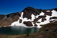 Window Lake
Red Tape
What's that? This is Idaho! Wander to your heart's content.
Camping
There are many wonderful campgrounds in and around the Boulders but there are limitless opportunities for backcountry camping in the range.
Please remember to practice Leave No Trace when camping in pristine areas.
External Links
Sawtooth National Forest-Ketchum Ranger DistrictSawtooth National Recreation Area
Idaho: A Climbing Guide The Idaho Climbing Bible.
Idaho Outdoors Forum. Where the locals chat about the mountains.
Splattski.com Great trip reports and pictures. This link goes to his Boulders page.
Idahosummits.com Parent site of the Idaho Outdoors Forum with tons of trip reports.
 Lorenzo Peak
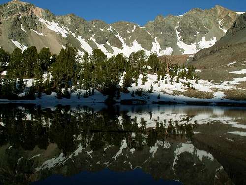 Solitude in the Boulders
hgrapid - Jun 18, 2011 6:03 pm - Hasn't voted
Problem with MapIdahoKid has Boulder Basin Peak in a way off latitude, so if you open your interactive map, it doesn't work so well due to his error. I contacted him to fix it.
mtybumpo - Jun 18, 2011 6:53 pm - Hasn't voted
Re: Problem with MapWhich map are you referring to? Thanks for the heads up!
hgrapid - Jun 18, 2011 9:46 pm - Hasn't voted
Left hand sideOn the left hand side Children Mountains & Rocks (15) [Map]
mtybumpo - Jun 18, 2011 11:39 pm - Hasn't voted
Re: Left hand sideI see now. I never noticed that before.