|
|
Mountain/Rock |
|---|---|
|
|
43.89735°N / 114.25469°W |
|
|
Custer |
|
|
Hiking |
|
|
Summer |
|
|
10785 ft / 3287 m |
|
|
Overview
Geographical Breakdown:Rocky Mountains>Bitteroot Chain>Sawtooth Range>Boulder Mountains>Mystery Peak
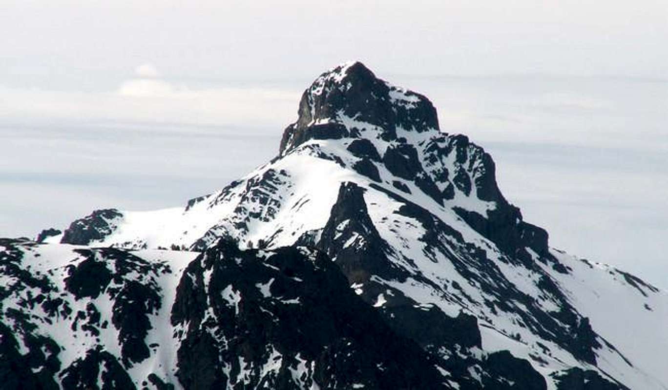
Mystery Peak is a beautiful, rugged peak, isolated away from the main crest of the Boulder Mountains in central Idaho.
 Few people are aware of this wonderful summit for its location makes it difficult to spot. Mystery Peak is a well rounded mountain with an impressive, and exciting to climb, 400 foot summit block that s nearly vertical in some spots.
Mystery Peak sits at the head of three drainages, Big Fall Creek, Miller Canyon, and Corral Creek, but because of high, intervening ridges, one must climb high to view this elusive mountain.
Mystery Peak's remote location has kept this wonderful mountain a secret from most hikers and scramblers in the area. From the summit it seemed as though very few people have ever climbed the auminous summit block.
There is only one, non-technical, route up Mystery Peak, which involves a lengthy, and tricky class 3 climb.
Getting There
To access Mystery Peak from Ketchum or Sun Valley, drive northeast on Trail Creek Road for 12.2 miles. This will lead you up a Trail Creek Pass, which has a tremendous drop the west. After the exciting drive to the pass, continue on Trail Creek Road for 9 miles until reaching the North Fork Big Lost River Road. Take this well worn dirt road 8.9 to Miller Canyon Road. This road immediaetly crosses the North Fork Big Lost River and then splits. Take the left fork, which begns to ascend up Miller Canyon to the south. Follow this road as far as you wish, or ar able, and park.
Southeast Face
From the end of Miller Canyon, continues uphill to the south until reaching the 8,000' contour line. Here, a stream flows down from the high country above to your east. Gain the ridge just south of this stream aiming for the ridge that tops out a 10,000'. This ridge is very steep, and forested, requiring quite a bit of stamina. Once you have topped out on the ridge, a beautiful view of Mystery Peak greets you. Turn southeast and work along the ridgeline to Peak 10,500. Once at Peak 10,500, drop down to the intervening saddle between it and Mystery Peak and your journey begins. Start hiking up the talus convered ridge beneath the summit block. Once you are close enough, stay to the right of the cliffs and continue toward the southeast face of the block. Turn toward the summit once on the face and hike until you encounter some impassable slabs. From here, look for a ledge that cuts to the north. Follow the ledge that eventually wraps around to the northeast side of the summit block. Climb to the south until reaching yet another north ledge that leads to small, steep gully. Climb the gully to the tidy summit and enjoy panoramic views of many Idaho mountain ranges.
Red Tape
No red tape or permts required. Miller Canyon as well as the upper reaches of the North Fork Big Lost River Road are closed during winter.
When To Climb
Because of the steep nature of Mystery Peak's summit, an ascent in winter would be very treacherous. As like most other Idaho summits, the climbing season in this area usually runs from about late-June through mid-September.
Camping
Many pullouts designated for camping exist along the North Fork Big Lost River Road. Two designated campgrounds are located nearby along Trail Creek Road as well, both with usual amenities.
- Phi Kappa Campground
- Park Creek Campground
Mountain Conditions
Although Mystery Peak may be a little drier due its location on the leeward slopes of the Boulders, that does not mean weather can be extreme and unpredictable. Here is a good site with general weather conditions for the Mystery Peak area.


