
|
|
Mountain/Rock |
|---|---|
|
|
43.98640°N / 114.2253°W |
|
|
9860 ft / 3005 m |
|
|
Overview
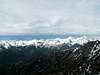
Herd Peak sits at the southeastern end of the beautiful Boulder Mountains in central Idaho.

Herd Peak is a double summitted mountain with a fairly banal appearence. Because of its location east of much higher peaks, Herd Peak sits in a rain shadow and is there fore much dryer than the surrounding areas. These dryer conditions have allowed only a few isolated tree stands to develop on Herd Peak's steep slopes.
East of Herd Peak the rain shadow effect is even more pronounced with the Boulder Mountains gradually lowering in elevation and distinction. In this area of the range, many groups of wild horses run free throughout the roadless rangeland. It is truly a unique area.
Herd Peak, like the majority of Boulder Mountains peaks, is rarely climbed. A seldom used trail leads nearly to the summit but few know about this area. The trail provdies an easy class 1 walk to the top. I pioneered a route up the south ridge for those you scramblers who enjoy a little more excitement than a trail.
 |  |  |
Getting There
For access to Herd Peak and the southridge from Ketchum and Sun Valley drive northeast on Trail Creek Road over the pass in 12.2 miles. Continue for another 9 miles before turning left onto the North Fork Big Lost River Road.
Turn left on this road and be sure to enjoy the spectacular view of the Devils Bedstead East. After 6 miles you will pass Toolbox Creek, one option for an ascent of Herd Peak. Drive a little further until the road begins to climb a small hill. At the top of this hill an ATV only road will veer off to the right. Park here and begin to climb the ATV road.
- Note: Be sure not to attempt to drive up the ATV road for it is far to narrow for passenger cars.
The ATV trail will wind its away through lower Herd Peak's lower slopes of long and gradual switchbacks. After 1.5-2.0 miles, the trail will reach a highpoint marked by large picnic area and grand views of the valley. Here is where your scramble begins.
From the picnic area, turn northeasterly and head up the steep, sage-filled slope aiming to reach a saddle between to prominent points. Once you have reached the saddle turn westward then northward along the south ridge of Herd peak.

A few hundred feet beneath Herd Peak's southern, lower, summit, the ridge transforms from gentle, tree covered slopes, to a steep, talus, ridge.
Scramble up the ridge until reaching a set of cliffs that block your way. Continuing through these cliffs requires class 4 climbing and quite a bit of exposure.
Drop down to the western side of these cliffs about 50' looking for a narrow gully that angles northeastward and returns you back to the south ridge. From the top of the gully, coninue up and over the lower summit to on a class 2 ridge to finally reach Herd Peak.
 |  |
Red Tape
No red tape or permits required in this area. During dry winters the North Fork Big Lost River may remain open to the trailhead.
When To Climb
Herd Peak is not a steep mountain in comparison to others in the region. A winter ascent would most likely be not more difficult than a summer one. Due to the exposure of this route the climbing season is a bit longer, about from late-May to mid-October.
Camping
Several areas along the ATV trail would be feasible for pitching a tent, especially the picnic area below the scramble. There are also pullouts for car camping along the North Fork Big Lost River Road.
On the way, two fine campgrounds with usual amenities can be found.
- Phi Kappa Campground
- Park Creek Campground
Mountain Conditions
The nearest town to Herd Peak is well over an hour and half away. For a good check on local weather conditions either the Lost-Wood Divide SNOTEL site a few miles to the south west, or this website should give you some idea of current weather.
Here are some yearly averages for the Lost-Wood DivideSNOTEL site, which sites more than 3,000' lower.
| Average Yearly Precipitation | 34" |
| Average max SWE | 23.8" |