
-
 5503 Hits
-
 85.87% Score
-
 21 Votes
|
|
Route |
|---|---|
|
|
Ice Climbing |
|
|
Winter |
|
|
Half a day |
|
|
Overview
 Campground Couloir
Campground Couloir is the distinct ice line seen from the South Mineral Campground, therefore its name. You will be passing several climbs on your way in, most are located on the south (north facing) side of the valley with the exception of Sundance.
It is a good warm up ice climb, one of the easiest climbs at South Mineral and good for a beginner ice climber who wants to advance to multi pitch ice climbs.
Silverton is a popular ice climbing destination. Most people head towards Eureka with a high density of multi pitch ice routes. South Mineral would be the 2nd most popular ice destination, and typically popular early in the season when one can drive in.
Ouray ice park is located 23 miles north from Silverton along Million Dollar Hwy. The road from Silverton to Ouray goes over Red Mountain Pass, 11,018 feet high pass (3,358 m), with very exposed road, amazing scenery, and prone to avalanches. The road does get closed if there is a lot of new snow fall for avalanche control. Red Mountain Pass is a popular back country ski destination.
Remember the area if prone to high avalanche danger for much of the winter. Always check on conditions before your adventure.
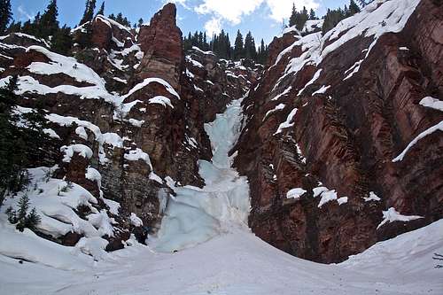 Campground Couloir - late in the season, nice and thick ice.
 Getting There
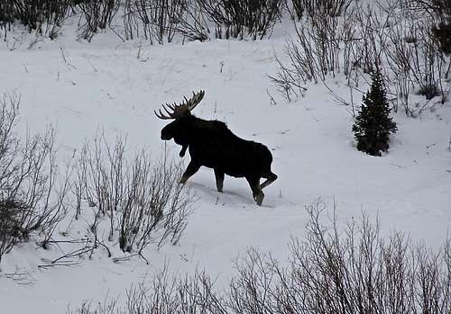 Moose along South Mineral Creek
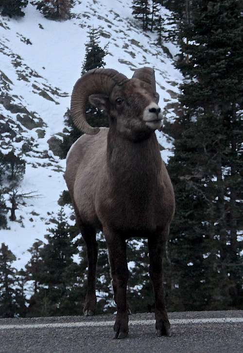 Bighorn Sheep
To reach ice climbing along South Mineral Creek, take Highway 550 north from Silverton for approximately 2 miles. There is a hard to miss turn off sign for South Mineral (County Road 7; Forest Service Road 585), on the west side of the Highway 550. Typically, this dirt road is easily passable by 2 WD vehicles, and is very popular in the summer providing access to Ice Lake Basin with many 13ers, including Vermillion Peak, Golden Horn, Fuller Peak, Pilot Knob, Ulysses S. Grant to mention a few.
In the winter, it is another story. The road is not snowplowed, and I heard many stories about people camping at South Mineral Campground who got stuck there during a snowstorm. Bring chains for your vehicle and a shovel just in case. Do not drive in if there is a lot of fresh snow and if you don't see any other tracks. Do not follow snowmobile tracks with your car.
It is 4.5 miles from Highway 550 to the South Mineral Campground.
Route Description
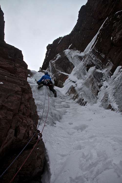
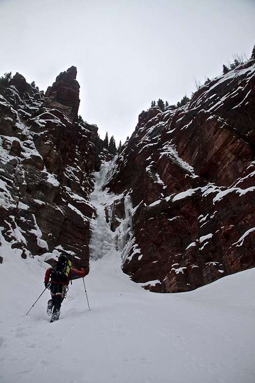 Approach to Campground Couloir
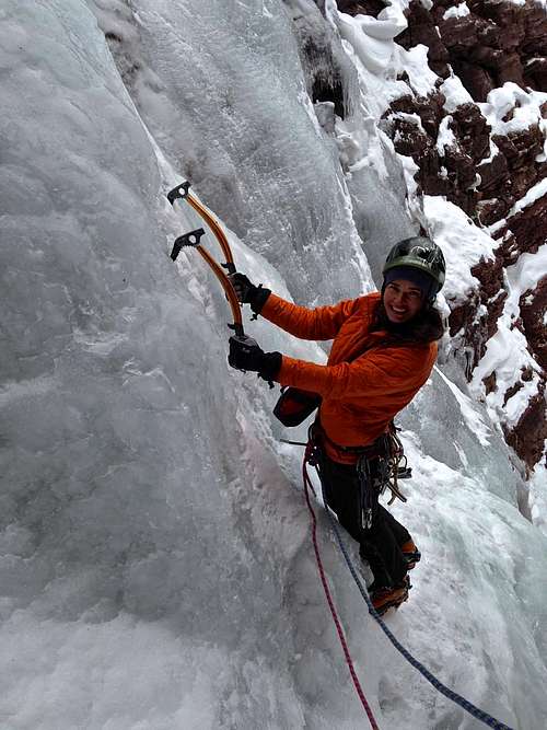 Toping the first pitch
Approach: It is easy approach since you can see the obvious line of ice from the road and from the campground. Be careful when crossing Mineral Creek (it can be tricky if creek not completely frozen). Head for the the obvious line of ice on the south side and uphill. You may find a trail in the snow. Approach time: depends on the amount of snow and whether you have to break the trail: 20-40 min
This is a popular climb, so start early. The couloir is narrow and there is no space for two parties. If you have climbers ahead of you, wait until they are completely down from their climb, or choose another climb. There is a lot of ice falling on this route!
The first pitch is WI3 (Jack Roberts describes it as WI3/4 climb - it is definitively much easier than most of the climbs in the area). You will start on a steeper short ice, then low angled ice followed by another short section of steeper ice. Anchors above the 2nd steeper ice flow. 60 meters long. Some break the first pitch into 2: making the first pitch just the first steeper flow, only 14 meters long. There is supposedly an old anchor right above this first flow made of a fixed nut and piton. I never seen it and have done this climb 3x now, but never really looked for it much. (We climbed it as a single 60 meter pitch). There is a safe spot for the belayer to the left of the climb - well protected from falling ice, and a good place to leave your backpacks.
The second pitch (WI2-3): It starts with a WI3, then mostly rolling easy WI2. About 40 meters long. Anchors on climbers left. If there is fresh now, this can be mostly going through a deep snow.
The climb continues above here for several more pitches - it is mostly slogging inside the couloir, often filled with snow and not very steep. Most climbing parties climb only the first two pitches. But you can continue higher up for about 335 meters total.
Descent: Two raps with double 60 meter ropes bring you back to the base of the climb.
Essential Gear
- Harness, helmet, ice axes, crampons, warm boots.
- Set of ice screws, runners/screamers, extra webbing or slings for V-threads higher up on route (anchors only on first 2 pitches)
- Two 60 meter ropes
- Consider trekking poles for access and crossing the creek
- Thermos with hot beverages is always a good idea
External Links
- Campground Couloir on Mountain Project
- Denver Post about ice climbs in South Mineral
- Ice climbing conditions in San Juans
- South Mineral Campground
- Nice description from Peak Mountain Guides