
-
 5958 Hits
-
 84.13% Score
-
 18 Votes
|
|
Route |
|---|---|
|
|
39.15793°N / 107.2518°W |
|
|
Ice Climbing |
|
|
Winter |
|
|
Less than two hours |
|
|
1 |
|
|
Overview
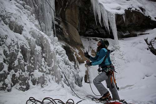
Photo with camera timer.
It was still early in the season (early December), so the left side (=running creek side) was still not completely frozen. There was a thin layer of ice with loud water running underneath and a little pool of water higher up. The right side was nicely in, with some watery ice near the top. The right side is slightly steeper, but still does not exceed WI3.
Hays Creek empties into the Crystal River, which flows along the Highway. The whole Hays fall area is nicely protected in a small gorge. Since the fall is close to the Highway with minimal approach time, expect some other climbers, especially on weekends. I ran into two groups of climbers.
Elevation at the falls: 7,457 feet (=2,273 meters)
Getting There
The Falls are located along Hwy 133, south of Carbondale. From Carbondale, follow Hwy 133 South to Redstone. It is another 1.8 miles south of Redstone's south entrance. A big sign marks the spot.There is a small pull-out parking lot on the side of the road (just next to Hays Creek Falls sign). It is big enough for about 3 cars.
Route Description
Popular beginner ice, rated WI2+, slightly easier on the right side and little more steep on the left side (you can find some WI3 sections). There are bolted anchors at the top of the climb, located underneath an overhang. May be hard to find in deep snow.
The climb is about 30 to 50 feet long depending which side of the waterfall you choose to climb, and wide enough that a couple of parties can climb at the same time.
Jack Roberts writes in his book Colorado Ice the the climb can be top roped and is good for bouldering. I think I would not recommend ice bouldering since landing on the ice with crampons is not very pleasant and cause broken ankles. Based on the above description that it can be top roped; I expected some way up along the climb to set up a top rope, but that is not an option. Luckily, the fall was easy to free solo and then set up a top rope to rope-solo some other sections of the icefall.
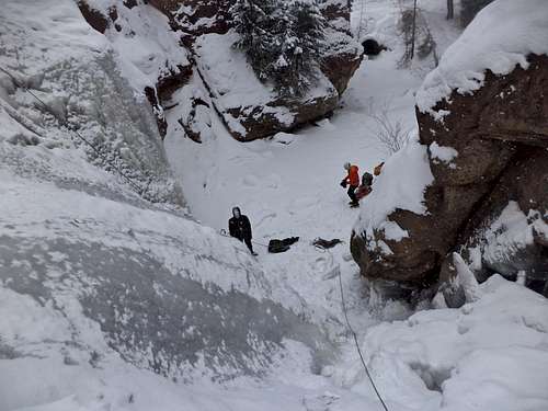 Hays Creek Falls - view from the top. | 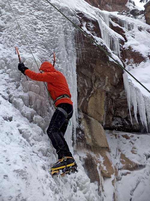 Right side of the fall offered some steeper ice, ? WI3 | 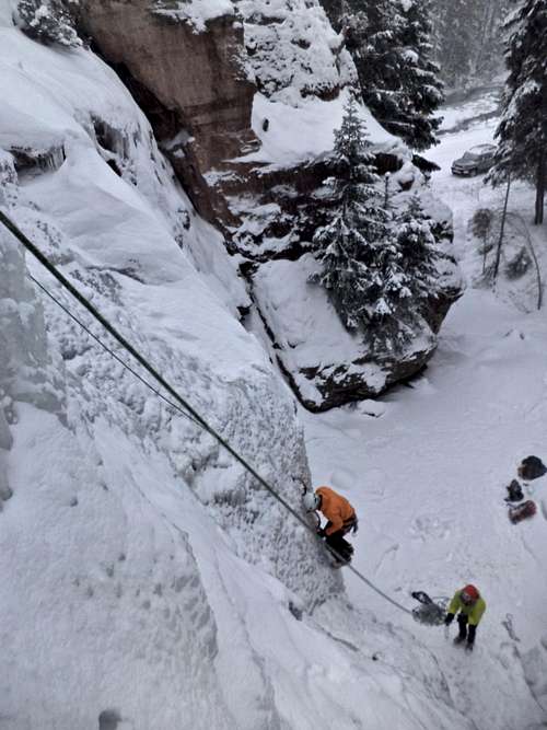 Nice overview of the area - you can see parking lot, approach, climbers. | 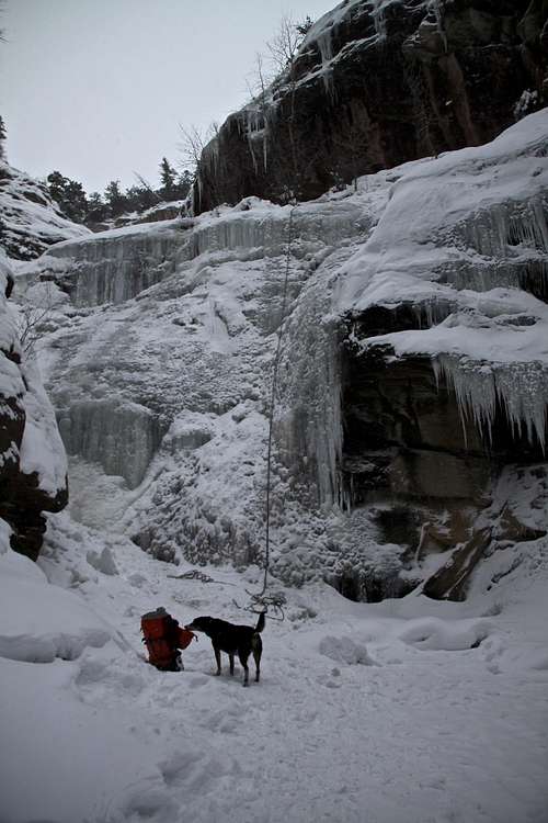 Duchess checking out the area. |
Essential Gear
Ice climbing gear: ice axes, crampons. Bolted anchors at the top - slings, locking carabiners. Rope (60 meter sufficient although it is a little stretch from the top of the climb to the anchors beneath the overhang). Ice screws.Nearby Penny Hot Springs
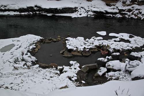
Nice little hot springs along the Hwy 133.
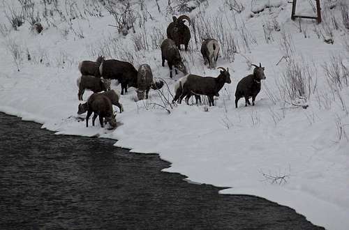
Bighorn sheep by the springs.
The entry is free and just requires to pull off the road and hike down to the river (2 min). The pools are along Crystal River and sectioned off with large rocks. Pools are about 15-20 feet across and about 2 feet deep, there is a sulfuric smell around. The waters are hot and temperature is controlled by adjusting the rock wall and allowing cold water from Crystal River to cool off the hot natural springs.
The hot springs can get flooded out during the spring snow melt.
Location: From Glenwood Springs take CO-82 east towards Aspen. After 10.2 miles take a right onto CO-133 sough (Carbondale). Proceed 14.1 miles.